De Soto, Kansas
| De Soto, Kansas | ||
|---|---|---|
| City | ||
|
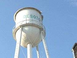
Water Tower in De Soto (2006) | ||
| ||
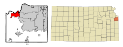 Location within Johnson County and Kansas | ||
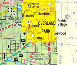 KDOT map of Johnson County (legend) | ||
| Coordinates: 38°57′54″N 94°57′44″W / 38.96500°N 94.96222°WCoordinates: 38°57′54″N 94°57′44″W / 38.96500°N 94.96222°W | ||
| Country | United States | |
| State | Kansas | |
| Counties | Johnson, Leavenworth, Wyandotte[1] | |
| Township | Lexington Township | |
| Settlement | 1828 | |
| Municipal Territory | 1857 | |
| Incorporated | 1901 | |
| Government | ||
| • Type | Mayor–Council | |
| • Mayor | Timothy Maniez | |
| • City Clerk | Lana McPherson | |
| Area[2] | ||
| • Total | 11.20 sq mi (29.01 km2) | |
| • Land | 11.07 sq mi (28.67 km2) | |
| • Water | 0.13 sq mi (0.34 km2) | |
| Elevation | 860 ft (262 m) | |
| Population (2010)[3] | ||
| • Total | 5,720 | |
| • Estimate (2015)[4] | 6,074 | |
| • Density | 510/sq mi (200/km2) | |
| Time zone | CST (UTC-6) | |
| • Summer (DST) | CDT (UTC-5) | |
| ZIP codes | 66018-66019 | |
| Area code | 913 | |
| FIPS code | 20-17850 [5] | |
| GNIS ID | 0479178 [6] | |
| Website | desotoks.us | |
De Soto /dəˈsoʊtoʊ/ is a city in Johnson, Leavenworth and Wyandotte counties in the U.S. state of Kansas,[7] and part of the Kansas City Metropolitan Area. The vast majority of the city, 11.13 sq. mi., lies within Johnson County. As of the 2010 census, the city population was 5,720,[8] and the 2015 census estimate is 6,074.[4] The area code is 913, and the two zip codes are 66018 and 66019.
History
De Soto began in the spring of 1857, named for sixteenth-century Spanish explorer, Hernando De Soto.[9] In 1858, John Possum, a Shawnee Indian, and Hattie Possum sold 80 acres to John F. Legate, S. Todd and Stratton and Williams for $1,200. The next sale was 80 acres to the De Soto Town Company in July 1861 for $1,176. Major James B. Abbott is remembered as one of the town's pioneer landowners and the builder of Abbot Hall. Today, Abbot Hall is one of two town museums.[10]
With the construction of the 9,080 acre Sunflower Army Ammunition Plant south of De Soto, De Soto's population boomed in the early 1940s during WWII. In May 1943, The Kansas City Star article reported "a town rapidly growing, with a population increase from 400 to 1,000 persons in under a year". This sudden overflow in population put a great strain on housing and other resources in the city; however, many original residents prospered during this time, buying property and starting new businesses. Production flowed steadily at the Sunflower Army Ammunition Plant until the plant went on standby in March 1948, with small scale production following shortly after until its closure in 1993.[10]

1951 flood
In mid-July 1951, heavy rains led to a great rise of water in the Kansas River and other surrounding areas of the central United States, known as the Great Flood of 1951. De Soto, being along the Kansas River, was severely damaged. The river crest at De Soto was recorded at 24.87 feet (7.58 m). Most of the downtown area was completely flooded, with over 2 feet of standing water in some places.
Geography
De Soto is located at 38°57′54″N 94°57′44″W / 38.96500°N 94.96222°W (38.965081, -94.962285)[11] along the Kansas River. According to the United States Census Bureau, the city has a total area of 11.20 square miles (29.01 km2), of which, 11.07 square miles (28.67 km2) is land and 0.13 square miles (0.34 km2) is water.[2]
Demographics
| Historical population | |||
|---|---|---|---|
| Census | Pop. | %± | |
| 1860 | 35 | — | |
| 1870 | 102 | 191.4% | |
| 1880 | 141 | 38.2% | |
| 1890 | 223 | 58.2% | |
| 1900 | 226 | 1.3% | |
| 1910 | 240 | 6.2% | |
| 1920 | 231 | −3.7% | |
| 1930 | 319 | 38.1% | |
| 1940 | 454 | 42.3% | |
| 1950 | 6,785 | 1,394.5% | |
| 1960 | 9,172 | 35.2% | |
| 1970 | 2,217 | −75.8% | |
| 1980 | 2,061 | −7.0% | |
| 1990 | 2,291 | 11.2% | |
| 2000 | 4,561 | 99.1% | |
| 2010 | 5,720 | 25.4% | |
| Est. 2015 | 6,074 | [4] | 6.2% |
| U.S. Decennial Census | |||
2010 census
As of the census[3] of 2010, there were 5,720 people, 2,007 households, and 1,523 families residing in the city. The population density was 516.7 inhabitants per square mile (199.5/km2). There were 2,204 housing units at an average density of 199.1 per square mile (76.9/km2). The racial makeup of the city was 89.7% White, 0.8% African American, 0.8% Native American, 0.4% Asian, 5.9% from other races, and 2.3% from two or more races. Hispanic or Latino of any race were 14.6% of the population.
There were 2,007 households of which 41.5% had children under the age of 18 living with them, 60.4% were married couples living together, 10.5% had a female householder with no husband present, 5.0% had a male householder with no wife present, and 24.1% were non-families. 19.0% of all households were made up of individuals and 6.3% had someone living alone who was 65 years of age or older. The average household size was 2.83 and the average family size was 3.25.
The median age in the city was 35.4 years. 28.6% of residents were under the age of 18; 8.8% were between the ages of 18 and 24; 26.5% were from 25 to 44; 26.3% were from 45 to 64; and 9.9% were 65 years of age or older. The gender makeup of the city was 50.2% male and 49.8% female.
2000 census
As of the census[5] of 2000, here were 4,561 people, 1,642 households, and 1,246 families residing in the city. The population density was 403.0/mi² (155.6/km²). There were 1,730 housing units at an average density of 152.9/mi² (59.0/km²). The racial makeup of the city was 94.80% White, 0.20% African American, 0.94% Native American, 0.37% Asian, 0.07% Pacific Islander, 1.69% from other races, and 1.93% from two or more races. Hispanic or Latino of any race were 6.86% of the population.
There were 1,642 households out of which 41.7% had children under the age of 18 living with them, 62.1% were married couples living together, 8.6% had a female householder with no husband present, and 24.1% were non-families. 21.3% of all households were made up of individuals and 7.4% had someone living alone who was 65 years of age or older. The average household size was 2.78 and the average family size was 3.23.
In the city the population was spread out with 30.5% under the age of 18, 8.1% from 18 to 24, 32.5% from 25 to 44, 20.9% from 45 to 64, and 8.1% who were 65 years of age or older. The median age was 32 years. For every 100 females there were 103.2 males. For every 100 females age 18 and over, there were 100.4 males.
The median income for a household in the city was $46,426, and the median income for a family was $52,219. Males had a median income of $36,203 versus $31,682 for females. The per capita income for the city was $23,141. About 3.2% of families and 5.2% of the population were below the poverty line, including 6.1% of those under age 18 and 13.1% of those age 65 or over.
Economy
Two local corporations, Great American Bank and Custom Foods, Inc., and one national corporation Goodcents Deli Fresh Subs, are headquartered in De Soto. Huhtamaki Americas, Inc. and Engineered Air, two international enterprises, chose De Soto for their North American headquarters. In addition, Intervet, one of the world's leading manufacturers of animal health supplies, selected De Soto for one of its four U.S. manufacturing facilities.
Largest employers
as of August 2016, the largest employers in the city are:
| # | Employer | # of Employees |
|---|---|---|
| 1 | De Soto USD #232 | 1,655 |
| 2 | Huhtamaki | 640 |
| 3 | Engineered Air | 270 |
| 4 | Merck Animal Health | 180 |
| 5 | Rehrig Pacific | 110 |
| 6 | Custom Foods Inc | 108 |
| 7 | Goodcent's Deli Fresh Subs Headquarters | 95 |
| 8 | Hillside Village | 85 |
| 9 | Harps Food Stores | 65 |
Arts and culture
Between 1999 and 2000, a barn that had originally been built in the 1880s was moved piece by piece from a farmstead and placed on the Zimmerman farm at the northwest corner of the Kill Creek Road and K-10 interchange.[12] The barn was historically called the White-Waitmann barn but after its erection in 2000, by contractors and community volunteers, it also became known as the Zimmerman barn. The barn was not only a piece of American history, but it became well known throughout the community because the owner, Darrel Zimmerman, allows the public to pay a fee and use the barn for events such as weddings, graduations, and other meetings. However, a fierce storm demolished the barn in May 2010. The barn was rebuilt in 2013, after it was determined that Zimmerman could not locate another historic-looking barn to move on the location.[13]
The Day After was filmed from Edgerton Road to the main De Soto exit K-285(Lexington Ave) on ![]() K-10 as Interstate 70.
K-10 as Interstate 70.
Regional Attractions
Riverfest Park
De Soto is home to the Riverfest Park and Amphitheater, first opened in 2006. This park serves as De Soto's main venue for concerts and festivals. The venue has undergone renovations to add a playground, gravel parking lot and riverfront benches. Plans to add permanent parking, a stage and Recreational vehicle plaza are in the works.[14]
De Soto Days Festival
The city has been the host of the annual De Soto Days Festival. The fair begins on the Thursday before Labor Day and runs until the holiday itself, making it the third longest Labor Day festival in the County.[15] The fair has booths and three stages, entertaining 15,000 patrons annually on the 5 operating days.[16]
Winesong at Riverfest
Winesong at Riverfest is a major cultural attraction for the Kansas City area. The event, which began in 2012, is a wine festival hosted by the De Soto Rotary Club annually in early June. The event features wineries from the Midwest, and includes samples, appetizers, music and art competitions.[17] Annual attendance is 1,000.
Harvest Fest
The 1st Annual Harvest Fest in Downtown De Soto was held on 22 October 2016. The event featured a food truck crawl, bouncy houses, pumpkin decorating, face painting, costume contest, balloons, "Main Street Crafters" and music. Attendance was in the hundreds.[18]
Cookin' on the Kaw
Cookin' on the Kaw is an annual blues and barbecue event at Riverfest Park hosted by the De Soto Chamber of Commerce. The event has several booths, one stage, a BBQ contest, beauty contests and a variety of other entertainment which attracts between 3,000 and 7,000 patrons annually on the 2 operating days.[19]
Government
The De Soto government consists of a mayor and five council members. The council meets the first and third Thursday of each month at 7:00 p.m. The current mayor is Timothy Maniez. City Hall is located at 32905 West 84th Street.
Education
The city of De Soto is served by the De Soto school district.
Other local education institutions near De Soto include:
- University of Kansas
- Ottawa University adult campus
- University of Kansas-Edwards Campus
- Johnson County Community College
- Baker University Overland Park Campus
- Emporia State University - Overland Park Campus (Metro Learning Center)
Library
The Johnson County Library System maintains the De Soto Downtown Library.
Media
Newspapers
The De Soto Explorer newspaper was started in 1998 and served as De Soto's main news source for 14 years, until the closure of the printing facility and website in 2012. The De Soto Edge Online-Newspaper was started in 2013 and served as the main news source for the city until a crew change was announced in 2015, but was never implemented. The website's domain went up for sale in 2016.
Television
FOX 4, NBC 41, CBS 5 & ABC 9 all broadcast in De Soto.
Transportation
De Soto is served directly by one state highway and four county roads:
Direct Routes
De Soto is served with direct routes to two state highways and two national highways:
Notable people
Notable individuals who were born in and/or have lived in De Soto include:
- Stanley Adams (1922-1999), U.S. Army Lieutenant Colonel, Medal of Honor Recipient[20]
- John Anderson, Jr. (1917-2014), 36th Governor of Kansas
- Howard Gloyd (1902-1978), herpetologist[21]
- Frank Lee (1873-1952), U.S. Representative from Missouri[22]
- John H. Outland (1871-1941), American Football Player and Coach
- Kenneth A. Spencer (1902-1960)
See also
- Sunflower Army Ammunition Plant
- Clearview City
- Sunflower Village Historic District
- Lexington Township
- Oregon Trail, Santa Fe Trail, California Road which all cross through of De Soto
- Highway 2 Bridge in De Soto
- Harps Food Stores
References
- ↑ "Wyandotte County". Kansas Historical Society. Retrieved 2016-06-26.
- 1 2 "US Gazetteer files 2010". United States Census Bureau. Retrieved 2012-07-06.
- 1 2 "American FactFinder". United States Census Bureau. Retrieved 2012-07-06.
- 1 2 3 "Annual Estimates of the Resident Population for Incorporated Places: April 1, 2010 to July 1, 2015". Retrieved July 2, 2016.
- 1 2 "American FactFinder". United States Census Bureau. Retrieved 2008-01-31.
- ↑ "US Board on Geographic Names". United States Geological Survey. 2007-10-25. Retrieved 2008-01-31.
- ↑ "Geographic Names Information System". United States Geological Survey. Retrieved 2008-01-31.
- ↑ "2010 City Population and Housing Occupancy Status". U.S. Census Bureau. Retrieved April 21, 2012.
- ↑ Blackmar, Frank Wilson (1912). Kansas: A Cyclopedia of State History, Embracing Events, Institutions, Industries, Counties, Cities, Towns, Prominent Persons, Etc. Standard Publishing Company. p. 516.
- 1 2 "About Us, Our History".
- ↑ "US Gazetteer files: 2010, 2000, and 1990". United States Census Bureau. 2011-02-12. Retrieved 2011-04-23.
- ↑ http://www.desotoks.org/KillCreekFarm.html
- ↑ http://www.kansascity.com/2010/05/13/1943534/storm-destroys-historic-zimmerman.html
- ↑ http://www.kdheks.gov/brownfields/download/workshops/DeSotoRiverfestPark.pdf
- ↑ http://www.desotodays.com
- ↑ http://festivalnet.com/78501/De-Soto-Kansas/Festivals/De-Soto-Days-Festival
- ↑ http://www.winesongatriverfest.com
- ↑ http://www.desotoks.org/ds-news.php
- ↑ http://www.cookinonthekaw.com/kaw-schedule.php
- ↑ "Johnson County to remember a Kansas Congressional Medal of Honor recipient on Veterans Day". Johnson County, Kansas. Retrieved 2016-04-01.
- ↑ "KHS Distinguished Life Members". Kansas Herpetological Society. Retrieved 2016-04-01.
- ↑ "Lee, Frank Hood (1873-1952)". Biographical Directory of the United States Congress. U.S. Congress. Retrieved 2016-04-01.
Further reading
County
- History of Leavenworth County Kansas; Jesse Hall and LeRoy Hand; Historical Publishing; 684 pages; 1921. (Download 27MB PDF eBook)
Kansas
- History of the State of Kansas; William G. Cutler; A.T. Andreas Publisher; 1883. (Online HTML eBook)
- Kansas : A Cyclopedia of State History, Embracing Events, Institutions, Industries, Counties, Cities, Towns, Prominent Persons, Etc; 3 Volumes; Frank W. Blackmar; Standard Publishing Co; 944 / 955 / 824 pages; 1912. (Volume1 - Download 54MB PDF eBook),(Volume2 - Download 53MB PDF eBook), (Volume3 - Download 33MB PDF eBook)
External links
| Wikimedia Commons has media related to De Soto, Kansas. |
- City of De Soto
- De Soto - Directory of Public Officials
- De Soto Chamber of Commerce
- De Soto City Map, KDOT
- De Soto, Kansas at DMOZ
- Grandpa's Old Ford Garage on YouTube, from Hatteberg's People on KAKE TV news
Municipalities and communities of Johnson County, Kansas, United States | ||
|---|---|---|
| Cities | 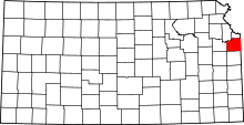 | |
| Unincorporated communities | ||
| Townships | ||
| Footnotes | ‡This populated place also has portions in an adjacent county or counties | |
Municipalities and communities of Leavenworth County, Kansas, United States | ||
|---|---|---|
| Cities | 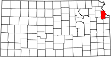 | |
| CDPs | ||
| Unincorporated communities | ||
| Townships |
| |
| Ghost town | ||
| Footnotes | ‡This populated place also has portions in an adjacent county or counties | |
Kansas City metropolitan area's cities and counties | ||
|---|---|---|
| Central city |  | |
| Largest cities (over 100,000 in 2000) | ||
| Medium-sized cities (10,000 to 100,000 in 2000) | ||
| Smaller Cities (between 5,000 and 9,900 in 2010) | ||
| Counties | ||