Edgerton, Kansas
| Edgerton, Kansas | |
|---|---|
| City | |
 Location within Johnson County and Kansas | |
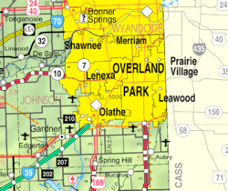 KDOT map of Johnson County (legend) | |
| Coordinates: 38°45′49″N 95°0′37″W / 38.76361°N 95.01028°WCoordinates: 38°45′49″N 95°0′37″W / 38.76361°N 95.01028°W[1] | |
| Country | United States |
| State | Kansas |
| County | Johnson |
| Area[2] | |
| • Total | 2.22 sq mi (5.75 km2) |
| • Land | 2.18 sq mi (5.65 km2) |
| • Water | 0.04 sq mi (0.10 km2) |
| Elevation[1] | 994 ft (303 m) |
| Population (2010)[3] | |
| • Total | 1,671 |
| • Estimate (2012[4]) | 1,699 |
| • Density | 750/sq mi (290/km2) |
| Time zone | CST (UTC-6) |
| • Summer (DST) | CDT (UTC-5) |
| ZIP code | 66021 |
| Area code | 913 |
| FIPS code | 20-19825 [1] |
| GNIS ID | 0479534 [1] |
| Website | EdgertonKS.org |
Edgerton is a city in Johnson County, Kansas, United States,[1] and part of the Kansas City metropolitan area. As of the 2010 census, the city population was 1,671.[5]
History
Edgerton was founded in 1870 when the railroad was extended to that point.[6] It was named for the chief engineer of the Atchison, Topeka and Santa Fe Railway.[7]
In October 2010, BNSF Railway announced plans to build its new 443-acre $250 million intermodal shipping facility in Edgerton, and after complete will replace the current one in Kansas City, Kansas. An adjacent $500 million industrial park with more than 7,000,000 square feet (650,000 m2) of warehouse space will be built over 10 years.[8] It officially opened in October 2013. When the logistics park is fully built out, according to its 1,550-acre master plan, its capacity at that point will be 1.5 million containers annually.[9][10]
Geography
Edgerton is located at 38°45′49″N 95°0′37″W / 38.76361°N 95.01028°W (38.763639, -95.010239).[1] According to the United States Census Bureau, the city has a total area of 2.22 square miles (5.75 km2), of which 2.18 square miles (5.65 km2) is land and 0.04 square miles (0.10 km2) is water.[2]
Demographics
| Historical population | |||
|---|---|---|---|
| Census | Pop. | %± | |
| 1890 | 321 | — | |
| 1900 | 310 | −3.4% | |
| 1910 | 443 | 42.9% | |
| 1920 | 323 | −27.1% | |
| 1930 | 278 | −13.9% | |
| 1940 | 264 | −5.0% | |
| 1950 | 266 | 0.8% | |
| 1960 | 414 | 55.6% | |
| 1970 | 513 | 23.9% | |
| 1980 | 1,214 | 136.6% | |
| 1990 | 1,244 | 2.5% | |
| 2000 | 1,440 | 15.8% | |
| 2010 | 1,671 | 16.0% | |
| Est. 2015 | 1,736 | [11] | 3.9% |
| U.S. Decennial Census | |||
2010 census
As of the census[3] of 2010, there were 1,671 people, 591 households, and 450 families residing in the city. The population density was 766.5 inhabitants per square mile (295.9/km2). There were 645 housing units at an average density of 295.9 per square mile (114.2/km2). The racial makeup of the city was 93.7% White, 0.8% African American, 0.6% Native American, 0.3% Asian, 0.8% from other races, and 3.8% from two or more races. Hispanic or Latino of any race were 4.3% of the population.
There were 591 households of which 42.8% had children under the age of 18 living with them, 58.4% were married couples living together, 12.7% had a female householder with no husband present, 5.1% had a male householder with no wife present, and 23.9% were non-families. 18.3% of all households were made up of individuals and 3.7% had someone living alone who was 65 years of age or older. The average household size was 2.83 and the average family size was 3.25.
The median age in the city was 32.1 years. 29.3% of residents were under the age of 18; 8.4% were between the ages of 18 and 24; 31.4% were from 25 to 44; 24.8% were from 45 to 64; and 6.2% were 65 years of age or older. The gender makeup of the city was 52.8% male and 47.2% female.
2000 census
As of the census[12] of 2000, there were 1,440 people, 474 households, and 388 families residing in the city. The population density was 1,127.7 people per square mile (434.4/km²). There were 500 housing units at an average density of 391.6 per square mile (150.8/km²). The racial makeup of the city was 95.97% White, 0.35% African American, 1.46% Native American, 0.21% Asian, 0.07% from other races, and 1.94% from two or more races. Hispanic or Latino of any race were 2.22% of the population. 23.5% were of German, 21.2% American, 14.5% Irish and 10.3% English ancestry according to Census 2000.
There were 474 households out of which 50.6% had children under the age of 18 living with them, 66.0% were married couples living together, 10.1% had a female householder with no husband present, and 18.1% were non-families. 11.8% of all households were made up of individuals and 2.7% had someone living alone who was 65 years of age or older. The average household size was 3.03 and the average family size was 3.31.
In the city the population was spread out with 33.0% under the age of 18, 11.4% from 18 to 24, 35.9% from 25 to 44, 16.0% from 45 to 64, and 3.7% who were 65 years of age or older. The median age was 28 years. For every 100 females there were 112.4 males. For every 100 females age 18 and over, there were 104.4 males.
The median income for a household in the city was $50,179, and the median income for a family was $51,213. Males had a median income of $32,041 versus $23,594 for females. The per capita income for the city was $16,911. About 2.3% of families and 3.0% of the population were below the poverty line, including 4.6% of those under age 18 and none of those age 65 or over.
Libraries
The Johnson County Library system includes 13 locations throughout Johnson County, including the Edgerton Library.
Notable people
Notable individuals who were born in and/or have lived in Edgerton include:
- John Henry Balch (1896-1980), U.S. Naval Reserve Commander, Medal of Honor recipient[13]
See also
References
- 1 2 3 4 5 6 Geographic Names Information System (GNIS) details for Edgerton, Kansas; United States Geological Survey (USGS); October 13, 1978.
- 1 2 "US Gazetteer files 2010". United States Census Bureau. Retrieved 2012-07-06.
- 1 2 "American FactFinder". United States Census Bureau. Retrieved 2012-07-06.
- ↑ "Population Estimates". United States Census Bureau. Retrieved 2013-05-29.
- ↑ "2010 City Population and Housing Occupancy Status". U.S. Census Bureau. Retrieved March 6, 2011.
- ↑ History of the State of Kansas: Containing a Full Account of Its Growth from an Uninhabited Territory to a Wealthy and Important State. A. T. Andreas. 1883. p. 643.
- ↑ Gannett, Henry (1905). The Origin of Certain Place Names in the United States. Govt. Print. Off. p. 114.
- ↑ BNSF's Plans For Edgerton Intermodal Facility Chug Along; Kansas City Business Journal; October 28, 2010.
- ↑ BNSF Railway opens Logistics Park Kansas City; The Kansas City Star; October 17, 2013.
- ↑ Shipping container makes world smaller, KC and world economy bigger; The Kansas City Star; January 13, 2014.
- ↑ "Annual Estimates of the Resident Population for Incorporated Places: April 1, 2010 to July 1, 2015". Retrieved July 2, 2016.
- ↑ "American FactFinder". United States Census Bureau. Retrieved 2008-01-31.
- ↑ "John Henry Balch". Kansas Historical Society. Retrieved 2016-04-01.
External links
| Wikimedia Commons has media related to Edgerton, Kansas. |
Municipalities and communities of Johnson County, Kansas, United States | ||
|---|---|---|
| Cities | 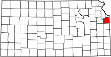 | |
| Unincorporated communities | ||
| Townships | ||
| Footnotes | ‡This populated place also has portions in an adjacent county or counties | |
Kansas City metropolitan area's cities and counties | ||
|---|---|---|
| Central city |  | |
| Largest cities (over 100,000 in 2000) | ||
| Medium-sized cities (10,000 to 100,000 in 2000) | ||
| Smaller Cities (between 5,000 and 9,900 in 2010) | ||
| Counties | ||