Rancho Rincon de Los Esteros
Rancho Rincón de Los Esteros was a 6,353-acre (25.71 km2) Mexican land grant in present-day Santa Clara County, California.
It was given by Governor Juan Bautista Alvarado in 1838 to Ignacio Alviso.[1] The name means Estuaries Corner or Estuaries Bend.
The rancho was located within the present day Santa Clara County,[2] on the southern shore of San Francisco Bay between the Guadalupe River and Coyote Creek outflows into the Bay.
History
Ignacio Alviso (1772 - 1848), the son of Domingo Alviso, one of the members of the De Anza Expedition, was a soldier at the San Francisco Presidio, and retired in 1838. The city of Alviso was named for Ignacio.[3][4]
Three claims for three separate parts of Rancho Rincón de Los Esteros were filed with the Public Land Commission. A claim by Rafael Nicanor Alviso (1840–1904)[5] was filed with the Commission in 1852 and a patent for 2,200 acres (8.9 km2) awarded in 1872.[6][7]
The second claim was filed by Francisco Berreyesa et al. with the Commission in 1852 and a patent for 1,844 acres (7.5 km2) awarded in 1873.[8] Francisco Berreyesa was the son of Guadalupe Berreyesa (1816–1850)[9] and Maria Dolores Alviso (1817–1850), who was daughter of Ignacio Alviso and Margarita Bernal.[10]
The third claim was filed by Ellen E. White with the Commission in 1852 and a patent for 2,308 acres (9.3 km2) awarded in 1862.[11] Charles White (1823–1853), a native of Ireland who came overland from Missouri in 1846 with his wife, Ellen E. White, and two children, was one of San Jose's leading and wealthiest citizens in the half-dozen years before and after statehood. He was alcalde of the Pueblo of San José in 1848. White also owned Rancho Cholame and Rancho Pala. Charles White was killed in the explosion of the steamboat "Jenny Lind" en route from Alviso to San Francisco on April 11, 1853.
Originally the Mexican rancho extended between Arroyo Penitencia in the east to Rio Guadaloupe in the west.[12] By the time the US courts confirmed the grant, the portion east of Coyote Creek had been lost to settlers in Milpitas.[13]
The marshy land, only a few feet above sea level in most places, was used for cattle grazing for a long period of time after the original grant. Numerous orchards existed on the land in the early 1900s, and, in addition, lettuce was grown here more recently in the 1970s.
In contemporary times the name Rincón de Los Esteros is also the name of a redevelopment project in the city of San Jose, California.
See also
- Berreyesa family
- Ranchos of Santa Clara County, California
References
- ↑ Ogden Hoffman, 1862, Reports of Land Cases Determined in the United States District Court for the Northern District of California, Numa Hubert, San Francisco
- ↑ Land Grant Profile for Rancho Rincón de Los Esteros
- ↑ Members of the Anza Expedition: Individual Profiles
- ↑ Robert Burrill and Lynn Rogers, 2006, Images of America: Alviso, San Jose, Arcadia Publishing, ISBN 0-7385-3140-5
- ↑ Domingo Alviso
- ↑ United States. District Court (California : Northern District) Land Case 204 ND
- ↑ Report of the Surveyor General 1844 - 1886
- ↑ United States. District Court (California : Northern District) Land Case 239 ND
- ↑ Descendants of Luis Cayetano (Berrelleza) Berreyesa
- ↑ Ignacio Alviso and Margarita Bernal
- ↑ United States. District Court (California: Northern District) Land Case 238 ND
- ↑ Diseño del Rancho Rincón de Los Esteros
- ↑ 75 US 337 Alviso v. United States
Coordinates: 37°26′24″N 121°55′48″W / 37.440°N 121.930°W
Municipalities and communities of Santa Clara County, California, United States | ||
|---|---|---|
| Cities and towns | 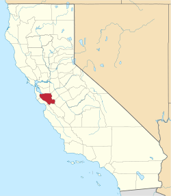 | |
| CDPs | ||
| Unincorporated communities | ||
| CCDs | ||
| Ghost towns | ||