Humboldt County, California
| County of Humboldt | ||
|---|---|---|
| County | ||
|
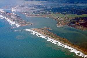
Aerial view of Humboldt Bay | ||
| ||
 Location in the state of California | ||
 California's location in the United States | ||
| Country |
| |
| State |
| |
| Region | California North Coast | |
| Incorporated | May 12, 1853[1] | |
| Named for | Humboldt Bay | |
| County seat | Eureka | |
| Largest city | Eureka | |
| Area | ||
| • Total | 4,052 sq mi (10,490 km2) | |
| • Land | 3,568 sq mi (9,240 km2) | |
| • Water | 484 sq mi (1,250 km2) | |
| Highest elevation[2] | 6,960 ft (2,120 m) | |
| Population (April 1, 2010)[3] | ||
| • Total | 134,623 | |
| • Estimate (2014)[3] | 135,727 | |
| • Density | 33/sq mi (13/km2) | |
| Time zone | Pacific Time Zone (UTC-8) | |
| • Summer (DST) | Pacific Daylight Time (UTC-7) | |
| Area code(s) | 707, 530 | |
| Website | www.humboldtgov.org | |
Humboldt County is a county in the U.S. state of California. As of the 2010 census, the population was 134,623.[4] The county seat is Eureka.[5]
Humboldt County comprises the Eureka-Arcata-Fortuna, CA Micropolitan Statistical Area. It is located on the far North Coast 200 miles north of San Francisco.
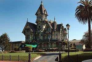
Its primary population centers of Eureka, the site of College of the Redwoods main campus, and the smaller college town of Arcata, site of Humboldt State University, are located adjacent to Humboldt Bay, California's second largest natural bay.[6] Area cities and towns are known for hundreds of ornate examples of Victorian architecture.
Humboldt County is a densely forested mountainous, and rural county with about 110 miles of coastline (more than any other county in the state)[7] situated along the Pacific coast in Northern California's rugged Coast (Mountain) Ranges. With nearly 1,500,000 acres (6,100 km2) of combined public and private forest in production, Humboldt County alone produces twenty percent of total volume and thirty percent of the total value of all forest products produced in California.[8] The county contains over forty percent of all remaining old growth Coast Redwood forests,[9] the vast majority of which is protected or strictly conserved within dozens of national, state, and local forests and parks, totaling approximately 680,000 acres (over 1,000 square miles).[10]
History
The original inhabitants of the area now known as Humboldt County include the Wiyot, Yurok, Hupa, Karuk, Chilula, Whilkut, and the Eel River Athapaskan peoples, including the Wailaki, Mattole and Nongatl.[11] Andrés de Urdaneta found the coast near Cape Mendocino then followed the coast south to Acapulco in 1565. Spanish traders made unintended visits to California with the Manila Galleons on their return trips from the Philippines beginning in 1565. Humboldt County was formed in 1853 from parts of Trinity County. The first recorded entry by people of European origin was a landing by the Spanish in 1775 in Trinidad.[11]
The first recorded entry of Humboldt Bay by non-natives was an 1806 visit from a sea otter hunting party from Sitka employed by the Russian American Company.[11] The hunting party included Captain Jonathan Winship,an American, and some Aleut hunters.[11][12] The bay was not visited again by people of European origin until 1849 when Josiah Gregg's party visited.[12] In 1850, Douglas Ottinger and Hans Buhne entered the bay, naming it Humboldt in honor of the great naturalist and world explorer, Alexander von Humboldt, and the name was later applied to the county as a whole.
The area around Humboldt Bay was once solely inhabited by the Wiyot Indian tribe. One of the largest Wiyot villages, Tolowot, was located on Indian Island in Humboldt Bay. Founded around 900 BC, it contains a shell midden 6 acres (2.4 ha) in size and 14 feet (4.3 m) deep. It was the site of the February 26, 1860 massacre of the Wiyot people that was recorded by Bret Harte, then living in Union, now called Arcata. Between 60 and 200 Wiyot men, women, and children were murdered that night. Tolowot is now a restricted site and a National Historic Landmark.[12]
State historic landmarks in Humboldt County include Arcata and Mad River Railroad, California's First Drilled Oil Wells in Petrolia, Camp Curtis, Centerville Beach Cross, the City of Eureka, the town of Ferndale, Fort Humboldt, Humboldt Harbor Historical District, the Jacoby Building, The Old Arrow Tree, Old Indian Village of Tsurai, the Town of Trinidad, and Trinidad Head.[12]
On February 5 and 6, 1885, Eureka's entire Chinese population of 300 men and 20 women were expelled after a gunfight between rival Chinese gangs (tongs) resulted in the wounding of a 12-year-old boy and the death of 56-year-old David Kendall, a Eureka City Councilman. After the shooting, an angry mob of 600 Eureka residents met and informed the Chinese that they were no longer wanted in Eureka and would be hanged if they were to stay in town longer than 3 p.m. the next day. They were put on two steamships and shipped to San Francisco. No-one was killed in the expulsion. Another Chinese expulsion occurred during 1906 in a cannery on the Eel River, in which 23 Chinese cannery workers were expelled after objections to their presence. However, some Chinese remained in the Orleans area, where some white landowners sheltered and purchased food for the Chinese mineworkers until after racial tension passed. Chinese did not return to the coastal cities until the 1950s.[13]
Climate
The coastal zone of the county experiences very wet, cool winters and dry, mild foggy summers. In the winter, highs range from the low 40's to high 50's (5 to 15 °C), with lows in the 30's and 40's (0 to 9 °C). Coastal summers are cool to mild, with average highs in the 60's (16 to 21 °C) and frequent fogs. Coastal summer highs range from the mid-60s to 70's (18 to 21 °C), with lows from the upper 40's to mid 50's (8 to 13 °C). In the populated areas and cities near the coast, the highest temperatures tend to occur at locations just a few miles inland from Eureka and Arcata, in towns like Fortuna, Rio Dell, and smaller unincorporated communities located somewhat further away from Humboldt Bay. In these locations summer highs measure in the low to mid 70's (21 to 24 °C). The coastal zone experiences a number of frosty nights in winter and early spring, though snowfall and hard freezes are rare. Coastal winters are cool and wet. Winter rainstorms are frequent, with averages from 30 inches (760 mm) to 100 inches (2,500 mm) a year varying with elevation.
Inland areas of the county also experience wet, cool winters. Snowfall is common at elevations over 3,000 ft (910 m) throughout the winter months. Summer displays the sharpest difference between the coastal and inland climates. Inland regions of Humboldt County experience highs from the 80's to the 90's (27 to 37 °C) depending on the elevation and distance from the ocean. Occasional summer highs of 100 degrees (38 °C) are common in eastern and southern parts of the county including Orleans, Hoopa, Willow Creek, Garberville, Honeydew, and inland river valleys.
| Location | Month | Temp (°F) | Temp (°C) | Month | Temp (°F) | Temp (°C) |
|---|---|---|---|---|---|---|
| Eureka | August | 64/52 | 18/11 | December | 55/40 | 12/4 |
| Arcata | September | 62/51 | 17/11 | December | 54/38 | 12/3 |
| Ferndale | August | 71/52 | 22/11 | December | 56/39 | 13/4 |
| Willow Creek | July | 94/52 | 34/11 | December | 50/35 | 10/1 |
| Garberville | August | 87/53 | 31/12 | December | 49/37 | 9/3 |
| Shelter Cove | August | 69/53 | 21/11 | January | 57/45 | 14/7 |
| Orick | August | 69/49 | 21/9 | January | 52/37 | 11/2 |
Tectonics
Historically, Humboldt County and the entire far north coast have had many earthquakes over 6.0 magnitude.
The 1992 Cape Mendocino earthquakes were a series of three major earthquakes that occurred off the coast of Cape Mendocino, California on April 25 and 26, 1992, the largest being a 7.2. Ninety-five people were injured and property in the county sustained considerable damage.[15]
In 2010 a 6.5 magnitude earthquake struck offshore, 33 mi. (53 km) west of Eureka, resulting in only minor injuries and some structural damage to houses and utilities, and no fatalities reported.[16]
The town of Arcata is built on top of an accretionary wedge. This was formed by the subduction of the Gorda plate underneath the North American plate.[17]
Geography
According to the U.S. Census Bureau, the county has a total area of 4,052 square miles (10,490 km2), of which 3,568 square miles (9,240 km2) is land and 484 square miles (1,250 km2) (12.0%) is water.[18]
Located inside Humboldt County is Cape Mendocino, the westernmost point in California (longitude124 degrees, 24 minutes, 30 seconds).
Humboldt County contains a diversity of plant and animal species, with significant forest and coastal habitats. In coastal areas there are extensive amounts of redwood forests.[19] A prominent understory shrub is the toyon, whose northern range limit is in Humboldt County.[20]
Bay
Humboldt Bay, the only deep water port between San Francisco and Coos Bay, Oregon, is located on the coast at the midpoint of the county.
Rivers

Humboldt County's major rivers include (in order of flow-cubic meters per second-from largest to smallest):
The smaller rivers include: Redwood Creek, significant due to amount of its flow; the Van Duzen; the Eel River syncline group composed of the South Fork, the North Fork, and the Salt River; the Mattole, Salmon, Elk, Bear, and Little rivers.
National protected areas
National Park
Conservation Area
Recreation Area
- Samoa Dunes Recreation Area - Bureau of Land Management
Forest
- Headwaters Forest Reserve - Bureau of Land Management
- Six Rivers National Forest - U.S. Forest Service
- Trinity National Forest - U.S. Forest Service
Wildlife Refuge
- Humboldt Bay National Wildlife Refuge - Bureau of Land Management and U.S. Fish and Wildlife Service
State protected areas
Beaches
Parks
- Fort Humboldt State Historic Park
- Grizzly Creek Redwoods State Park
- Humboldt Lagoons State Park
- Humboldt Redwoods State Park
- Patrick's Point State Park
- Prairie Creek Redwoods State Park
- Richardson Grove State Park
- Sinkyone Wilderness State Park
Tide Pools
Recreation Areas
- Benbow Lake State Recreation Area
- Harry A. Merlo State Recreation Area
Reserves
- Azalea State Reserve
- John B. Dewitt Redwoods State Reserve
County parks
Demographics
2000
As of the 2000 census, the population of Humboldt County was 126,518. As of that census, there were 51,238 households in Humboldt County, and the population density was 35 people per square mile (14/km²). By 2006, the population was projected to have increased to 131,361 by the California Department of Finance.[33] There were 55,912 housing units at an average density of 16 per square mile (6/km²). The racial makeup of the county was 84.7% White, 0.9% Black or African American, 5.7% Native American, 1.7% Asian, 0.2% Pacific Islander, 2.5% from other races, and 4.4% from two or more races. 6.5% of the population were Hispanic or Latino of any race. 13.3% were of German, 10.7% Irish, 10.3% English, 7.4% American and 5.7% Italian ancestry according to Census 2000. 92.1% spoke English and 4.6% Spanish as their first language.
There were 51,238 households out of which 28.5% had children under the age of 18 living with them, 43.1% were married couples living together, 11.8% had a female householder with no husband present, and 40.2% were non-families. 28.9% of all households were made up of individuals and 9.2% had someone living alone who was 65 years of age or older. The average household size was 2.39 and the average family size was 2.95.
In the county the population was spread out with 23.2% under the age of 18, 12.4% from 18 to 24, 27.4% from 25 to 44, 24.5% from 45 to 64, and 12.5% who were 65 years of age or older. The median age was 36 years. For every 100 females there were 97.7 males. For every 100 females age 18 and over, there were 95.6 males.
The median income for a household in the county was $31,226, and the median income for a family was $39,370. Males had a median income of $32,210 versus $23,942 for females. The per capita income for the county was $17,203. About 12.9% of families and 19.5% of the population were below the poverty line, including 22.5% of those under age 18 and 7.2% of those age 65 or over.
2010
| Historical population | |||
|---|---|---|---|
| Census | Pop. | %± | |
| 1860 | 2,694 | — | |
| 1870 | 6,140 | 127.9% | |
| 1880 | 15,512 | 152.6% | |
| 1890 | 23,469 | 51.3% | |
| 1900 | 27,104 | 15.5% | |
| 1910 | 33,857 | 24.9% | |
| 1920 | 37,413 | 10.5% | |
| 1930 | 43,233 | 15.6% | |
| 1940 | 45,812 | 6.0% | |
| 1950 | 69,241 | 51.1% | |
| 1960 | 104,892 | 51.5% | |
| 1970 | 99,692 | −5.0% | |
| 1980 | 108,514 | 8.8% | |
| 1990 | 119,118 | 9.8% | |
| 2000 | 126,518 | 6.2% | |
| 2010 | 134,623 | 6.4% | |
| Est. 2015 | 135,727 | [34] | 0.8% |
| U.S. Decennial Census[35] 1790–1960[36] 1900–1990[37] 1990–2000[38] 2010–2015[4] | |||
The 2010 United States Census reported that Humboldt County had a population of 134,623. The racial makeup of Humboldt County was 109,920 (81.7%) White, 1,505 (1.1%) African American, 7,726 (5.7%) Native American, 2,944 (2.2%) Asian, 352 (0.3%) Pacific Islander, 5,003 (3.7%) from other races, and 7,173 (5.3%) from two or more races. Hispanic or Latino of any race were 13,211 persons (9.8%).[39]
| Population reported at 2010 United States Census | |||||||||
|---|---|---|---|---|---|---|---|---|---|
Population | American | American | | Islander | races | more races | or Latino (of any race) | ||
| Humboldt County | 134,623 | 109,920 | 1,505 | 7,726 | 2,944 | 352 | 5,003 | 7,173 | 13,211 |
city | Population | American | American | | Islander | races | more races | or Latino (of any race) | |
| Arcata | 17,231 | 14,094 | 351 | 393 | 454 | 35 | 769 | 1,135 | 2,000 |
| Blue Lake | 1,253 | 1,094 | 5 | 55 | 13 | 4 | 24 | 58 | 82 |
| Eureka | 27,191 | 21,565 | 514 | 1,011 | 1,153 | 176 | 1,181 | 1,591 | 3,143 |
| Ferndale | 1,371 | 1,281 | 1 | 22 | 20 | 2 | 17 | 28 | 77 |
| Fortuna | 11,926 | 9,686 | 73 | 444 | 106 | 9 | 1,065 | 543 | 2,032 |
| Rio Dell | 3,368 | 2,894 | 13 | 125 | 25 | 3 | 140 | 168 | 384 |
| Trinidad | 367 | 331 | 2 | 15 | 2 | 1 | 1 | 15 | 11 |
place | Population | American | American | | Islander | races | more races | or Latino (of any race) | |
| Alderpoint | 186 | 170 | 0 | 9 | 1 | 0 | 1 | 5 | 10 |
| Bayview | 2,510 | 1,959 | 28 | 119 | 88 | 5 | 185 | 126 | 425 |
| Benbow | 321 | 294 | 0 | 2 | 1 | 0 | 13 | 11 | 25 |
| Big Lagoon | 93 | 73 | 0 | 11 | 0 | 0 | 1 | 8 | 11 |
| Cutten | 3,108 | 2,628 | 27 | 119 | 80 | 11 | 78 | 165 | 254 |
| Fieldbrook | 859 | 763 | 4 | 19 | 5 | 0 | 14 | 54 | 51 |
| Fields Landing | 276 | 210 | 6 | 13 | 21 | 1 | 6 | 19 | 18 |
| Garberville | 913 | 815 | 14 | 29 | 17 | 0 | 7 | 31 | 54 |
| Humboldt Hill | 3,414 | 2,853 | 41 | 119 | 102 | 2 | 129 | 168 | 298 |
| Hydesville | 1,237 | 1,108 | 4 | 33 | 6 | 0 | 30 | 56 | 71 |
| Indianola | 823 | 713 | 2 | 42 | 11 | 1 | 12 | 42 | 44 |
| Loleta | 783 | 643 | 12 | 16 | 5 | 0 | 65 | 42 | 114 |
| McKinleyville | 15,177 | 13,010 | 103 | 700 | 211 | 17 | 338 | 798 | 1,081 |
| Manila | 784 | 686 | 14 | 25 | 5 | 0 | 12 | 42 | 30 |
| Miranda | 520 | 439 | 4 | 13 | 4 | 1 | 31 | 28 | 75 |
| Myers Flat | 146 | 125 | 0 | 6 | 1 | 0 | 4 | 10 | 11 |
| Myrtletown | 4,675 | 3,969 | 53 | 142 | 155 | 19 | 126 | 211 | 387 |
| Orick | 357 | 288 | 0 | 39 | 0 | 3 | 6 | 21 | 20 |
| Phillipsville | 140 | 121 | 0 | 4 | 1 | 0 | 0 | 14 | 3 |
| Pine Hills | 3,131 | 2,648 | 22 | 86 | 116 | 4 | 72 | 183 | 220 |
| Redcrest | 89 | 73 | 0 | 5 | 0 | 0 | 3 | 8 | 4 |
| Redway | 1,225 | 1,093 | 5 | 35 | 6 | 1 | 15 | 70 | 96 |
| Samoa | 258 | 198 | 1 | 9 | 0 | 0 | 31 | 19 | 52 |
| Scotia | 850 | 674 | 3 | 35 | 3 | 9 | 90 | 36 | 150 |
| Shelter Cove | 693 | 630 | 3 | 5 | 7 | 1 | 13 | 34 | 47 |
| Weott | 288 | 252 | 0 | 13 | 1 | 0 | 3 | 19 | 20 |
| Westhaven-Moonstone | 1,205 | 1,083 | 9 | 39 | 18 | 0 | 10 | 46 | 53 |
| Willow Creek | 1,710 | 1,375 | 6 | 167 | 14 | 6 | 29 | 113 | 108 |
communities | Population | American | American | | Islander | races | more races | or Latino (of any race) | |
| All others not CDPs (combined) | 26,145 | 20,082 | 185 | 3,807 | 292 | 41 | 482 | 1,256 | 1,750 |
2011
| Population, race, and income | |||||
|---|---|---|---|---|---|
| Total population[40] | 133,585 | ||||
| White[40] | 110,418 | 82.7% | |||
| Black or African American[40] | 1,590 | 1.2% | |||
| American Indian or Alaska Native[40] | 7,718 | 5.8% | |||
| Asian[40] | 3,131 | 2.3% | |||
| Native Hawaiian or other Pacific Islander[40] | 452 | 0.3% | |||
| Some other race[40] | 3,959 | 3.0% | |||
| scope="row" style="text-align: ? | Two or more races[40] | 6,317 | 4.7% | ||
| Hispanic or Latino (of any race)[41] | 12,771 | 9.6% | |||
| Per capita income[42] | $24,209 | ||||
| Median household income[43] | $40,376 | ||||
| Median family income[44] | $52,317 | ||||
Places by population, race, and income
| Places by population and race | ||||||||
|---|---|---|---|---|---|---|---|---|
| Place | Type[45] | Population[40] | White[40] | Other[40] [note 1] |
Asian[40] | Black or African American[40] |
Native American[40] [note 2] |
Hispanic or Latino (of any race)[41] |
| Alderpoint | CDP | 113 | 100.0% | 0.0% | 0.0% | 0.0% | 0.0% | 0.0% |
| Arcata | City | 17,118 | 81.4% | 8.0% | 3.1% | 2.7% | 4.8% | 12.2% |
| Bayview | CDP | 2,818 | 82.9% | 11.9% | 0.8% | 0.0% | 4.4% | 25.2% |
| Benbow | CDP | 415 | 91.8% | 8.2% | 0.0% | 0.0% | 0.0% | 8.2% |
| Big Lagoon | CDP | 179 | 48.0% | 0.0% | 0.0% | 0.0% | 52.0% | 1.7% |
| Blue Lake | City | 1,336 | 84.6% | 3.6% | 1.6% | 2.2% | 8.1% | 5.0% |
| Cutten | CDP | 3,166 | 89.5% | 2.7% | 4.5% | 0.0% | 3.3% | 0.6% |
| Eureka | City | 27,027 | 82.3% | 6.6% | 3.9% | 1.8% | 5.4% | 9.3% |
| Ferndale | City | 1,503 | 92.0% | 5.6% | 0.2% | 0.0% | 2.2% | 2.5% |
| Fieldbrook | CDP | 1,053 | 83.1% | 11.4% | 0.9% | 1.4% | 3.2% | 4.8% |
| Fields Landing | CDP | 195 | 100.0% | 0.0% | 0.0% | 0.0% | 0.0% | 0.0% |
| Fortuna | City | 11,753 | 80.8% | 13.2% | 2.7% | 1.1% | 2.3% | 12.5% |
| Garberville | CDP | 610 | 97.0% | 3.0% | 0.0% | 0.0% | 0.0% | 3.4% |
| Humboldt Hill | CDP | 4,145 | 76.5% | 7.3% | 1.9% | 2.6% | 11.8% | 12.4% |
| Hydesville | CDP | 1,114 | 88.4% | 3.6% | 4.7% | 1.3% | 2.0% | 7.2% |
| Indianola | CDP | 1,167 | 83.7% | 6.4% | 1.8% | 0.0% | 8.1% | 0.9% |
| Loleta | CDP | 705 | 87.5% | 9.2% | 3.3% | 0.0% | 0.0% | 3.8% |
| McKinleyville | CDP | 16,701 | 87.5% | 6.4% | 1.2% | 0.1% | 4.8% | 7.9% |
| Manila | CDP | 810 | 91.2% | 6.0% | 0.0% | 0.0% | 2.7% | 1.2% |
| Miranda | CDP | 100 | 100.0% | 0.0% | 0.0% | 0.0% | 0.0% | 0.0% |
| Myers Flat | CDP | 89 | 100.0% | 0.0% | 0.0% | 0.0% | 0.0% | 0.0% |
| Myrtletown | CDP | 4,586 | 86.6% | 9.4% | 1.9% | 0.2% | 1.9% | 9.8% |
| Orick | CDP | 325 | 79.1% | 15.1% | 0.0% | 0.0% | 5.8% | 8.3% |
| Phillipsville | CDP | 130 | 100.0% | 0.0% | 0.0% | 0.0% | 0.0% | 0.0% |
| Pine Hills | CDP | 2,483 | 92.6% | 6.2% | 0.3% | 0.4% | 0.4% | 3.1% |
| Redcrest | CDP | 53 | 100.0% | 0.0% | 0.0% | 0.0% | 0.0% | 0.0% |
| Redway | CDP | 953 | 96.2% | 0.0% | 0.0% | 0.0% | 3.8% | 0.0% |
| Rio Dell | City | 3,342 | 83.9% | 9.7% | 1.5% | 1.9% | 3.0% | 15.7% |
| Samoa | CDP | 364 | 78.8% | 16.2% | 0.0% | 0.3% | 4.7% | 29.1% |
| Scotia | CDP | 863 | 78.6% | 13.4% | 0.0% | 7.2% | 0.8% | 11.5% |
| Shelter Cove | CDP | 508 | 100.0% | 0.0% | 0.0% | 0.0% | 0.0% | 1.0% |
| Trinidad | City | 286 | 95.5% | 2.4% | 0.0% | 0.0% | 2.1% | 1.7% |
| Weott | CDP | 87 | 81.6% | 0.0% | 0.0% | 0.0% | 18.4% | 0.0% |
| Westhaven-Moonstone | CDP | 1,041 | 88.4% | 6.2% | 1.2% | 0.0% | 4.2% | 0.0% |
| Willow Creek | CDP | 1,141 | 86.9% | 12.2% | 0.0% | 0.0% | 1.0% | 4.0% |
| Places by population and income | |||||
|---|---|---|---|---|---|
| Place | Type[45] | Population[46] | Per capita income[42] | Median household income[43] | Median family income[44] |
| Alderpoint | CDP | 113 | $13,062 | $31,000 | $31,000 |
| Arcata | City | 17,118 | $19,996 | $31,815 | $46,702 |
| Bayview (Humboldt County) | CDP | 2,818 | $21,146 | $31,828 | $37,604 |
| Benbow | CDP | 415 | $34,072 | $54,250 | $58,393 |
| Big Lagoon | CDP | 179 | $23,938 | $46,354 | $87,946 |
| Blue Lake | City | 1,336 | $25,588 | $55,568 | $57,045 |
| Cutten | CDP | 3,166 | $29,545 | $63,542 | $68,426 |
| Eureka | City | 27,027 | $22,972 | $36,081 | $51,808 |
| Ferndale | City | 1,503 | $37,348 | $60,147 | $77,083 |
| Fieldbrook | CDP | 1,053 | $28,113 | $54,886 | $76,000 |
| Fields Landing | CDP | 195 | $25,856 | $50,298 | $50,238 |
| Fortuna | City | 11,753 | $23,208 | $37,532 | $48,467 |
| Garberville | CDP | 610 | $20,880 | $20,529 | $52,431 |
| Humboldt Hill | CDP | 4,145 | $17,905 | $38,171 | $42,917 |
| Hydesville | CDP | 1,114 | $29,409 | $53,229 | $66,250 |
| Indianola | CDP | 1,167 | $23,634 | $49,962 | $80,667 |
| Loleta | CDP | 705 | $21,498 | $35,833 | $47,596 |
| McKinleyville | CDP | 16,701 | $23,902 | $46,696 | $54,899 |
| Manila | CDP | 810 | $18,036 | $30,833 | $38,382 |
| Miranda | CDP | 100 | $17,055 | $26,328 | [47] |
| Myers Flat | CDP | 89 | [47] | [47] | [47] |
| Myrtletown | CDP | 4,586 | $38,064 | $51,402 | $66,654 |
| Orick | CDP | 325 | $23,690 | $24,519 | $44,500 |
| Phillipsville | CDP | 130 | $9,557 | $18,542 | $2,499 |
| Pine Hills | CDP | 2,483 | $34,202 | $60,137 | $84,120 |
| Redcrest | CDP | 53 | $21,913 | $31,845 | $39,583 |
| Redway | CDP | 953 | $25,122 | $29,429 | $63,893 |
| Rio Dell | City | 3,342 | $23,446 | $39,240 | $39,932 |
| Samoa | CDP | 364 | $22,010 | $58,036 | $58,393 |
| Scotia | CDP | 863 | $32,809 | $53,063 | $52,083 |
| Shelter Cove | CDP | 508 | $26,915 | $44,500 | $44,500 |
| Trinidad | City | 286 | $34,480 | $63,438 | $75,000 |
| Weott | CDP | 87 | $27,921 | $13,824 | [47] |
| Westhaven-Moonstone | CDP | 1,041 | $24,398 | $36,335 | $37,049 |
| Willow Creek | CDP | 1,141 | $18,803 | $27,500 | $29,000 |
Agriculture
Humboldt County is known for its impressive redwood trees, and many acres of private redwood timberland make Humboldt the top timber producer in California. The lush river bottoms adjacent to the ocean are renowned for producing rich, high-quality dairy products. Somewhat more inland the warmer valleys have historically produced abundant apples and other fruit. More recently vineyards have been planted in the Trinity, Klamath, Mattole and upper Eel river valleys.
Dairy
Humboldt County is known for its quality family operated dairy farms. The Humboldt Creamery, a significant producer of high grade ice cream and other dairy products, still operates from the original headquarters located at Fernbridge adjacent to the Eel River.[48]
Cannabis
Humboldt County is known for its cultural attributes associated with the cultivation and proliferation of marijuana.[49][50] Proposition 215 allows patients and caregivers who are given a doctor's recommendation to legally (State level only) grow up to 99 plants in Humboldt County.[51] David Samuels of The New Yorker describes the county as "the heartland of high-grade marijuana farming in California."[52] However, in the years before Prop 215 (early 1970s-late 1980s), Humboldt County saw a large migration of the Bay Area counter-culture to its region. Many came looking to purchase cheap land, and ended up growing marijuana to pay for their land. Especially around Garberville and Redway, the rural culture and hippie scene eventually collaborated to create a rural hippie community in which marijuana became the center of the economy. Many people prospered by exporting their marijuana down the California coast and to other states because of its reputation for quality. A Redway radio station, KMUD, in the past has issued warnings and alerts to the region with information on whereabouts of law enforcement on their way to raid marijuana gardens.[53] The 2008 independent film Humboldt County centers on the county's marijuana cultivation subculture.
Politics
Voter registration
| Population and registered voters | ||
|---|---|---|
| Total population[40] | 133,585 | |
| Registered voters[54][note 3] | 79,708 | 59.7% |
| Democratic[54] | 33,155 | 41.6% |
| Republican[54] | 20,238 | 25.4% |
| Democratic–Republican spread[54] | +12,917 | +16.2% |
| Independent[54] | 2,557 | 3.2% |
| Green[54] | 3,036 | 3.8% |
| Libertarian[54] | 801 | 1.0% |
| Peace and Freedom[54] | 342 | 0.4% |
| Americans Elect[54] | 1 | 0.0% |
| Other[54] | 221 | 0.3% |
| No party preference[54] | 19,357 | 24.3% |
Cities by population and voter registration
| Cities by population and voter registration | |||||||
|---|---|---|---|---|---|---|---|
| City | Population[40] | Registered voters[54] [note 3] |
Democratic[54] | Republican[54] | D–R spread[54] | Other[54] | No party preference[54] |
| Arcata | 17,118 | 71.9% | 45.1% | 10.2% | +34.9% | 15.5% | 32.2% |
| Blue Lake | 1,336 | 61.4% | 43.0% | 20.4% | +22.6% | 13.7% | 26.1% |
| Eureka | 27,027 | 53.6% | 42.5% | 25.3% | +17.2% | 11.3% | 24.1% |
| Ferndale | 1,503 | 63.7% | 39.4% | 38.2% | +1.2% | 7.5% | 17.4% |
| Fortuna | 11,753 | 54.6% | 33.7% | 38.1% | -4.4% | 10.0% | 22.0% |
| Rio Dell | 3,342 | 50.9% | 33.5% | 35.3% | -1.8% | 13.3% | 23.1% |
| Trinidad | 286 | 94.8% | 52.8% | 18.1% | +34.7% | 9.2% | 22.5% |
Overview
| Year | GOP | DEM | Others |
|---|---|---|---|
| 2016 | 31.5% 17,016 | 56.2% 30,379 | 12.3% 6,647 |
| 2012 | 32.6% 18,825 | 59.7% 34,457 | 7.6% 4,404 |
| 2008 | 33.9% 21,713 | 62.0% 39,692 | 4.0% 2,563 |
| 2004 | 39.0% 25,714 | 57.7% 37,988 | 3.3% 2,184 |
| 2000 | 41.5% 23,219 | 44.4% 24,851 | 14.1% 7,902 |
| 1996 | 35.5% 19,803 | 44.2% 24,628 | 20.3% 11,326 |
| 1992 | 30.5% 18,299 | 48.1% 28,854 | 21.4% 12,868 |
| 1988 | 41.2% 21,460 | 57.1% 29,781 | 1.7% 905 |
| 1984 | 51.6% 27,832 | 46.8% 25,217 | 1.6% 842 |
| 1980 | 49.4% 24,047 | 35.2% 17,113 | 15.5% 7,532 |
| 1976 | 41.6 18,034 | 54.2% 23,500 | 4.2% 1,838 |
| 1972 | 48.8% 22,345 | 46.2% 21,132 | 5.0% 2,286 |
| 1968 | 46.2% 16,719 | 45.5% 16,476 | 8.3% 3,019 |
| 1964 | 33.5% 12,909 | 66.3% 25,515 | 0.2% 75 |
| 1960 | 46.7% 18,074 | 52.7% 20,391 | 0.6% 226 |
| 1956 | 52.6% 19,019 | 47.1% 17,025 | 0.4% 133 |
| 1952 | 60.1% 19,949 | 39.0% 12,949 | 0.9% 293 |
| 1948 | 47.2% 10,979 | 48.4% 11,268 | 4.4% 1,019 |
| 1944 | 42.9% 9,127 | 56.8% 12,083 | 0.2% 50 |
| 1940 | 43.0% 9,470 | 56.0% 12,329 | 1.0% 225 |
| 1936 | 36.0% 6,808 | 62.9% 11,909 | 1.1% 208 |
| 1932 | 42.2% 6,795 | 54.2% 8,723 | 3.6% 577 |
| 1928 | 69.8% 9,162 | 28.4% 3,726 | 1.9% 247 |
| 1924 | 56.8% 6,767 | 7.1% 845 | 36.1% 4,298 |
| 1920 | 69.9% 6,528 | 19.0% 1,778 | 11.1% 1,034 |
| Election results from statewide races | ||
|---|---|---|
| Year | Office | Results |
| 2010 | Governor | Brown 56.3 - 36.2% |
| Lieutenant Governor | Newsom 53.7 - 34.9% | |
| Secretary of State | Bowen 54.3 - 33.6% | |
| Controller | Chiang 58.0 - 30.1% | |
| Treasurer | Lockyer 57.6 - 31.4% | |
| Attorney General | Harris 50.0 - 36.9% | |
| Insurance Commissioner | Jones 49.0 - 33.2% | |
From 1920 to 1984, the county voted for the national winner of each Presidential election held within these years. Since 1988, Humboldt has been a Democratic county in Presidential and congressional elections. The last Republican presidential candidate to win a majority in the county was Ronald Reagan, a Californian, in 1984.[56] In the late 1990s and early 2000s, Humboldt also had a substantial number of people affiliated with the Green Party, but that number has declined in recent years.
Humboldt County is in California's 2nd congressional district, represented by Democrat Jared Huffman.[57]
In the state legislature, Humboldt is part of the 2nd Senate District, represented by Democrat Mike McGuire,[58] and the 2nd Assembly District, represented by Democrat Jim Wood.[59]
Crime
The following table includes the number of incidents reported and the rate per 1,000 persons for each type of offense.
| Population and crime rates | ||
|---|---|---|
| Population[40] | 133,585 | |
| Violent crime[60] | 541 | 4.05 |
| Homicide[60] | 8 | 0.06 |
| Forcible rape[60] | 33 | 0.25 |
| Robbery[60] | 117 | 0.88 |
| Aggravated assault[60] | 383 | 2.87 |
| Property crime[60] | 2,270 | 16.99 |
| Burglary[60] | 1,057 | 7.91 |
| Larceny-theft[60][note 4] | 2,513 | 18.81 |
| Motor vehicle theft[60] | 475 | 3.56 |
| Arson[60] | 51 | 0.38 |
Cities by population and crime rates
| Cities by population and crime rates | ||||||||
|---|---|---|---|---|---|---|---|---|
| City | Population[61] | Violent crimes[61] | Violent crime rate per 1,000 persons |
Property crimes[61] | Property crime rate per 1,000 persons | |||
| Arcata | 17,748 | 78 | 4.39 | 702 | 39.55 | |||
| Eureka | 26,843 | 145 | 5.40 | 2,176 | 81.06 | |||
| Ferndale | 1,360 | 3 | 2.21 | 17 | 12.5 | |||
| Fortuna | 11,752 | 33 | 2.81 | 496 | 42.21 | |||
| Rio Dell | 3,358 | 19 | 5.66 | 57 | 16.97 | |||
Education
The List of schools in Humboldt County, California shows the many school districts, including charter and private schools, at the elementary and high school level. Post-secondary education is offered locally at the College of the Redwoods and Humboldt State University. Blue Lake's Dell'Arte International School of Physical Theatre offers accredited three-year Masters of Fine Arts in Ensemble Based Physical Theatre
Culture
- The Sequoia Park Zoo is the oldest zoo in California operating on a 7 acres (2.8 ha) facility operated by the City of Eureka in 60 acres (24 ha) Sequoia Park.[62]
- The Clarke Historical Museum in Eureka, displays North Coast regional and cultural history in the repurposed Historic Register Bank of Eureka building.
- The Morris Graves Museum of Art conserves and displays the works of local artists in a restored Carnegie Library building.
- The Ferndale Repertory Theatre is the county's oldest theater company; it has been in operation since 1972 at the Hart Theater building in Ferndale.[63]
- See also the List of museums in the North Coast (California).
Media
The Times-Standard is the only daily newspaper in the region; in continuous publication since 1854, and owned by Media News Group since 1996,[64][65] they also print three weeklies: the Redwood Times,[66] the Tri-City Weekly,[67] and Northcoast 101.[68] Other local publications include The Independent, the North Coast Journal,[69] the Ferndale Enterprise,[70] the Two Rivers Tribune,[71] the Isis Scrolls,[72] and The Lumberjack.[73] The Arcata Eye and the McKinleyville Press merged in August 2013 to form the Mad River Union.[74][75]
Television
Humboldt County's locally produced television stations, KIEM and KEET, are based in Eureka. KIEM produces the only local TV newscast and KEET is the only PBS station in the region. CBS and Fox affiliates KVIQ and KBVU, the latter a semi-satellite of KCVU, are based in Chico and ABC affiliate KAEF, a semi-satellite of KRCR-TV, is based in Redding. In previous decades all major networks had production capacity in Eureka.
Radio
For-profit
Non-profit
Community media
Community broadband networks and public, educational, and government access (PEG) cable tv channels provide air time for local voices on Access Humboldt.[97] Cable TV channels are carried by Suddenlink Communications[98] and local programs are provided online through the Community Media Archive.[99] The Digital Redwoods initiative of Access Humboldt is developing local networks to meet comprehensive community needs, including public, education and government purposes.[100]
Transportation
Major highways
Public transportation
- Humboldt Transit Authority operates two fixed route transit bus systems:
- Redwood Transit System provides intercity service to and within communities between Trinidad and Garberville, including Manila, King Salmon, Field's Landing, Loleta, Fernbridge and Fortuna. HTA also offers service between McKinleyville or Arcata and Willow Creek and an express bus between Arcata and College of the Redwoods when classes are in session.
- Eureka Transit Service, operated in the City of Eureka, provides local service on four scheduled routes (one hour headway) in Eureka and its adjacent unincorporated communities. Connections can be made to the Redwood Transit System at several places in Eureka.
- Arcata and Mad River Transit System, operated by the City of Arcata with funding from Humboldt State University. A&MRTS provides fixed route local bus service on two scheduled routes (one hour headway) in Arcata and an additional route between the Valley West Neighborhood and the university when classes are in session.
- The city of Blue Lake and the Blue Lake Rancheria operates the Blue Lake Rancheria Transit Authority. Blue Lake Rancheria Transit provides fixed route intercity transit bus service (one hour headway) between Arcata and the Blue Lake Rancheria Indian Reservation and casino and local service within the city of Blue Lake.
- Del Norte County's Redwood Coast Transit operates fixed route intercity transit bus service between Arcata and Crescent City or Smith River.
- Amtrak Thruway bus has stops in many towns in the region, including Eureka, Arcata, and Fortuna. These stops are not managed by Amtrak and therefore have no services beyond serving passengers. Full service is only provided at the train station in Martinez, near San Francisco.
Airports
Arcata-Eureka Airport is located in McKinleyville (north of Arcata). Commercial flights are available. Other (general aviation) airports are located at Dinsmore, Garberville, Kneeland, Murray Field (Eureka), Samoa Field and Rohnerville (Fortuna).
Seaport
Port of Humboldt Bay - on Humboldt Bay, California's second largest natural bay.
Events
| Name | Month | Location | Citation |
|---|---|---|---|
| Apple Harvest Festival | October | Fortuna | [101] |
| Arcata Oyster Festival | June | Arcata Plaza | [102] |
| Azalea Festival | June | McKinleyville | |
| Avenue of The Giants Marathon | May | Southern Humboldt | [103] |
| Blackberry Festival | July | Westhaven | [104] |
| Blues by the Bay | July | Eureka | [105] |
| Brew at the Zoo | May | Eureka | [106] |
| Chicken Wingfest | September | Eureka | [107] |
| Craftsman's Days | November | Eureka | [108] |
| College of the Redwoods Wood Fair | June | Eureka | [109] |
| Fourth of July Festival | July 4 | Old Town Eureka | [110] |
| Humboldt Pride | September | Arcata | [111] |
| Godwit Days (Birding festival) | April | Arcata | [112] |
| Humboldt Arts Festival | May | Arcata/Blue Lake | [113] |
| Humboldt County Fair | August | Ferndale | [114] |
| Humboldt Film Festival | March & April | Arcata | [115] |
| Humboldt Juggling Festival | April/May | Arcata (HSU) | [116] |
| Humboldt Redwoods Marathon | October | Southern Humboldt | [117] |
| Mushroom Fair | November | Eureka | [118] |
| North Country Fair | September | Arcata | [119] |
| Organic Planet Festival | September | Eureka | [120] |
| Redwood Acres Fair | June | Eureka | [121] |
| Redwood Coast Jazz Festival | March | Eureka | [122] |
| Redwood Run | June | Southern Humboldt | [123] |
| Rhododendron Festival and Parade | April | Eureka | [124] |
| Roll on the Mattole | Summer | Mattole Grange | [125] |
| Summer Arts and Music Festival | June | Benbow | [126] |
| Swauger's Station Day | July | Loleta | [127] |
| Tour of Loleta (by Bicycle) | July | Loleta | [128] |
| Tour of the Unknown Coast (by Bicycle) | May | Southern Humboldt | [129] |
| Trinidad Fish Festival | June | Trinidad | [130] |
| Trinidad to Clam Beach Run | February | Trinidad | [131] |
| Truckers Christmas Parade | December | Eureka | [132] |
| Two Rivers Harvest Festival | October | Willow Creek | [133] |
| World-Championship Kinetic Sculpture Race | May | Arcata to Ferndale | [134] |
| Zootini | August | Eureka | [106] |
Communities
Cities
Census-designated places
Unincorporated communities
- Alton
- Bayside
- Blocksburg
- Briceland
- Bridgeville
- Carlotta
- Cooks Valley
- Dinsmore
- Dyerville
- Elk River
- Englewood
- Fairhaven
- Fernbridge
- Fort Seward
- Freshwater
- Freshwater Corners
- Fruitland
- Glendale
- Holmes
- Honeydew
- Hoopa
- Johnsons
- King Salmon
- Kneeland
- Korbel
- Maple Creek
- Moonstone
- Orleans
- Patricks Point
- Pepperwood
- Petrolia
- Pine Hill
- Port Kenyon
- Ridgewood Heights
- Riverside Park
- Rohnerville
- Rosewood
- Shively
- Stafford
- Sunny Brae
- Weitchpec
- Westhaven
- Whitethorn
Indian reservations
Humboldt County has eight Indian reservations lying within its borders. Only four other counties in the United States have more: San Diego County, California; Sandoval County, New Mexico; Riverside County, California; and Mendocino County, California. The Hoopa Valley Indian Reservation is the largest in the state of California, a state that generally has very small reservations (although very numerous) relative to those in other states.
- Big Lagoon Rancheria
- Blue Lake Rancheria
- Hoopa Valley Indian Reservation
- Karuk Indian Reservation (partly in Siskiyou County)
- Rohnerville Rancheria
- Table Bluff Rancheria
- Cher-Ae Heights Indian Community of the Trinidad Rancheria
- Yurok Indian Reservation (partly in Del Norte County)
Population ranking
The population ranking of the following table is based on the 2010 census of Humboldt County.[135]
† county seat
| Rank | City/Town/etc. | Municipal type | Population (2010 Census)
|
|---|---|---|---|
| 1 | † Eureka | City | 27,191 |
| 2 | Arcata | City | 17,231 |
| 3 | McKinleyville | CDP | 15,177 |
| 4 | Fortuna | City | 11,926 |
| 5 | Myrtletown | CDP | 4,675 |
| 6 | Humboldt Hill | CDP | 3,414 |
| 7 | Rio Dell | City | 3,368 |
| 8 | Pine Hills | CDP | 3,131 |
| 9 | Cutten | CDP | 3,108 |
| 10 | Hoopa Valley Reservation[136] | AIAN | 3,041 |
| 11 | Bayview | CDP | 2,510 |
| 12 | Willow Creek | CDP | 1,710 |
| 13 | Ferndale | City | 1,371 |
| 14 | Blue Lake | City | 1,253 |
| 15 | Yurok Reservation[137] (partially in Del Norte County) | AIAN | 1,238 |
| 16 | Hydesville | CDP | 1,237 |
| 17 | Redway | CDP | 1,225 |
| 18 | Westhaven-Moonstone | CDP | 1,205 |
| 19 | Garberville | CDP | 913 |
| 20 | Fieldbrook | CDP | 859 |
| 21 | Scotia | CDP | 850 |
| 22 | Indianola | CDP | 823 |
| 23 | Manila | CDP | 784 |
| 24 | Loleta | CDP | 783 |
| 25 | Shelter Cove | CDP | 693 |
| 26 | Miranda | CDP | 520 |
| 27 | Karuk Reservation[138] | AIAN | 506 |
| 28 | Trinidad | City | 367 |
| 29 | Orick | CDP | 357 |
| 30 | Benbow | CDP | 321 |
| 31 | Weott | CDP | 288 |
| 32 | Fields Landing | CDP | 276 |
| 33 | Samoa | CDP | 258 |
| 34 | Alderpoint | CDP | 186 |
| 35 | Myers Flat | CDP | 146 |
| 36 | Phillipsville | CDP | 140 |
| 37 | Trinidad Rancheria[139] | AIAN | 132 |
| 38 | Table Bluff Reservation[140] | AIAN | 103 |
| 39 | Big Lagoon | CDP | 93 |
| 40 | Redcrest | CDP | 89 |
| 41 | Blue Lake Rancheria[141] | AIAN | 58 |
| 42 | Rohnerville Rancheria[142] | AIAN | 38 |
| 43 | Big Lagoon Rancheria[143] | AIAN | 17 |
Notable people
- Sara Bareilles
- Lloyd Bridges
- Hobart Brown
- Wesley Chesbro
- David Cobb
- Alexander Cockburn
- Trevor Dunn
- Guy Fieri
- Michael John Fles
- Brendan Fraser
- Robert A. Gearheart
- James Gillett
- Ulysses S. Grant[144][145][146]
- Robert M. Viale, U.S. Medal of Honor recipient
- Stephen Girard Whipple, 49er, newspaper editor, Union Army officer, and politician[147]
- Steven Hackett
- Bret Harte
- Dan Hauser
- El Hefe
- Christa Johnson
- Howard B. Keck
- Seth Kinman
- Naomi Lang
- Rey Maualuga
- Pamela McGee
- Tim McKay
- Mike Patton
- Maurice Purify
- Nate Quarry
- Eric Rofes
- Stephen W. Shaw
- Steve Sillett
- Trey Spruance
- Greg Stafford
- Don Van Vliet
- Ned Yost
See also
- Arcata and Eureka Community Recycling Centers
- Arcata - Jacoby Creek Community Forests
- Arcata Marsh and Wildlife Sanctuary
- HSU First Street Gallery
- Humboldt Arts Council
- Humboldt County Historical Society
- Humboldt Crabs - semi-professional baseball team
- National Register of Historic Places listings in Humboldt County, California
- Operation Green Sweep
- Humboldt State University
Notes
- ↑ Other = Some other race + Two or more races
- ↑ Native American = Native Hawaiian or other Pacific Islander + American Indian or Alaska Native
- 1 2 Percentage of registered voters with respect to total population. Percentages of party members with respect to registered voters follow.
- ↑ Only larceny-theft cases involving property over $400 in value are reported as property crimes.
References
- ↑ Kerr, J.M. - The Codes of California. - 1905. - p.1043.
- ↑ "Salmon Mountain". Peakbagger.com. Retrieved May 22, 2015.
- 1 2 "American Fact Finder - Results". United States Census Bureau. Retrieved April 4, 2016.
- 1 2 "State & County QuickFacts". United States Census Bureau. Retrieved April 4, 2016.
- ↑ "Find a County". National Association of Counties. Archived from the original on May 31, 2011. Retrieved June 7, 2011.
- ↑ Discover Humboldt Bay. - Humboldt Bay Harbor, Recreation and Conservation District. - Retrieved: July 13, 2008
- ↑ "California Coastal Trail.info". Retrieved September 3, 2013.
- ↑ Forestry, Forest Industry, and Forest Products Consumption in California. University of California, Davis: Division of Agriculture and Natural Resources. - (Adobe Acrobat *.PDF document). - Retrieved: March 30, 2008
- ↑ Area of Old-Growth Forests in California, Oregon, and Washington. - United States Forest Service - USDA. - (Adobe Acrobat *.PDF document). - Retrieved: November 18, 2007
- ↑ Humboldt County Public Lands. - Humboldt County Community Development Services. - (Adobe Acrobat *.PDF document). - Retrieved: November 19, 2007
- 1 2 3 4 Van Kirk, Susie, Humboldt County: A Briefest of Histories, Humboldt County Historical Society, May 1999
- 1 2 3 4 Humboldt County State Designated Historical Landmarks. - California Historical Landmarks
- ↑ Easthouse, Keith. - "The Chinese Expulsion: Looking Back on a Dark Episode". - North Coast Journal. - February 27, 2003. - Retrieved: November 26, 2006
- ↑ "California climate averages". Weatherbase. Retrieved October 31, 2015.
- ↑ Cape Mendocino, California Earthquakes , U.S.G.S. (April 25, 1992)
- ↑ Magnitude 6.5 - OFFSHORE NORTHERN CALIFORNIA, U.S.G.S. (January 9, 2010)
- ↑ Thompson, Jerry (March 10, 2012). Cascadia's Fault. Counterpoint Press. p. 352. ISBN 978-1582438245.
"The towns of Eureka and Arcata were built on top of it..." (the accretionary wedge)
- ↑ "2010 Census Gazetteer Files". United States Census Bureau. August 22, 2012. Retrieved September 26, 2015.
- ↑ Neil G. Sugihara, Jan W. Van Wagtendonk, Kevin E. Shaffer, JoAnn Fites-Kaufman, Andrea E. Thode (2006) Fire in California's Ecosystems, University of California Press, 596 pages ISBN 0-520-24605-5
- ↑ C. Michael Hogan (2008) Toyon: Heteromeles arbutifolia, GlobalTwitcher.com, ed. N. Stromberg "Archived copy". Archived from the original on September 6, 2009. Retrieved December 16, 2008.
- ↑ A.W. Way Park, Humboldt County Parks, 2013
- ↑ Big Lagoon Park, Humboldt County Parks, 2013
- ↑ Centerville Beach, Humboldt County Parks, 2013
- ↑ Clam Beach, Humboldt County Parks, 2013
- ↑ Crab Park, Humboldt County Parks, 2013
- ↑ Freshwater Park, Humboldt County Parks, 2013
- ↑ Hammond Trail, Humboldt County Parks, 2013
- ↑ Luffenholtz Beach, Humboldt County Parks, 2013
- ↑ Mad River, Humboldt County Parks, 2013
- ↑ Margarite Lockwood, Humboldt County Parks, 2013
- ↑ Moonstone Beach, Humboldt County Parks, 2013
- ↑ Van Duzen Pamplin Grove, Humboldt County Parks, 2013
- ↑ "California State Statistical Abstract 2007". Dof.ca.gov. Retrieved March 6, 2012.
- ↑ "County Totals Dataset: Population, Population Change and Estimated Components of Population Change: April 1, 2010 to July 1, 2015". Retrieved July 2, 2016.
- ↑ "U.S. Decennial Census". United States Census Bureau. Archived from the original on May 11, 2015. Retrieved September 26, 2015.
- ↑ "Historical Census Browser". University of Virginia Library. Retrieved September 26, 2015.
- ↑ Forstall, Richard L., ed. (March 27, 1995). "Population of Counties by Decennial Census: 1900 to 1990". United States Census Bureau. Retrieved September 26, 2015.
- ↑ "Census 2000 PHC-T-4. Ranking Tables for Counties: 1990 and 2000" (PDF). United States Census Bureau. April 2, 2001. Retrieved September 26, 2015.
- ↑ "2010 Census P.L. 94-171 Summary File Data". United States Census Bureau.
- 1 2 3 4 5 6 7 8 9 10 11 12 13 14 15 16 17 U.S. Census Bureau. American Community Survey, 2011 American Community Survey 5-Year Estimates, Table B02001. American FactFinder Archived September 11, 2013, at the Wayback Machine.. Retrieved October 26, 2013.
- 1 2 U.S. Census Bureau. American Community Survey, 2011 American Community Survey 5-Year Estimates, Table B03003. American FactFinder Archived September 11, 2013, at the Wayback Machine.. Retrieved October 26, 2013.
- 1 2 U.S. Census Bureau. American Community Survey, 2011 American Community Survey 5-Year Estimates, Table B19301. American FactFinder Archived September 11, 2013, at the Wayback Machine.. Retrieved October 21, 2013.
- 1 2 U.S. Census Bureau. American Community Survey, 2011 American Community Survey 5-Year Estimates, Table B19013. American FactFinder Archived September 11, 2013, at the Wayback Machine.. Retrieved October 21, 2013.
- 1 2 U.S. Census Bureau. American Community Survey, 2011 American Community Survey 5-Year Estimates, Table B19113. American FactFinder Archived September 11, 2013, at the Wayback Machine.. Retrieved October 21, 2013.
- 1 2 U.S. Census Bureau. American Community Survey, 2011 American Community Survey 5-Year Estimates. American FactFinder Archived September 11, 2013, at the Wayback Machine.. Retrieved October 21, 2013.
- ↑ U.S. Census Bureau. American Community Survey, 2011 American Community Survey 5-Year Estimates, Table B01003. American FactFinder Archived September 11, 2013, at the Wayback Machine.. Retrieved October 21, 2013.
- 1 2 3 4 5 Data unavailable
- ↑ Wilson, Emily (November 2, 2006). "On ice cream, organic milk and avoiding corporate takeovers". The North Coast Journal. Retrieved December 29, 2008.
- ↑ California to Let Voters Decide on Marijuana Legalization, PBS News Hour, aired October 13, 2010.
- ↑ Heart of the Emerald Triangle, The Believer, June 2014
- ↑ "Humboldt County Medical Marijuana Guidelines". Safeaccessnow.net. Retrieved March 6, 2012.
- ↑ Samuels, David. - A Reporter at Large: "Dr. Kush: How medical marijuana is transforming the weed industry". The New Yorker, July 28, 2008.
- ↑ Anderson, Glenda (April 25, 2010). "Garberville's KMUD radio alerts: Helpful or dangerous?". PressDemocrat.com. Retrieved March 6, 2012.
- 1 2 3 4 5 6 7 8 9 10 11 12 13 14 15 16 17 California Secretary of State. February 10, 2013 - Report of Registration Archived November 3, 2013, at the Wayback Machine.. Retrieved October 31, 2013.
- ↑ http://uselectionatlas.org/RESULTS/
- ↑ United States Historical Election Returns Series, University of Michigan, 2013
- ↑ "California's 2nd Congressional District - Representatives & District Map". Civic Impulse, LLC. Retrieved March 1, 2013.
- ↑ "Senators". State of California. Retrieved March 10, 2013.
- ↑ "Members Assembly". State of California. Retrieved March 2, 2013.
- 1 2 3 4 5 6 7 8 9 10 Office of the Attorney General, Department of Justice, State of California. Table 11: Crimes – 2009. Retrieved November 14, 2013.
- 1 2 3 United States Department of Justice, Federal Bureau of Investigation. Crime in the United States, 2014, Table 8 (California). Retrieved April 14, 2016.
- ↑ Sequoia Park Zoo, 2013
- ↑ "Ferndale Repertory Theatre". 2013. Retrieved December 10, 2011.
- ↑ Honoring the 150th Anniversary of the Times-Standard, Congressional Record, November 18, 2004
- ↑ Times-Standard - History
- ↑ Redwood Times Website
- ↑ Tri-City Weekly Website
- ↑ North Coast 101 Website
- ↑ The North Coast Journal Website
- ↑ Ferndale Enterprise homepage
- ↑ Two Rivers Tribune Website
- ↑ Isis Scrolls Website
- ↑ The Lumberjack Website
- ↑ The Arcata Eye Website
- ↑ McKinleyville Press Website
- ↑ KATA
- ↑ KEKA
- ↑ KFMI
- ↑ KGOE
- ↑ KHUM
- ↑ KINS
- ↑ KISS-FM>
- ↑ KKHB
- ↑ KNCR
- ↑ KRED
- ↑ KSLG
- ↑ KWPT
- ↑ KWSW
- ↑ KXGO
- ↑ KIDE
- ↑ KHSU
- ↑ Blue Ox Radio
- ↑ KMUD
- ↑ KMUE upgraded and moved to new frequency, Humboldt Beacon, April 10, 2012
- 1 2 Jefferson Public Radio
- ↑ KRFH
- ↑ Access Humboldt
- ↑ Suddenlink
- ↑ Community Media Archive
- ↑ Digital Redwoods
- ↑ Apple Harvest Festival October 6 and 7, 2012, accessed March 22, 2013
- ↑ Arcata Oyster Festival, Humboldt County Convention & Visitors Bureau, 2013, accessed March 22, 2013
- ↑ Avenue of the Giants Marathon Website, accessed March 22, 2013
- ↑ Blackberry Festival, Humboldt County Convention & Visitors Bureau, 2013, accessed March 22, 2013
- ↑ Blues by the Bay, Humboldt County Convention & Visitors Bureau, 2013, accessed March 22, 2013
- 1 2 sequoiaparkzoo.net Sequoia Park Zoo Website, accessed March 22, 2013
- ↑ "Businesses Against Meth Use". Chicken Wing Fest. Retrieved July 26, 2012., accessed March 22, 2013
- ↑ Craftsman's Days, Humboldt County Convention & Visitors Bureau, 2013, accessed March 22, 2013
- ↑ Community and Economic Development Wood Fair 2012, College of the Redwoods, accessed March 22, 2013
- ↑ 4th of July Festival, Eureka Main Street, accessed March 22, 2013
- ↑ Humboldt Pride Website, accessed March 22, 2013
- ↑ Godwit Days website, accessed March 22, 2013
- ↑ Humboldt Arts Festival, Humboldt County Convention & Visitors Bureau, 2013, accessed March 22, 2013
- ↑ Humboldt County Fair, Humboldt County Convention & Visitors Bureau, 2013, accessed March 22, 2013
- ↑ "Reel Revolution". Humboldt Magazine. Retrieved March 22, 2013.
- ↑ Humboldt Juggling Society, 2012, accessed November 25, 2013
- ↑ Humboldt Redwoods Marathon, Humboldt County Convention & Visitors Bureau, 2013, accessed March 22, 2013
- ↑ Mushroom Fair, Humboldt County Convention & Visitors Bureau, 2013, accessed March 22, 2013
- ↑ North Country Fair Website, accessed March 22, 2013
- ↑ Organic Planet Festival Website, accessed March 22, 2013
- ↑ Redwood Acres Fair Website, accessed March 22, 2013
- ↑ Redwood Coast Jazz Fest, Humboldt County Convention & Visitors Bureau, 2013, accessed March 22, 2013
- ↑ Kiwanis Redwood Run Website, accessed March 22, 2013
- ↑ Rhododendron Parade, Humboldt County Convention & Visitors Bureau, 2013, accessed March 22, 2013
- ↑ NCJ Calendar, accessed March 22, 2013
- ↑ The 37th Annual Summer Arts and Music Festival, accessed March 22, 2013
- ↑ Loleta, Humboldt County Convention & Visitors Bureau, 2013, accessed March 22, 2013
- ↑ "Tour of Loleta Bike Race & Fun Ride". Tourofloleta.com. July 8, 2012. Retrieved March 22, 2013.
- ↑ Tour of the Unknown Coast Website, accessed March 22, 2013
- ↑ Trinidad Fish Festival, Humboldt County Convention & Visitors Bureau, 2013, accessed March 22, 2013
- ↑ Trinidad to Clam Beach Run Website, accessed March 22, 2013
- ↑ Truckers Christmas Parade, Humboldt County Convention & Visitors Bureau, 2013, accessed March 22, 2013
- ↑ 1st Annual Two Rivers Harvest Festival, North Coast Journal, 2009, accessed March 22, 2013
- ↑ Kinetic Grand Championship, Humboldt County Convention & Visitors Bureau, 2013, accessed March 22, 2013
- ↑ "Archived copy". Archived from the original on December 21, 2013. Retrieved February 10, 2013.
- ↑ http://www.census.gov/2010census/popmap/ipmtext.php?fl=1490
- ↑ http://www.census.gov/2010census/popmap/ipmtext.php?fl=4760
- ↑ http://www.census.gov/2010census/popmap/ipmtext.php?fl=1750
- ↑ http://www.census.gov/2010census/popmap/ipmtext.php?fl=4275
- ↑ http://www.census.gov/2010census/popmap/ipmtext.php?fl=4095
- ↑ http://www.census.gov/2010census/popmap/ipmtext.php?fl=0325
- ↑ http://www.census.gov/2010census/popmap/ipmtext.php?fl=3220
- ↑ http://www.census.gov/2010census/popmap/ipmtext.php?fl=0240
- ↑ History of Humboldt County California - Historic Record Co., Los Angeles, 1915, Transcribed by Kathy Sedler, CHAPTER VII. Grant's Career in Humboldt County, California Genealogy & History Archives transcription, Internet Archive, page 52
- ↑ Fort Humboldt State Historic Park
- ↑ California Military Museum
- ↑ California. Adjutant General's Office, Records of California men in the war of the rebellion 1861 to 1867, SACRAMENTO: State Office, J. D. Young, Supt. State Printing, 1890, pp. 11, 826-831
Further reading
- Emerson, F. W. (July 1903). "Among The Redwoods of Humboldt County". Overland Monthly. XLII: 69–96.
External links
| Wikivoyage has a travel guide for Humboldt County. |
| Wikimedia Commons has media related to Humboldt County, California. |
- Official website
- Humboldt Economic Index
- All About Living in Humboldt County
- General Guide to Humboldt County
 |
Del Norte County | Siskiyou County | | |
| Pacific Ocean | |
Trinity County | ||
| ||||
| | ||||
| Mendocino County |

Coordinates: 40°48′N 123°48′W / 40.8°N 123.8°W