Susanville, California
| City of Susanville | |
|---|---|
| City | |
|
Historic Uptown Susanville | |
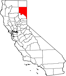
 Location in Lassen County and the state of California | |
 City of Susanville Location in the United States | |
| Coordinates: 40°24′59″N 120°39′11″W / 40.41639°N 120.65306°WCoordinates: 40°24′59″N 120°39′11″W / 40.41639°N 120.65306°W | |
| Country |
|
| State |
|
| County | Lassen |
| Incorporated | August 24, 1900[1] |
| Named for | Susan Roop |
| Area[2] | |
| • Total | 8.017 sq mi (20.763 km2) |
| • Land | 7.931 sq mi (20.541 km2) |
| • Water | 0.086 sq mi (0.222 km2) 1.07% |
| Elevation[3] | 4,186 ft (1,276 m) |
| Population (2010) | |
| • Total | 17,974 |
| • Density | 2,200/sq mi (870/km2) |
| Time zone | Pacific (PST) (UTC-8) |
| • Summer (DST) | PDT (UTC-7) |
| ZIP codes | 96127, 96130 |
| Area code(s) | 530 |
| FIPS code | 06-77364 |
| GNIS feature IDs | 277619, 2412017 |
| Website |
cityofsusanville |


Susanville (formerly known as Rooptown) is the county seat of Lassen County, California, United States.[3] Susanville is located on the Susan River in the southern part of the county,[4] at an elevation of 4,186 feet (1,276 m).[3] The population was 17,974 in the 2010 census, up from 13,541 in the 2000 census. Much of the population increase is related to persons held at two state prisons in the city.
Susanville, a former logging and mining town, is the site of two state prisons: the California Correctional Center, a minimum-medium security facility, which opened in 1963; and the High Desert State Prison, California (not to be confused with High Desert State Prison, Nevada), which opened in 1995. The Federal Correctional Institution, Herlong is nearby, having opened in 2007.
The prisons and their effects on the community, including the provision of much needed jobs, were explored in the documentary, Prison Town, USA (2007), aired on PBS[5][6] Nearly half the adult population of Susanville works at the three prisons in the area where 11,000 people are incarcerated.[7]
Geography
Susanville is located at 40°24′59″N 120°39′11″W / 40.41639°N 120.65306°W.[3] The elevation of Susanville is approximately 4,258 feet (1,298 m) above sea level. It is considered a gateway city to Reno on U.S. Route 395.
According to the United States Census Bureau, the city has a total area of 8.0 square miles (20.8 km²), of which 7.9 square miles (20.5 km²) is land and 1.07% is water.
Eagle Lake is located 15 miles (24 km) north of the town.
Geology
Susanville is underlain by igneous rock, which provides the parent material for its well-drained brown stony to gravelly sandy loams or loams. On the western outskirts under forest cover, the soils are often reddish brown. The most common soil series in Susanville's urban area is Springmeyer gravelly fine sandy loam.[8]
History
Susanville was named after Susan Roop, daughter of Isaac Roop, an early settler.[3] It was first called Rooptown, and the present name was adopted in 1857.[3] The Susanville US post office was established in 1860.[4] Susanville was incorporated in 1900.[4]
Formerly the center of farming, mining and the lumber industry, Susanville suffered from the loss of jobs as these industries changed or declined in the 20th century. Since the late 20th century, the only area of growth in the economy has been associated with the construction and operation of two state prisons in the city and one federal prison in the area. In 2007 half of the adult population of Susanville worked in the prisons:[7] the California Correctional Center, a minimum-medium security facility, which opened in 1963; the High Desert State Prison, California (not to be confused with High Desert State Prison, Nevada), which opened in 1995; and the Federal Correctional Institution, Herlong, which opened in 2007.
Climate
Susanville has a humid continental climate (Köppen Dsb) with cold winters and very warm, mostly dry summers. Records have been kept at several stations since 1893, including Susanville Airport and Susanville 2 SW, southwest of the town centre, along with two other stations with shorter records. Using the 27 °F (−3 °C) isotherm for the coldest month instead, Susanville could also be classified as a warm-summer Mediterranean climate (Csb).
Average January temperatures are a high of 40.4 °F (4.7 °C) and a low of 20.8 °F (−6.2 °C).[9] Average July temperatures are a high of 88.4 °F (31.3 °C) and a low of 49.8 °F (9.9 °C).[9] Temperatures reach 90 °F (32 °C) or higher on an average of 36.9 days annually, and drop to 32 °F (0 °C) or lower on an average of 164.6 days annually;[9] freezing temperatures have been recorded in every month of the year and summer nighttime temperatures are usually cool, but extreme cold is rare and temperatures under 0 °F (−17.8 °C) are reached only on 2.9 days per winter.[9] The highest recorded temperature in Susanville was 106 °F (41 °C) in July 1931, and the lowest recorded temperature was −23 °F (−31 °C) on February 1, 1956.[10]
Annual precipitation averaged 13.44 inches (341 mm) from 1971 to 2000, with an average of 66 days with measurable precipitation.[9] Susanville Airport has averaged a somewhat higher 15.04 inches (382.0 mm) between 1893 and 2012. At the airport the wettest calendar year has been 1907 with 33.51 inches (851.2 mm) and the driest 1976 with 5.33 inches (135.4 mm), though the wettest "rain year" was from July 1937 to June 1938 with 33.01 inches (838.5 mm) as against 32.42 inches (823.5 mm) between July 1906 and June 1907 and 4.36 inches (110.7 mm) in the driest rain year from July 1975 to June 1976. The most precipitation in one month was 12.30 inches (312.4 mm) in March 1907, and the most in 24 hours 5.04 inches (128.0 mm) on January 31, 1897.[11]
Annual snowfall averages 18.7 inches (47.5 cm) at Susanville 2 SW and 32.8 inches (83 cm) at the airport, though the median at Susanville 2 SW is only 6.5 inches (16.5 cm).[12] The most snowfall in one year was 89 inches (226.1 cm) in 1937, with the most in one month 65.5 inches (166 cm) in January 1895.
| Climate data for Susanville 2 SW, California (1971-2000) | |||||||||||||
|---|---|---|---|---|---|---|---|---|---|---|---|---|---|
| Month | Jan | Feb | Mar | Apr | May | Jun | Jul | Aug | Sep | Oct | Nov | Dec | Year |
| Record high °F (°C) | 67 (19) |
69 (21) |
81 (27) |
90 (32) |
96 (36) |
102 (39) |
106 (41) |
105 (41) |
101 (38) |
90 (32) |
83 (28) |
65 (18) |
106 (41) |
| Average high °F (°C) | 40.4 (4.7) |
45.9 (7.7) |
53.3 (11.8) |
61.3 (16.3) |
70.3 (21.3) |
79.6 (26.4) |
88.7 (31.5) |
87 (31) |
78.4 (25.8) |
66.4 (19.1) |
51.9 (11.1) |
41.8 (5.4) |
63.8 (17.7) |
| Average low °F (°C) | 20.9 (−6.2) |
24.3 (−4.3) |
28.8 (−1.8) |
33.1 (0.6) |
39.3 (4.1) |
45.6 (7.6) |
50.8 (10.4) |
48.8 (9.3) |
42.4 (5.8) |
35.1 (1.7) |
27.9 (−2.3) |
22.3 (−5.4) |
34.9 (1.6) |
| Record low °F (°C) | −22 (−30) |
−23 (−31) |
−4 (−20) |
13 (−11) |
20 (−7) |
25 (−4) |
8 (−13) |
31 (−1) |
18 (−8) |
14 (−10) |
−1 (−18) |
−22 (−30) |
−23 (−31) |
| Average precipitation inches (mm) | 2.36 (59.9) |
2.06 (52.3) |
1.53 (38.9) |
0.57 (14.5) |
0.88 (22.4) |
0.45 (11.4) |
0.28 (7.1) |
0.19 (4.8) |
0.49 (12.4) |
1.00 (25.4) |
1.65 (41.9) |
1.98 (50.3) |
13.44 (341.3) |
| Average snowfall inches (cm) | 7.3 (18.5) |
1.8 (4.6) |
2.6 (6.6) |
0.4 (1) |
0.1 (0.3) |
0.0 (0) |
0.0 (0) |
0.0 (0) |
0.1 (0.3) |
0.2 (0.5) |
1.3 (3.3) |
4.9 (12.4) |
18.7 (47.5) |
| Average precipitation days (≥ 0.01 inch) | 8.3 | 8.6 | 8.2 | 6.0 | 5.1 | 3.5 | 2.0 | 1.8 | 3.1 | 4.5 | 7.2 | 7.5 | 65.8 |
| Average snowy days (≥ 0.1 inch) | 2.8 | 1.1 | 1.0 | 0.2 | 0.1 | 0.0 | 0.0 | 0.0 | 0.1 | 0.1 | 0.7 | 1.7 | 7.8 |
| Source: National Oceanic and Atmospheric Administration[9] | |||||||||||||
Demographics
| Historical population | |||
|---|---|---|---|
| Census | Pop. | %± | |
| 1890 | 882 | — | |
| 1910 | 688 | — | |
| 1920 | 918 | 33.4% | |
| 1930 | 1,358 | 47.9% | |
| 1940 | 1,575 | 16.0% | |
| 1950 | 5,338 | 238.9% | |
| 1960 | 5,598 | 4.9% | |
| 1970 | 6,608 | 18.0% | |
| 1980 | 6,520 | −1.3% | |
| 1990 | 7,279 | 11.6% | |
| 2000 | 13,541 | 86.0% | |
| 2010 | 17,947 | 32.5% | |
| Est. 2015 | 15,247 | [13] | −15.0% |
2010
The 2010 United States Census[15] reported that Susanville had a population of 17,947. The population density was 2,238.7 people per square mile (864.4/km²). The racial makeup of Susanville was 11,269 (62.8%) White, 2,249 (12.5%) African American, 612 (3.4%) Native American, 198 (1.1%) Asian, 111 (0.6%) Pacific Islander, 2,928 (16.3%) from other races, and 580 (3.2%) from two or more races. Hispanic or Latino of any race were 4,259 persons (23.7%).
The Census reported that 9,439 people (52.6% of the population) lived in households, 108 (0.6%) lived in non-institutionalized group quarters, and 8,400 (46.8%) were institutionalized.
There were 3,833 households, out of which 1,357 (35.4%) had children under the age of 18 living in them, 1,645 (42.9%) were opposite-sex married couples living together, 499 (13.0%) had a female householder with no husband present, 233 (6.1%) had a male householder with no wife present. There were 327 (8.5%) unmarried opposite-sex partnerships, and 16 (0.4%) same-sex married couples or partnerships. 1,161 households (30.3%) were made up of individuals and 405 (10.6%) had someone living alone who was 65 years of age or older. The average household size was 2.46. There were 2,377 families (62.0% of all households); the average family size was 3.05.
The population was spread out with 2,559 people (14.3%) under the age of 18, 2,547 people (14.2%) aged 18 to 24, 7,633 people (42.5%) aged 25 to 44, 4,024 people (22.4%) aged 45 to 64, and 1,184 people (6.6%) who were 65 years of age or older. The median age was 33.6 years. For every 100 females there were 273.7 males. For every 100 females age 18 and over, there were 327.3 males.
There were 4,256 housing units at an average density of 530.9 per square mile (205.0/km²), of which 1,974 (51.5%) were owner-occupied, and 1,859 (48.5%) were occupied by renters. The homeowner vacancy rate was 3.4%; the rental vacancy rate was 7.7%. 5,039 people (28.1% of the population) lived in owner-occupied housing units and 4,400 people (24.5%) lived in rental housing units.
2000
As of the census[16][17] of 2000, there were 13,541 people, 3,516 households, and 2,250 families residing in the city. The population density was 2,294.8 people per square mile (886.1/km²). There were 3,882 housing units at an average density of 657.9 per square mile (254.0/km²). The racial makeup of the city was 76.0% White, 12.5% African American, 3.2% Native American, 1.1% Asian, 0.9% Pacific Islander, 3.5% from other races, and 2.8% from two or more races. Hispanic or Latino of any race were 15.6% of the population.
There were 3,516 households out of which 37.4% had children under the age of 18 living with them, 46.4% were married couples living together, 13.2% had a female householder with no husband present, and 36.0% were non-families. 29.9% of all households were made up of individuals and 10.7% had someone living alone who was 65 years of age or older. The average household size was 2.49 and the average family size was 3.10.
In the city the population was spread out with 20.0% under the age of 18, 13.6% from 18 to 24, 41.5% from 25 to 44, 17.1% from 45 to 64, and 7.7% who were 65 years of age or older. The median age was 32 years. For every 100 females there were 198.3 males. For every 100 females age 18 and over, there were 231.6 males.
The median income for a household in the city was $35,675, and the median income for a family was $45,216. Males had a median income of $29,973 versus $27,044 for females. The per capita income for the city was $13,238. About 11.0% of families and 14.3% of the population were below the poverty line, including 14.5% of those under age 18 and 9.1% of those age 65 or over.
Government and infrastructure
Two California Department of Corrections and Rehabilitation facilities, High Desert State Prison and California Correctional Center,[18][19] are in Susanville.[20]
Transportation

Susanville lies at the junction of California State Routes 36 and 139. Highway 139 heads north to the Oregon border as a direct route to Klamath Falls. Highway 36 runs west to Red Bluff, then east to where it terminates with U.S. Route 395 just outside Susanville's city limits. U.S. 395 connects Alturas to the north and Reno to the south.
Susanville Municipal Airport, 5 miles (8 km) southeast of Susanville, serves as a public, general aviation airport. Lassen Rural Bus provided bus service within the city. Sage Stage connects Alturas, Susanville, and Reno, Nevada.
The Quincy Railroad no longer serves Susanville on the former Southern Pacific Railroad line since 2004. A Union Pacific Railroad caboose has been placed on an intact section of track next to the rail depot.
Modoc county runs the "sage stage" buses that run from Susanville to Alturas, California and Reno, Nevada, with connections to Redding, California and Klamoth Falls, Oregon
State and federal representation
In the California State Legislature, Susanville is in the 1st Senate District, represented by Republican Ted Gaines,[22] and the 1st Assembly District, represented by Republican Brian Dahle.[23]
In the United States House of Representatives, Susanville is in California's 1st congressional district, represented by Republican Doug LaMalfa.[24]
Economy
Top employers
According to Susanville's 2014 Comprehensive Annual Financial Report,[25] the top employers in the city are:
| # | Employer | # of Employees |
|---|---|---|
| 1 | High Desert State Prison | 1,250 |
| 2 | California Correctional Center | 1,000 |
| 3 | Lassen County | 441 |
| 4 | Susanville Indian Rancheria | 295 |
| 5 | Lassen College | 267 |
| 6 | Banner Lassen Medical Center | 197 |
| 7 | Diamond Mountain Casino | 179 |
| 8 | Walmart | 150 |
| 9 | Susanville School District | 101 |
| 10 | Lassen Nursing & Rehabilitation Center | 101 |
| 11 | Lassen Union High School District | 85 |
| 12 | Northeastern Rural Health | 81 |
| 13 | Safeway | 80 |
| 14 | City of Susanville | 62 |
| 15 | Susanville Supermarket IGA | 48 |
Notable people
This is a list of people who have lived in Susanville at some time.
- Hardin Barry, baseball player and local lawyer, returned to practice law after a one-season career in professional baseball[26]
- Frank Cady, actor (Petticoat Junction, Green Acres, and The Beverly Hillbillies).[27]
- Aaron Duran, writer, media producer grew up in Susanville.[28]
- Jack Ellena, former Los Angeles Rams player, born and raised in Susanville and ran a summer camp near town[29]
- Mike Leach, Washington State's head football coach was born in Susanville.[30]
- Kevin Mangold, professional jockey, stunt double, actor, author
- Ryan O'Callaghan, NFL player(Kansas City Chiefs, New England Patriots).[31]
- Frank Shamrock, mixed martial artist[32]
- Ken Shamrock, mixed martial artist and professional wrestler[32]
- Mike Skinner, NASCAR driver[33]
- Benjamin "Coach" Wade, reality television contestant[34]
References
- ↑ "California Cities by Incorporation Date" (Word). California Association of Local Agency Formation Commissions. Retrieved August 25, 2014.
- ↑ "2010 Census U.S. Gazetteer Files – Places – California". United States Census Bureau.
- 1 2 3 4 5 6 "Susanville". Geographic Names Information System. United States Geological Survey. Retrieved December 17, 2014.
- 1 2 3 Durham, David L. (1998). California's Geographic Names: A Gazetteer of Historic and Modern Names of the State. Clovis, Calif.: Word Dancer Press. p. 423. ISBN 1-884995-14-4.
- ↑ "Prison Town, USA". Making Contact. Season 11. Episode 31. 2008-07-30. External link in
|title=(help) - ↑ POV - Prison Town, pbs.org; retrieved 2010-05-13.
- 1 2 Taylor, Robert. "'Prison Town' a view from outside", Contra Costa Times, 28 July 2007; hosted at Mercury News.
- ↑
- 1 2 3 4 5 6 Station: SUSANVILLE 2 SW, CA, Climatography of the United States No. 20 1971-2000, U.S. Department of Commerce, National Oceanic & Atmospheric Administration, Golden Gate Weather Services, accessed 22 April 2013.
- ↑ Monthly Averages for Susanville, CA (96130), Weather.com, accessed 22 April 2013
- ↑ Susanville Airport – Precipitation Summary
- ↑ Susanville, California (048701) Period of Record Monthly Climate Summary, General Climate Summary Tables: Precipitation, Western Regional Climate Center, Desert Research Institute, accessed 22 April 2013.
- ↑ "Annual Estimates of the Resident Population for Incorporated Places: April 1, 2010 to July 1, 2015". Retrieved July 2, 2016.
- ↑ "Census of Population and Housing". Census.gov. Retrieved June 4, 2015.
- ↑ "2010 Census Interactive Population Search: CA - Susanville city". U.S. Census Bureau. Retrieved July 12, 2014.
- ↑ "American FactFinder". United States Census Bureau. Retrieved 2008-01-31.
- ↑ Census 2000 Gateway
- ↑ "High Desert State Prison." California Department of Corrections. Retrieved on September 25, 2011. "475-750 Rice Canyon Rd. Susanville, CA"
- ↑ "California Correctional Center." California Department of Corrections and Rehabilitation. Retrieved on September 25, 2011. "711-045 Center Rd. Susanville, CA 96127-0790"
- ↑ "Susanville city, California." U.S. Census Bureau. Retrieved on September 25, 2011.
- ↑ California Office of Historic Preservation (April 5, 2001). "National Register of Historic Places Inventory – Nomination Form: Susanville Railroad Depot" (PDF). National Park Service. Retrieved April 27, 2015.
- ↑ "Senators". State of California. Retrieved March 10, 2013.
- ↑ "Members Assembly". State of California. Retrieved March 2, 2013.
- ↑ "California's 1st Congressional District - Representatives & District Map". Civic Impulse, LLC. Retrieved March 2, 2013.
- ↑ City of Susanville CAFR
- ↑ Hardin Barry, Statistics and History, Baseball-Reference.com, USA TODAY, 2013, accessed September 13, 2013
- ↑ Slotnik, Daniel E. (June 11, 2012). "Frank Cady, Kept Store on 'Green Acres,' Dies at 96". The New York Times. Retrieved January 3, 2013.
- ↑ Aaron Duran – Media Guest of Honor, 34.orycon.org, Oregon Science Fiction Conventions.
- ↑ "Jack Ellena". Pro-Football-Reference. Retrieved December 22, 2010.
- ↑ Mike Leach profile, NNDB.com; accessed March 22, 2015.
- ↑ Profile, archive.patriots.com; accessed March 22, 2015.
- 1 2 Woods, Michael, Brothers Ken, Frank Shamrock itching to fight, ESPN.go.com, October 12, 2008; accessed September 13, 2013.
- ↑ Mike Skinner website; accessed September 13, 2013.
- ↑ Magagnini, Stephen (2009-10-31). "Susanville Symphony Hits a High Note in Small Lassen County City". Sacramento Bee. p. 1B.
| Wikimedia Commons has media related to Susanville, California. |
External links
- Official website
- SusanvilleStuff.com The Internet Home of All Things Susanville
- Lassen County Chamber of Commerce website
- Images of Susanville from the Eastman’s Originals Collection, Special Collections Dept., University of California, Davis.