South Santa Clara Valley, California
| South Santa Clara Valley | |
|---|---|
| census county division (CCD) | |
 South Santa Clara Valley Location in the United States | |
| Coordinates: 37°3′17″N 121°34′40″W / 37.05472°N 121.57778°WCoordinates: 37°3′17″N 121°34′40″W / 37.05472°N 121.57778°W | |
| Country |
|
| State |
|
| County | Santa Clara |
| Area[1] | |
| • Total | 117.764 sq mi (305.007 km2) |
| • Land | 117.145 sq mi (303.404 km2) |
| • Water | 0.619 sq mi (1.603 km2) 0.005% |
| Elevation[2] | 236 ft (72 m) |
| Population (2010) | |
| • Total | 103,477 |
| • Density | 880/sq mi (340/km2) |
| Time zone | PST (UTC-8) |
| • Summer (DST) | PDT (UTC-7) |
| ZIP code(s) | 95046, 95038, 95037, 95020 |
| Area code(s) | 408 |
| FIPS code | 06-08593175 |
| GNIS feature ID | 2583195 |
South Santa Clara Valley is a census county division (CCD) located in south Santa Clara County, California.[3] The area covers approximately 118 square miles (310 km2), and includes the cities of Morgan Hill, San Martin, and Gilroy as well as their immediate outlying unincorporated areas. The area is bounded by Coyote to the north, Llagas-Uvas to the west, Diablo Range to the east, and San Benito County to the south.
As of the 2010 US Census, the population was 103,477 residents of whom 47.0% were Hispanic, 40.8% non-Hispanic white, 7.6% Asian, and 4.6% of other races, with a median age of 40.5 years old.[4]
Most residents and businesses in the area use postal zip codes from neighboring cities of Morgan Hill, San Martin, and Gilroy. The telephone area code is 408.
Climate
The region lies in the southern part of Santa Clara Valley, and supports a relatively mild Mediterranean climate.
References
Municipalities and communities of Santa Clara County, California, United States | ||
|---|---|---|
| Cities and towns | 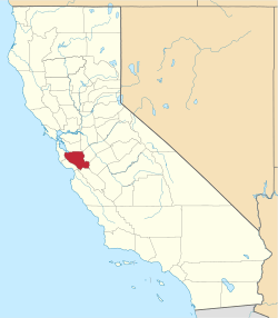 | |
| CDPs | ||
| Unincorporated communities | ||
| CCDs | ||
| Ghost towns | ||
| Bodies of water |
|  |
|---|---|---|
| Counties | ||
| Major cities | ||
| Cities and towns 100k–250k | ||
| Cities and towns 50k–99k | ||
| Cities and towns 25k-50k | ||
| Cities and towns 10k–25k |
| |
| Sub-regions | ||