Volcán de Colima
| Volcán de Colima | |
|---|---|
 Volcán de Colima is on the left with Nevado de Colima on the right. | |
| Highest point | |
| Elevation | 3820+ m (12,533+ ft) [1] |
| Prominence | 600 m (2,000 ft) [1] |
| Listing | |
| Coordinates | 19°30′46″N 103°37′02″W / 19.512727°N 103.617241°WCoordinates: 19°30′46″N 103°37′02″W / 19.512727°N 103.617241°W [1] |
| Geography | |
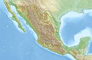 Volcán de Colima Location in Mexico | |
| Location | Jalisco / Colima, Mexico |
| Parent range | Eje Volcánico Transversal |
| Geology | |
| Age of rock | 5 million years |
| Mountain type | Stratovolcano |
| Volcanic arc/belt | Trans-Mexican Volcanic Belt |
| Last eruption | 2014 to Present (ongoing) |
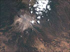
The Volcán de Colima, 3,820 m (12,533 ft), also known as Volcán de Fuego, is part of the Colima Volcanic Complex (CVC) consisting of Volcán de Colima, Nevado de Colima (Spanish pronunciation: [neˈβaðo ðe koˈlima])[2] and the eroded El Cantaro (listed as extinct). It is the youngest of the three and as of 2015 is one of the most active volcanos in Mexico and in North America. It has erupted more than 40 times since 1576. One of the largest eruptions was on January 20–24, 1913.[3] Nevado de Colima, also known as Tzapotépetl, lies 5 kilometres (3.1 mi) north of its more active neighbor and is the taller of the two at 4,271 meters (14,015 ft). It is the 26th-most prominent peak in North America.[4]
Despite its name, only a fraction of the volcano's surface area is in the state of Colima; the majority of its surface area lies over the border in the neighboring state of Jalisco, toward the western end of the Eje Volcánico Transversal mountain range. It is about 485 km (301 mi) west of Mexico City and 125 km (78 mi) south of Guadalajara, Jalisco.
Since 1869–1878, a parasitic set of domes, collectively known as El Volcancito, has formed on the northeast flank of the main cone of the volcano.[5]
Geological history
In the late Pleistocene era, a huge landslide occurred at the mountain, with approximately 25 km³ of debris travelling some 120 km, reaching the Pacific Ocean. An area of some 2,200 km² was covered in landslide deposits.The currently active cone is situated within a large caldera that was probably formed by a combination of landslides and large eruptions. About 300,000 people live within 40 km (25 miles) of the volcano, which makes it the most dangerous volcano in Mexico.[3] In light of its history of large eruptions and situation in a densely populated area, it was designated a Decade Volcano, singling it out for study.

.svg.png)
Current activity
In recent years there have been frequent temporary evacuations of nearby villagers due to threatening volcanic activity. Eruptions have occurred in 1991, 1998–1999 and from 2001 to the present day, with activity being characterised by extrusion of viscous lava forming a lava dome, and occasional larger explosions, forming pyroclastic flows and dusting the areas surrounding the volcano with ash and tephra.
The largest eruption for several years occurred on May 24, 2005. An ash cloud rose to more than 3 km over the volcano, and satellite monitoring indicated that the cloud spread over an area extending 110 nautical miles (200 km) west of the volcano in the hours after the eruption.[6] Pyroclastic flows travelled 4–5 km from the vent, and lava bombs landed 3–4 km away. Authorities set up an exclusion zone within 6.5 km of the summit.
On November 21, 2014, the volcano erupted again. An ash column was sent 5 km into the air, covering towns as far as 25 km away in ash. No fatalities were reported, and no evacuations took place.[7] There were eruptions on January 10, 21 and 25, with the ash from the January 21 eruption falling in towns more than 15 miles (24 km) away.[8][9] On 10 July 2015, there was another eruption. The most recent eruption occurred on Sunday, September 25, 2016, sending a plume of ash and smoke 10,000 ft into the sky.
Volcanological center
This volcano is being permanently monitored by Colima volcano observatory installed in University of Colima, Mexico, there is a specialized team that analyze, interpret and communicate every event produced by this volcano.
Last year a webcam was installed very close to the volcano, and everybody is now able to see the last status of volcano activity in real time.
References
- Notes
- 1 2 3 "Volcán de Colima, Mexico". Peakbagger.com.
- ↑ "The Colima Volcanic Complex, Mexico" (PDF). Mineralogy and Petrology. Retrieved 2012-05-04.
- 1 2 Ritchie, David (2006). Encyclopedia of Earthquakes and Volcanoes. Alexander E. Gates, Ph.D., and David Ritchie. p. 52.
- ↑ "North America Peaks with 2000 meters of Prominence". Peakbagger.com. Retrieved 2012-05-03.
- ↑ "Structure of the Volcancito Dome, Volcan Fuego De Colima, Mexico, Revealed in High Resolution Magnetic Anomalies". confex.com.
- ↑ http://www.ssd.noaa.gov/VAAC/ARCHIVE/COLI/2005E240658.html[]
- ↑ "Mexican Volcano of Fire spews 5km-high pillar of ash (VIDEOS)". RT.com. November 22, 2014. Retrieved November 22, 2014.
- ↑ "VIDEO: Mexico's Colima Volcano spews enormous cloud of ash". NY Daily News.
- ↑ "Footage of huge ash plume as Mexico's Colima volcano erupts". BBC News. 25 January 2015. Retrieved 27 January 2015.
- Bibliography
- Domínguez T., Ramírez J.J., Breton M. (2003), Present Stage Of Activity At Colima Volcano, Mexico, American Geophysical Union, Fall Meeting 2003, abstract #V42B-0350
External links
- Universidad de Colima, Observatorio Vulcanológico (in Spanish)
- Universidad de Colima, Centro de Intercambio e Investigación en Vulcanología (in English and Spanish)
- Experiments at Colima by the Alaska Volcano Observatory
- "Colima". Global Volcanism Program. Smithsonian Institution. Retrieved 2009-01-14.
- "Volcán de Colima". SummitPost.org. Retrieved 2016-12-03.
