Mount Crested Butte, Colorado
| Mount Crested Butte, Colorado | |
|---|---|
| Town | |
|
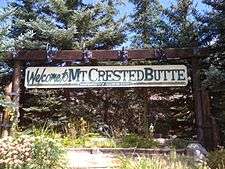
Welcome to Mt. Crested Butte, elevation 9,375 feet (2,858 m) | |
 Location in Gunnison County and the state of Colorado | |
| Coordinates: 38°54′6″N 106°58′3″W / 38.90167°N 106.96750°WCoordinates: 38°54′6″N 106°58′3″W / 38.90167°N 106.96750°W | |
| Country |
|
| State |
|
| County[1] | Gunnison |
| Incorporated (town) | 1973[2] |
| Government | |
| • Type | Home Rule Municipality[1] |
| Area | |
| • Total | 2.22 sq mi (5.75 km2) |
| • Land | 2.22 sq mi (5.75 km2) |
| • Water | 0 sq mi (0 km2) |
| Elevation[3] | 9,898 ft (3,017 m) |
| Population (2010)[4] | |
| • Total | 801 |
| • Density | 360/sq mi (140/km2) |
| Time zone | MST (UTC-7) |
| • Summer (DST) | MDT (UTC-6) |
| ZIP code[5] | 81225 (Crested Butte PO Box) |
| Area code(s) | 970 |
| FIPS code | 08-52570 |
| GNIS feature ID | 0197451 |
| Website |
www |
Mount Crested Butte is a home rule municipality in Gunnison County, Colorado, United States. Mount Crested Butte is the home of the Crested Butte Mountain Resort. The population was 801 at the 2010 census.[6] ZIP code 81225 serves post office boxes for Mount Crested Butte and for neighboring Crested Butte; mail must be addressed to Crested Butte.[5]
Geography

Mt. Crested Butte is located in north-central Gunnison County at 38°54′6″N 106°58′3″W / 38.90167°N 106.96750°W (38.901649, -106.967554)[7] in the Gunnison National Forest, 2 miles (3 km) north of the town of Crested Butte on Gothic Road. The town sits at the northern and western base of Crested Butte, a 12,162-foot (3,707 m) summit that is the site of the Crested Butte ski resort.
According to the United States Census Bureau, the town of Mount Crested Butte covers a total area of 2.22 square miles (5.75 km2), all of it land.[6]
Demographics
| Historical population | |||
|---|---|---|---|
| Census | Pop. | %± | |
| 1980 | 272 | — | |
| 1990 | 264 | −2.9% | |
| 2000 | 707 | 167.8% | |
| 2010 | 801 | 13.3% | |
| Est. 2015 | 827 | [8] | 3.2% |
As of the census[4] of 2000, there were 707 people, 323 households, and 114 families residing in the town. The population density was 459.2 people per square mile (177.3/km²). There were 1,052 housing units at an average density of 683.3 per square mile (263.8/km²). The racial makeup of the town was 97.31% White, 1.56% Native American, 0.28% from other races, and 0.85% from two or more races. Hispanic or Latino of any race were 3.54% of the population.
There were 323 households out of which 11.8% had children under the age of 18 living with them, 31.6% were married couples living together, 2.8% had a female householder with no husband present, and 64.4% were non-families. 26.9% of all households were made up of individuals and 1.2% had someone living alone who was 65 years of age or older. The average household size was 2.19 and the average family size was 2.55.
In the town the population was spread out with 9.3% under the age of 18, 17.3% from 18 to 24, 48.2% from 25 to 44, 21.5% from 45 to 64, and 3.7% who were 65 years of age or older. The median age was 31 years. For every 100 females there were 160.9 males. For every 100 females age 18 and over, there were 156.4 males.
The median income for a household in the town was $48,864, and the median income for a family was $64,167. Males had a median income of $33,542 versus $32,188 for females. The per capita income for the town was $35,657. About 2.7% of families and 13.0% of the population were below the poverty line, including none of those under the age of eighteen or sixty-five or over.
Awards
Mt. Crested Butte and the area surrounding it have won numerous awards including:
- 2012 Gunnison-Crested Butte – Doctors Park, near Almont and Trail 401, Crested Butte – Two of the Top 10 Best Colorado Trails/Mountain Bike Magazine
- 2012 Crested Butte - #15 in North America/Ski Magazine Annual Reader’s Survey
- 2012 Crested Butte - 10 Best Summer Festivals Crested Butte Wildflower Festival by OutsideOnline.com
- 2012 Crested Butte - America’s Best Mountain Towns by Men's Journal
- 2012 Gunnison-Crested Butte - #20 in Top 50 Bucket List by Outside Magazine
- 2012 Crested Butte - Top 25 Ski Resorts in the World by National Geographic
- 2011 Crested Butte - Top 20 Ski Resorts (#15) by Ski Magazine
- 2011 Crested Butte - Top 20 Ski Resorts (#9) by Conde Nast Reader Survey
- 2011 Gunnison - 10 Best Colleges in the US for skiers, Western State College by ESPN
- 2011 Crested Butte - 10 Best Ski Resorts for Families by Forbes
- 2011 Gunnison - 101 Best of the West by American Cowboy
- 2011 Crested Butte - "Top 5 Mountain Towns" by AAA Northern California's Via Magazine
- 2010 Gunnison-Crested Butte "America's Greatest Fall Color Drives" by Travel + Leisure
- 2010 Gunnison - "Pioneer Museum Outstanding Contributions to Colorado History" by Denver Posse
- 2010 Crested Butte - "Ten Great Trips for Older Skiers" by AARP Magazine
- 2010 Crested Butte - "Best Nightlife" by 2011 Outside Magazine Buyer's Guide
- 2010 Crested Butte - "Ten Soaring Ski Resorts in the World" by Woman's Day Magazine
- 2010 Crested Butte - "The West's Best Ski Towns...Most Charm" by Sunset Magazine
- 2009 Crested Butte- Bike Magazine North America Reader Survey - Best Destination, Best Climb, Best Tight n' Twisty Trail and the 401 Trail is one of the top 3 trails in North America
- 2009 Gunnison-Crested Butte - "20 Best Places to Live the West" by American Cowboy Magazine
- 2009 Crested Butte - "Top 10 Family Ski Resorts" by Sherman's Travel
- 2008 Crested Butte - "10 Best Towns in America" by Outside Magazine
- 2008 Crested Butte - "Top 10 Dream Towns" by Sunset Magazine
- 2008 Crested Butte - "Dozen Distinctive Destinations" by the National Trust for Historic Preservation
- 2008 Crested Butte - "Top 20 Ski Towns" by SKI Magazine
- 2008 Crested Butte - #1 Best Steeps, #8 Best Trees & #10 Best Powder" by Skiing magazine
- 2008 Crested Butte - #3 Top Ski Town by Ski.net
- 2008 Crested Butte - "America's Best Small Ski Towns by Travel + Leisure Magazine
- 2007 Gunnison - "50 Best Adventure Towns" by National Geographic Adventure Magazine
See also
References
- 1 2 "Active Colorado Municipalities". State of Colorado, Department of Local Affairs. Retrieved 2007-09-01.
- ↑ "Colorado Municipal Incorporations". State of Colorado, Department of Personnel & Administration, Colorado State Archives. 2004-12-01. Retrieved 2007-09-02.
- ↑ "US Board on Geographic Names". United States Geological Survey. 2007-10-25. Retrieved 2008-01-31.
- 1 2 "American FactFinder". United States Census Bureau. Retrieved 2008-01-31.
- 1 2 "ZIP Code Lookup" (JavaScript/HTML). United States Postal Service. Retrieved November 22, 2007.
- 1 2 "Geographic Identifiers: 2010 Demographic Profile Data (G001): Mount Crested Butte town, Colorado". American Factfinder. U.S. Census Bureau. Retrieved November 18, 2016.
- ↑ "US Gazetteer files: 2010, 2000, and 1990". United States Census Bureau. 2011-02-12. Retrieved 2011-04-23.
- ↑ "Annual Estimates of the Resident Population for Incorporated Places: April 1, 2010 to July 1, 2015". Retrieved July 2, 2016.
- ↑ "Census of Population and Housing". Census.gov. Retrieved June 4, 2015.
External links
- Town of Mount Crested Butte official website
- Gunnison-Crested Butte Tourism Association
- Crested Butte Resort
- 3dSkiMap of Crested Butte Mountain Resort
Municipalities and communities of Gunnison County, Colorado, United States | ||
|---|---|---|
| City | 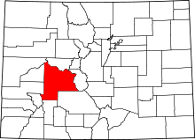 | |
| Towns | ||
| Unincorporated communities | ||
| Ghost town | ||
