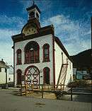
Crested Butte, Colorado
| Town of Crested Butte, Colorado | |
|---|---|
| Home Rule Municipality | |
|
Crested Butte - the town and mountain | |
| Nickname(s): Wildflower Capital of Colorado | |
| Motto: "A National Historic District" | |
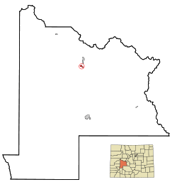 Location in Gunnison County and the State of Colorado | |
| Coordinates: 38°52′04″N 106°58′38″W / 38.867736°N 106.977266°WCoordinates: 38°52′04″N 106°58′38″W / 38.867736°N 106.977266°W[1] | |
| Country |
|
| State |
|
| County | Gunnison County[2] |
| Incorporated | July 15, 1880[3] |
| Government | |
| • Type | Home Rule Municipality[2] |
| Area | |
| • Total | 0.8 sq mi (2.2 km2) |
| • Land | 0.8 sq mi (2.2 km2) |
| • Water | 0 sq mi (0 km2) |
| Elevation | 8,909 ft (2,715 m) |
| Population (2010) | |
| • Total | 1,487 |
| • Density | 1,800/sq mi (680/km2) |
| Time zone | MST (UTC-7) |
| • Summer (DST) | MDT (UTC-6) |
| ZIP Codes[4] | 81224 & 81225 (PO Box) |
| Area code(s) | 970 |
| INCITS place code | 0818310 |
| GNIS feature ID | 0188848 |
| Website |
www |

Crested Butte is a home rule municipality in Gunnison County, Colorado, United States. The town population was 1,487 at the 2010 United States Census.[5] The former coal mining town is now called "the last great Colorado ski town".[6] Crested Butte is a destination for skiing, mountain biking, and a variety of other outdoor activities.
The Colorado General Assembly has designated Crested Butte the Wildflower Capital of Colorado.[7]
History
The East River Valley where Crested Butte is located was once used as a summer residence by the Ute people. However, they were quickly displaced when European-Americans first entered the area. The first whites to explore the valley were beaver trappers, shortly followed by surveyors. Captain John Gunnison, after whom Gunnison County is named, was one of the early explorers to enter the area.
In the 1860s and 1870s coal and silver mines began to open in the surrounding area, and many little mining towns formed. However, when silver mining began to decline, many of these towns failed. Crested Butte, however, was in a better position to survive because it served as a supply town to the surrounding area.
Another industry that served to support Crested Butte was ranching.
When the coal mines closed, the town began to shrink, and eventually the local high school was closed. Students had to travel to Gunnison to go to high school. The town did not revive until a ski area was built on Crested Butte Mountain in the 1960s. From the 1960s to 1990, the Crested Butte public school only facilitated K-5 students, while 6th grade and higher attended school in Gunnison. In 1990 Crested Butte offered middle school in the railroad depot building. In 1992 a new middle school was completed which allowed the public school to facilitate grades K through 8. Finally in 1997, a new facility for the Crested Butte Community School was completed. This included the addition of a public high school so that the school now serves students in grades K-12.
In 1993 the Crested Butte Academy opened in Crested Butte, bringing a private high school into town. However, on 9 July 2008, the academy was closed permanently due to financial difficulties that had plagued its entire existence.[8]
Since the 1970s, several companies have attempted to mine molybdenum on Mount Emmons (called the "Red Lady") near Crested Butte. In 1977 W Mitchell was elected mayor of Crested Butte and led a campaign which stopped AMAX (now Freeport-McMoRan) from building a billion-dollar molybdenum mine on Mount Emmons. Because of his battle against the anticipated environmental impact, Mitchell is known as the man who "saved a mountain". The same year, 1977, saw the formation of the High Country Citizens' Alliance (HCCA), an environmental organization dedicated to protecting natural resources within the Upper Gunnison River Valley.[9]
Currently the rights for Mount Emmons molybdenum are owned by U.S. Energy Corp. On 25 April 2011, Thomson Creek Metals announced that it had terminated its option agreement with U.S. Energy Corp. to acquire an interest in the Mount Emmons molybdenum project.[10] Although US Energy continued to maintain its commitment to moving the project forward on its own behalf,[11] the withdrawal of Thomson Creek Metals was heralded as a major victory in the town of Crested Butte in its battle against the proposed molybdenum mine.[12]
Activities

Winter
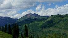
The primary winter activity in Crested Butte is skiing or snowboarding at nearby Crested Butte Mountain Resort in Mount Crested Butte. Backcountry skiing in the surrounding mountains is some of the best in Colorado. The mountain, Crested Butte, rises to 12,162 feet (3,707 m) above sea level. The ski area base is at 9,375 feet (2,858 m). 14 lifts serve 1,058 acres (4.28 km2) of terrain. 448 acres (1.81 km2) of the terrain are double black diamond runs. The large amount of extreme skiing terrain at Crested Butte has attracted the US Extreme Skiing Championships and the X Games. The longest run on Mount Crested Butte is 2.6 miles (4.2 km).
The town of Crested Butte itself has a Nordic Center which has an ice skating rink as well as many miles of groomed cross-country skiing trails.

Summer
Crested Butte is one of the locations that claims to have created the sport of mountain biking. The Mountain Bike Hall of Fame used to be located in Crested Butte before moving to Fairfax, California, in 2014. Other popular summer activities in Crested Butte include hiking, backpacking, rock climbing, whitewater rafting and kayaking, four wheeling, disc golf, and fishing.
Festivals
Crested Butte hosts a number of unique festivals and parades throughout the year. These include Torchlight, New Years, Winter Carnival, Butte Bash College Ski Week and Mardi Gras during the winter months; Extreme Board Fest, Slushuck and Flauschink during spring; the Crested Butte Bike Week, Crested Butte Music Festival, Crested Butte International Film Festival, 4th of July,[13] the Crested Butte Wildflower Festival, Alpenglow Concert Series, Festival of the Arts and Ball Bash during summer; and Fall Fest, Vinotok [14] and Paragon Peoples' Fair during fall.
Geography
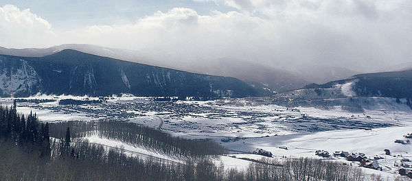
Crested Butte is located in north-central Gunnison County on the west side of the valley of the Slate River, along Coal Creek. Colorado State Highway 135 runs south from Crested Butte 27 miles (43 km) to Gunnison, the county seat. According to the United States Census Bureau, the town of Crested Butte has a total area of 0.85 square miles (2.2 km2), all of it land.[5] Crested Butte lies at an elevation of 8,885 feet (2,708 m) above sea level.[15]
Crested Butte is served by the Gunnison-Crested Butte Regional Airport in Gunnison.
Climate
Climate type is dominated by the winter season, a long, bitterly cold period with short, clear days, relatively little precipitation mostly in the form of snow, and low humidity. The Köppen Climate Classification sub-type for this climate is "Dfc" (Continental Subarctic Climate).[16]
| Climate data for Crested Butte, Colorado (Elevation 8,885ft) | |||||||||||||
|---|---|---|---|---|---|---|---|---|---|---|---|---|---|
| Month | Jan | Feb | Mar | Apr | May | Jun | Jul | Aug | Sep | Oct | Nov | Dec | Year |
| Record high °F (°C) | 59 (15) |
52 (11) |
58 (14) |
72 (22) |
80 (27) |
89 (32) |
95 (35) |
91 (33) |
87 (31) |
78 (26) |
69 (21) |
60 (16) |
95 (35) |
| Average high °F (°C) | 27.8 (−2.3) |
31.4 (−0.3) |
38.1 (3.4) |
47.2 (8.4) |
59.1 (15.1) |
70.2 (21.2) |
76.0 (24.4) |
73.9 (23.3) |
66.7 (19.3) |
56.2 (13.4) |
40.9 (4.9) |
30.1 (−1.1) |
51.5 (10.8) |
| Average low °F (°C) | −4.4 (−20.2) |
−1.3 (−18.5) |
7.1 (−13.8) |
18.3 (−7.6) |
27.7 (−2.4) |
33.2 (0.7) |
38.5 (3.6) |
37.7 (3.2) |
30.2 (−1) |
20.9 (−6.2) |
8.7 (−12.9) |
−2.1 (−18.9) |
17.9 (−7.8) |
| Record low °F (°C) | −43 (−42) |
−47 (−44) |
−32 (−36) |
−17 (−27) |
−1 (−18) |
15 (−9) |
17 (−8) |
17 (−8) |
3 (−16) |
−26 (−32) |
−28 (−33) |
−39 (−39) |
−47 (−44) |
| Average precipitation inches (mm) | 2.69 (68.3) |
2.35 (59.7) |
2.29 (58.2) |
1.79 (45.5) |
1.42 (36.1) |
1.28 (32.5) |
1.99 (50.5) |
2.10 (53.3) |
2.01 (51.1) |
1.53 (38.9) |
1.71 (43.4) |
2.30 (58.4) |
23.46 (595.9) |
| Average snowfall inches (cm) | 39.9 (101.3) |
34.5 (87.6) |
31.3 (79.5) |
17.6 (44.7) |
6.5 (16.5) |
0.7 (1.8) |
0 (0) |
0 (0) |
1.3 (3.3) |
7.7 (19.6) |
23.8 (60.5) |
34.3 (87.1) |
197.5 (501.7) |
| Source: The Western Regional Climate Center[17] | |||||||||||||
Demographics
| Historical population | |||
|---|---|---|---|
| Census | Pop. | %± | |
| 1890 | 857 | — | |
| 1900 | 988 | 15.3% | |
| 1910 | 904 | −8.5% | |
| 1920 | 1,213 | 34.2% | |
| 1930 | 1,251 | 3.1% | |
| 1940 | 1,145 | −8.5% | |
| 1950 | 730 | −36.2% | |
| 1960 | 289 | −60.4% | |
| 1970 | 372 | 28.7% | |
| 1980 | 959 | 157.8% | |
| 1990 | 878 | −8.4% | |
| 2000 | 1,529 | 74.1% | |
| 2010 | 1,487 | −2.7% | |
| Est. 2015 | 1,579 | [18] | 6.2% |
As of the census[20] of 2000, there were 1,529 people, 692 households, and 253 families residing in the town. The population density was 2,183.1 people per square mile (843.4/km²). There were 930 housing units at an average density of 1,327.9 per square mile (513.0/km²). The racial makeup of the town was 97.19% White, 0.26% African American, 0.92% Native American, 0.72% Asian, 0.00% Pacific Islander, 0.46% from other races, and 0.46% from two or more races. 2.75% of the population were Hispanic or Latino of any race.
There were 692 households out of which 19.1% had children under the age of 18 living with them, 28.9% were married couples living together, 5.1% had a female householder with no husband present, and 63.3% were non-families. 28.3% of all households were made up of individuals and 1.4% had someone living alone who was 65 years of age or older. The average household size was 2.21 and the average family size was 2.69.
In the town the population was spread out with 13.5% under the age of 18, 11.5% from 18 to 24, 55.6% from 25 to 44, 17.5% from 45 to 64, and 1.9% who were 65 years of age or older. The median age was 31 years. For every 100 females there were 124.5 males. For every 100 females age 18 and over, there were 131.9 males.
The median income for a household in the town was $41,250, and the median income for a family was $49,118. Males had a median income of $27,386 versus $23,073 for females. The per capita income for the town was $26,789. 11.4% of the population and 2.7% of families were below the poverty line. Out of the total population, 3.5% of those under the age of 18 and 0.0% of those 65 and older were living below the poverty line.
In popular culture
Crested Butte was the setting and main filming location for the Walt Disney ski movie Snowball Express starring Dean Jones and Harry Morgan. 1970s musicians Brewer & Shipley wrote and performed a song called "Crested Butte" dedicated to the town. Crested Butte is the birthplace and hometown of Heidi Montag of MTV's The Hills. It is also the town Bud Light took over for a weekend in 2014 and renamed "Whatever, USA".
Crested Butte was the site for other films in the 1970s, including Snowbeast (1977), The Further Adventures of the Wilderness Family (1978), and Mountain Family Robinson (1979), and Ink (2009).[21]
James Cameron's movie Avatar has very tangible parallels to Crested Butte with regard to both mining issues and environmental coexistence. One of the people who led the fight against the proposed molybdenum mine on Mount Emmons in the late 1970s, former mayor W Mitchell, uses a wheelchair, just like the protagonist in Cameron's film.[22] James Cameron has spent a lot of time at his wife Suzy Amis's cabin in Crested Butte.[23]
Aliens vs. Predator: Requiem is set in Gunnison County. "CRESTED BUTTE" is given as the destination of the bus in which Dallas Howard arrives at Gunnison at the beginning of the movie.
In 2014, Powder Magazine's "Ski Town Throw Down" voted Crested Butte as the number 1 ski town in the United States.
See also
- Outline of Colorado
- State of Colorado
- Crested Butte
- Crested Butte Film Festival
- Crested Butte Mountain Resort
- National Register of Historic Places listings in Gunnison County, Colorado
- West Elk Mountains
References
- ↑ "2014 U.S. Gazetteer Files: Places". United States Census Bureau. July 1, 2014. Retrieved January 5, 2015.
- 1 2 "Active Colorado Municipalities". State of Colorado, Department of Local Affairs. Archived from the original on 2010-11-22. Retrieved 2007-09-01.
- ↑ "Colorado Municipal Incorporations". State of Colorado, Department of Personnel & Administration, Colorado State Archives. 2004-12-01. Retrieved 2007-09-02.
- ↑ "ZIP Code Lookup". United States Postal Service. Archived from the original (JavaScript/HTML) on November 23, 2010. Retrieved September 6, 2007.
- 1 2 "Geographic Identifiers: 2010 Demographic Profile Data (G001): Crested Butte town, Colorado". American Factfinder. U.S. Census Bureau. Retrieved November 18, 2016.
- ↑ "About Crested Butte". Retrieved June 10, 2013.
- ↑ "Crested Butte, the Wildflower Capital of Colorado". Gunnison-Crested Butte, Colorado. Retrieved 9 June 2013.
- ↑ Academy to close its doors for good. The Crested Butte News (2008-07-09). Retrieved on 2012-01-03.
- ↑ Stevens, Mark (February 12, 1979). "Battle on Mount Emmons". The Christian Science Monitor, cited by The Deseret News. Retrieved 9 June 2013.
- ↑ Thompson Creek Metals Company – News Releases – Thompson Creek Terminates Option Agreement with U.S. Energy Corp. – Tue Jan 3, 2012. Thompsoncreekmetals.com. Retrieved on 2012-01-03.
- ↑ Thompson Creek Metals Terminates Its Mount Emmons Option Agreement with U.S. Energy Corp. | U.S. Energy Corp. Investor.usnrg.com (2011-04-25). Retrieved on 2012-01-03.
- ↑ High Country Citizens' Alliance – Home. Hccaonline.org (2010-11-18). Retrieved on 2012-01-03.
- ↑ Harte, Julia (2014-07-02). "Fourth of July Parade Brings Scientists Dressed in Foliage—Some With Nothing Else". Wall Street Journal. Retrieved 2014-07-04.
- ↑ Carla Davidson "Secret Season: Colorado before the Snow Flies," American Heritage, Aug./Sept. 2006.
- ↑ U.S. Geological Survey Crested Butte CO 7.5 minute topographic map
- ↑ Climate Summary for Crested Butte, Colorado
- ↑ "Seasonal Temperature and Precipitation Information". Western Regional Climate Center. Retrieved November 24, 2013.
- ↑ "Annual Estimates of the Resident Population for Incorporated Places: April 1, 2010 to July 1, 2015". Retrieved July 2, 2016.
- ↑ "Census of Population and Housing". Census.gov. Archived from the original on May 11, 2015. Retrieved June 4, 2015.
- ↑ "American FactFinder". United States Census Bureau. Archived from the original on 2013-09-11. Retrieved 2008-01-31.
- ↑ http://www.imdb.com/search/title?locations=Crested%20Butte,%20Colorado,%20USA&ref_=tt_dt_dt
- ↑ Husted, Bill (January 24, 2010). "Husted: "Avatar" sounds like a veiled tale of Crested Butte's battle". Denver Post. Retrieved 11 June 2013.
- ↑ Avatar Based on Colorado Town's History? – Entertainment News Story – KMGH Denver. Thedenverchannel.com (2010-03-07). Retrieved on 2012-01-03.
External links
- Town of Crested Butte official website
- Gunnison – Crested Butte tourism site
- Crested Butte News
- Crested Butte Mountain Resort
- Crested Butte Film Festival
- Crested Butte Photos at Western Mining History
- Crested Butte Mountain Theatre
- Crested Butte Music Festival
Municipalities and communities of Gunnison County, Colorado, United States | ||
|---|---|---|
| City | 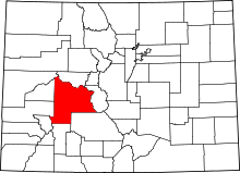 | |
| Towns | ||
| Unincorporated communities | ||
| Ghost town | ||