List of Outer Hebrides

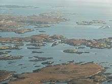
The Outer Hebrides is a chain of more than 100 islands and small skerries located about 70 kilometres (43 mi) west of mainland Scotland. There are 15 inhabited islands in this archipelago, which is also known as the Western Isles and archaically as the Long Isle (Scottish Gaelic: An t-Eilean Fada).[Note 1]
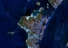
Lewis and Harris is the largest island in Scotland and the third largest in the British Isles, after Great Britain and Ireland.[2] It incorporates Lewis in the north and Harris in the south, both of which are frequently referred to as individual islands, although they are joined by a land border.[Note 2] The largest settlement in Lewis and in the Outer Hebrides is Stornoway.
To the south across the Sound of Harris lie the Uists and Benbecula, which were joined by a series of causeways constructed between 1940 and 1960 to improve transport links.[4] Further south are Barra and the smaller Barra Isles, whose southernmost extremity is Barra Head. There are other outliers with cultural links to the Outer Hebrides that are not part of the archipelago itself. These include the St Kilda group, which are quite distinct geologically and no longer inhabited,[5] Sula Sgeir and North Rona to the north and isolated Rockall, which is 367 kilometres (228 mi) to the west of North Uist.[Note 3]
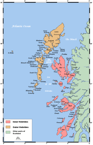
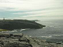
The islands of Scotland's west coast are known collectively as the Hebrides and the Outer Hebrides are separated from the Inner Hebrides by The Minch to the north and the Sea of the Hebrides to the south. The Outer Hebrides are administered by Comhairle nan Eilean Siar and had a population of 26,502 in 2001.[7] The Outer Hebrides have historically been a strong Scottish Gaelic (Gàidhlig) speaking area. Despite recent declines, in the 2001 census more than 50% of the resident population in each island was able to speak Gaelic, for an overall total of 15,842 speakers throughout the archipelago.[8] The modern economy centres on tourism, crofting, fishing, and weaving, the latter of which includes the manufacture of Harris tweed. The archipelago is exposed to wind and tide, and there are numerous lighthouses as an aid to navigation.[9]
The definition of an island used in this list is that it is "land that is surrounded by seawater on a daily basis, but not necessarily at all stages of the tide, excluding human devices such as bridges and causeways".[Note 4]
Inhabited islands
The inhabited islands of the Outer Hebrides had a total population of 26,502 in 2001[7] and 27,684 at the time of the 2011 census.[10]
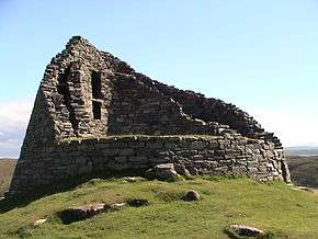
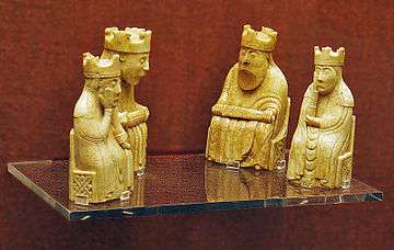
The highest peaks of the islands have names deriving from both Gaelic and Old Norse indicating the historical importance of these two cultures. The archeological record for the period of Viking domination during the Early Historic period is however very limited, the Lewis chessmen being an exception.
In addition to the North Ford (Oitir Mhòr) and South Ford causeways that connect North and South Uist, Benbecula and the northern of the two Grimsays in the southern part of the island chain, several other islands are now connected by causeways and bridges. Great Bernera and Scalpay have bridge connections to Lewis and Harris respectively, Baleshare and Berneray are linked to North Uist, Eriskay to South Uist, Flodaigh, Fraoch-eilean and the southern Grimsay to Benbecula, and Vatersay is connected to Barra by a causeway.[4][11][12] This means that all of the inhabited islands are now connected to at least one other island by a land transport route.
| Island | Gaelic name | Group[Note 5] | Area (ha)[13] | Population[10] | Highest point[14] | Height (m)[Note 6] |
|---|---|---|---|---|---|---|
| Baleshare | Am Baile Sear | Uists and Benbecula | 910 | 58 | 12 | |
| Barra | Barraigh | Barra | 5,875 | 1,174 | Heaval | 383 |
| Benbecula | Beinn nam Fadhla | Uists and Benbecula | 8,203 | 1,303 | Ruaval | 124 |
| Berneray | Beàrnaraigh | Uists and Benbecula | 1,010 | 138 | Beinn Shleibhe | 93 |
| Eriskay | Èirisgeigh | Uists and Benbecula | 703 | 143 | Ben Scrien | 185 |
| Flodaigh | Flodaigh | Uists and Benbecula | 145 | 7[Note 7] | 20 | |
| Fraoch-eilean | Fraoch-eilean | Uists and Benbecula | 55[15] | ?[Note 8] | Cnoc Mor | 11 |
| Great Bernera | Beàrnaraigh Mòr | Lewis (Loch Ròg) | 2,122 | 252 | 87 | |
| Grimsay (North)[Note 9] | Griomasaigh | Uists and Benbecula | 833 | 169 | 22 | |
| Grimsay (South)[Note 10] | Griomasaigh | Uists and Benbecula | 117 | 20 | 20 | |
| Lewis and Harris | Leòdhas agus na Hearadh[3] | Lewis and Harris | 217,898 | 21,031 | Clisham | 799 |
| North Uist | Uibhist a Tuath | Uists and Benbecula | 30,305 | 1,254 | Eaval | 347 |
| Scalpay | Sgalpaigh na Hearadh | Harris | 653 | 291 | Beinn Scorabhaig | 104 |
| South Uist | Uibhist a Deas | Uists and Benbecula | 32,026 | 1,754 | Beinn Mhòr | 620 |
| Vatersay | Bhatarsaigh | Barra | 960 | 90 | Theiseabhal Mòr | 190 |
Ensay, Kisimul Castle and Eilean na Cille are "included in the NRS statistical geography for inhabited islands but had no usual residents at the time of either the 2001 or 2011 censuses".[10]
Uninhabited islands

This is a list of islands with an area greater than 25 hectares (approximately 37 acres). Records for the last date of settlement for the smaller uninhabited islands are incomplete, but most of the islands listed here would have been inhabited at some point during the Neolithic, Iron Age, Early Historic or Norse periods.
In common with the other main island chains of Scotland many of the more remote islands were abandoned during the 19th and 20th centuries, in some cases after continuous habitation since the prehistoric period. This process involved a transition from these places being perceived as relatively self-sufficient agricultural economies[16] to a view becoming held by both island residents and outsiders alike that the more remote islands lacked the essential services of a modern industrial economy.[17]
Some of the islands continue to contribute to modern culture. The "Mingulay Boat Song", although evocative of island life, was written after the abandonment of the island in 1938[18] and Taransay hosted the BBC television series ‘’Castaway 2000’’. Others have played a part in Scottish history. On 4 May 1746, Bonnie Prince Charlie hid on Eilean Liubhaird with some of his men for four days whilst Royal Navy vessels patrolled the Minch. They camped under a sail stretched over a "low pitiful hut" while it rained torrentially.[19]
The difficulties of definition are considerable in some cases. For example, Haswell-Smith (2004) treats Eileanan Iasgaich[Note 11] as a single island of 50 ha, although during high tides it becomes several tidal islets—none of which is ever connected to the "mainland" of South Uist. Despite its name Eilean an Taighe (English: "house island") in the Shiant Isles does not qualify for inclusion as it is connected to Garbh Eilean by a natural isthmus.
| Island | Gaelic name | Group[Note 12] | Area (ha)[20] | Last inhabited[Note 13] | Highest point[14] | Height (m)[Note 14] |
|---|---|---|---|---|---|---|
| Barra Head or Berneray | Beàrnaraigh Cheann Bharraigh | Barra Isles | 204 | 1980 | Sotan | 193 |
| Boreray | Boraraigh | North Uist | 198 | 1960s | Mullach Mòr | 56 |
| Calbhaigh | Calbhaigh | South Uist[Note 15] | 26[15] | Unknown | 10 | |
| Ceabhaigh | Ceabhaigh | Lewis (Loch Ròg) | 25[15] | Unknown | 20 | |
| Ceallasaigh Beag | Ceallasaigh Beag | Loch Maddy | 55[15] | Unknown | 10 | |
| Ceallasaigh Mòr | Ceallasaigh Mòr | Loch Maddy | 55[15] | Unknown | 10 | |
| Ceann Ear | An Ceann Ear | Monach Islands | 203 | 1931–33 | 17 | |
| Ceann Iar | An Ceann Iar | Monach Islands | 154 | 1931–33 | Cnoc Bharr | 19 |
| Eilean Chaluim Chille | Eilean Chaluim Chille | Lewis (Loch Erisort) | 85 | Post-16th century | Creag Mhor | 43 |
| Eilean Chearstaidh | Eilean Chearstaigh | Lewis (Loch Ròg) | 77 | No census records | 37 | |
| Eileanan Iasgaich | Eileanan Iasgaich | South Uist | 50 | No census records | 20 | |
| Eilean Liubhaird | Eilean Liubhaird | Lewis (Loch Sealg) | 125 | Early 19th century | 76 | |
| Eilean Mhealasta | Eilean Mhealasta | Lewis (Park) | 124 | 1823 | Cnoc Àrd | 77 |
| Eilean Mhuire | Eilean Mhuire | Shiant Isles | 30[15] | 18th century | 90 | |
| Ensay | Easaigh | Sound of Harris | 186 | 1971 | 49 | |
| Fiaraidh | Fiaraigh | Sound of Barra | 41 | No record of habitation | 30 | |
| Flodaigh | Flodaigh | Lewis (Loch Ròg) | 39[15] | 1827 | 48 | |
| Flodaigh Mòr | Flodaigh Mòr | North Uist | 58 | No census records | 28 | |
| Flodday[Note 16] | Flodaigh | Barra Isles | 35 | Inhabitation unlikely | 43 | |
| Flodday[Note 17] | Flodaigh | Sound of Barra | 40 | 1851 | 41 | |
| Fodragaigh | Fodragaigh | Benbecula | 25[15] | Unknown | 10 | |
| Fuaigh Beag | Fuaigh Beag | Lewis (Loch Ròg) | 35[15] | 1827 | 48 | |
| Fuaigh Mòr | Fuaigh Mòr | Lewis (Loch Ròg) | 84 | 1840s[Note 18] | Mullach na Beinne | 67 |
| Fuday | Fuideigh | Sound of Barra | 232 | 1901 | Mullach Neacail | 89 |
| Fuiay | Fuidheigh | Sound of Barra | 84 | Mid-19th century | 107 | |
| Garbh Eilean | Garbh Eilean | Shiant Isles | 143 | 1901 | Mullach Buidhe | 160 |
| Gighay | Gioghaigh | Sound of Barra | 96 | Early 19th century | Mullach a' Chàrnain | 95 |
| Groaigh | Groaigh | Sound of Harris | 28[15] | Unknown | 26 | |
| Hellisay | Theiliseigh | Sound of Barra | 142 | 1890 | Beinn a' Chàrnain | 72 |
| Hermetray | Theàrnatraigh | Sound of Harris | 72 | 1840s | Compass Knoll | 35 |
| Killegray | Ceileagraigh | Sound of Harris | 176 | 1970s | 45 | |
| Kirkibost | Eilean Chirceboist | North Uist | 205 | Unknown | 10 | |
| Lingeigh | Lingeigh | Barra Isles | 27 | Inhabitation unlikely | 83 | |
| Little Bernera | Beàrnaraigh Beag | Lewis (Loch Ròg) | 138 | 1861 | Tordal | 41 |
| Mingulay | Miùghalaigh | Barra Isles | 640 | 1912 | Càrnan | 273 |
| Muldoanich | Maol Dòmhnaich | Barra Isles | 78 | No census records | Maol Dòmhnaich | 153 |
| Orosay | Orasaigh | Sound of Barra | c. 30[12] | Unknown | 38 | |
| Oronsay | Orasaigh | North Uist | 85 | 19th century | 25 | |
| Pabbay | Pabaigh | Barra Isles | 250 | 1911–20 | An Tobha | 171 |
| Pabbay | Pabaigh | Harris | 820 | 1970s[Note 19] | Beinn a' Chàrnain | 196 |
| Pabaigh Mòr | Pabaigh Mòr | Lewis (Loch Ròg) | 101 | 1827 | Beinn Mhòr | 68 |
| Ronay | Rònaigh | North Uist | 563 | 1920s | Beinn á Charnain | 115 |
| Sandray | Sanndraigh | Barra Isles | 385 | 1934 | Carn Ghaltair | 207 |
| Scarp | An Sgarp | Harris | 1,045 | 1971 | Sròn Romul | 308 |
| Seaforth Island | Eilean Shìophoirt | Lewis (Loch Seaforth) | 273 | No record of habitation | 217 | |
| Sgeotasaigh | Sgeotasaigh | Harris (East Loch Tarbert) | 49 | 1921 | 57 | |
| Sibhinis | Sibhinis | Monach Islands | 28 | Unknown | 15 | |
| Shillay | Siolaigh | North Uist | 47 | No evidence of habitation | 79 | |
| Soay Mor | Sòdhaigh Mòr | Harris | 45 | 1890s | 37 | |
| Stromay | Stròmaigh[Note 20] | Sound of Harris | 66 | Unknown | 16 | |
| Stockinish Island | Eilean Stocainis | Harris | 49 | No record of habitation | 44 | |
| Stuley | Stulaigh | South Uist | 45 | 19th century?[Note 21] | 40 | |
| Sursaigh | Sursaigh | Sound of Harris | 30[15] | Unknown | 27 | |
| Tahay | Taghaigh | Sound of Harris | 53 | 1850s | 65 | |
| Taransay | Tarasaigh | Harris | 1,475 | 1974 | Ben Raah | 267 |
| Trialabreac | Trialabreac | Benbecula | 25[15] | Unknown | 20 | |
| Torogaigh | Torogaigh | Sound of Harris | 28[15] | Unknown | 13 | |
| Vacsay | Bhacasaigh | Lewis (Loch Ròg) | 41 | 1869 | 34 | |
| Vallay | Bhàlaigh | North Uist | 260 | 19th century? | Ceann Uachdarach | 38 |
| Wiay | Fuidheigh | Benbecula | 375 | 1901 | Beinn a' Tuath | 102 |
The Eileanan Chearabhaigh are a complex group of islets off the east coast of Benbecula, the area of which changes as the tides rise and fall. The total area is circa 49 hectares[15] and largest part that might be considered to be a genuine island is circa 32 hectares.[27]
Smaller islets and skerries
Smaller islands, tidal islets only separated at higher stages of the tide, and skerries that are only exposed at lower stages of the tide pepper the North Atlantic surrounding the main islands. This is a continuing list of these smaller Outer Hebridean islands.[12]
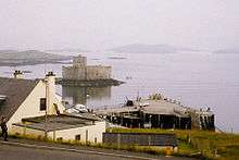
Many of them are obscure and few have ever been inhabited. Nonetheless, some have a significant degree of notability. The islet on which Kisimul Castle stands is the ancient seat of Clan MacNeil and Shillay in the Monach Isles had a manned lighthouse until 1942.[28] The tiny Beasts of Holm of the east coast of Lewis were the site of the sinking of the Iolaire during the first few hours of 1919,[29] one of the worst maritime disasters in United Kingdom waters during the 20th century. Calvay in the Sound of Barra provided the inspiration for Compton MacKenzie's 1947 novel Whiskey Galore after the SS Politician ran aground there with a cargo of whisky. Unusually for an island without permanent inhabitation, Eilean na Cille (NF847459) is connected to Grimsay (south) by a causeway.
Various Gaelic names are used repeatedly. The suffix ay or aigh or aidh is generally from the Norse øy meaning "island". Eilean (plural: eileanan) also means "island". Beag and mòr (also bheag and mhòr) mean "little" and "big" and are often found together. Sgeir is "skerry" and often refers to a rock or rocks that lie submerged at high tide. Dubh is "black", dearg is "red" and glas means "grey" or "green". Orasaigh is from the Norse Örfirirsey meaning "tidal" or "ebb island".[30]
Smaller islands grouped geographically:
Barra and the Barra Isles
- Barra: Eilean a' Mhail, Eilean Mhiathlais, Eileanan Dubha, Greanamul, Healam, Kisimul Castle, Lamalum, Lingeigh-Fada, Orasaigh (2), Sgeir Mhòr, Sgeirislum
- Barra Head: Rubha Niosaim and Sgeir Mhòr
- Flodday: None
- Lingeigh: None.
- Mingulay: Arnamuil, Barnacle Rock, Geirum Beag, Geirum Mòr, Gunamul. Lianamul, Sgeirean nan Uibhein, Solon Beag, Solon Mòr, Sròn à Dùin and The Red Boy.
- Muldoanich: An Laogh, Sgeirean Fiaclach.
- Pabbay: Greenamul, Heisgeir a-muigh, Heisgeir a-staigh, Lingeigh, Roisnis
- Sandray: Cleite, Creag an Sheadair, Eilean Mòr, Sgeir Lithinis
- Vatersay: Biruaslum, Orasaigh, Sgeir Liath, Sgeir na Muice, Snuasamul, Uineasan
Sound of Barra
- Eriskay: Calbhaigh, Eilean à Gheoidh, Eileanan Dubha, Hearteamul, Lingay, Na Stacan Dubha, Sgeir an Fheidh
- Fiaraidh: Corran Bàn
- Flodday: Snagaras
- Fuday: Traillisgeir
- Fuiay: Eilean Sheumis, Garbh Lingeigh
- Gighay: Eilean à Ceud
- Hellisay: Bodha nan Sgeiran Mòra
- Orosay: None
South Uist
- West coast: Eilean Bheirean, Eilean Cuithe nam Fiadh, Gualan, Orasaigh
- North east coast: Dioraigh, Eilean à Mhadaidh, Eilean Ban, Eilean Ornais, Eilean na h-Airde Mhoire, Gasaigh, Glas-Eileanan, Luirsaigh Dubh, Luirsaigh Glas, Orasaigh, Sioloagh Mòr, Tathanais
- East coast: Cleit a' Ghlinn Mhòir, Dùn Othail, Eilean Bholuim, Eilean nan Ghamna, Na Dubh-sgeiran
- Loch Aineort: Eilean Ailein, Eilean an Easbuig, Eilean Mhic Eachain, Rosgaigh, Unsaraigh Islands
- Lochboisdale:
- Eileanan Iasgaich: Main group: Eilean Bàgh Mhic Rois, Eileanan Iasgaich Beag, Eileanan Iasgaich Meadhonach, Eileanan Iasgaich Mòr, Eilean nam Feannag. Surrounding: Eilean Mòr, Eilean nan Moireachean, Gasaigh, Pabaigh, Sgeir Chaise. Further east: Calbhaigh, Calvay Castle.
- Stuley: Dubh-Sgeir Mhòr, Glas-Eilean Mòr
Benbecula
- North coast: Calabhagh, Eilean Leathann, Eilean Mhic Caoilte, Sunamul, Traillabreac Mòr
- East coast: Bearran, Collam, Eilean Baile Gearriadh, Eilean Dubh na Muice, Eilean nan Each, Fuidheigh Beag, Greanamul, Greanamul Deas, Maithidh Glas, Maithidh Riabhach, Maragaidh Beag, Maragaidh Mòr, Orasaigh (2), Orasaigh Uisgeabhagh
- South coast: Eilean Ard an Eoin, Heistamuil
- Fraoch-eilean: Eilean Roinoch, Mas Grimsay
- Flodaigh: Lingay and numerous others but none named by Ordnance Survey
- Grimsay (North): Eilean à Ghobha, Eilean Mòr
- Grimsay (South): Caraigh Mhòr, Eilean na Cille, Eilean nan Gamhna, Eileanan Stafa, Oitir Bheag, Siusaigh, Steiseigh
- Ronay: Eilean an Fheidh, Eilean na Clioche, Eilean nan h-Iolaire, Eilean nan Gamhna, Eilean nan Gearr, Garbh Eilean Mòr, Huanariagh
- Wiay: An Dubh-sgeir à Deas, Cleit Mhòr, Lingeigh, Reagam, Scaracleit
North Uist
- North west coast: Eilean Mhorain, Haskeir, Hasgeir Eagach, Lingeigh
- Traigh Bhalaigh: Eilean Dubh Mòr, Stangram, Torogaigh
- Sound of Harris, East:
- Loch Mhic Phail: Cafuam, Croabhagun, Eilean Fhionnlaidh, Frobost Island, Hestum, Mealla Bru, Rangas, Teilum
- West Coast: Causamul, Eilean Trostain
- East coast:
- Loch Euphort: Eilean an Stiobuill, Eilean Mhic Shealtair, Eilean nam Mult, Orasaigh, Riobhaig Mhòr, Steisaigh, Treanaigh
- Loch nam Madadh: Cnap Ruigh Dubh, Eilean Bhalaig, Eilean Phail, Fathoire, Fearamas, Flodaigh, Glas Eilean Mòr, Hamarsaigh, Madadh Beag, Madadh Gruamach, Madadh Mòr, Oronsay
- Ceallasaigh Mòr: Orasay
- Ceallasaigh Beag: Callum More, Cliasagh Beag, Cliasagh Mor, Corr Eilean Keallasay, Eileanan Dhomhnuill, Eilean Bridich, Eilean Gheoidh, Eilean Mhidhinis, Eilean nan Lion, Fearamas, Lonachan, Rhiobhagan Mhidhinis
- South Coast: Craigionn, Eilean an Teampaill, Eilean Iochdrach, Eilean Mòr
- Causeway: Eileanan Glasa, Eilean Ghiorr, Eilean Leathann, Eilean na h-Airigh, Gairbh-eilean
- Baleshare: Bhorogaigh, Eilean Mòr, Eilean nan Carnan, Glas-eilean Beag, Horaigh
- Flodaigh Mòr: Duibh-eilean, Flodaigh Beag
- Kirkibost: Bior Eilean, Eilean Mòr, Sromaigh
- Oronsay: Fuskafaol, Greanam, Lingay
- Vallay: Dun Tomaidh, Sgeir Dubh Mòr
Monach Isles

- Ceann Ear: Heilleam, Stocaigh
- Ceann Iar: Deasgair, Raisgeir, Stromay
- Shillay: Eilean Siorruidh, Thusigeirean
- Sibhinis: None
Sound of Harris
- Harris - Rubha Reinis to Gob an Tobha: Bumersam Beag, Copaigh, Craigo, Dun Arn, Eilean Reinis, Eire, Gilsaigh, Gousman, Gumersam Mhòr, Langaigh, Liungaigh, Saghaigh Beag, Saghaigh Mòr, Sgarabhaigh, Sgeir Sine, Sromaigh
- Berneray: Bhaiteam, Greineam
- Boreray: Bogha Mairi, Spuir
- Ensay: Creag Ruadh, Dubh Sgeir, Sleicham, Sromaigh, Suam
- Hermetray: Bhacasaigh, Dun Mhic Leathann, Eileana Dubha, Fuam, Greineam, Grodaigh, Hulmatraigh, Orasaigh, Righe nam Ban
- Killegray: Caolaigh, Eilean Chodam, Eilean na Ceardaich, Langa Sgeir, Sgeir Dhubh, Sgeir Mhurain
- Pabbay: Cuidhnis
- Shillay: Siolaigh Beag
- Stromay: Heastam Sròmaigh, Rusgaigh, Orasaigh
- Tahay: Bhotarsaigh, Cleite nan Luch, Creag nan Sealladh, Fuam na h-Ola, Narstaigh, Opasaigh, Sarstaigh, Sgeir à Chuain, Trollaman
West Harris
- Gob an Tobha to Rubha Huisinis: Gaisgeir, Glas-sgeir, Gloraig Huisinis, Gloraig Tharasaigh, Iosaigh
- Rubha Huisinis to Ceann Loch Resort: Greine Sgeir,
- Scarp: Cearstaigh, Duisgeir, Fladaigh
- Soay Mòr: Soay Beag
- Taransay: None
East Harris
- Loch Seaforth: Eilean Mharaig, Glas Sgeir
- Àrd Caol to Rubha Crago: Eilean Reiningeadil
- Rubha Crago to Rubha Bocaig (including East Loch Tarbert): Cuidsgeir, Eilean à Gheoidh, Eileanan à Ghille-bheid, Eilean Aird Rainis, Eilean an Direcleit, Eilean Dubh, Eilean Mhic Fionnlaidh, Eilean na Gearrabreac, Eilean na Sgaite, Gloraig à Chaimbeulach, Gloraig Dubh, Gloraig Iosal, Sgeir an Leim Mhoir, Sgeir Glas, Sgeir Urgha
- Rubha Bocaig to Rubha Reinis: (see also Stockinish Island): Bhalaigh, Caiream, Corr-eilean, Eilean Chuidhtinis, Eilean Dubh, Eilean Dubh Chollaim, Eilean Fhionnsbhaigh, Eilean Lingreabhaigh, Eilean Mhanais, Glas Sgeir (2)
- Scalpay: Fuam an Tolla, Greineam, Raiream, Rosaigh, Stiolamair, Stiughaigh, Stiughaigh na Leum, Thamarasaigh
- Sgeotasaigh: Eilean Dubh, Eilean Rainich, Sgeir Ghlas
- Stockinish: Eilean Leasait, Eilean nan Eun
Shiant Isles
- Eilean Mhuire: Seann Chaisteal
- Garbh Eilean: Sgeir Mianais
- The Galtachan: Bodach, Damhag, Galta Beag, Galta Mòr, Stacan Laidir, Sgeir Mhic a' Ghobha
Lewis
South west coast
Ceann Loch Resort to Aird Dhrolaige: Liongam, Staca Liath
- Aird Dhrolaige to Camas Uig: Eilean Molach, Greineam, Sgeir an Tamna, Sgeir Liath, Staca Leathann
- Camas Uig: Fraoch Eilean, Leac Holm, Sarah's Island, Sgeir a' Chàis, Sgeir Liath, Sgeir Sheilibhig, Tom, Tolm
- Camas Uig to Gallan Head: Gallan Beg, Sgeir Fiabhaig Tarras, Sgeir Gallan
- Eilean Mhealasta: Hairsgeir Beag, Hairsgeir Mòr
Loch Ròg
- Loch Ròg:
- Loch Ceann Hulabhig: Eilean Trosdam, Eilean Orasaigh, Eilean an Tighe, Eimisgeir
- Loch Charlabhaigh: Eilean Bhinndealaim
- Loch Ròg Beag: Eilean Dubh, Eileanan Glasa
- Loch Shiadair: Crovag
- Ceabhaigh: Greinam, Sgeir nan Cliabh
- Eilean Chearstaidh: Bratanais Mòr, Eilean Sgarastaigh
- Flodaigh: Gousam
- Fuaigh Beag: Aird Orasaigh, Cliatasaigh, Eilean nam Feannag, Floday, Geile Sgeir, Garbh Eilean, Glas Eilean, Linngeam
- Fuaigh Mòr: EileanTeinis, Eunaigh Beag, Eunaigh Mòr, Geile Sgeir, Sgeir Dubh Mhòr, Sgeir Liath
- Great Bernera: Eilean Beag, Eilean Bhacasaigh, Eilean Mòr, Eilean Riosaigh, Eughlam, Greineam, Liongam Valasay
- Little Bernera: Bearasaigh, Campaigh, Cealasaigh, Cruitear, Cul Campaigh, Eilean Fir Chrothair, Flodaigh, Hairsgeir, Mas Sgier, Seanna Chnoc, Sgeir à Mhurain, Sgeir Dhearg, Sgeir na h-Aon Chaorocah.
- Pabaigh Mòr: Bogha Dubh, Mas Sgeir, Pabeigh Beag, Siaram Mòr
- Vacsay: Sgeir Bocaig, Sgeir Fail, Sgeir na h-Aon Chaorach, Trathasam
North west coast
- Aird Laimisiadair to Butt of Lewis: Buistean, Cleite Gile, Cul Chraigeam, Craigeam, Dubh Sgeir, Eilean Arnol, Lith Sgeir, Mas Sgeir, Sgeir Dhail, Sgeir Dhearg Cul Chraigeam, Sgeir Lainganish, Sgeir Mhòr, Stac à Phris
East Coast

- Butt of Lewis to Tolsta Head: Am Braga, Braighe Mhòr, Dùn Èistean, Dun Eoradail, Eilean Glas, Mas Sgeir
- Tolsta Head to Tiumpan Head: Heisgeir, Lada Sgeir, Langasgeir Mòr, Sgeir Leathann
- Tiumpan Head to Rubha Raerinis: Beasts of Holm, Buaile Mhòr, Eilean à Chaise, Eilean à Chrotaich, Eilean Beag Phabail, Eilean Mòr Phabail, Eilean na Greinne, Eilean Grioda, Eilean nan Uan, Eilean Thuilm, Mol Shildinis, Sgeir Mhòr Shildinis
- Rubha Raerinis to Rubha na Creige Moire (including Loch Erisort and Loch Liurbost): Bhatarsaidh, Dun Bharclin, Eilean à Bhlair, Eilean Cheois, Eilean Glas, Eilean Miabhiag, Eilean Mòr Lacasaidh, Eilean Mhic Thormaid, Eilean Orasaigh (2), Eilean Rosaidh, Eilean Thoraidh, Garbh Eilean, Glas Sgeir, Riosaigh, Seumas Cleite, Sgeiran Arbhair, Sgeir Tanais, Stac Tabhaidh, Tabhaigh Beah, Tabhaigh Mòr, Tannaraidh
- Rubha na Creige Moire to Gob Rubha Uisnis (including Loch Sealg): Bogha Ruadh
- Gob Rubha Uisnis to Rubha Brìodog: Eilean Beag à Bhaigh, Eilean Dubh à Bhaigh, Eilean Glas na h-Acarsaid Fhalaich, Eilean Mòr à Bhaigh, Eilean Thinngartsaigh, Sgeir Mhòr Bhalamuis
- Eilean Chaluim Chille: Eilean Calabraigh, Crois Eilean, Duine, Eilean a Bhlair, Riasiagh, Sgeir nan Muirsgian, Sgeir nan Each
- Eilean Liubhaird: Sgeir Fhraoich, Sgeir nan Caorach, Stac à Bhaigh
- Seaforth Island: None
Small archipelagos
There are various small archipelagos within the Outer Hebrides. These include:
| Name | Location |
|---|---|
| Barra Isles (or Bishop's Isles) | South of Barra |
| Flannan Isles | 32 kilometres (20 mi) west of Lewis |
| Monach Islands | 9 kilometres (5.6 mi) west of North Uist |
| Shiant Isles | 7 kilometres (4.3 mi) southeast of Harris |
The St Kilda group is 64 kilometres (40 mi) west-northwest of North Uist.
See also
- History of the Outer Hebrides
- Flora and fauna of the Outer Hebrides
- Religion in the Outer Hebrides
- List of places in the Western Isles
- Inner Hebrides
- List of Orkney islands
- List of Shetland islands
- Islands of the Clyde
- Islands of the Forth
- List of islands of Scotland
- List of islands of the British Isles
- North Sea islands
- Rockall
References and footnotes
- General references
- Armit, Ian (1998) Scotland's Hidden History. Tempus (in association with Historic Scotland). ISBN 0-7486-6067-4
- Haswell-Smith, Hamish. (2004) The Scottish Islands. Edinburgh. Canongate. ISBN 1-84195-454-3
- Hunter, James (2000) Last of the Free: A History of the Highlands and Islands of Scotland. Edinburgh. Mainstream. ISBN 1-84018-376-4
- Mac an Tàilleir, Iain (2003) Ainmean-àite/Placenames. (pdf) Pàrlamaid na h-Alba. Retrieved 26 August 2012.
- Maclean, Charles (1977) Island on the Edge of the World: the Story of St. Kilda. Edinburgh. Canongate. ISBN 0-903937-41-7
- Ordnance Survey. Get-a-map (Map). 1:25,000. Leisure. Ordinance Survey. Retrieved 21 August 2013.
- Murray, W.H. (1973) The Islands of Western Scotland. London. Eyre Methuen. ISBN 0-413-30380-2
- Thompson, Francis (1968) Harris and Lewis, Outer Hebrides. Newton Abbot. David & Charles. ISBN 0-7153-4260-6
- Notes
- ↑ Murray (1973) notes that "Western Isles" has tended to mean "Outer Hebrides" since the creation of the Na h-Eileanan an Iar or Western Isles parliamentary constituency in 1918. The phrase can also be used to refer to the Hebrides in general. Murray also notes that "Gneiss Islands"—a reference to the underlying geology – is another name used to refer to the Outer Hebrides but that its use is "confined to books".[1]
- ↑ The island does not have a common name in either English or Gaelic and is referred to as "Lewis and Harris", "Lewis with Harris", "Harris with Lewis" etc.[3]
- ↑ Aird an Runair, North Uist approximately Mean High Water Springs ETRS89 57°36'10.42010"N 7°32'56.63226"W, grid reference NF 68686,70560. Distance to Rockall approximately 366.966 km (228.022 mi / 198.146 nmi).[6]
- ↑ Other definitions are used in the Scottish context. For example the General Register Office for Scotland define an island as "a mass of land surrounded by water, separate from the Scottish mainland" but although they include islands linked by bridges etc. this is not clear from this definition. Haswell-Smith (2004) uses "an Island is a piece of land or group of pieces of land which is entirely surrounded by water at Lowest Astronomical Tide and to which there is no permanent means of dry access". This is widely agreed to be unhelpful as it consciously excludes bridged islands.
- ↑ Geographically, the inhabited islands can easily be separated into those that are or surround Lewis and Harris, The Uists and Benbecula, and Barra.
- ↑ The Ordnance Survey maps mark the height above sea level of a high point on most islands, but in a small number of cases, this may not be the highest point.[12]
- ↑ The 2001 and 2011 censuses refer to the island by its anglified name of Flodda.
- ↑ This island is at (grid reference NF860580) and the evidence of both Ordnance Survey maps and photographs (e.g. "Houses on Seana Bhaile" Geograph. Retrieved 10 August 2009) indicates a resident population. There is even a name, "Seana Bhaile" for the main settlement. However, neither the census nor the main reference work (Haswell-Smith 2004) refer to the island at all. Its population is presumably included in nearby Grimsay by the census.
- ↑ There are two inhabited islands called "Grimsay" or Griomasaigh that are joined to Benbecula by a road causeway, one to the north at grid reference NF855572 and one to the south east at grid reference NF831473.
- ↑ See above note.
- ↑ Eileanan Iasgaich is at grid reference NF785186.
- ↑ Geographically, these islands can be separated into those surrounding Lewis and Harris, North and South Uist, Benbecula, and Barra—plus those that are members of the smaller archipelagos of the Barra Isles, the Flannan Isles, the Monach Isles, and the Shiant Islands. There is also a complex group that lies between North Uist and Harris in the Sound of Harris.
- ↑ Indicates the last known date of permanent, year round settlement.[21]
- ↑ Note that the Ordnance Survey maps mark the height above sea level of a high point on most islands, but in a small number of cases, this may not be the highest point.[12]
- ↑ Calbhaigh is a tidal islet in Loch Eynort, not to be confused with Calvay or Calbhaigh in Loch Boisdale, both of which are also off South Uist.
- ↑ There are two "Flodday"s near Barra. One is in the Barra Isles at grid reference NL612924, the other in the Sound of Barra to the north at grid reference NF751022.
- ↑ See above note.
- ↑ It is said that the Clearances here were of a particularly brutal nature.[22]
- ↑ Pabbay had a population of about 100 in the early 19th century but was cleared in 1846 and by 1868 there was only a single shepherd living there.[23]
- ↑ The gaelic name is Stromaigh in the Gazetteer for Scotland and the English name "Stromay" is used both here and by the JNCC. The Ordnance Survey calls the island Sròmaigh but this is not used in other sources. It is connected to North Uist at all but the highest stages of the tide and a JNCC report describes it as "the low 'island' of Stromay".[24][25]
- ↑ Haswell-Smith (2004) writes "old lazybeds and a few scattered shieling ruins show that Stuley was probably yet another place where people who were considered of less importance than sheep fought to survive."[26]
- Citations
- ↑ Murray (1973) p. 32.
- ↑ Haswell-Smith (2004) p. 262.
- 1 2 Thompson (1968) p. 13.
- 1 2 "Fleet Histories" Caledonian MacBrayne. Retrieved 3 August 2009.
- ↑ Haswell-Smith (2004) pp. 313–331 lists these islands in "Section 9: The Atlantic Outliers".
- ↑ Admiralty Chart NE Atlantic (1) Reykjanes Ridge & Rockall Plateau. Chart C6566. (2009) Imray, Laurie, Norie & Wilson. St Ives.
- 1 2 General Register Office for Scotland (2003).
- ↑ Mac an Tàilleir, Iain 1901–2001 Gaelic in the Census, PowerPoint Presentation made available via Linguae Celticae. Retrieved 1 June 2008.
- ↑ "Lighthouse Library" Northern Lighthouse Board. Retrieved 14 July 2007.
- 1 2 3 National Records of Scotland (15 August 2013) (pdf) Statistical Bulletin: 2011 Census: First Results on Population and Household Estimates for Scotland - Release 1C (Part Two). "Appendix 2: Population and households on Scotland’s inhabited islands". Retrieved 17 August 2013.
- ↑ Haswell-Smith (2004) pp. 205–253.
- 1 2 3 4 5 "Get-a-map". Ordnance Survey. Retrieved 1–15 August 2009.
- ↑ Haswell-Smith (2004) p. 206 save those indicated with a separate footnote.
- 1 2 Haswell-Smith (2004) and Ordnance Survey maps. Blanks indicate that no name is recorded for this eminence.
- 1 2 3 4 5 6 7 8 9 10 11 12 13 14 "Rick Livingstone's Tables of the Islands of Scotland" (pdf) Argyll Yacht Charters. Retrieved 12 Dec 2011.
- ↑ See for example Hunter (2000) pp. 152–158.
- ↑ See for example Maclean (1977) Chapter 10: "Arcady Despoiled" pp. 125–35.
- ↑ "Mingulay Boat Song" Cantaria. Retrieved 26 December 2006.
- ↑ Haswell-Smith (2004) pp. 282–83.
- ↑ Haswell-Smith (2004) and Ordnance Survey maps for islands <40 ha (100 acres) unless otherwise stated.
- ↑ Haswell-Smith (2004) unless otherwise stated.
- ↑ Haswell-Smith (2004) p. 306.
- ↑ Haswell-Smith (2004) p. 268.
- ↑ "Stromay (Stromaigh)" Gazetteer for Scotland. Retrieved 12 August 2009.
- ↑ "Loch Maddy – Sound of Harris Coastline" (PDF) Geological Conservation Review 28 Retrieved 12 August 2009.
- ↑ Haswell-Smith (2004) p. 234.
- ↑ Estimate from Ordnance Survey Maps.
- ↑ "Monach Light". Northern Lighthouse Board. Retrieved 2007-12-08.
- 1 2 Thompson (1968) p. 76.
- ↑ Mac an Tàilleir (2003) various pages.
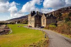
Settlements and places of interest in the Outer Hebrides (Na h-Eileanan Siar) | ||
|---|---|---|
| on Lewis and Harris |  | |
| on North Uist, Benbecula and South Uist |
| |
| on Barra | ||
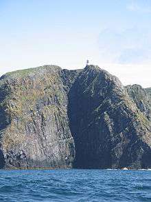
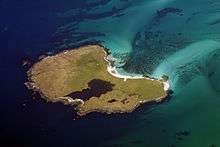
| Places of interest | ||
Inhabited islands of the Hebrides | ||
|---|---|---|
| Inner Hebrides | | |
| Outer Hebrides | ||
|  | ||||||||||||||||||||||||||||
|
| |||||||||||||||||||||||||||||
| |||||||||||||||||||||||||||||
| |||||||||||||||||||||||||||||
| |||||||||||||||||||||||||||||
| |||||||||||||||||||||||||||||
| |||||||||||||||||||||||||||||
| |||||||||||||||||||||||||||||