Stromay
| Gaelic name | Sròmaigh |
|---|---|
| Norse name | Straum-øy |
| Meaning of name | Old Norse for 'island in the tidal stream'. |
| Location | |
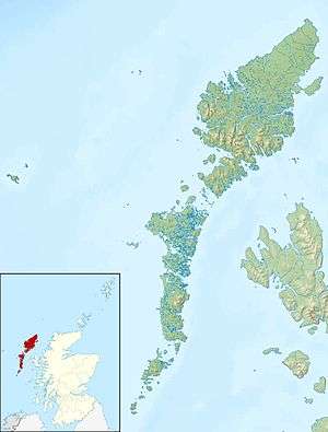 Stromay Stromay shown within the Outer Hebrides | |
| OS grid reference | NF936746 |
| Physical geography | |
| Island group | Uists and Barra |
| Area | approx 66 ha (163 acres) |
| Area rank | 178= [1] |
| Highest elevation | 16 m (52 ft) |
| Administration | |
| Sovereign state | United Kingdom |
| Country | Scotland |
| Council area | Na h-Eileanan Siar |
| Demographics | |
| Population | 0[2] |
| References | [3] |
Not to be confused with Stroma, Scotland.
Stromay (Scottish Gaelic: Sròmaigh) is a tidal island[4] off North Uist in the Sound of Harris, Scotland.
The low island of Stromay lies between two wide, shallow sea lochs, Loch Mhic Phàil and Loch Aulasary.[4] Stromay is joined to North Uist for most of the tidal cycle.
A smaller islet of the same name lies between Harris and Ensay,[5] and another (Stròmaigh) between North Uist and Kirkibost.[3]
There are extensive sands and rocks offshore that are exposed at low tide.[6]
See also
Footnotes
- ↑ Area and population ranks: there are c. 300 islands over 20 ha in extent and 93 permanently inhabited islands were listed in the 2011 census.
- ↑ "Stromay". Gazetteer for Scotland. Retrieved 2009-08-12.
- 1 2 Get-a-map (Map). Ordnance Survey.
- 1 2 J.D. Hansom. "Loch Maddy - Sound Of Harris Coastline" (PDF). JNCC. Retrieved 2009-08-12.
- ↑ Haswell-Smith, Hamish (2004). The Scottish Islands. Edinburgh: Canongate. ISBN 978-1-84195-454-7.
- ↑ Rick Livingstone’s Tables provide an area of 100 ha, which may include the inter-tidal zone. Rick Livingstone’s Tables of the Islands of Scotland (pdf) Argyll Yacht Charters. Retrieved 12 Dec 2011.

Stromay from the air, looking west. The narrow channel of Sruth Beag between Stromay and North Uist is at centre
Coordinates: 57°39′26″N 7°8′18″W / 57.65722°N 7.13833°W
|  | ||||||||||||||||||||||||||||
|
| |||||||||||||||||||||||||||||
| |||||||||||||||||||||||||||||
| |||||||||||||||||||||||||||||
| |||||||||||||||||||||||||||||
| |||||||||||||||||||||||||||||
| |||||||||||||||||||||||||||||
| |||||||||||||||||||||||||||||
This article is issued from Wikipedia - version of the 3/1/2013. The text is available under the Creative Commons Attribution/Share Alike but additional terms may apply for the media files.