Grimsay (South East Benbecula)
For other places with the same name, see Grimsay.
| Gaelic name | Griomasaigh |
|---|---|
| Norse name | Grímsey |
| Meaning of name | "Grim's island", from Norse |
| Location | |
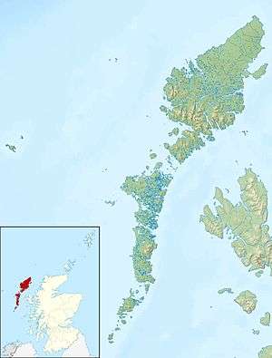 Grimsay Grimsay shown within the Outer Hebrides | |
| OS grid reference | NF831473 |
| Physical geography | |
| Island group | Uist and Barra |
| Area | 117 ha (0.45 sq mi)[1] |
| Area rank | 142 [2] |
| Highest elevation | 20 m (66 ft) |
| Administration | |
| Sovereign state | United Kingdom |
| Country | Scotland |
| Council area | Na h-Eileanan Siar |
| Demographics | |
| Population | 20[3] |
| Population rank | 65 [2] |
| Pop. density | 17 people/km2[1][3] |
| References | [4][5] |
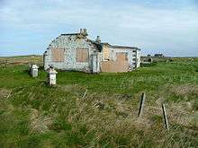
An unusual abandoned building on Grimsay
Grimsay, south east of Benbecula is a tidal island of the Outer Hebrides. It is connected to Benbecula by a causeway which carries the B891. In the 2001 census, Grimsay had a population of 19[1] and 20 in 2011.[3]
An extension to the B891 now connects Grimsay to Eilean na Cille to the south east via a causeway. The road was built at a cost of £1,800 to service the pier at Peter's Port, which was constructed in 1896 at cost of £2,000 - although the anchorage is awkward and should not be used without local knowledge.[6]
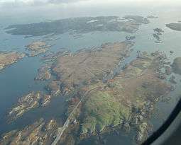
Eilean na Cille, Triallabreac and Wiay east of Grimsay from the air, with Peter's Port at right
Notes
- 1 2 3 Fleming, Alan D (28 Nov 2003). "Occasional Paper No 10: Statistics for Inhabited Islands". General Register Office for Scotland. Retrieved 2007-08-02.
- 1 2 Area and population ranks: there are c. 300 islands over 20 ha in extent and 93 permanently inhabited islands were listed in the 2011 census.
- 1 2 3 National Records of Scotland (15 August 2013) (pdf) Statistical Bulletin: 2011 Census: First Results on Population and Household Estimates for Scotland - Release 1C (Part Two). "Appendix 2: Population and households on Scotland’s inhabited islands". Retrieved 17 August 2013.
- ↑ Ordnance Survey. Get-a-map (Map). 1:25,000. Leisure. Ordinance Survey. Retrieved 21 August 2013.
- ↑ Mac an Tàilleir, Iain (2003) Ainmean-àite/Placenames. (pdf) Pàrlamaid na h-Alba. Retrieved 26 August 2012.
- ↑ Haswell-Smith (2004) pp. 243, 250
References
- Haswell-Smith, Hamish (2004). The Scottish Islands. Edinburgh: Canongate. ISBN 978-1-84195-454-7.
Coordinates: 57°24.3′N 7°16.6′W / 57.4050°N 7.2767°W
This article is issued from Wikipedia - version of the 2/21/2016. The text is available under the Creative Commons Attribution/Share Alike but additional terms may apply for the media files.