Fuday
| Gaelic name | Fùideigh |
|---|---|
| Location | |
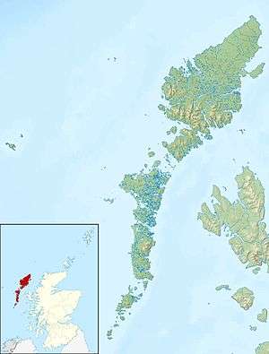 Fuday Fuday shown within the Outer Hebrides | |
| OS grid reference | NF736082 |
| Physical geography | |
| Island group | Uists and Barra |
| Area | 232 hectares (0.90 sq mi) |
| Area rank | 101 [1] |
| Highest elevation | Mullach Neacail 89 metres (292 ft) |
| Administration | |
| Sovereign state | United Kingdom |
| Country | Scotland |
| Council area | Na h-Eileanan Siar |
| Demographics | |
| Population | uninhabited since 1901 |
| References | [2][3] |

Fuday (Fuideigh) is an uninhabited island of about 232 hectares (0.90 square miles) in the Outer Hebrides of Scotland. It lies in the Sound of Barra, just east of Scurrival Point on Barra and west of Eriskay. Fuday is owned by the Scottish Government.[4] Deserted since 1901, its peak population is recorded only as seven.
It is still used for the summer grazing of cattle, and they used to be swum across the mile-wide, but shallow, Caolas Fuideach (strait) to there from Eoligarry. When cattle were first introduced to the island, they were killed by dehydration. The crofters who left the cattle on the island failed to show the animals the location of the only drinkable source of water on the island, a loch far inland on the island. The cattle thus could not find drinking water and died of thirst.
Footnotes
- ↑ Area and population ranks: there are c. 300 islands over 20 ha in extent and 93 permanently inhabited islands were listed in the 2011 census.
- ↑ Haswell-Smith, Hamish (2004). The Scottish Islands. Edinburgh: Canongate. ISBN 978-1-84195-454-7.
- ↑ Ordnance Survey. Get-a-map (Map). 1:25,000. Leisure. Ordinance Survey. Retrieved 21 August 2013.
- ↑ "Overview of Fuday". Gazetteer for Scotland. Retrieved 2007-11-11.
Coordinates: 57°03′N 7°23′W / 57.050°N 7.383°W