List of Inner Hebrides
This List of Inner Hebrides summarises a chain of islands and skerries located off the west coast of mainland Scotland. There are 36 inhabited islands in this archipelago, of which Islay, Mull and Skye are the largest and most populous.
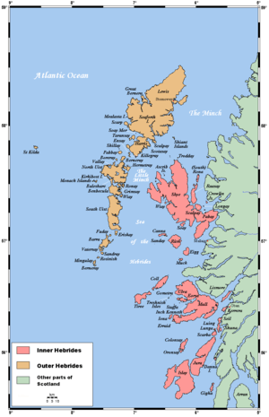
The islands of Scotland's west coast are known collectively as the Hebrides; the Inner Hebrides are separated from the Outer Hebrides by The Minch to the north and the Sea of the Hebrides to the south. The Inner Hebrides that lie respectively north and south of Ardnamurchan are administered by two separate local authorities as part of larger territories. The northern Inner Hebrides, including Skye, the Small Isles and the Summer Isles, are part of the Highland unitary council region. The southern group, including Islay, Jura, the Slate Islands and Gigha are part of the Argyll and Bute council region.
In the past, the Hebrides as a whole were a strong Scottish Gaelic-speaking area, and in 1921 more than 50% of the populations of most of these islands, including Skye, Mull and Islay, were proficient in the language. However, although the Outer Hebrides have retained many Gaelic speakers, in the 2001 census only Skye (31%) and Tiree (48%) had more than 25% of the resident population able to speak Gaelic; Mull, Jura, Gigha and Coll each recorded figures of less than 15%.[1]
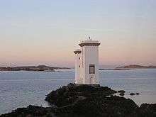
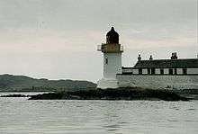
The modern economy centres on tourism, crofting, farming, fishing, and whisky distilling. The archipelago is exposed to wind and tide. There are numerous lighthouses as an aid to navigation.[2]
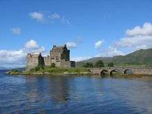
There are various descriptions of the scope of the Hebrides. The Collins Encyclopedia of Scotland describes the Inner Hebrides as lying "east of The Minch", which would include any and all offshore islands. There are various islands that lie in the sea lochs, such as Eilean Bàn and Eilean Donan, that might not ordinarily be described as "Hebridean", but no formal definition exists and for simplicity they are included in this list rather than elsewhere.[3][4][Note 1]
Etymology
Various Gaelic names are used repeatedly. The suffix ay or aigh or aidh is generally from the Norse øy meaning "island". Eilean (plural: eileanan) also means "island". Beag and mòr (also bheag and mhòr) mean "little" and "big" and are often found together. Sgeir is "skerry" and often refers to a rock or rocks that lie submerged at high tide. Dubh is "black", dearg is "red" and glas means "grey" or "green". Orasaigh is from the Norse Örfirirsey meaning "tidal" or "ebb island".[5]
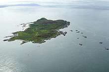
Inhabited islands
Apr2006.jpg)
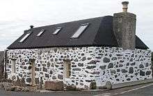

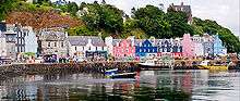
The inhabited islands of the Inner Hebrides had a population of 18,257 in 2001,[7] and 18,948 at the time of the 2011 census.[8] The highest peaks of the islands have names deriving from both Gaelic and Old Norse, indicating the historical importance of these two cultures. The archaeological record for the period of Viking domination during the Early Historic period is, however, limited.
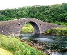
In the Outer Hebrides all of the inhabited islands are now connected to at least one other island by a land transport route, but only four Inner Hebridean islands are connected by road, all to the mainland. The Clachan Bridge from Argyll to Seil was designed by Thomas Telford and dates from 1792.[6] Skye has been connected to Kyle of Lochalsh by the Skye Bridge since 1995.[9] Danna is also connected to the Tayvallich peninsula in Argyll by a stone causeway; and tiny Eilean Donan, dominated by its castle, has had a connection to the mainland perhaps from as early as the 13th century. The arched bridge in use today was constructed in the early 20th century.[10]
| Island | Gaelic name | Group[Note 2] | Area (ha)[11] | Population[8] | Highest point[12] | Height (m)[13] |
|---|---|---|---|---|---|---|
| Canna | Canaigh | Small Isles | 1,130 | 12 | Càrn a' Ghaill | 210 |
| Coll | Cola | Mull | 7,685 | 195 | Ben Hogh | 104 |
| Colonsay | Colbhasa | Islay | 4,074 | 124 | Carnan Eoin | 104 |
| Danna | Danna | Islay | 315[14] | 1 | Cruiadh Bharr | 54 |
| Easdale | Eilean Èisdeal | Slate Islands | 20 | 59 | – | 38 |
| Eigg | Eige | Small Isles | 3,049 | 83 | An Sgurr | 393 |
| Eilean Bàn | An t-Eilean Bàn | Skye | 2.4 | 0 | – | c. 6 |
| Eilean dà Mhèinn | Eilean dà Mhèinn | Knapdale | 3 | 1 | – | 16 |
| Eilean Donan | Eilean Donnain | Loch Duich | 1 | 0 | – | 3 |
| Eilean Shona | Eilean Seona | Loch Moidart | 525[14] | 2 | Beinn a' Bhàillidh | 265 |
| Eilean Tioram | Eilean Tioram | Loch Moidart | 2[14] | 6 | – | 10 |
| Eriska | Aoraisge | Loch Linnhe | 310[14] | ?[Note 3] | Ceann Garbh | 47 |
| Erraid | Eilean Earraid | Mull | 187 | 6 | Cnoc Mòr | 75 |
| Gigha | Giogha | Islay | 1,395 | 163 | Creag Bhàn | 100 |
| Gometra | Gòmastra | Mull | 425 | 2 | – | 155 |
| Isle of Ewe | Eilean Iùbh | North Highland | 309 | 7 | Creag Streap | 72 |
| Iona | Ì Chaluim Chille | Mull | 877 | 177 | Dùn Ì | 101 |
| Islay | Ìle | Islay | 61,956 | 3,228 | Beinn Bheigeir | 491 |
| Jura | Diùra | Islay | 36,692 | 196 | Beinn an Òir | 785 |
| Kerrera | Cearrara | Firth of Lorn | 1,214 | 34 | Carn Breugach | 189 |
| Lismore | Lios Mòr | Firth of Lorn | 2,351 | 192 | Barr Mòr | 127 |
| Luing | Luinn | Slate Islands | 1,430 | 195 | Beinn Furachail | 94 |
| Lunga | Lunga | Slate Islands | 254 | 0 | Bidean na h-Iolaire | 98 |
| Muck | Eilean nam Muc | Small Isles | 559 | 27 | Beinn Airein | 137 |
| Mull | Muile | Mull | 87,535 | 2,800 | Ben More | 966 |
| Oronsay | Orasaigh | Islay | 543 | 8 | Beinn Orasaigh | 93 |
| Raasay | Ratharsair | Skye | 6,231 | 161 | Dùn Caan | 444 |
| Rona | Rònaigh | Skye | 930 | 3 | Meall Acairseidh | 125 |
| Rùm | Rùm | Small Isles | 10,463 | 22 | Askival | 812 |
| Sanday | Sandaigh | Small Isles | 184 | 9 | Tallabric | 59 |
| Scalpay | Sgalpaigh | Skye | 2,483 | 4 | Mullach na Càrn | 396 |
| Seil | Saoil | Slate Islands | 1,329 | 551 | Meall Chaise | 146 |
| Shuna | Siuna | Slate Islands | 451 | 3 | Druim na Dubh Ghlaic | 90 |
| Skye | An t-Eilean Sgitheanach | Skye | 165,625 | 10,008 | Sgurr Alasdair | 993 |
| Soay | Sòdhaigh | Skye | 1,036 | 1 | Beinn Bhreac | 141 |
| Tanera Mòr | Tannara Mòr | Summer Isles | 310 | 4 | Meall Mòr | 124 |
| Tiree | Tiriodh | Mull | 7,834 | 653 | Ben Hynish | 141 |
| Ulva | Ulbha | Mull | 1,990 | 11 | Beinn Chreagach | 313 |
Lunga in the Firth of Lorn had a population of 7, Eilean Bàn a population of 2 and Eilean Donan a single resident in 2001 but none recorded a usually resident population in 2011.[8]
Castle Stalker, Eilean Horrisdale, Eilean Loain and Inch Kenneth are "included in the NRS statistical geography for inhabited islands but had no usual residents at the time of either the 2001 or 2011 censuses".[8]
Uninhabited islands
There are 43 uninhabited Inner Hebrides with an area greater than 30 hectares (approximately 74 acres). Records for the last date of settlement for the smaller uninhabited islands are incomplete, but most of the islands listed here would have been inhabited at some point during the Neolithic, Iron Age, Early Historic or Norse periods.
In common with the other main island chains of Scotland many of the more remote islands were abandoned during the 19th and 20th centuries, in some cases after continuous habitation since prehistoric times. These places had been perceived as relatively self-sufficient agricultural economies,[15] but both island residents and outsiders later came to consider that the more remote islands lacked the essential services of a modern industrial economy.[16]
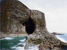
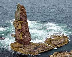
Some of the islands continue to contribute to modern culture. Staffa came to prominence in the late 18th century after a visit by Sir Joseph Banks. He and his fellow travellers extolled the natural beauty of the basalt columns in general, and in particular of the island's main sea cavern, which Banks renamed "Fingal's Cave". Many other prominent personalities visited Staffa over the next two centuries, including Felix Mendelssohn, whose Hebrides Overture brought further fame to the island.[17] During the Second World War, Gruinard was the site of a biological warfare test by British military scientists.[18] At that time there was an investigation by the British government to test both the vulnerability of Britain to attack and the possibility of attacking Germany using anthrax.[19]
The difficulties of definition are considerable in some cases. For example, Haswell-Smith (2004) treats Lunga[Note 4] as a single island, although during high tides it becomes one inhabited island and numerous uninhabited tidal islets. Another example is the smaller island of Eilean Mòr in Loch Dunvegan, which joins with nearby Eilean Dubh and Garay Island at low tides.[Note 5]
| Island | Gaelic name | Group[Note 2] | Area (ha)[20] | Last inhabited[Note 6] | Highest point[12] | Height (m)[13] |
|---|---|---|---|---|---|---|
| Calbha Beag | Calbha Beag | Eddrachillis Bay | 31 | Unknown | – | 41 |
| Calbha Mor | Calbha Mòr | Eddrachillis Bay | 70[22] | Unknown | – | 67 |
| Calve Island | Eilean Chailbhe | Mull | 72 | Unknown | – | 20 |
| Cara | Cara | Gigha | 66 | 1940s | – | 56 |
| Càrna | Càrna | Loch Sunart | 213 | 1970s | Cruachan Chàrna | 169 |
| Eileach an Naoimh | Eileach an Naoimh | Garvellachs | 56 | 10th century | – | 80 |
| Eilean an Ròin Mòr | Eilean an Ròin Mòr | North Highland | 33 | Unknown | – | 63 |
| Eilean Dubh Mòr | An t-Eilean Dubh Mòr | Slate Islands | 65 | No census records | – | 53 |
| Eilean Fladday | Eilean Fhladaigh | Skye | 137 | 1970s | – | 39 |
| Eilean Horrisdale | Eilean Thòireasdal | North Highland | 32 | 20th century | Carn Garbh | 38 |
| Eilean Ighe | Eilean Ighe | Sound of Arisaig | 35 | Unknown | – | 20 |
| Eilean Macaskin | Eilean MhicAsgain | Loch Craignish | 50 | 1880s | – | 65 |
| Eilean Meadhonach | An t-Eilean Meadhanach | Crowlin Islands | 77 | Unknown | – | 54 |
| Eilean Mhic Chrion | Eilean MhicChrìon | Loch Craignish | 54[14] | Unknown | – | 63 |
| Eilean Mòr | An t-Eilean Mòr | Crowlin Islands | 170 | circa 1920 | Meall a' Chòis | 114 |
| Eilean Rìgh | Eilean Rìgh | Loch Craignish | 86 | 1939 | Dùn Righ | 55 |
| Eilean Tigh | Eilean an Taighe | Skye | 58 | Unknown | Meall Mòr | 111 |
| Eilean Trodday | Eilean Throdaigh | Skye | 42[13] | Unknown | – | 45 |
| Eorsa | Eòrsa | Mull | 122 | No census records | – | 98 |
| Garbh Eileach | Garbh Eileach | Garvellachs | 142 | Pre-modern[Note 7] | – | 110 |
| Gruinard | Eilean Ghruinneart | North Highland | 196 | 1920s | An Eilid | 106 |
| Gunna | Gunnaigh | Mull | 69 | Pre-modern[Note 8] | – | 35 |
| Handa | Eilean Shannda | North Highland | 309 | 1848 | Sithean Mòr | 123 |
| Harlosh Island | Eilean Heàrrlois | Skye | 34 | Unknown | – | 51 |
| Horse Island | Eilean nan Each | Summer Isles | 53 | 19th century | Sgurr nan Uan | 60 |
| Inch Kenneth | Innis Choinnich | Mull | 55 | 1970s | – | 49 |
| Insh | An Innis | Slate Islands | 36 | Unknown | – | 69 |
| Isay | Ìosaigh | Skye | 60 | 1860 | – | 28 |
| Isle Martin | Eilean Mhàrtainn | Summer Isles | 157 | 1948[Note 9] | – | 120 |
| Isle Ristol | Eilean Ruisteil | Summer Isles | 225 | 18th century? | – | 71 |
| Little Colonsay | Colbhasa Beag | Mull | 88 | 1940s | – | 61 |
| Longa Island | Longa | North Highland | 126 | late 19th century | Druim am Eilean | 70 |
| Longay | Longaigh | Skye | 50 | 16th century | – | 67 |
| Lunga | Lungaigh | Mull | 81 | 1857 | Cruachan | 103 |
| Oldany Island | Eilean Alltanaidh | Eddrachillis Bay | 200 | Unknown | Sidhean nan Ealachan | 104 |
| Ornsay | Eilean Iarmain | Skye | c. 35[14] | Unknown | – | 46 |
| Oronsay | Orasaigh | Loch Sunart | 230[14] | Unknown | Druim Mòr | 58 |
| Pabay | Pabaigh | Skye | 122 | 1980s | – | 28 |
| Priest Island | Eilean a' Chlèirich | Summer Isles | 122 | No census records | – | 78 |
| Scarba | Sgarba | Islay | 1,474 | 1960s | Cruach Scarba | 449 |
| Shuna | Siuna | Mull | 155 | 1960s | Tom an t-Seallaidh | 71 |
| Staffa | Stafa | Mull | 33 | 18th century | – | 42 |
| Tanera Beag | Tannara Beag | Summer Isles | 66 | No census records | – | 83 |
| Texa | Teacsa [Note 10] | Islay | 48 | Early 19th century | Ceann Garbh | 48 |
| Torsa | Torsa | Slate Islands | 113 | 1960s | – | 62 |
| Wiay | Fuidheigh | Skye | 148 | 19th century | – | 60 |
Smaller islets and skerries
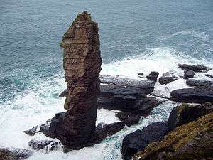
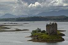
Smaller islands, tidal islets only separated at higher stages of the tide, and skerries which are only exposed at lower stages of the tide pepper the seas surrounding the main islands. Many of them are obscure and only a few have ever been inhabited. Nonetheless, some have a significant degree of notability. Lady's Rock, a skerry in Loch Linnhe, was the site of the attempted murder of Lady Catherine Campbell by her husband Lachlan Maclean of Duart in 1527. He rowed out to the rock one night at low tide and left his wife stranded on the rock to die.[29][30] Nearby Castle Stalker was in the possession of Clan Stewart of Appin at this time, but its more recent claim to fame is as a location in the film Monty Python and the Holy Grail.
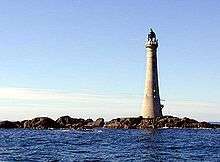
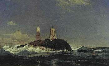
Remote Dubh Artach and Skerryvore are the sites of two unmanned lighthouses; the latter reaches 48 metres (157 ft) in height and is the tallest in the United Kingdom.[31] Belnahua supported a population of slate workers in its substantial and now flooded central quarry during the 19th century.[32] Nearby Eilean-a-beithich once stood in the Easdale Sound between Easdale and Seil. However, it was quarried to a depth of 76 metres (249 ft) below sea level leaving only the outer rim of the island. This was eventually swept away by the sea and little visible sign of the island now remains.[33]
In addition to being a hazard to navigation, the Torran Rocks south of Erraid are one of the locations featured in the novel Kidnapped by Robert Louis Stevenson. It was here that Alan Breck Stewart and David Balfour were ship-wrecked.[34]
The smaller Inner Hebridean islands, grouped by location (from south to north), in the vicinity of:
South Argyll Coast
- Kintyre: Mull, Scart Isle, The Merchants
- Gigha: Còrr Eilean, Craro, Eilean á Chuill, Eilean Leim, Eilean Liath, Eilean na h-Aird, Eilean na h-Uilinn, Gamhna Giogha, Gigalum
- Cara: Coire Cara, Sgeir à Bhuntata, Sgeir Buideil
- West Loch Tarbert: Eilean Ceann na Creige, Eilean da Ghallagain, Eilean Eòghainn, Eilean nan Craobh, Eilean Traighe
- Loch Stornoway: Carriag Mhaidean, Eilean Clach nan Uamhannan, Sgeir Choigreach
- Loch Caolisport: Eilean Fada, Eilean na h-Uamhaidh, Eilean nam Muc, Eilean Naomhachd, Glas Eilean, Liath Eilein
- MacCormaig Isles: Corr Eilean, Eilean Ghamna, Eilean Mòr, Eilean nan Leac, Eilean Puirt Leithe
- Loch Sween: Cala, Eilean Loain, Eilean Mhartan, Eilean na Circe, Taynish Island, Ulva Islands
- Danna: Eilean à Chapuill, Eilean nan Uan, Liath Eilean
- Fairy Islands: Eilean a' Bhrein
- West Taynish: Carsaig Island, Eilean Dubh, Eilean Fraoich, Eilean nan Coinean, Eilean Traighe, Leth Sgeir, Ruadh Sgeir
- Loch Crinan: An-unalin, Black Rock, Eilean Glas, Eilean nan Coinean
- Loch Craignish: Eilean na Cille, Eilean na-h Eairne, Garbh Rèisa, Sgeir na Maoile
- Eilean Macaskin: Liath-sgeir Bheag, Liath-sgeir Mhòr
- Eilean Mhic Chrion: Eilean Buidhe, Eilean Dubh, Eilean Inshaig, Eilean na Nighinn, Eilean Traighte
- Eilean Rìgh: Eilean nan Gabhar,
- West Craignish: Coiresa, Creagach Chrosgach, Culbhaic, Eilean Ona, Reisa an t-Sruith, Reisa Mhic Phaidean
- Craobh Haven: Eich Donna, Eilean an Duin, Eilean Arsa, Eilean Buidhe, Eilean Creagach, Fraoch Eilean, Liath Sgeir
- Loch Melfort: Eilean Coltair, Eilean Gamhna, Scoul Eilean
Islay group
- Islay:
- Mull of Oa and Laggan Bay: Eileanan Mòra, Sgeirean Buidhe Ghil
- Loch Indaal: Carraig Dhubh
- Rinns of Islay: Am Ballan, Eilean Liath, Eilean Mhic Coinnich, Frenchman's Rocks, Orsay, Sgeiran Dubha
- North west coast: Boghachan Mòra, Eilean an Tannais-sgeir, Eilean Beag, Eilean Mòr, Nave Island, Post Rocks
- East coast: Eilean Liath
- Kildalton: Ceann nan Sgieran, Eilean á Chùirn, Eilean an Droighinn, Eilean Bhride, Eilean Craobhach, Eilean Mhic Mhaolmhoire, Outram, Sgeir nam Ban
- Ardbeg: Carmichael's Rocks, Cleit Buidhe, Corr Sgeir, Eilean an t-Sluic, Eilean Imersay, Iseanach Beag, Iseanach Mòr
- Carraig Fhada: Am Plodan, An Gànradh, Eilean nan Caorach, Sgeir Fhada, Sgeir Phlocach
- Colonsay: Eilean à Chladaich, Eilean Dubh, Eilean na Brathan, Eilean Leathann, Eilean Mhártain, Eilean na Bilearach, Eilean nam Ban, Eilean nam Feannaig, Eilean Olmsa, Glas Eilean
- Jura:
- East coast: Eilean à Bhorra, Eilean an Rubha, Eilean Buidhe Mòr, Eilean na h-Aorinn, Eilean Traigh an Airgid, Liath Eilean, Na Cuiltean
- Small Isles: Eilean Bhride, Eilean Diomhain, Eilean nan Coinnean, Eilean nan Gabhar, Pladda
- Sound of Islay: Am Fraoch Eilean, Brosdale Island, Glas Eilean
- Loch Tarbert: Eilean an Easbuig, Eilean Ard, Eilean Dubh à Cumhainn Bhig, Eilean Dubh à Cumhainn Mhoir, Eileanan Gleann Righ, Eilean Iosal
- West coast: Eilean Beag, Eilean Mòr, Shian Island
- Oronsay: Dubh Eilean, Eileanan à Chuir, Eilean Ghaoideamal, Eilean Mhic Iain Ruaidh, Eilean Mhugaig, Eilean nam Uan, Eilean nan Ron
- Scarba: Eilean à Bhealach, Eilean Ard, Sgeiran à Mhaoil, Sgeir nan Gobhar
- Texa: Sgeiran an Lòin, Tarr Sgeir
Firth of Lorn
- Slate Islands:
- Easdale: None
- Eilean Dubh Mòr: Eilean Dubh Beag, Liath Sgeir, Sgeir à Gheòidh, Sgeir nan Taod
- Insh: Dubh-sgeir, Eilean Bàn-leac
- Luing: Diar Sgeir, Dubh-fheith, Dubh Sgeir, Eilean Loisgte, Fraoch Eilean (2), Funaich Mhòr, Glas Eilean, Rubh Aird Luing, Sgeir Bhuidhe
- Lunga: An Tudan, Belnahua, Eilean Ioasal, Eilean nan Ceann, Fiola an Droma, Fiola Meadhonach, Fladda, Guirasdeal, Liath Sgeir, Ormsa, Rubha Fiola, Sgeir Mhic an Altair, Sgeir Poll nan Corran
- Torsa: Eilean Fraoch, Glas Eilean, Torsa Beag
- Seil: Eilean à Chomraidh, Eilean Buidhe, Eilean Dùin, Eilean nam Beathach, Eilean nam Freumha, Eilean Tornal, Henderson's Rock,
- Shuna: None
- Garvellachs:
- Eileach an Naoimh: Sgeiran Dubha, Sgeir Leth à Chuain
- Garbh Eileach: À Chùli, Dùn Channuill
Loch Linnhe
- Loch Feochan: Eilean an Ruisg
- Kerrera: Bach Island, Eilean nan Gamhna, Eilean nan Uan, Eilean Orasaig, Heather Island,[Note 11] Maiden Island, Rubh'a Cruidh, Sgeir à Gheòidh
- Loch Etive: Abbot's Isle, Eilean Beag, Eilean Mòr, Eilean nam Meann, Eilean Traighe, Kilmaronag Islands
- Eriska: Glas Eilean, Sgeir Caillich,
- Lismore: Bernera Island, Branra, Creag Island, Eilean Dubh (2), Eilean Loch Oscair, Eilean Musdile, Eilean na Cloich, Eilean nam Bàn, Eilean nam Meann, Eilean nan Caorach, Eilean nan Chaorainn, Eilean nan Gamhna, Eilean Ramsay, Inn Island, Lady's Rock, Pladda Island,
- Shuna: Eilean Balnagowan, Castle Stalker
- Loch Leven: Eilean à Chòmraidh, Eilean Coinneach, Eilean Munde, Eilean nam Ban
- Loch Eil: Eilean à Bhealaidh, Eilean na Creich, Eilean nan Craobh, Rubha Dearg
Mull group
- Coll: A' Chairidhe, Airne na Sgeire, An Glas-eilean, Eag na Maoile, Eilean an Eith, Eilean an t-Sean Chaisteil, Eilean Ascaoineach, Eilean Bhoramuil, Eilean Bhuigistile, Eilean Dubh, Eilean Eatharna, Eilean Halum, Eilean Iomallach, Eilean Mòr, Eilean na Bà, Eilean nam Muc, Eilean Odhar, Eilean Ornsay, Eilean Tomaluam, Soa, Sùil Ghorm
- Eorsa: None
- Gometra: Eilean Dioghlum, Màisgier
- Gunna: Eilean nam Maidean, Eilean nan Gamhna
- Iona: Corr Eilean, Eilean Annraidh, Eilean Chalbha Eilean Didil, Eilean Musimul, Eilean na h-Aon Chaorach, Reidh Eilean, Soa Island, Stac an Aoineidh, Stac Mhic Muhurchaidh
- Inch Kenneth: Samalan Island
- Little Colonsay: None
- Mull:
- Calve Island: Cnap à Chailbe, Eilean na Beithe
- Sound of Mull: Am Brican, Dearg Sgeir, Eileanan Bàna, Eileanan Glasa, Eilean Bàn
- Loch Don: Eilean Bàn, Eilean a' Mhadaidh, Eileanan nan Caorach
- Loch Spelve: Eilean Amalaig
- Loch Buie: Eilean Mòr, Eilean Uamh Ghuaidhre, Frank Lockwood's Island[Note 12]
- Ross of Mull south: Eilean à Chròtha, Eilean Imheir, Eilean Liath, Eilean Mòr, Eilean Nam Boc, Eilean nan Caorann, Gamhnach Mhòr, Garbh Eilean, Na Minn, Na Maoil Mhòra
- Erraid: Am Baister, Eilean a' Chalmain, Eilean Dubh (2), Eilean Ghomain, Eilean nam Muc, Eilean na Seamair, Livingston's Rocks, Rankin's Rocks, Sgeir à Chobhain, Sgeir na Caillich
- Torran Rocks: Dearg Sgeir, MacPhail's Anvil, Na Torrain, Torran Sgoilte, Torr an t-Saothaid
- Sound of Iona: Eilean à Ghearrain, Eilean Dubh, Eilean Dubh na Ciste, Eilean Gainmheinich, Eilean nam Ban, Liath Eilean
- Loch na Làthaich: Eilean an Fheòir, Eilean Bàn, Na Liathanaich
- Loch Scridain: Eilean nan Caorach, Sgeir Leathan
- Ardmeanach: Eilean Dubh Cruinn, Erisgeir
- Loch na Keal: Eilean Casach, Eilean Feòir,
- Mishnish: Cuan Mòr, Eilean an Tairt, Eilean nan Gabhar
- Staffa: Am Buchaille
- Tiree: Ceann Mòr, Chreachasdal Mòr, Eilean Ghreasamuill (2), Eilean Ghreusgain, Eilean nan Siolag, Eilean Shomhairle, Fadamull, Rubha Liath, Sgeir Mhòr, Soa
- Lunga: Bac Beag, Bac Mòr, Cairn na Burgh Beag, Cairn na Burgh Mòr, Fladda, Sgeir an Eirionnaich, Sgeir a' Chaisteil
- Ulva: Eilean à Bhuic, Eilean à Chaolais, Eilean an Dusain, Eilean an Righ, Eilean na Creiche, Eilean na h-Uamha, Eilean Reilean, Garbh Eilean, Geasgill Beag, Geasgill Mòr, Sgeir Feòir, Trealbhan
- Outliers: Dubh Artach, Skerryvore
Small Isles
- Canna: Alman, An Stéidh, Eilean à Bhaird, Haslam
- Eigg: Eilean Chathastail, Eilean Thuilm
- Muck: Eagamol, Eilean nan Each
- Rùm: None
- Sanday: Dùn Mòr
- Outliers: Garbh Sgeir, Humla, Hyskeir
North Argyll coast
From Ininmore Bay in Morvern to the River Sheil.[Note 13]
- Sound of Mull: Eilean na Beitheiche, Eilean Rubha an Ridire, Glas Eileanan, Sgeir Chorrach
- Loch Sunart: Dun Ghallain, Eilean an t-Sionnaich, Eilean à Chuilinn, Eilean à Mhuirich, Eilean Mòr, Eilean mo Shlinneag, Garbh Eilean, Glas Eilean
- Càrna: Eilean an Fheidh, Eilean nan Eildean, Eilean nan Gabhar, Eilean nan Gad, Risga
- Oronsay: Eilean Mòr, Sligneach Mòr
- Ardnamurchan:
- South coast: Eilean nan Seachd Seisrichean, Glas Eilean
- North coast: Eilean Carrach, Eilean Chaluim Cille, Eilean Dubh, Eilean na h-Acairseid, Sanna Island, Sgeir à Chàm Eilein, Sgeir an Eididh, Sgeir an Rathaid, Sgeir nam Meann
- Kentra Bay: Eilean an Eididh Eilean Dhònuill, Eilean Dubh, Eilean Loisgte, Eilean nan Gad
South Highland coast
.jpg)
- Eilean Shona: An Glas-eilean, Eilean à Choire, Eilean an Feheidh, Eilean an t-Sabhail, Eilean Coille, Eilean Dubh, Eilean Mhic Neill, Eilean Raonuill, Eilean Tioram, Eilean Uaine, Riska
- Sound of Arisaig:
- Loch Ailort: Eilean à Bhuic, Eilean à Chaolais, Eilean Buidhe, Eilean Dubh, Eilean Dubh an Aonaich, Eilean na Gualinn, Eilean nam Bairneach, Eilean nan Gabhar, Eilean nan Trom, Samalaman Island, Sgeir Glas
- Loch nan Uamh: Am Fraoch-eilean, An Garbh-eilean, An Glas-eilean, Còrr Eilean, Eilean à Ghaill, Eilean Aird nam Bùth, Eilean an t-Snidhe, Eilean Ceann Fèidh, Eilean Gobhlach, Eilean nan Cabar, Eilean Port nam Murrach
- Eilean Ighe: Am Fraoch-eilean, Eilean Ban, Luinga Beag, Luinga Mhòr
- North Arisaig coast: An Glas-eilean, Bogh' Oitir, Rubha dà Chuain, Sgeirean na Corra-gribhich
- Morar Bay: Eilean Ruadh, Eilean Toigal
- Mallaig: Eilean na h-Acairseid
- Loch Nevis: An Corr-eilean, Eilean Giubhais, Eilean Maol, Eilean na Glaschoille,
- West Knoydart coast: Airor Island, Eilean an t-Sionnach, Eilean Dearg, Eilean na Gàmhna, Eilean Shamadalain, Glas Eilean, Sgeir Glas
- Loch Hourn: Corr Eileanan, Eilean à Chuilinn, Eilean à Gharb-Iain, Eilean à Mhuineil, Eilean à Phiobaire, Eilean Chamas nan Doth, Eilean Chlamial, Eilean Choinnich, Eilean Mhartain, Eilean Mhogh-sgeir, Eilean Ràrsaidh, Eilean Tioram, Fraoch Eilean, Glas Eilean
- Sandaig Islands: An Gurraban, Eilean Carach, Eilean Mòr Fraoich Eilean
Skye group

- Crowlin Islands:
- Eilean Mòr: None
- Eilean Meadhonach: Eilean Beag,
- Eilean Bàn: None
- Eilean Trodday: None
- Isay: Clett, Mingay
- Longay: None
- Pabay: None
- Raasay: Eilean Aird nan Gobhar, Eilean an Inbhire, Holoman Island, Manish Island
- Eilean Fladday: Fraoch Eilean, Glas Eilean, Griana-sgeir
- Eilean Tigh: Eilean an Fhraoich
- Rona: Cow Rock, Eilean Garbh, Eilean Seamraig, Garbh Eilean, Sgeirean Buidhe Borlum, Sgeir Shuas
- Scalpay: Eilean Leac na Gainimh, Guillamon Island, Sgeir Dhearg
- Skye:
- Sleat: Eilean Dubh, Eilean Ruairidh, Eilean Sgorach
- Ornsay: Eilean an Eòin, Eilean Sionnach
- Loch Eishort north coast: Eilean Gaineamhach Boreraig, Eilean Heast
- Strathaird: Eilean na h-Àirde
- Minginish: An Dubh-sgeir, Eilean Glas, Eilean Reamhar, Stac à Mheadais
- Loch Bracadale: Oronsay, Sula Skerry, Tarner Island
- Harlosh Island: None
- Duirinish: An Dubh Sgeir, An Stac, Macleod's Maidens
- Loch Dunvegan: Carraig Shleamhuinn, Eilean Dubh, Eilean Dubh Beag, Eilean Glas, Eilean Grianal, Eilean Mòr, Eilean na h-Eigheach, Eilean Traigh, Garay Island, Garbh Eilean, Lampay
- Waternish: Caisteal an Fhithich
- Loch Snizort: Eilean Beag, Eilean Mòr
- Ascrib Islands: Eilean Creagach, Eilean Garave, Eilean Iosal, Sgeir à Chapuill, Sgeir à Chuin, South Ascrib
- Trotternish: An t-Iasgair, Eilean Chaluim-chille, Eilean Flodigarry, Holm Island, Sgeir na Eireann, Staffin Island, Tulm Island,
- Fladda-chùain group: Fladaigh Chuain, Gaeilavore Island, Gearran, Lord MacDonald's Table (Am Bord), The Cleats, Thon Eilean
- Broadford Bay: Eilean na Ruadhaich, Glas Eilean, Sgeir Dubh
- Loch Alsh: Sgeir na Caillich
- Soay: Na Gamhnaichean
- Wiay: None
North Highland coast
- Wester Ross:
- Loch Alsh: Glas Eilean
- Loch Long: À Ghlas-sgeir, Sheep Island
- Eilean Donan: Eilean Tioram
- Loch Duich: Am Fraoch-eilean
- Kyle of Lochalsh: Black Islands, Eilean à Mhal, Eileanan Dubha, Eilean na Crèadha, Eilean nan Gobhar Beag, Eilean nan Gobhar Mòr
- Loch Carron: An Garbh-Eilean, Eilean an-t-Sratha, Eilean Glasiach, Eilean na Beinne, Eilean na Creige Duibhe, Eilean nan Fraoich, Eilean nan Stac, Kishorn Island, Sgeir Bhuidhe, Sgeir Fhada, Strome Islands,
- Plockton: À Ghlas-leac, An Garbh-Eilean, Eilean à Bhata, Eilean à Chait, Eilean an Duine, Eilean Dubh, Eilean Dubh Dhurinis, Eilean Lagach, Eilean na Bà Beag, Eilean na Bà Mòr, Eilean nam Fiadh, Eilean na Sgeir-Feor, Eilean nan Gamhainn, Eilean Stacan, Eilean Sgreabach, Sgeir Bhuidhe
- Inner Sound: An Ruadh-Eilean, Eilean Chuaig, Eilean na Bà, Eilean nan Naomh,
- Loch Torridon: Eilean à Chaoil, Eilean an Inbhire Bhàin, Eilean Dùghaill, Eilean Mòr, Eilean Tioram, Sgeir Ghlas, Sgeir na Trian, Shieldaig Island
- Eilean Horrisdale: Eilean Tioram, Sgeir Glas
- Gairloch: Eilean an t-Sabhail, Eilean Shieldaig, Fraoch-eilean, Glas Eilean, Na Dùnain
- Longa Island: None
- Rubha Rèidh: An Sean Sgeir, Stac Buidhe, Stac Dubh
- Isle of Ewe: Boor Rocks, Eilean Furadh Beag, Eilean Furadh Mòr, Sgeir an Araig, Sgeir Maol Mhoraidh, Sgeir Maol Mhoraidh Shuas, Stac Ruadh
- Gruinard: Fraoch, Eilean Beag, Fraoch Eilean Mòr
- Summer Isles:
- Horse Island: Càrn nan Sgeir, Meall nan Caorach, Meall nan Gabhar
- Isle Martin: None
- Isle Ristol: Bò Bhùiridh, Eilean Glas, Eilean Mullagrach
- Priest Island: Bottle Island, Carn Deas, Carn Iar, Eilean Dubh, Glas-leac Beag, Sgeirean Glasa, Sgeir nam Mult
- Tanera Beag: Eilean à Chàr, Eilean Choinaid, Eilean Fada Beag, Eilean Fada Mòr, Glas-leac Mòr, Sgeir an Aon Iomairt, Sgeir Loisgte, Sgeir nam Feusgan, Sgeir Ribhinn, Stac Mhic Aonghais
- Tanera Mor: Eilean à Bhuic, Eilean Beag, Eilean Mòr, Eilean na Saille
- Enard Bay: À Chleit, Eilean Mòineseach, Eilean Mòr, Fraochlan, Green Island, Rubha à Bhrocaire, Sgeir Bhuidhe, Sgeir Ghlas Bheag, Sgeir Ghlas Mhòr, Sgeir nam Boc
- Loch Alsh: Glas Eilean
- Sutherland:

- Loch Inver: Glas Leac, Soyea Island
- Stoer: Old Man of Stoer
- Oldany: Bogh' an Tairbh, Eilean Chrona, Eilean na Ligheach, Eilean nam Boc, Eilean nan Gobhar, Eilean nan Uan, Mòr Eilean, Sgeir nan Gall
- Eddrachillis Bay: An Calbh, Eilean à Bhuic, Eilean Rairidh, Meall Beag, Meall Mòr, Sgeir à Chlaidheimh
- Badcall Bay: Dubh Sgeir, Eilean à Bhreitheimh, Eilean Garbh, Eilean na Bearachd, Eilean na Rainich, Eilean Riabhach, Glas Leac, Meall Earca, Ox Rock
- Loch a' Chàirn Bhàin: Eilean à Ghamhna, Eilean na Furaradh, Eilean na Rainich, Garbh Eilean
- Loch Glencoul: Creag Bàgh an Liath Bhaid, Eilean à Chon' à Chreige, Eilean à Chumhainn, Eilean an Tighe, Eilean an Tuim, Eilean Àrd, Eilean na Moine
- Loch Dhrombaig: Cul Eilean, Eilean an Achaidh, Sgeir Liath,
- Handa: Eilean an Aigeich, Glas Leac, Sgeirean Glasa
- Loch Laxford: Dubh Sgeirean, Eilean à Chadh-fi, Eilean à Mhadaidh, Eileanan Dubha, Eilean an Eireannaich, Eilean an t-Sithein, Eilean Àrd, Eilean Dubh an Teoir, Eilean Dubh na Fionndalach Bige, Eilean Dubh nam Boc, Eilean Meall à Chaorainn, Eilean na Carraig, Eilean na Saille, Eilean Port à Choit, Glas Leac, Rubh' à Cheathraimh Ghairbh, Sgeirean Cruaidhe, Sgeir Eorna, Sgeir Fhanda, Sgeir Iosal, Sgeir Ruadh
- Kinlochbervie: Eilean à Chonnaidh, Eilean Dubh, Glas Leac, Na Clusnadh
- Eilean an Ròin Mòr: Dubh Sgeir, Eilean an Ròin Beag, Eilean na h-Aiteg, Na Stacan, Seana Sgeir
- Sandwood Bay and Cape Wrath: Am Balg, Am Bodach, Am Buchaille, Goedha Ruadh na Fola
Small archipelagos
There are various small island groups within the Inner Hebrides that are included above. The largest of these mini-archipelagos are:
- The Ascrib Islands in Loch Snizort off the northwest coast of Skye.
- The Crowlin Islands in the Inner Sound between Skye and Applecross.
- The Garvellachs north of Scarba in the Firth of Lorne.
- The MacCormaig Isles off Kintyre south of Danna.
- The Sandaig Islands south of Glenelg in the Sound of Sleat.
- The Slate Islands north of Jura and southwest of Oban.
- The Small Isles south of Skye and west of Mallaig.
- The Summer Isles in Loch Broom northwest of Ullapool.
- The Treshnish Isles west of Mull and north of Iona.
There is another group of islets off Craighouse on the east coast of Jura called the Small Isles.[37]
See also
References and footnotes
- General references
- Baird, Bob (1995) Shipwrecks of the West of Scotland. Glasgow. Nekton Books. ISBN 1-897995-02-4
- Haswell-Smith, Hamish (2004). The Scottish Islands. Edinburgh: Canongate. ISBN 978-1-84195-454-7.
- Hunter, James (2000) Last of the Free: A History of the Highlands and Islands of Scotland. Edinburgh. Mainstream. ISBN 1-84018-376-4
- Keay, J. & Keay, J. (1994) Collins Encyclopaedia of Scotland. London. HarperCollins.
- Mac an Tàilleir, Iain (2003) Ainmean-àite/Placenames. (pdf) Pàrlamaid na h-Alba. Retrieved 26 August 2012.
- Maclean, Charles (1977) Island on the Edge of the World: the Story of St. Kilda. Edinburgh. Canongate. ISBN 0-903937-41-7
- Ordnance Survey. Get-a-map (Map). 1:25,000. Leisure. Ordinance Survey. Retrieved 21 August 2013.
- Murray, W.H. (1973) The Islands of Western Scotland. London. Eyre Methuen. ISBN 0-413-30380-2
- Notes
- ↑ The definition of an island used in this list is that it is "land that is surrounded by seawater on a daily basis, but not necessarily at all stages of the tide, excluding human devices such as bridges and causeways". Other definitions are used in the Scottish context. For example the General Register Office for Scotland define an island as "a mass of land surrounded by water, separate from the Scottish mainland" but although they include islands linked by bridges etc. this is not clear from this definition. Haswell-Smith (2004) uses "an Island is a piece of land or group of pieces of land which is entirely surrounded by water at Lowest Astronomical Tide and to which there is no permanent means of dry access". This is widely agreed to be unhelpful as it intentionally excludes bridged islands.
- 1 2 Geographically, the inhabited islands can easily be separated into those that are or surround Islay, Gigha, Mull, and Skye or are in the Small Isles, Slate Islands, Firth of Lorn, Crowlin Islands, Summer Isles, one of the major sea lochs or the North Highland group.
- ↑ Although obviously inhabited (there is a hotel on the island) the General Registers Office did not provide a population total for this tidal island in either the 2001 or 2011 censuses.
- ↑ Lunga is at grid reference NM707088.
- ↑ Eilean Mòr is at grid reference NG224489.
- ↑ Indicates the last known date of permanent, year round settlement[21]
- ↑ There are no historical records of inhabitation although there are the ruins of an "ancient fort".[23]
- ↑ There are the ruins of a "small cell", perhaps once used by an anchorite.[24]
- ↑ The Census indicates a population of 3 in 1931 and nil in 1961. A mill was operated on the island until 1948 and abandonment is assumed when it closed and the associated buildings and wharves were dismantled.[25][26]
- ↑ The Gaelic etymology is disputed. It may have been called Oideach by Adomnan and was referred to as "Ilantasson" (i.e. "island Tasson") in 1624.[27]
- ↑ This island is in the Sound of Kerrera at grid reference NM841293 but is not named by the Ordnance Survey. The name is confirmed by Oban Sailing Club.[35]
- ↑ This island is named after Frank Lockwood, the brother-in-law of the 21st MacLean of Lochbuie, who was Solicitor General from 1894 to 1895.[36]
- ↑ This refers to the historic county of Argyll rather than the modern council area of Argyll and Bute. Since 1996 this section has been in the Highland council area.
- Citations
- ↑ Mac an Tàilleir, Iain 1901–2001 Gaelic in the Census, PowerPoint Presentation made available via Linguae Celticae. Retrieved 1 June 2008.
- ↑ "Lighthouse Library" Northern Lighthouse Board. Retrieved 14 July 2007. Archived September 18, 2009, at the Wayback Machine.
- ↑ Keay & Keay (1994) p. 507
- ↑ Encyclopædia Britannica (1978) states: "Hebrides – group of islands of the west coast of Scotland extending in an arc between 55.35 and 58.30 N and 5.26 and 8.40 W." This includes Gigha, St Kilda and everything up to Cape Wrath – although not North Rona.
- ↑ Mac an Tàilleir (2003) various pages.
- 1 2 "Seil" Undiscovered Scotland. Retrieved 8 November 2009.
- ↑ General Register Office for Scotland (28 November 2003) Scotland's Census 2001 – Occasional Paper No 10: Statistics for Inhabited Islands. Retrieved 26 February 2012.
- 1 2 3 4 National Records of Scotland (15 August 2013) (pdf) Statistical Bulletin: 2011 Census: First Results on Population and Household Estimates for Scotland - Release 1C (Part Two). "Appendix 2: Population and households on Scotland’s inhabited islands". Retrieved 17 August 2013.
- ↑ "Skye Bridge". Undiscovered Scotland. Retrieved 4 November 2009.
- ↑ "History" eileandonancastle.com. Retrieved 14 July 2009.
- ↑ Haswell-Smith (2004) pp. 30, 79, 130, 148 and 182 except estimates from Ordnance Survey maps as indicated.
- 1 2 Haswell-Smith (2004) and Ordnance Survey maps. Blanks indicate that no name is recorded for this eminence.
- 1 2 3 Ordnance Survey maps mark the height above sea level of a high point on most islands, but in a small number of cases, this may not be the highest point.
- 1 2 3 4 5 6 7 Estimate from Ordnance Survey maps.
- ↑ See for example Hunter (2000) pp. 152–158
- ↑ See for example Maclean (1977) Chapter 10: "Arcady Despoiled" pp. 125–35
- ↑ Keay & Keay (1994) p. 894
- ↑ "Britain's 'Anthrax Island' " BBC News. Retrieved 5 November 2009.
- ↑ "Living with anthrax island" BBC News. Retrieved 5 November 2009.
- ↑ Haswell-Smith (2004) and Ordnance Survey maps for islands <40 ha (100 acres) unless otherwise stated.
- ↑ Haswell-Smith (2004) unless otherwise stated.
- ↑ Rick Livingstone’s Tables of the Islands of Scotland (pdf) Argyll Yacht Charters. Retrieved 12 Dec 2011.
- ↑ Haswell-Smith (2004) p. 75
- ↑ Haswell-Smith (2004) p. 116
- ↑ Haswell-Smith (2004) p. 189
- ↑ Osborne, Roy. "The Isle Martin Trust". Caledonia Centre for Social Development. Retrieved 28 December 2009.
- ↑ Haswell-Smith (2004) p. 31
- ↑ Photo by permission of West Lothian Sub Aqua Club: Scotland 5 – 7 May, 2000 – MV Jane R: Skerryvore.
- ↑ "The Lady's Rock – Lismore in Alba". Clan MacLea. Retrieved 25 July 2009.
- ↑ Murray (1973) p. 158
- ↑ "Historical Information" Northern Lighthouse Board. Retrieved 17 January 2008.
- ↑ Haswell-Smith (2004) p. 67
- ↑ "Slate Islands – The Islands that Roofed the World" southernhebrides.com. Retrieved 14 November 2009.
- ↑ Stevenson, R.L. (1988 – first published 1883). Kidnapped. Edinburgh. Canongate.
- ↑ "The Location of Sailing Marks Within the Sound of Kerrera" (pdf) Oban Sailing Club. Retrieved 18 November 2009. Archived July 27, 2011, at the Wayback Machine.
- ↑ Baird (1995) p. 142
- ↑ "Welcome to Jura" (PDF). Jura Development Trust. Retrieved 17 October 2010.
External links
| Wikimedia Commons has media related to Inner Hebrides. |
Inhabited islands of the Hebrides | ||
|---|---|---|
| Inner Hebrides | | |
| Outer Hebrides | ||
|  | ||||||||||||||||||||||||||||
|
| |||||||||||||||||||||||||||||
| |||||||||||||||||||||||||||||
| |||||||||||||||||||||||||||||
| |||||||||||||||||||||||||||||
| |||||||||||||||||||||||||||||
| |||||||||||||||||||||||||||||
| |||||||||||||||||||||||||||||