Lingeigh
For the island off North Uist, see Lingeigh, North Uist.
For other places with the same name, see List of islands called Linga.
| Meaning of name | heather island |
|---|---|
| Location | |
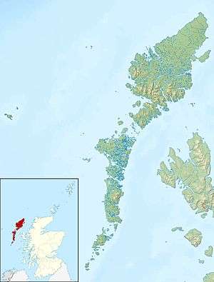 Lingeigh Lingeigh shown within the Outer Hebrides | |
| OS grid reference | NL602896 |
| Physical geography | |
| Island group | Uists and Barra |
| Area | 27 hectares (0.10 sq mi)[1] |
| Highest elevation | 83 m (272 ft) |
| Administration | |
| Sovereign state | United Kingdom |
| Country | Scotland |
| Council area | Na h-Eileanan Siar |
| Demographics | |
| Population | 0 |
| References | [2] |
Lingeigh or Lingay is an unpopulated islet in the Outer Hebrides. It lies towards the southern end of the archipelago, just north of Rosinish and 3 miles (5 km) south of Vatersay. There is a cave on the south-east side of the island.
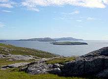
Lingeigh from Vatersay. It is the small island behind the first small one
Footnotes
- ↑ "Rick Livingstone's Tables of the Islands of Scotland" (pdf). Argyll Yacht Charters. Retrieved 12 Dec 2011.
- ↑ Ordnance Survey. Get-a-map (Map). 1:25,000. Leisure. Ordinance Survey. Retrieved 21 August 2013.
Coordinates: 56°52′22″N 7°34′47″W / 56.87289°N 7.57963°W
This article is issued from Wikipedia - version of the 2/27/2016. The text is available under the Creative Commons Attribution/Share Alike but additional terms may apply for the media files.