Hanoverton, Ohio
| Hanoverton, Ohio | |
|---|---|
| Village | |
|
Hanover House (1835) in the Hanoverton Canal Town District | |
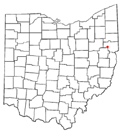 Location of Hanoverton, Ohio | |
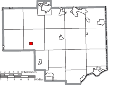 Location of Hanoverton in Columbiana County | |
| Coordinates: 40°45′13″N 80°56′8″W / 40.75361°N 80.93556°WCoordinates: 40°45′13″N 80°56′8″W / 40.75361°N 80.93556°W | |
| Country | United States |
| State | Ohio |
| County | Columbiana |
| Area[1] | |
| • Total | 0.70 sq mi (1.81 km2) |
| • Land | 0.70 sq mi (1.81 km2) |
| • Water | 0 sq mi (0 km2) |
| Elevation[2] | 1,129 ft (344 m) |
| Population (2010)[3] | |
| • Total | 408 |
| • Estimate (2012[4]) | 400 |
| • Density | 582.9/sq mi (225.1/km2) |
| Time zone | Eastern (EST) (UTC-5) |
| • Summer (DST) | EDT (UTC-4) |
| ZIP code | 44423 |
| Area code(s) | 330, 234 |
| FIPS code | 39-33306[5] |
| GNIS feature ID | 1041292[2] |
.JPG)
Hanoverton is a village in Hanover Township, Columbiana County, Ohio, United States. The population was 408 at the 2010 census.
History
Hanoverton was laid out in 1813, and incorporated as a village in 1836.[6] Hanoverton experienced growth in the 1830s by the building of the Sandy and Beaver Canal through the town, but by the late 1840s, the canal was no longer profitable and the town declined.[7]
In 1977 a 23-acre area of Hanoverton was added to the National Register of Historic Places as the Hanoverton Canal Town District. The district is noted for canal-era architecture which is largely unchanged since construction in the mid-1800s.
Hanoverton also played it's part in the Underground Railroad. At least one old home has a hidden room and the old Spread Eagle Tavern has a underground tunnel that goes between two buildings. This tunnel is still functional today
Geography

Hanoverton is located at 40°45′13″N 80°56′8″W / 40.75361°N 80.93556°W (40.753731, -80.935563).[8]
According to the United States Census Bureau, the village has a total area of 0.70 square miles (1.81 km2), all land.[1]
Hanoverton lies south of Salem and west of the county seat of Lisbon.
Demographics
| Historical population | |||
|---|---|---|---|
| Census | Pop. | %± | |
| 1870 | 481 | — | |
| 1880 | 443 | −7.9% | |
| 1890 | 306 | −30.9% | |
| 1900 | 399 | 30.4% | |
| 1910 | 317 | −20.6% | |
| 1920 | 266 | −16.1% | |
| 1930 | 287 | 7.9% | |
| 1940 | 292 | 1.7% | |
| 1950 | 344 | 17.8% | |
| 1960 | 442 | 28.5% | |
| 1970 | 483 | 9.3% | |
| 1980 | 490 | 1.4% | |
| 1990 | 434 | −11.4% | |
| 2000 | 387 | −10.8% | |
| 2010 | 408 | 5.4% | |
| Est. 2015 | 400 | [9] | −2.0% |
2010 census
As of the census[3] of 2010, there were 408 people, 162 households, and 115 families residing in the village. The population density was 582.9 inhabitants per square mile (225.1/km2). There were 175 housing units at an average density of 250.0 per square mile (96.5/km2). The racial makeup of the village was 100.0% White.
There were 162 households of which 30.9% had children under the age of 18 living with them, 53.1% were married couples living together, 9.9% had a female householder with no husband present, 8.0% had a male householder with no wife present, and 29.0% were non-families. 22.8% of all households were made up of individuals and 10.5% had someone living alone who was 65 years of age or older. The average household size was 2.52 and the average family size was 2.97.
The median age in the village was 39.6 years. 23.8% of residents were under the age of 18; 8.1% were between the ages of 18 and 24; 25% were from 25 to 44; 27.6% were from 45 to 64; and 15.4% were 65 years of age or older. The gender makeup of the village was 47.8% male and 52.2% female.
2000 census
As of the census[5] of 2000, there were 387 people, 157 households, and 116 families residing in the village. The population density was 547.4 people per square mile (210.5/km²). There were 165 housing units at an average density of 233.4 per square mile (89.7/km²). The racial makeup of the village was 98.45% White, 0.26% African American, 0.26% Native American, and 1.03% from two or more races. Hispanic or Latino of any race were 0.52% of the population.
There were 157 households out of which 32.5% had children under the age of 18 living with them, 61.1% were married couples living together, 12.1% had a female householder with no husband present, and 26.1% were non-families. 22.9% of all households were made up of individuals and 14.6% had someone living alone who was 65 years of age or older. The average household size was 2.46 and the average family size was 2.93.
In the village the population was spread out with 24.8% under the age of 18, 7.0% from 18 to 24, 27.9% from 25 to 44, 20.4% from 45 to 64, and 19.9% who were 65 years of age or older. The median age was 38 years. For every 100 females there were 87.0 males. For every 100 females age 18 and over, there were 90.2 males.
The median income for a household in the village was $36,538, and the median income for a family was $41,250. Males had a median income of $31,719 versus $20,625 for females. The per capita income for the village was $14,970. About 1.7% of families and 3.2% of the population were below the poverty line, including 4.4% of those under age 18 and 1.4% of those age 65 or over.
Notable person
References
- 1 2 "US Gazetteer files 2010". United States Census Bureau. Retrieved 2013-01-06.
- 1 2 "US Board on Geographic Names". United States Geological Survey. 2007-10-25. Retrieved 2008-01-31.
- 1 2 "American FactFinder". United States Census Bureau. Retrieved 2013-01-06.
- ↑ "Population Estimates". United States Census Bureau. Retrieved 2013-06-17.
- 1 2 "American FactFinder". United States Census Bureau. Retrieved 2008-01-31.
- ↑ Mack, Horace (1879). History of Columbiana County, Ohio: With Illustrations and Biographical Sketches of Some of Its Prominent Men and Pioneers. Unigraphic. pp. 159–160.
- ↑ McCord, William B. (1905). History of Columbiana County, Ohio and Representative Citizens. Biographical Publishing Company. p. 281.
- ↑ "US Gazetteer files: 2010, 2000, and 1990". United States Census Bureau. 2011-02-12. Retrieved 2011-04-23.
- ↑ "Annual Estimates of the Resident Population for Incorporated Places: April 1, 2010 to July 1, 2015". Retrieved July 2, 2016.
- ↑ "Census of Population and Housing". Census.gov. Retrieved June 4, 2015.
Municipalities and communities of Columbiana County, Ohio, United States | ||
|---|---|---|
| Cities | 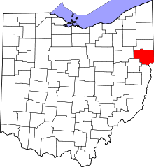 | |
| Villages | ||
| Townships | ||
| CDPs | ||
| Unincorporated communities |
| |
| Ghost town | ||
| Footnotes | ‡This populated place also has portions in an adjacent county or counties | |