Rogers, Ohio
| Rogers, Ohio | |
|---|---|
| Village | |
|
| |
 Location of Rogers, Ohio | |
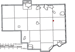 Location of Rogers in Columbiana County | |
| Coordinates: 40°47′26″N 80°37′32″W / 40.79056°N 80.62556°WCoordinates: 40°47′26″N 80°37′32″W / 40.79056°N 80.62556°W | |
| Country | United States |
| State | Ohio |
| County | Columbiana |
| Area[1] | |
| • Total | 0.23 sq mi (0.60 km2) |
| • Land | 0.23 sq mi (0.60 km2) |
| • Water | 0 sq mi (0 km2) |
| Elevation[2] | 1,027 ft (313 m) |
| Population (2010)[3] | |
| • Total | 237 |
| • Estimate (2012[4]) | 235 |
| • Density | 1,030.4/sq mi (397.8/km2) |
| Time zone | Eastern (EST) (UTC-5) |
| • Summer (DST) | EDT (UTC-4) |
| ZIP code | 44455 |
| Area code(s) | 330, 234 |
| FIPS code | 39-68084[5] |
| GNIS feature ID | 1045153[2] |

Rogers is a village in Columbiana County, Ohio, United States. The population was 237 at the 2010 census.
History
Rogers had its start in the year 1883 by the building of the PL&W railroad through that territory. It was named for its founder, T. G. Rogers. Rogers was incorporated as a village in 1895.[6]
Mount Hope College
Mount Hope College was an academy in Rogers, located on Highland Avenue. In 1894, the academy burned, but was rebuilt the same year. A.A. Galbreath and Charles Galbreath bought the academy in 1894. In 1905, the college was changed to a summer school, and later to a public school. The public school, Rogers Area School, served students in grades 1-8. The school was again destroyed by fire in January 1951.[7]
Geography
Rogers is located at 40°47′26″N 80°37′32″W / 40.79056°N 80.62556°W (40.790549, -80.625501).[8]
According to the United States Census Bureau, the village has a total area of 0.23 square miles (0.60 km2), all land.[1]
Demographics
| Historical population | |||
|---|---|---|---|
| Census | Pop. | %± | |
| 1900 | 287 | — | |
| 1910 | 258 | −10.1% | |
| 1920 | 241 | −6.6% | |
| 1930 | 270 | 12.0% | |
| 1940 | 300 | 11.1% | |
| 1950 | 297 | −1.0% | |
| 1960 | 295 | −0.7% | |
| 1970 | 310 | 5.1% | |
| 1980 | 298 | −3.9% | |
| 1990 | 247 | −17.1% | |
| 2000 | 266 | 7.7% | |
| 2010 | 237 | −10.9% | |
| Est. 2015 | 233 | [9] | −1.7% |
2010 census
As of the census[3] of 2010, there were 237 people, 85 households, and 66 families residing in the village. The population density was 1,030.4 inhabitants per square mile (397.8/km2). There were 93 housing units at an average density of 404.3 per square mile (156.1/km2). The racial makeup of the village was 98.3% White, 0.4% African American, and 1.3% from two or more races.
There were 85 households of which 37.6% had children under the age of 18 living with them, 48.2% were married couples living together, 22.4% had a female householder with no husband present, 7.1% had a male householder with no wife present, and 22.4% were non-families. 16.5% of all households were made up of individuals and 7.1% had someone living alone who was 65 years of age or older. The average household size was 2.79 and the average family size was 3.05.
The median age in the village was 39.3 years. 21.1% of residents were under the age of 18; 13% were between the ages of 18 and 24; 23.6% were from 25 to 44; 30.8% were from 45 to 64; and 11.4% were 65 years of age or older. The gender makeup of the village was 47.7% male and 52.3% female.
2000 census
As of the census[5] of 2000, there were 266 people, 95 households, and 72 families residing in the village. The population density was 1,132.4 people per square mile (446.5/km²). There were 99 housing units at an average density of 421.5 per square mile (166.2/km²). The racial makeup of the village was 99.25% White, and 0.75% from two or more races. Hispanic or Latino of any race were 0.75% of the population.
There were 95 households out of which 45.3% had children under the age of 18 living with them, 55.8% were married couples living together, 14.7% had a female householder with no husband present, and 24.2% were non-families. 21.1% of all households were made up of individuals and 10.5% had someone living alone who was 65 years of age or older. The average household size was 2.80 and the average family size was 3.19.
In the village the population was spread out with 30.8% under the age of 18, 7.9% from 18 to 24, 35.3% from 25 to 44, 16.5% from 45 to 64, and 9.4% who were 65 years of age or older. The median age was 33 years. For every 100 females there were 111.1 males. For every 100 females age 18 and over, there were 106.7 males.
The median income for a household in the village was $31,250, and the median income for a family was $33,036. Males had a median income of $30,625 versus $18,750 for females. The per capita income for the village was $12,055. About 15.5% of families and 14.7% of the population were below the poverty line, including 15.1% of those under the age of eighteen and 21.7% of those sixty five or over.
Local attraction
Along with the nearby community of Signal, since 1955 Rogers has been home to Rogers Community Auction and Flea Market. One of the largest flea markets in Ohio, it is an open-air market held year-round, sitting on 250 acres (1,000,000 m2) of land.[11] The market has an assortment of vendors including produce, clothing, novelties, and antiques. The market has more than 1,600 vendors' spaces, 350 of which are covered; no admission fee; and more than 70 acres (280,000 m2) of free parking. It is located off Ohio State Route 154, with access also available from Ohio State Route 7.
Weekly events include the weekly Friday flea market, with auctions of household items, antiques, farm fresh produce and livestock. Hays and grains are auctioned on Wednesdays, and the second Tuesday of each month is reserved for the equipment/consignment auction.[12]
On July 25, 2014, the U.S. Immigration and Customs Enforcement raided more than one dozen vendors at the flea market for selling counterfeit consumer goods. The merchandise seized was worth over US$500,000.[13] The sale of counterfeit goods violated the flea market's policies.[11] The flea market resumed normal business on August 8.[11]
References
- 1 2 "US Gazetteer files 2010". United States Census Bureau. Retrieved 2013-01-06.
- 1 2 "US Board on Geographic Names". United States Geological Survey. 2007-10-25. Retrieved 2008-01-31.
- 1 2 "American FactFinder". United States Census Bureau. Retrieved 2013-01-06.
- ↑ "Population Estimates". United States Census Bureau. Retrieved 2013-06-17.
- 1 2 "American FactFinder". United States Census Bureau. Retrieved 2008-01-31.
- ↑ McCord, William B. (1905). History of Columbiana County, Ohio and Representative Citizens. Biographical Publishing Company. p. 303.
- ↑ Rogers Elementary School. SuperPages.com.
- ↑ "US Gazetteer files: 2010, 2000, and 1990". United States Census Bureau. 2011-02-12. Retrieved 2011-04-23.
- ↑ "Annual Estimates of the Resident Population for Incorporated Places: April 1, 2010 to July 1, 2015". Retrieved July 2, 2016.
- ↑ "Census of Population and Housing". Census.gov. Retrieved June 4, 2015.
- 1 2 3 Roger Community Auction opens week after federal agents seized counterfeit merchandise WFMJ-TV (08/08/2014)
- ↑ http://www.vindy.com/content/local_regional/289730601895394.php The Youngstown (Ohio) Vindicator
- ↑ Federal agents seize counterfeit items at Ohio flea market Pittsburgh Post-Gazette (08/05/2014)
Municipalities and communities of Columbiana County, Ohio, United States | ||
|---|---|---|
| Cities | 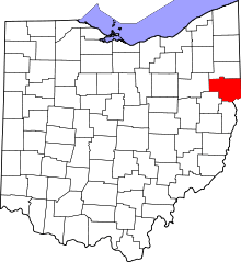 | |
| Villages | ||
| Townships | ||
| CDPs | ||
| Unincorporated communities |
| |
| Ghost town | ||
| Footnotes | ‡This populated place also has portions in an adjacent county or counties | |