Damascus, Ohio
| Damascus, Ohio | |
|---|---|
| CDP | |
 Location of Damascus, Ohio | |
| Coordinates: 40°54′4″N 80°57′18″W / 40.90111°N 80.95500°WCoordinates: 40°54′4″N 80°57′18″W / 40.90111°N 80.95500°W | |
| Country | United States |
| State | Ohio |
| Counties | Mahoning, Columbiana |
| Townships | Goshen, Butler |
| Area | |
| • Total | 0.81 sq mi (2.09 km2) |
| • Land | 0.80 sq mi (2.07 km2) |
| • Water | 0.008 sq mi (0.02 km2) |
| Elevation[1] | 1,115 ft (340 m) |
| Population (2010) | |
| • Total | 443 |
| • Density | 554/sq mi (214.0/km2) |
| Time zone | Eastern (EST) (UTC-5) |
| • Summer (DST) | EDT (UTC-4) |
| ZIP code | 44619 |
| Area code(s) | 330, 234 |
| FIPS code | 39-20030 |
| GNIS code | 1064504 |
Damascus is a census-designated place (CDP) in southwestern Goshen Township in Mahoning County and northwestern Butler Township in Columbiana County in the U.S. state of Ohio.[2][3] As of the 2010 census, it had a population of 443.[4] Damascus has a post office, with the ZIP code of 44619.[5] Its elevation is 1,211 feet (369 m), and it is located at 40°54′7″N 80°57′18″W / 40.90194°N 80.95500°W (40.9020031, -80.9550891).[6] The community lies at the intersection of U.S. Route 62 and State Routes 173 and 534.[7]
The Mahoning County portion of Damascus is part of the Youngstown–Warren–Boardman, OH-PA Metropolitan Statistical Area, while the Columbiana County portion is part of the East Liverpool–Salem Micropolitan Statistical Area.
History
Damascus was platted in 1808.[8] The community derives its name from the ancient city of Damascus, in Syria.[9] Damascus was originally built up chiefly by Quakers.[10]
The Damascus post office opened in 1828.[11]
References
- ↑ "US Board on Geographic Names". United States Geological Survey. 2007-10-25. Retrieved 2008-01-31.
- ↑ DeLorme. Ohio Atlas & Gazetteer. 7th ed. Yarmouth: DeLorme, 2004, p. 52. ISBN 0-89933-281-1.
- ↑ U.S. Geological Survey Geographic Names Information System: Damascus, Ohio
- ↑ "Geographic Identifiers: 2010 Demographic Profile Data (G001): Damascus CDP, Ohio". U.S. Census Bureau, American Factfinder. Retrieved March 28, 2013.
- ↑ Zip Code Lookup
- ↑ U.S. Geological Survey Geographic Names Information System: Damascus, Ohio
- ↑ DeLorme. Ohio Atlas & Gazetteer. 7th ed. Yarmouth: DeLorme, 2004, p. 34. ISBN 0-89933-281-1.
- ↑ Mack, Horace (1879). History of Columbiana County, Ohio: With Illustrations and Biographical Sketches of Some of Its Prominent Men and Pioneers. Unigraphic. p. 100.
- ↑ Overman, William Daniel (1958). Ohio Town Names. Akron, OH: Atlantic Press. p. 36.
- ↑ McCord, William B. (1905). History of Columbiana County, Ohio and Representative Citizens. Biographical Publishing Company. p. 267.
- ↑ Sanderson, Thomas W. (1907). Twentieth Century History of Youngstown and Mahoning County. Biographical Publishing Company. p. 204.
Municipalities and communities of Columbiana County, Ohio, United States | ||
|---|---|---|
| Cities | 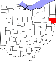 | |
| Villages | ||
| Townships | ||
| CDPs | ||
| Unincorporated communities |
| |
| Ghost town | ||
| Footnotes | ‡This populated place also has portions in an adjacent county or counties | |
Municipalities and communities of Mahoning County, Ohio, United States | ||
|---|---|---|
| Cities | 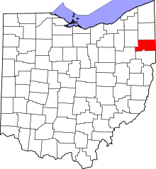 | |
| Villages | ||
| Townships | ||
| CDPs | ||
| Unincorporated communities |
| |
| Footnotes | ‡This populated place also has portions in an adjacent county or counties | |