Columbiana, Ohio
| Columbiana, Ohio | |
|---|---|
| City | |
|
Downtown Columbiana | |
| Motto: "The City with the Small-Town Heart" | |
 Location of Columbiana, Ohio | |
 Location of Columbiana in Columbiana County | |
| Coordinates: 40°53′8″N 80°41′18″W / 40.88556°N 80.68833°WCoordinates: 40°53′8″N 80°41′18″W / 40.88556°N 80.68833°W | |
| Country | United States |
| State | Ohio |
| Counties | Columbiana, Mahoning |
| Government | |
| • Type | Council-Manager |
| • City Manager | Lance Willard |
| • Mayor | Bryan Blakeman |
| Area[1] | |
| • Total | 6.14 sq mi (15.90 km2) |
| • Land | 6.00 sq mi (15.54 km2) |
| • Water | 0.14 sq mi (0.36 km2) |
| Elevation[2] | 1,158 ft (353 m) |
| Population (2010)[3] | |
| • Total | 6,384 |
| • Estimate (2012[4]) | 6,334 |
| • Density | 1,064.0/sq mi (410.8/km2) |
| Time zone | Eastern (EST) (UTC-5) |
| • Summer (DST) | EDT (UTC-4) |
| ZIP code | 44408 |
| Area code(s) | 330, 234 |
| FIPS code | 39-17036[5] |
| GNIS feature ID | 1060989[2] |
| Website |
www |

Columbiana is a city in Columbiana and Mahoning counties in the U.S. state of Ohio. The population was 6,384 at the 2010 census.
The Columbiana County portion of Columbiana (by far the larger) is part of the Salem, OH Micropolitan Statistical Area, while the Mahoning County portion (only a small section) is part of the Youngstown-Warren-Boardman, OH-PA Metropolitan Statistical Area.
History
Columbiana was laid out by Joshua Dixon in 1805.[6] The city takes its name from Columbiana County.[7] Columbiana was incorporated as a village in 1837.[8] The village officially became a city in 2000.
Geography
Columbiana is located at 40°53′8″N 80°41′18″W / 40.88556°N 80.68833°W (40.885579, -80.688327).[9]
According to the United States Census Bureau, the city has a total area of 6.14 square miles (15.90 km2), of which 6.00 square miles (15.54 km2) is land and 0.14 square miles (0.36 km2) is water.[1]
Demographics
| Historical population | |||
|---|---|---|---|
| Census | Pop. | %± | |
| 1860 | 1,174 | — | |
| 1870 | 870 | −25.9% | |
| 1880 | 1,223 | 40.6% | |
| 1890 | 1,112 | −9.1% | |
| 1900 | 1,339 | 20.4% | |
| 1910 | 1,582 | 18.1% | |
| 1920 | 2,114 | 33.6% | |
| 1930 | 2,485 | 17.5% | |
| 1940 | 2,687 | 8.1% | |
| 1950 | 3,369 | 25.4% | |
| 1960 | 4,164 | 23.6% | |
| 1970 | 4,959 | 19.1% | |
| 1980 | 4,987 | 0.6% | |
| 1990 | 4,961 | −0.5% | |
| 2000 | 5,635 | 13.6% | |
| 2010 | 6,384 | 13.3% | |
| Est. 2015 | 6,291 | [10] | −1.5% |
| Sources:[11][12][13][14][15][16][5][17] | |||
2010 census
As of the census[3] of 2010, there were 6,384 people, 2,881 households, and 1,763 families residing in the city. The population density was 1,064.0 inhabitants per square mile (410.8/km2). There were 3,181 housing units at an average density of 530.2 per square mile (204.7/km2). The racial makeup of the city was 97.7% White, 0.6% African American, 0.5% Asian, 0.4% from other races, and 0.8% from two or more races. Hispanic or Latino of any race were 1.0% of the population.
There were 2,881 households of which 21.6% had children under the age of 18 living with them, 49.3% were married couples living together, 8.5% had a female householder with no husband present, 3.4% had a male householder with no wife present, and 38.8% were non-families. 34.5% of all households were made up of individuals and 18.4% had someone living alone who was 65 years of age or older. The average household size was 2.15 and the average family size was 2.74.
The median age in the city was 49.4 years. 17.5% of residents were under the age of 18; 7.6% were between the ages of 18 and 24; 19.9% were from 25 to 44; 27.7% were from 45 to 64; and 27.4% were 65 years of age or older. The gender makeup of the city was 46.6% male and 53.4% female.
2000 census
As of the census[5] of 2000, there were 5,635 people, 2,534 households, and 1,576 families residing in the city. The population density was 930.4 people per square mile (359.0/km²). There were 2,707 housing units at an average density of 446.9 per square mile (172.5/km²). The racial makeup of the city was 98.86% White, 0.11% African American, 0.07% Native American, 0.18% Asian, 0.02% Pacific Islander, 0.07% from other races, and 0.69% from two or more races. Hispanic or Latino of any race were 0.32% of the population.
There were 2,534 households out of which 22.2% had children under the age of 18 living with them, 51.8% were married couples living together, 7.5% had a female householder with no husband present, and 37.8% were non-families. 34.9% of all households were made up of individuals and 17.7% had someone living alone who was 65 years of age or older. The average household size was 2.15 and the average family size was 2.76.
In the city the population was spread out with 19.0% under the age of 18, 6.8% from 18 to 24, 23.5% from 25 to 44, 25.3% from 45 to 64, and 25.3% who were 65 years of age or older. The median age was 46 years. For every 100 females there were 87.3 males. For every 100 females age 18 and over, there were 82.1 males.
The median income for a household in the city was $34,560, and the median income for a family was $42,363. Males had a median income of $33,693 versus $21,648 for females. The per capita income for the city was $19,727. About 4.9% of families and 6.5% of the population were below the poverty line, including 7.8% of those under age 18 and 6.1% of those age 65 or over.
Education
The school's athletic teams are known as the Clippers. The city is served by Columbiana Exempted Village Schools, a small district with three school buildings:
- Columbiana High School, with approximately 350 students in grades 9-12. In recent years, the high school has received an excellent rating from the Ohio Department of Education.[18]
- South Side Middle School, with approximately 425 students in grades 5-8[19]
- Joshua Dixon Elementary School, with approximately 300 students in grades PreK-4[20]
Some local children attend Heartland Christian School, which first opened for the 1996-1997 schoolyear. The school's philosophy is based upon the Bible.[21]
Arts and culture
One major town event is the Columbiana Street Fair, a civic festival hosted by American Legion Post #290. It is held the Thursday - Saturday following Labor Day. Columbiana also hosts the Harvey S. Firestone Festival of the Arts the first Saturday in August, the Shaker Woods Festival the 2nd, 3rd and 4th weekends (Saturdays and Sundays) of August. Columbiana also prides it's self on its annual Community Celebration which runs from 8am - 10pm on the Fourth of July at Firestone Park with the day concluding with one of the areas best fireworks displays.
Notable people
Columbiana was the birthplace of Harvey S. Firestone, who founded the Firestone rubber company in Akron, Ohio.
References
- 1 2 "US Gazetteer files 2010". United States Census Bureau. Archived from the original on 2012-07-14. Retrieved 2013-01-06.
- 1 2 "US Board on Geographic Names". United States Geological Survey. 2007-10-25. Retrieved 2008-01-31.
- 1 2 "American FactFinder". United States Census Bureau. Retrieved 2013-01-06.
- ↑ "Population Estimates". United States Census Bureau. Archived from the original on 2013-06-17. Retrieved 2013-06-17.
- 1 2 3 "American FactFinder". United States Census Bureau. Archived from the original on 2013-09-11. Retrieved 2008-01-31.
- ↑ McCord, William B. (1905). History of Columbiana County, Ohio and Representative Citizens. Biographical Publishing Company. p. 277.
- ↑ Overman, William Daniel (1958). Ohio Town Names. Akron, OH: Atlantic Press. p. 32.
- ↑ Mack, Horace (1879). History of Columbiana County, Ohio: With Illustrations and Biographical Sketches of Some of Its Prominent Men and Pioneers. Unigraphic. p. 144.
- ↑ "US Gazetteer files: 2010, 2000, and 1990". United States Census Bureau. 2011-02-12. Retrieved 2011-04-23.
- ↑ "Annual Estimates of the Resident Population for Incorporated Places: April 1, 2010 to July 1, 2015". Retrieved July 2, 2016.
- ↑ "Population of Civil Divisions Less than Counties" (PDF). Statistics of the Population of the United States at the Tenth Census. U.S. Census Bureau. Retrieved 28 November 2013.
- ↑ "Population of Civil Divisions Less than Counties" (PDF). Statistics of the Population of the United States at the Tenth Census. U.S. Census Bureau. Retrieved 28 November 2013.
- ↑ "Population: Ohio" (PDF). 1910 U.S. Census. U.S. Census Bureau. Retrieved 28 November 2013.
- ↑ "Population: Ohio" (PDF). 1930 US Census. U.S. Census Bureau. Retrieved 28 November 2013.
- ↑ "Number of Inhabitants: Ohio" (PDF). 18th Census of the United States. U.S. Census Bureau. Retrieved 22 November 2013.
- ↑ "Ohio: Population and Housing Unit Counts" (PDF). U.S. Census Bureau. Retrieved 22 November 2013.
- ↑ "Incorporated Places and Minor Civil Divisions Datasets: Subcounty Population Estimates: April 1, 2010 to July 1, 2012". U.S. Census Bureau. Archived from the original on 17 June 2013. Retrieved 25 November 2013.
- ↑ Welcome to ClipperNet, Columbiana Exempted Village Schools. Accessed 2009-07-08.
- ↑ Welcome to ClipperNet, Columbiana Exempted Village Schools. Accessed 2009-07-08.
- ↑ Welcome to ClipperNet, Columbiana Exempted Village Schools. Accessed 2009-07-08.
- ↑ About Us, Heartland Christian School, 2006. Accessed 2007-09-10.
External links
- City website
- Columbiana Chamber of Commerce
- Columbiana Public Library
- Columbiana Public Library/ Jesse Cannella
- Shaker Woods Festival
Municipalities and communities of Columbiana County, Ohio, United States | ||
|---|---|---|
| Cities | 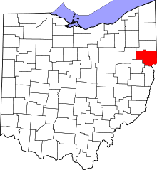 | |
| Villages | ||
| Townships | ||
| CDPs | ||
| Unincorporated communities |
| |
| Ghost town | ||
| Footnotes | ‡This populated place also has portions in an adjacent county or counties | |
Municipalities and communities of Mahoning County, Ohio, United States | ||
|---|---|---|
| Cities | 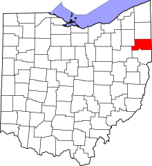 | |
| Villages | ||
| Townships | ||
| CDPs | ||
| Unincorporated communities |
| |
| Footnotes | ‡This populated place also has portions in an adjacent county or counties | |