Wayne Township, Columbiana County, Ohio
| Wayne Township, Columbiana County, Ohio | |
|---|---|
| Township | |
|
Township garage | |
 Location of Wayne Township in Columbiana County | |
| Coordinates: 40°41′50″N 80°47′47″W / 40.69722°N 80.79639°WCoordinates: 40°41′50″N 80°47′47″W / 40.69722°N 80.79639°W | |
| Country | United States |
| State | Ohio |
| County | Columbiana |
| Area | |
| • Total | 25.0 sq mi (64.8 km2) |
| • Land | 25.0 sq mi (64.7 km2) |
| • Water | 0.04 sq mi (0.1 km2) |
| Elevation[1] | 1,161 ft (354 m) |
| Population (2010) | |
| • Total | 814 |
| • Density | 33/sq mi (12.6/km2) |
| Time zone | Eastern (EST) (UTC-5) |
| • Summer (DST) | EDT (UTC-4) |
| FIPS code | 39-82138[2] |
| GNIS feature ID | 1085905[1] |

Wayne Township is one of the eighteen townships of Columbiana County, Ohio, United States. As of the 2010 census the population was 814.[3]
Geography
Located in the southern part of the county, it borders the following townships:
- Center Township - north
- Elkrun Township - northeast corner
- Madison Township - east
- Washington Township - south
- Franklin Township - west
No municipalities are located in Wayne Township.
Name and history
It is one of twenty Wayne Townships statewide.[4]
The township was organized in 1806.[5]
On July 26, 1863 Confederate Brig. Gen. John Hunt Morgan and his command surrendered to Federal forces on the Gavers-West Point Road one mile east of Prosperity Corners. http://civilwardailygazette.com/2013/07/26/the-absurd-and-ridiculous-surrender-of-john-hunt-morgan/
Government
The township is governed by a three-member board of trustees, who are elected in November of odd-numbered years to a four-year term beginning on the following January 1. Two are elected in the year after the presidential election and one is elected in the year before it. There is also an elected township fiscal officer,[6] who serves a four-year term beginning on April 1 of the year after the election, which is held in November of the year before the presidential election. Vacancies in the fiscal officership or on the board of trustees are filled by the remaining trustees.
References
- 1 2 "US Board on Geographic Names". United States Geological Survey. 2007-10-25. Retrieved 2008-01-31.
- ↑ "American FactFinder". United States Census Bureau. Retrieved 2008-01-31.
- ↑ "Geographic Identifiers: 2010 Demographic Profile Data (G001): Wayne township, Columbiana County, Ohio". U.S. Census Bureau, American Factfinder. Retrieved January 28, 2015.
- ↑ "Detailed map of Ohio" (PDF). United States Census Bureau. 2000. Retrieved 2007-02-16.
- ↑ Cranmer, Gibson Lamb (1891). History of the upper Ohio Valley. 2. Madison, Wisconsin: Brant & Fuller. p. 22.
- ↑ §503.24, §505.01, and §507.01 of the Ohio Revised Code. Accessed 4/30/2009.
External links
Municipalities and communities of Columbiana County, Ohio, United States | ||
|---|---|---|
| Cities | 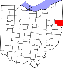 | |
| Villages | ||
| Townships | ||
| CDPs | ||
| Unincorporated communities |
| |
| Ghost town | ||
| Footnotes | ‡This populated place also has portions in an adjacent county or counties | |