Crescent Station, New York
| Crescent Station | |
| Hamlet | |
| Official name: Crescent Station, New York | |
| Name origin: railroad station named for nearest hamlet- Crescent in Saratoga County | |
| Country | United States |
|---|---|
| State | New York |
| Region | Capital District |
| County | Albany |
| Municipality | Town of Colonie |
| Coordinates | 42°47′54″N 73°44′1″W / 42.79833°N 73.73361°WCoordinates: 42°47′54″N 73°44′1″W / 42.79833°N 73.73361°W |
| Timezone | EST (UTC-5) |
| - summer (DST) | EDT (UTC-4) |
| ZIP Code | 12047 |
| Area code | 518 |
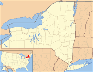 Location of Crescent Station within the state of New York
| |
Crescent Station is a hamlet of the town of Colonie in Albany County, New York that straddles US Route 9.
History
Crescent Station takes its name from a stop on the Schenectady and Troy Railroad (T&S), later a branch of the New York Central Railroad. The T&S Line was completed in 1842, and owned by the nearby city of Troy. Passenger service ended in 1942, though a Ford tractor branch in Crescent continued to receive service. In 1965, service between Crescent Station and Niskayuna was cut, and then when the Green Island Bridge was converted from rail to automobile use service was cut to Troy in 1958. Service between Crescent Station and Green Island was abandoned in 1976. It is now part of the Mohawk Hudson Hike/Bike Trail.[1]
Geography
Colonie's town landfill is located at the north end of the hamlet, near the border with Cohoes and the Mohawk River. The Colonie Town Park is to the west, between Crescent Station and the Colonie hamlet of Dunsbach Ferry.
Location
 |
Mohawk River | Mohawk River
Saratoga County Town of Halfmoon Hamlet of Crescent |
Mohawk River
Saratoga County |
|
| Colonie Town Park
Mohawk River |
|
Mohawk River
Saratoga County Town of Waterford | ||
| ||||
| | ||||
| Hamlet of Dunsbach Ferry | Hamlet of Boght Corners | City of Cohoes |
References
- ↑ "The Troy and Schenectady: Now it is a Bike Path". Kingly Heirs. Retrieved 2010-02-05.
External links
- Town of Colonie (includes Crescent Station)
Municipalities and communities of Albany County, New York, United States | ||
|---|---|---|
| Cities |  | |
| Towns | ||
| Villages | ||
| CDPs | ||
| Other hamlets |
| |