Dunsbach Ferry, New York
| Dunsbach Ferry | |
| hamlet | |
| Official name: Dunsbach Ferry, New York | |
| Country | United States |
|---|---|
| State | New York |
| Region | Capital District |
| County | Albany |
| Municipality | Town of Colonie |
| River | Mohawk River |
| Elevation | 187 ft (57 m) |
| Coordinates | 42°47′31″N 73°45′22″W / 42.79194°N 73.75611°WCoordinates: 42°47′31″N 73°45′22″W / 42.79194°N 73.75611°W |
| Timezone | EST (UTC-5) |
| - summer (DST) | EDT (UTC-4) |
| ZIP Code | 12047 |
| Area code | 518 |
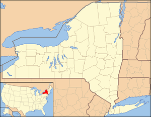 Location of Dunsbach Ferry within the state of New York | |
Dunsbach Ferry is a hamlet of the town of Colonie, in Albany County, New York. The hamlet sits to the east of, and below, the Thaddeus Kosciusko Bridge (also known as "The Twin Bridges"), where Interstate 87 (I-87) crosses the Mohawk River. There are numerous private and public docks and landings between the Twin Bridges and the Colonie Town Park. Dunsbach Ferry was once an important river crossing and a stop on the Schenectady and Troy Railroad (T&S), later a branch of the New York Central Railroad. The ZIP code is 12047 (Cohoes).
History
In 1718 an early settler and ferry owner, Cornelius Claes Vandenburgh, built a landmark stone house on the Mohawk west of Crescent. Cornelius Claes Ferry was later called Dunsbach Ferry.[1] Dunsbach Ferry originated, as the name suggests, as a ferry crossing over the Mohawk River. The ferry was replaced for a short time by the Dunsbach Ferry Bridge, a bridge that had an unusual pier construction method involving cylinders with piles driven inside with heavy crib work outside.[2] This bridge was constructed by the Dunsbach Ferry Bridge Company in 1898 in three spans, two were carried away by ice in 1903, and the third in 1905.[3] When the creation of the New York State Barge Canal moved the Erie Canal to the Mohawk River in 1910 the hamlet became home to many barge captains and as a stop for provisioning the barges.[4] A gauging station was established at Dunsbach Ferry in 1898 by D.J. Howell for measuring the discharge flow of the river and the record continued on at the West Troy Water Company dam and pumping station at the hamlet, it was located roughly 200 feet south (upstream) of the bridge.[5] The dam was built in order to supply West Troy (later Watervliet) with water,[6] and was partially removed in 1912.[7]
The bucolic nature of the surroundings made it a natural summer resort village. As year-round residents have become more common summer homes have become remodeled and winterized with additions built on, though some summer cottages remain and farms and undeveloped woodlands still shelter the inland side of the hamlet from the developments in Latham along U.S. Route 9 (US 9).[4]
Geography
While Colonie's hamlets do not have specifically demarcated borders, Dunsbach Ferry is generally considered to include the areas along the Mohawk River from I-87 to the Colonie Town Park. It is accessible by road from the Colonie hamlets of Boght Corners, Crescent Station, and Latham.
Location
 |
Mohawk River | Colonie Town Park
Hamlet of Crescent Station |
| |
| Mohawk River | |
|||
| ||||
| | ||||
| Hamlet of Latham | Hamlet of Boght Corners |
Architecture
Dunsbach Ferry has architectural styles ranging from colonial, ranch, and cape, with sidings finished in a range of different materials including aluminum, clapboard, and shingles. Many of the homes along the river began as summer cottages and have been winterized and enlarged while some still remain in strictly summer-camp style.[4]
Education
Dunsbach Ferry is a part of the North Colonie Central School District (NCCS) and the children attend Boght Hills Elementary School for kindergarten through sixth grade; and Shaker High School for seventh through twelfth.[4]
References
- ↑ http://www.livingplaces.com/NY/Saratoga_County/Halfmoon_Town.html
- ↑ The Engineering Magazine, Vol. 21, April-Sept. 1901. John R. Dunlap. 1901. p. 947. Retrieved 2010-02-05.
- ↑ William Schuyler Jackson (1908). Annual Report of the Attorney-General of the State of New York; for the year ending December 31, 1907. J.B. Lyon Company. p. 350. Retrieved 2010-02-05.
- 1 2 3 4 Frances Ingraham (January 22, 1995). "Resortlike Dunsbach Ferry draws year-round residents". Albany Times Union. Retrieved 2010-02-05.
- ↑ New York State Education Department (1906). 58th Annual Report of the New York State Museum, 1904; Vol. 2. New York State Education Department. p. 403. Retrieved 2010-02-05.
- ↑ Board of Engineers on Deep Waterways (1900). Report of the Board of Engineers on Deep Waterways; between the Great Lakes and the Atlantic tide waters; part 1. United States Government Printing Office. p. 515. Retrieved 2010-02-05.
- ↑ Frank M. Williams (1917). Annual Report of the State Engineer and Surveyor of the State of New York; for the fiscal year ended June 30, 1916. J.B. Lyon. p. 352. Retrieved 2010-02-05.
External links
- Town of Colonie (includes Dunsbach Ferry)
Municipalities and communities of Albany County, New York, United States | ||
|---|---|---|
| Cities |  | |
| Towns | ||
| Villages | ||
| CDPs | ||
| Other hamlets |
| |