Gloversville, New York
| Gloversville, New York | |
|---|---|
| City | |
| City of Gloversville[1] | |
 Gloversville Location in the state of New York | |
| Coordinates: 43°3′N 74°21′W / 43.050°N 74.350°WCoordinates: 43°3′N 74°21′W / 43.050°N 74.350°W | |
| Country | United States |
| State | New York |
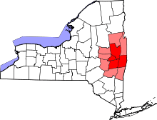
| County | Fulton |
| Incorporated (village)[2] | 1853 |
| Incorporated (city)[2] | March 19, 1890 |
| Government | |
| • Type | Mayor-Council |
| • Mayor | Dayton J. King (I) |
| • Common Council |
Members' List[3]
|
| Area[4] | |
| • Total | 5.15 sq mi (13.33 km2) |
| • Land | 5.14 sq mi (13.31 km2) |
| • Water | 0.008 sq mi (0.02 km2) |
| Elevation | 820 ft (250 m) |
| Population (2010) | |
| • Total | 15,665 |
| • Density | 3,048/sq mi (1,176.9/km2) |
| Time zone | Eastern (EST) (UTC-5) |
| • Summer (DST) | EDT (UTC-4) |
| ZIP code | 12078 |
| Area code(s) | 518 Exchanges: 725,773,775 |
| FIPS code | 36-29443 |
| GNIS feature ID | 0951265 |
| Website |
www |
Gloversville, a city in Fulton County, New York, was once the hub of the United States' glovemaking industry, with over two hundred manufacturers in Gloversville and the adjacent city of Johnstown.[5] In 2010, Gloversville had a population of 15,665.[4]
History
The region, historically known as "Kingsborough", was acquired by Sir William Johnson, 1st Baronet. In 1752, Arent Stevens bought land. Puritans from New England settled there at the end of the 18th century. The proximity of hemlock forests to supply bark for tanning made the community a center of leather production early in its history. It earned its name for being the center of the American glovemaking industry for many years. Upon the establishment of a United States post office in 1828, "Gloversville" became the official name of the community. Prior to that Gloversville had been known as "Stump City"[6] because of the large number of trees that had been cut down. In 1890–1950, 90 percent of all gloves sold in the United States were made in Gloversville.[7]
Large tanneries and glove shops employed nearly 80% of the residents of Gloversville and environs. Home workers sewed the gloves from leather that had been cut in factories. Related businesses, such as box makers, sewing machine repairmen, and thread dealers opened to serve the industry.
In 1853, Gloversville incorporated as a village. In 1890, it incorporated as a city.[2]
Until 1936, Gloversville had a very active electric interurban line, the Fonda, Johnstown and Gloversville Railroad. It ran from Gloversville, through Johnstown, along the Mohawk River to Amsterdam, then to Scotia, then across the Mohawk River, and into downtown Schenectady to the New York Central station. In 1932 in a bold move during the Great Depression it acquired unique Bullet cars in an attempt to revive business. Passenger service ended in 1936, but freight operation continued.[8]
Gloversville was the main headquarters for the Schine movie industry. The Glove Theatre was the Schines' favorite movie house. Hollywood movies sometimes premiered in Gloversville before they opened in California.
The decline of the glove industry left the city financially depressed, with many downtown storefronts abandoned and store windows covered with plywood. Many of the houses were abandoned when people moved out of town to find jobs elsewhere.
Local government
The mayor of Gloversville is Dayton King. He began a four-year term on January 1, 2010, and was reelected to a second term in 2013.
Mayors of Gloversville
- Ashley DeLos Baker 1890–91
- Clark L Jordan 1892–93
- Howard G Dewey 1894–95
- Curtis S Cummings 1896–99
- Edward S Parkhurst 1900–01
- Albert L Covell 1902–03
- Dr Eugene Beach 1904–07
- Frederick M Young 1908–09
- Wesley M Borst 1910–11
- Alden L Henry 1912–13
- George W Schermerhorn 1914–15
- Abram Baird 1916–19
- Theodore R Haviland 1920–21
- Frank A Patten 1922–23
- John W Sisson 1924–27
- Franklin J Clark 1928–31
- George W Green 1932–33
- Chauncey C Thayer 1934–41
- Robert B Ramsey 1942–53
- Roger B Haviland 1954–57
- Eugene S Grover 1958–61
- Richard H Hood 1962–69
- Robert P Best 1970–73
- Richard H Hood 1974–75
- Eugene D Reppenhagen 1975–77, 1982–85
- Louis Nicolella 1978–81
- Susan J Hammond 1986–89
- John M Reich 1990–93
- Frank DeSantis 1994–97
- Abraham Seroussi 1998–2001
- Frank LaPorta 2002–05
- Timothy G Hughes 2006–09
- Dayton J King 2010–present
Geography and climate
According to the United States Census Bureau, the city has a total area of 5.1 square miles (13.3 km2), of which 0.0077 square miles (0.02 km2), or 0.17%, is water.[4] New York State Route 29A (Fulton Street) is an east-west road through the city. New York State Route 30A is a north-south highway along the east edge of the city, leading south 4 miles (6 km) into Johnstown and northeast 5 miles (8 km) to Mayfield at the southwest end of Great Sacandaga Lake. Another north-south highway, New York State Route 309 (Bleecker Street), has its southern terminus at NY-29A in the center of Gloversville.
Cayadutta Creek, a tributary of the Mohawk River, flows southward through the city.
The city sits in the foothills of the Adirondack Mountains and therefore is within a climatic transition zone. Gloversville experiences the warmer summer temperatures common throughout the Capital Region's Hudson and Mohawk Valleys while experiencing generally more copious precipitation throughout the year than the Capital Region. This manifests in commonplace rolling thunderstorms throughout the summer months and snowfall amounts more akin to the lake-pocked higher elevations of the Adirondacks in the winter months.
| Climate data for Gloversville, New York (12078) | |||||||||||||
|---|---|---|---|---|---|---|---|---|---|---|---|---|---|
| Month | Jan | Feb | Mar | Apr | May | Jun | Jul | Aug | Sep | Oct | Nov | Dec | Year |
| Record high °F (°C) | 68 (20) |
62 (17) |
83 (28) |
90 (32) |
90 (32) |
96 (36) |
98 (37) |
96 (36) |
99 (37) |
87 (31) |
77 (25) |
66 (19) |
99 (37) |
| Average high °F (°C) | 28 (−2) |
32 (0) |
41 (5) |
55 (13) |
68 (20) |
76 (24) |
80 (27) |
79 (26) |
71 (22) |
58 (14) |
46 (8) |
34 (1) |
55.7 (13.2) |
| Average low °F (°C) | 10 (−12) |
11 (−12) |
21 (−6) |
33 (1) |
44 (7) |
54 (12) |
58 (14) |
57 (14) |
48 (9) |
36 (2) |
28 (−2) |
17 (−8) |
34.8 (1.6) |
| Record low °F (°C) | −29 (−34) |
−26 (−32) |
−14 (−26) |
5 (−15) |
24 (−4) |
34 (1) |
40 (4) |
34 (1) |
22 (−6) |
17 (−8) |
0 (−18) |
−23 (−31) |
−28 (−33) |
| Average precipitation inches (mm) | 3.20 (81.3) |
2.89 (73.4) |
3.88 (98.6) |
3.95 (100.3) |
4.16 (105.7) |
4.65 (118.1) |
4.35 (110.5) |
4.57 (116.1) |
3.70 (94) |
4.53 (115.1) |
3.10 (78.7) |
3.51 (89.2) |
46.49 (1,180.8) |
| Average snowfall inches (cm) | 24.2 (61.5) |
16.5 (41.9) |
13.4 (34) |
1.7 (4.3) |
0 (0) |
0 (0) |
0 (0) |
0 (0) |
0 (0) |
0.1 (0.3) |
3.7 (9.4) |
17.4 (44.2) |
77.0 (195.6) |
| Source: The Weather Channel[9] | |||||||||||||
Demographics
| Historical population | |||
|---|---|---|---|
| Census | Pop. | %± | |
| 1870 | 4,518 | — | |
| 1880 | 7,133 | 57.9% | |
| 1890 | 13,864 | 94.4% | |
| 1900 | 18,349 | 32.3% | |
| 1910 | 20,642 | 12.5% | |
| 1920 | 22,075 | 6.9% | |
| 1930 | 23,099 | 4.6% | |
| 1940 | 23,329 | 1.0% | |
| 1950 | 23,634 | 1.3% | |
| 1960 | 21,741 | −8.0% | |
| 1970 | 19,677 | −9.5% | |
| 1980 | 17,836 | −9.4% | |
| 1990 | 16,656 | −6.6% | |
| 2000 | 15,413 | −7.5% | |
| 2010 | 15,665 | 1.6% | |
| Est. 2015 | 15,023 | [10] | −4.1% |
As of the census of 2010, there were 15,665 people, 6,486 households, and 3,763 families residing in the city. The population density was 3,047.7 people per square mile (1,176.9/km²). There were 7,477 housing units at an average density of 1,454.7 per square mile (561.8/km²). The racial makeup of the city was 93.4% White, 2.8% African American, 0.3% Native American, 0.5% Asian, 0.9% some other race, and 2.1% from two or more races. Hispanic or Latino of any race were 3.4% of the population.[12]
In the city the population was spread out with 24.9% under the age of 18, 9.3% from 18 to 24, 26.1% from 25 to 44, 25.8% from 45 to 64, and 14.0% who were 65 years of age or older. The median age was 37.1 years. For every 100 females there were 92.5 males. For every 100 females age 18 and over, there were 88.9 males.[12]
For the period 2010-14, the estimated median annual income for a household in the city was $35,317, and the median income for a family was $47,114. Male full-time workers had a median income of $39,682 versus $30,288 for females. The per capita income for the city was $18,949. About 20.7% of families and 25.8% of the population were below the poverty line, including 36.4% of those under age 18 and 15.2% of those age 65 or over.[13]
Education
Gloversville falls almost entirely within the Gloversville Enlarged School District, with small portions of the city falling within Mayfield Central and Greater Johnstown School Districts.[14] Nearly all of Gloversville ESD's schools are within city limits, with the exception of Meco Elementary, which is in the Town of Johnstown within 0.5 miles (0.80 km) of the city's western border. Boulevard Elementary School is partially within the city and partially within the Town of Johnstown.[15][16]
Notable people
Actress Elizabeth Anne Allen, who played Amy Madison on Buffy the Vampire Slayer, was raised in Gloversville, as was 1950s film actress Betty Buehler.
Ambassador Samuel David Berger (1911-1980) was born and grew up in Gloversville. He was President John F. Kennedy's first Ambassadorial appointment (to Korea), and later served as Deputy Ambassador to Vietnam.
Harvard University physician, pathologist, and immunologist Dr. Albert Coons grew up in Gloversville. Coons devised the technology of immunofluorescence microscopy and was given the prestigious Albert Lasker Award in 1959 for his achievements in medical science.
Kenneth F. Cramer, United States Army Major General and Chief of the National Guard Bureau, was born in Gloversville.
Physicist William A. Edelstein, one of the key developers of MRI scanning, was born in Gloversville.
In 1899, the Hollywood producer Samuel Goldwyn immigrated from Poland through England to Canada, walked through snow into the United States at an unmanned border point in rural Maine, eventually making his way to Gloversville, where he worked as a glove maker and commissioned salesman for the Elite Glove Company.[17]
Eugene Goossen (1921–1997), an art historian, was born in Gloversville.[18]
Hall of Fame harness racing driver Billy Haughton was born here.
Artist Frederic Remington was a one-time resident.
Pulitzer Prize winning author Richard Russo (Empire Falls, The Risk Pool) was raised in Gloversville. The city and its residents were the inspiration for many of his characters and locations in his novels, especially his novel Mohawk.
References
- ↑ "Charter and Code of City of Gloversville". General Code. Retrieved August 9, 2010.
- 1 2 3 "Community – Demographic/Historical". City of Gloversville. Retrieved August 9, 2010.
- ↑ "Members of the Common Council". City of Gloversville. Retrieved August 9, 2010.
- 1 2 3 "Geographic Identifiers: 2010 Census Summary File 1 (G001), Gloversville city, New York". American FactFinder. U.S. Census Bureau. Retrieved June 16, 2016.
- ↑ gloversandtanners http://www.gloversandtanners.com/1910_directory.html. Missing or empty
|title=(help) - ↑ "Historic Gloversville". City of Gloversville.
- ↑ Trebay, Guy (October 21, 2009). "Heir to a Glove Town's Legacy". The New York Times. Retrieved August 9, 2010.
- ↑ Middleton. "Bullet cars on the FJ&G Railroad".
- ↑ "The Weather Channel – Monthly Weather for Gloversville, NY". Weather.com. Retrieved February 27, 2012.
- ↑ "Annual Estimates of the Resident Population for Incorporated Places: April 1, 2010 to July 1, 2015". Retrieved July 2, 2016.
- ↑ "Census of Population and Housing". Census.gov. Archived from the original on May 11, 2015. Retrieved June 4, 2015.
- 1 2 "Profile of General Population and Housing Characteristics: 2010 Demographic Profile Data (DP-1), Gloversville city, New York". American FactFinder. U.S. Census Bureau. Retrieved June 16, 2016.
- ↑ "Selected Economic Characteristics: 2010-2014 American Community Survey 5-Year Estimates (DP03), Gloversville city, New York". American FactFinder. U.S. Census Bureau. Retrieved June 16, 2016.
- ↑ Fulton County Map Viewer (Map). Fulton County, NY. Retrieved August 9, 2010.
- ↑ Overview of Gloversville showing locations of GESD schools (Map). Cartography by My Topo.com. Acme Mapper 2.0. Retrieved August 9, 2010.
- ↑ Phillips, Elizabeth. "Gloversville Enlarged School District – Gloversville, NY". Gloversville Enlarged School District, Capital Region BOCES Communications Service. Retrieved August 9, 2010.
- ↑ Berg, Scott, Goldwyn, A Biography, A. Knopf, NYC. 1989
- ↑ Dobryznski, Judith H. (July 17, 1997). "Eugene Goossen, 76, Art Critic". The New York Times. Retrieved August 9, 2010.
Bibliography
- Berg, Scott. Goldwyn, A Biography, A. Knopf, NYC. 1989.
- Decker, Randy. "The Fonda, Johnstown, and Gloversville Railroad: The Sacandaga Route to the Adirondacks", Arcadia Publishing.
- Engel, Herbert M. Shtetl in the Adirondacks: The Story of Gloversville and Its Jews, Purple Mountain Press, 1991.
- Middleton, Wm. D. "The Interurban Era", 432pp. Kalmbach Publishing, Milwaukee, WI. 1961, reissue 2000. (ISBN 978-0-89024-003-8, Library of Congress 61-10728)
- Larner, Paul. "Our Railroad: History of the Fonda, Johnstown, and Gloversville Railroad 1867–1893", St. Albans, VT.
External links
- City of Gloversville official website
- City Charter and Code
- "Glovers, Tanners & Leather Dressers of Fulton County, New York"
- Fulton-Montgomery Photographic Archives
- Fulton County Historical Society & Museum
- Gloversville City Court information at town-court.com
- Herbert M. Engel, "The Glove Cutters' Strike of 1914", SUNY-A History and Media
- Glove Performing Arts Center
Municipalities and communities of Fulton County, New York, United States | ||
|---|---|---|
| Cities | 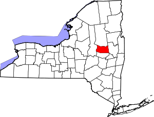 | |
| Towns | ||
| Villages | ||
| CDP | ||
| Other Hamlets | ||
| Footnotes | ‡This populated place also has portions in an adjacent county or counties | |