White Hall, California
Coordinates: 38°46′31″N 120°24′19″W / 38.77528°N 120.40528°W
| White Hall | |
|---|---|
| Unincorporated community | |
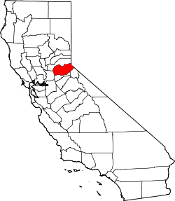
 White Hall  White Hall Location in California | |
| Coordinates: 38°46′31″N 120°24′19″W / 38.77528°N 120.40528°W | |
| Country | United States |
| State | California |
| County | El Dorado County |
| Elevation[1] | 3,383 ft (1,031 m) |
White Hall (formerly, Whitehall and Randall)[2] is a small unincorporated community in El Dorado County, California, United States.[1] It is located on the South Fork of the American River 2.5 miles (4.0 km) east of Riverton,[2] at an elevation of 3383 feet (1031 m).[1] The ZIP code is 95726. The community is inside area code 530.
A post office operated at Randall from 1917 to 1937.[2] The name Randall commemorates Albert B. Randall, its first postmaster.[2]
References
This article is issued from Wikipedia - version of the 7/5/2016. The text is available under the Creative Commons Attribution/Share Alike but additional terms may apply for the media files.