Dugan, California
Coordinates: 38°36′16″N 120°57′32″W / 38.60444°N 120.95889°W
| Dugan | |
|---|---|
| Unincorporated community | |
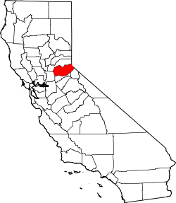
 Dugan  Dugan Location in California | |
| Coordinates: 38°36′16″N 120°57′32″W / 38.60444°N 120.95889°W | |
| Country | United States |
| State | California |
| County | El Dorado County |
| Elevation[1] | 1,135 ft (346 m) |
Dugan (formerly, Bullard-Dugan) is an unincorporated community in El Dorado County, California.[1] It is located on the Southern Pacific Railroad 3.25 miles (5 km) north-northeast of Latrobe,[2] at an elevation of 1135 feet (346 m).[1]
References
This article is issued from Wikipedia - version of the 7/18/2016. The text is available under the Creative Commons Attribution/Share Alike but additional terms may apply for the media files.