Spanish Flat, El Dorado County, California
Coordinates: 38°49′24″N 120°48′34″W / 38.82333°N 120.80944°W
| Spanish Flat | |
|---|---|
| Unincorporated community | |
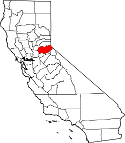
 Spanish Flat  Spanish Flat Location in California | |
| Coordinates: 38°49′24″N 120°48′34″W / 38.82333°N 120.80944°W | |
| Country | United States |
| State | California |
| County | El Dorado County |
| Elevation[1] | 2,431 ft (741 m) |
Spanish Flat is an unincorporated community in El Dorado County, California.[1] It is located 4 miles (6 km) north of Chili Bar,[2] at an elevation of 2431 feet (741 m).[1]
A post office operated at Spanish Flat from 1853 to 1872 and for a while in 1888.[2] The name commemorates Spanish-speaking miners at the site.[2]
References
This article is issued from Wikipedia - version of the 7/5/2016. The text is available under the Creative Commons Attribution/Share Alike but additional terms may apply for the media files.