Tahoma, California
| Tahoma | |
|---|---|
| census-designated place | |
 Tahoma | |
| Coordinates: 39°04′03″N 120°07′42″W / 39.06750°N 120.12833°WCoordinates: 39°04′03″N 120°07′42″W / 39.06750°N 120.12833°W | |
| Country |
|
| State |
|
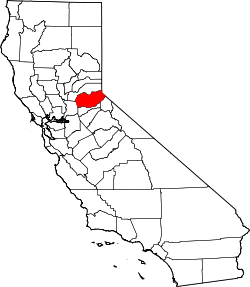
| Counties | Placer & El Dorado |
| Area | |
| • Total | 2.594 sq mi (6.717 km2) |
| • Land | 2.594 sq mi (6.717 km2) |
| • Water | 0 sq mi (0 km2) |
| Elevation | 6,270 ft (1,910 m) |
| Population (2010) | |
| • Total | 1,191 |
| • Density | 460/sq mi (180/km2) |
| Time zone | Pacific (PST) (UTC-8) |
| • Summer (DST) | PDT (UTC-7) |
| ZIP code | 96142 |
| Area code(s) | 530 |
| GNIS feature IDs | 1659948;[1] 2628793 |
| U.S. Geological Survey Geographic Names Information System: Tahoma, California; U.S. Geological Survey Geographic Names Information System: Tahoma, California | |
Tahoma (formerly, Chambers Lodge)[2] is a census-designated place[3] in Placer and El Dorado counties, California, United States. Tahoma is located along Lake Tahoe 2 miles (3.2 km) southeast of Homewood.[2] Tahoma has a population of 1,191 (780 in El Dorado County and 411 in Placer County).
Tahoma has a post office with ZIP code 96142, which opened in 1946.[2][4]
History
Tahoma started as a resort in 1916. The place name was created from combining "Tahoe" and "home"[5]
During the 1960 Winter Olympics in nearby Squaw Valley, Tahoma was selected as the site of the cross-country skiing and biathlon, as there was insufficient space in Squaw Valley. The temporary McKinney Creek Stadium was built for the game and demolished afterwards.[6]
Geography
According to the United States Census Bureau, the CDP covers an area of 2.6 square miles (6.7 km²), all of it land.
Demographics
The 2010 United States Census[7] reported that Tahoma had a population of 1,191. The population density was 459.2 people per square mile (177.3/km²). The racial makeup of Tahoma was 1,129 (94.8%) White, 6 (0.5%) African American, 10 (0.8%) Native American, 14 (1.2%) Asian, 0 (0.0%) Pacific Islander, 12 (1.0%) from other races, and 20 (1.7%) from two or more races. Hispanic or Latino of any race were 51 persons (4.3%).
The Census reported that 1,191 people (100% of the population) lived in households, 0 (0%) lived in non-institutionalized group quarters, and 0 (0%) were institutionalized.
There were 553 households, out of which 134 (24.2%) had children under the age of 18 living in them, 250 (45.2%) were opposite-sex married couples living together, 29 (5.2%) had a female householder with no husband present, 27 (4.9%) had a male householder with no wife present. There were 62 (11.2%) unmarried opposite-sex partnerships, and 4 (0.7%) same-sex married couples or partnerships. 172 households (31.1%) were made up of individuals and 29 (5.2%) had someone living alone who was 65 years of age or older. The average household size was 2.15. There were 306 families (55.3% of all households); the average family size was 2.66.
The population was spread out with 208 people (17.5%) under the age of 18, 89 people (7.5%) aged 18 to 24, 342 people (28.7%) aged 25 to 44, 443 people (37.2%) aged 45 to 64, and 109 people (9.2%) who were 65 years of age or older. The median age was 43.1 years. For every 100 females there were 124.3 males. For every 100 females age 18 and over, there were 126.5 males.
There were 2,058 housing units at an average density of 793.5 per square mile (306.4/km²), of which 359 (64.9%) were owner-occupied, and 194 (35.1%) were occupied by renters. The homeowner vacancy rate was 6.0%; the rental vacancy rate was 12.6%. 773 people (64.9% of the population) lived in owner-occupied housing units and 418 people (35.1%) lived in rental housing units.
References
- ↑ "US Board on Geographic Names". United States Geological Survey. 2007-10-25. Retrieved 2008-01-31.
- 1 2 3 Durham, David L. (1998). California's Geographic Names: A Gazetteer of Historic and Modern Names of the State. Clovis, Calif.: Word Dancer Press. p. 566. ISBN 1-884995-14-4.
- ↑ U.S. Geological Survey Geographic Names Information System: Tahoma, California
- ↑ ZIP Code Lookup
- ↑ Gudde, Erwin G. (1998). California place names : the origin and etymology of current geographical names (4th ed., rev. and enl. ed.). Berkeley: University of California Press. p. 384. ISBN 0520213165.
- ↑ Squaw Valley Organizing Committee (1960). VIII Olympic Winter Games Squaw Valley, California 1960 Final Report (PDF). Squaw Valley: California Olympic Commission. p. 115. Retrieved 20 June 2012.
- ↑ "2010 Census Interactive Population Search: CA - Tahoma CDP". U.S. Census Bureau. Retrieved July 12, 2014.