Wellston, Oklahoma
| Wellston, Oklahoma | |
|---|---|
| Town | |
 Location of Wellston, Oklahoma | |
| Coordinates: 35°41′27″N 97°3′47″W / 35.69083°N 97.06306°WCoordinates: 35°41′27″N 97°3′47″W / 35.69083°N 97.06306°W | |
| Country | United States |
| State | Oklahoma |
| County | Lincoln |
| Area | |
| • Total | 1.4 sq mi (3.5 km2) |
| • Land | 1.4 sq mi (3.5 km2) |
| • Water | 0.0 sq mi (0.0 km2) |
| Elevation | 899 ft (274 m) |
| Population (2000) | |
| • Total | 825 |
| • Density | 608.5/sq mi (234.9/km2) |
| Time zone | Central (CST) (UTC-6) |
| • Summer (DST) | CDT (UTC-5) |
| ZIP code | 74881 |
| Area code(s) | 405 |
| FIPS code | 40-79900[1] |
| GNIS feature ID | 1099483[2] |
Wellston is a town in Lincoln County, Oklahoma, United States. The population was 825 at the 2000 census.
History

Wellston was named by Christian T. Wells, who established a trading post on the site in 1883. The post office officially opened September 19, 1884.
Geography
Wellston is located at 35°41′27″N 97°3′47″W / 35.69083°N 97.06306°W (35.690863, -97.063185).[3]
According to the United States Census Bureau, the town has a total area of 1.4 square miles (3.6 km2), all of it land.
Demographics
| Historical population | |||
|---|---|---|---|
| Census | Pop. | %± | |
| 1900 | 383 | — | |
| 1910 | 590 | 54.0% | |
| 1920 | 650 | 10.2% | |
| 1930 | 632 | −2.8% | |
| 1940 | 607 | −4.0% | |
| 1950 | 643 | 5.9% | |
| 1960 | 630 | −2.0% | |
| 1970 | 789 | 25.2% | |
| 1980 | 802 | 1.6% | |
| 1990 | 912 | 13.7% | |
| 2000 | 825 | −9.5% | |
| 2010 | 788 | −4.5% | |
| Est. 2015 | 795 | [4] | 0.9% |
As of the census[1] of 2000, there were 825 people, 338 households, and 225 families residing in the town. The population density was 608.5 people per square mile (234.2/km²). There were 380 housing units at an average density of 280.3 per square mile (107.9/km²). The racial makeup of the town was 86.67% White, 5.58% African American, 2.91% Native American, 0.48% from other races, and 4.36% from two or more races. Hispanic or Latino of any race were 2.42% of the population.
There were 338 households out of which 36.4% had children under the age of 18 living with them, 48.5% were married couples living together, 14.8% had a female householder with no husband present, and 33.4% were non-families. 29.9% of all households were made up of individuals and 13.3% had someone living alone who was 65 years of age or older. The average household size was 2.44 and the average family size was 3.05.
In the town the population was spread out with 30.3% under the age of 18, 8.6% from 18 to 24, 28.4% from 25 to 44, 19.5% from 45 to 64, and 13.2% who were 65 years of age or older. The median age was 33 years. For every 100 females there were 95.0 males. For every 100 females age 18 and over, there were 87.3 males.
The median income for a household in the town was $28,553, and the median income for a family was $33,906. Males had a median income of $24,911 versus $20,000 for females. The per capita income for the town was $14,052. About 12.2% of families and 13.7% of the population were below the poverty line, including 18.0% of those under age 18 and 16.7% of those age 65 or over.
National Register of Historic Places
- Captain Creek Bridge
References
- 1 2 "American FactFinder". United States Census Bureau. Retrieved 2008-01-31.
- ↑ "US Board on Geographic Names". United States Geological Survey. 2007-10-25. Retrieved 2008-01-31.
- ↑ "US Gazetteer files: 2010, 2000, and 1990". United States Census Bureau. 2011-02-12. Retrieved 2011-04-23.
- ↑ "Annual Estimates of the Resident Population for Incorporated Places: April 1, 2010 to July 1, 2015". Retrieved July 2, 2016.
- ↑ "Census of Population and Housing". Census.gov. Retrieved June 4, 2015.
Municipalities and communities of Lincoln County, Oklahoma, United States | ||
|---|---|---|
| Cities | 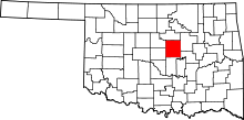 | |
| Towns | ||
| Unincorporated communities |
| |
| Ghost towns | ||
| Footnotes | ‡This populated place also has portions in an adjacent county or counties | |