The Village, Oklahoma
| The Village, Oklahoma | |
|---|---|
| City | |
| Motto: " Shop The Village " | |
 Location in Oklahoma County and the state of Oklahoma. | |
| Coordinates: 35°34′7″N 97°33′24″W / 35.56861°N 97.55667°WCoordinates: 35°34′7″N 97°33′24″W / 35.56861°N 97.55667°W | |
| Country | United States |
| State | Oklahoma |
| County | Oklahoma |
| Area | |
| • Total | 2.5 sq mi (6.6 km2) |
| • Land | 2.5 sq mi (6.6 km2) |
| • Water | 0.0 sq mi (0.0 km2) |
| Elevation | 1,220 ft (372 m) |
| Population (2010) | |
| • Total | 8,929 |
| • Density | 3,506/sq mi (1,354/km2) |
| Time zone | Central (CST) (UTC-6) |
| • Summer (DST) | CDT (UTC-5) |
| FIPS code | 40-73250[1] |
| GNIS feature ID | 1098839[2] |
The Village is a city in Oklahoma County, Oklahoma, United States, and a part of the Oklahoma City metropolitan area. The population was 8,929 at the 2010 Census.[3]
The Village is entirely surrounded by Oklahoma City, except where it abuts Nichols Hills, Oklahoma. The Village is home to the corporate headquarters of Love's Travel Stops & Country Stores, the OKC Friday community newspaper, and Casady School.
The Village has a City Manager form of government. The City Manager is overseen by an elected Council. The position of Mayor rotates among the Council members.
The Village is represented in Congress by Steve Russell, in the Oklahoma Senate by David Holt, and in the Oklahoma House by Randy McDaniel and Cyndi Munson.
Geography
The Village is located at 35°34′7″N 97°33′24″W / 35.56861°N 97.55667°W (35.568723, -97.556600).[4]
According to the United States Census Bureau, the city has a total area of 2.5 square miles (6.5 km2), of which, 2.5 square miles (6.5 km2) of it is land and 0.39% is water. Oklahoma City surrounds the borders of The Village.
Demographics
| Historical population | |||
|---|---|---|---|
| Census | Pop. | %± | |
| 1960 | 12,118 | — | |
| 1970 | 13,695 | 13.0% | |
| 1980 | 11,114 | −18.8% | |
| 1990 | 10,353 | −6.8% | |
| 2000 | 10,157 | −1.9% | |
| 2010 | 8,929 | −12.1% | |
| Est. 2015 | 9,400 | [5] | 5.3% |
As of the census[1] of 2000, there were 10,157 people, 4,778 households, and 2,823 families residing in the city. The population density was 3,999.8 people per square mile (1,544.0/km²). There were 4,997 housing units at an average density of 1,967.8 per square mile (759.6/km²). The racial makeup of the city was 80.19% White, 10.47% African American, 2.54% Native American, 1.91% Asian, 0.03% Pacific Islander, 1.13% from other races, and 3.73% from two or more races. Hispanic or Latino of any race were 3.77% of the population.
There were 4,778 households out of which 24.2% had children under the age of 18 living with them, 42.8% were married couples living together, 10.9% had a female householder with no husband present, and 43.0% were non-families. 35.2% of all households were made up of individuals and 12.1% had someone living alone who was 65 years of age or older. The average household size was 2.12 and the average family size was 2.76.
In the city the population was spread out with 20.2% under the age of 18, 10.2% from 18 to 24, 34.4% from 25 to 44, 18.9% from 45 to 64, and 16.3% who were 65 years of age or older. The median age was 35 years. For every 100 females there were 86.8 males. For every 100 females age 18 and over, there were 84.1 males.
The median income for a household in the city was $37,559, and the median income for a family was $44,632. Males had a median income of $32,204 versus $24,896 for females. The per capita income for the city was $20,444. About 7.2% of families and 10.1% of the population were below the poverty line, including 13.3% of those under age 18 and 7.9% of those age 65 or over.
Shopping
Local Shopping:
- Village Park South
- Village Park North
- North Park Mall
- French Market Mall
References
- 1 2 "American FactFinder". United States Census Bureau. Archived from the original on September 11, 2013. Retrieved 2008-01-31.
- ↑ "US Board on Geographic Names". United States Geological Survey. 2007-10-25. Retrieved 2008-01-31.
- ↑ "The Villaeg (city) QuickFacts". United State Census Bureau. Retrieved January 21, 2015.
- ↑ "US Gazetteer files: 2010, 2000, and 1990". United States Census Bureau. 2011-02-12. Retrieved 2011-04-23.
- ↑ "Annual Estimates of the Resident Population for Incorporated Places: April 1, 2010 to July 1, 2015". Retrieved July 2, 2016.
- ↑ "Census of Population and Housing". Census.gov. Archived from the original on May 11, 2015. Retrieved June 4, 2015.
External links
Municipalities and communities of Oklahoma County, Oklahoma, United States | ||
|---|---|---|
| Cities | 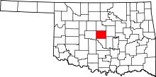 | |
| Towns | ||
| Unincorporated communities | ||
| Footnotes | ‡This populated place also has portions in an adjacent county or counties | |