Rush Springs, Oklahoma
| Rush Springs, Oklahoma | |
|---|---|
| Town | |
| Motto: "Watermelon Capital of the World" | |
 Location of Rush Springs, Oklahoma | |
| Coordinates: 34°46′55″N 97°57′20″W / 34.78194°N 97.95556°WCoordinates: 34°46′55″N 97°57′20″W / 34.78194°N 97.95556°W | |
| Country | United States |
| State | Oklahoma |
| County | Grady |
| Area | |
| • Total | 1.1 sq mi (2.8 km2) |
| • Land | 1.1 sq mi (2.8 km2) |
| • Water | 0.0 sq mi (0.0 km2) |
| Elevation | 1,355 ft (413 m) |
| Population (2000) | |
| • Total | 1,278 |
| • Density | 1,201.7/sq mi (464.0/km2) |
| Time zone | Central (CST) (UTC-6) |
| • Summer (DST) | CDT (UTC-5) |
| ZIP code | 73082 |
| Area code(s) | 580 |
| FIPS code | 40-64300[1] |
| GNIS feature ID | 1097535[2] |
Rush Springs is a town in Grady County, Oklahoma, United States. The population was 1,231 at the 2010 census. The town promotes itself as the "Watermelon Capital of the World."[3]
The community's largest event is an annual Rush Springs Watermelon Festival, that attracts about 30,000 people each year, who consume about 50,000 pounds of watermelon.[4]
History
The Wichita tribe placed a village four miles southeast of the modern-day town of Rush Springs in the mid-1800s. The town was incorporated on November 21, 1898.[5]
A Civilian Conservation Corps project was located on the east side of Rush Springs. Young men were paid to construct terraces and ponds and to restore vegetation by replanting trees. The project camp was opened June 18, 1933, and closed July 20, 1942.[6]
Geography
Rush Springs is located at 34°46′55″N 97°57′20″W / 34.78194°N 97.95556°W (34.781989, -97.955610).[7]
According to the United States Census Bureau, the town has a total area of 1.1 square miles (2.8 km2), all of it land.
Demographics
| Historical population | |||
|---|---|---|---|
| Census | Pop. | %± | |
| 1900 | 518 | — | |
| 1910 | 823 | 58.9% | |
| 1920 | 768 | −6.7% | |
| 1930 | 1,340 | 74.5% | |
| 1940 | 1,422 | 6.1% | |
| 1950 | 1,402 | −1.4% | |
| 1960 | 1,303 | −7.1% | |
| 1970 | 1,381 | 6.0% | |
| 1980 | 1,451 | 5.1% | |
| 1990 | 1,229 | −15.3% | |
| 2000 | 1,278 | 4.0% | |
| 2010 | 1,231 | −3.7% | |
| Est. 2015 | 1,275 | [8] | 3.6% |
As of the census[1] of 2000, there were 1,278 people, 525 households, and 349 families residing in the town. The population density was 1,201.7 people per square mile (465.5/km²). There were 627 housing units at an average density of 589.6 per square mile (228.4/km²). The racial makeup of the town was 88.18% White, 6.96% Native American, 1.17% from other races, and 3.68% from two or more races. Hispanic or Latino of any race were 2.35% of the population.
There were 525 households out of which 32.6% had children under the age of 18 living with them, 50.1% were married couples living together, 11.2% had a female householder with no husband present, and 33.5% were non-families. 30.1% of all households were made up of individuals and 18.5% had someone living alone who was 65 years of age or older. The average household size was 2.43 and the average family size was 3.01.
In the town the population was spread out with 27.6% under the age of 18, 8.8% from 18 to 24, 26.9% from 25 to 44, 18.7% from 45 to 64, and 17.9% who were 65 years of age or older. The median age was 36 years. For every 100 females there were 92.2 males. For every 100 females age 18 and over, there were 84.6 males.
The median income for a household in the town was $21,078, and the median income for a family was $25,391. Males had a median income of $24,453 versus $20,769 for females. The per capita income for the town was $10,803. About 24.7% of families and 32.5% of the population were below the poverty line, including 45.3% of those under age 18 and 24.6% of those age 65 or over.
References
- 1 2 "American FactFinder". United States Census Bureau. Retrieved 2008-01-31.
- ↑ "US Board on Geographic Names". United States Geological Survey. 2007-10-25. Retrieved 2008-01-31.
- ↑ Etter, Jim. "Catchy Slogans Strive to Put Towns on Map." The Oklahoman. October 20, 1985. Accessed November 3, 2016.
- ↑ McNutt, Michael. Oklahoma heat wave hasn't dried up Rush Springs melon crop, The Oklahoman. Published Aug. 3, 2012.
- ↑ Brooks, Paula K. Rush Springs, Encyclopedia of Oklahoma History and Culture. Retrieved August 6, 2012.
- ↑ Grady County Historical Society Spotlight of the Week, http://chickashanews.com Chickasha Express-Star]. Published July 25, 2012.
- ↑ "US Gazetteer files: 2010, 2000, and 1990". United States Census Bureau. 2011-02-12. Retrieved 2011-04-23.
- ↑ "Annual Estimates of the Resident Population for Incorporated Places: April 1, 2010 to July 1, 2015". Retrieved July 2, 2016.
- ↑ "Census of Population and Housing". Census.gov. Retrieved June 4, 2015.
External links
Municipalities and communities of Grady County, Oklahoma, United States | ||
|---|---|---|
| Cities | 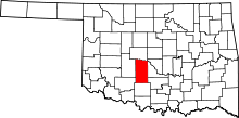 | |
| Towns |
| |
| Unincorporated communities |
| |
| Ghost towns | ||
| Footnotes | ‡This populated place also has portions in an adjacent county or counties | |