Tryon, Oklahoma
| Tryon, Oklahoma | |
|---|---|
| Town | |
 Location of Tryon, Oklahoma | |
| Coordinates: 35°52′21″N 96°57′47″W / 35.87250°N 96.96306°WCoordinates: 35°52′21″N 96°57′47″W / 35.87250°N 96.96306°W | |
| Country | United States |
| State | Oklahoma |
| County | Lincoln |
| Area | |
| • Total | 2.3 sq mi (6.0 km2) |
| • Land | 2.3 sq mi (6.0 km2) |
| • Water | 0.0 sq mi (0.0 km2) |
| Elevation | 1,037 ft (316 m) |
| Population (2000) | |
| • Total | 448 |
| • Density | 194.7/sq mi (75.2/km2) |
| Time zone | Central (CST) (UTC-6) |
| • Summer (DST) | CDT (UTC-5) |
| ZIP code | 74875 |
| Area code(s) | 539/918 |
| FIPS code | 40-74550[1] |
| GNIS feature ID | 1098993[2] |
Tryon is a town in Lincoln County, Oklahoma, United States. The population was 448 at the 2000 census. The community is named after early land owner Fred S. Tryon.
Geography
Tryon is located at 35°52′21″N 96°57′47″W / 35.87250°N 96.96306°W (35.872494, -96.963078).[3]
According to the United States Census Bureau, the town has a total area of 2.3 square miles (6.0 km2), of which, 2.3 square miles (6.0 km2) of it is land and 0.43% is water.
Tryon is located on State Highway 105, east of US Route 177.
Demographics
| Historical population | |||
|---|---|---|---|
| Census | Pop. | %± | |
| 1910 | 176 | — | |
| 1920 | 225 | 27.8% | |
| 1930 | 299 | 32.9% | |
| 1940 | 279 | −6.7% | |
| 1950 | 285 | 2.2% | |
| 1960 | 254 | −10.9% | |
| 1970 | 301 | 18.5% | |
| 1980 | 435 | 44.5% | |
| 1990 | 514 | 18.2% | |
| 2000 | 273 | −46.9% | |
| 2010 | 491 | 79.9% | |
| Est. 2015 | 502 | [4] | 2.2% |
As of the census[1] of 2000, there were 448 people, 185 households, and 118 families residing in the town. The population density was 194.7 people per square mile (75.2/km²). There were 229 housing units at an average density of 99.5 per square mile (38.4/km²). The racial makeup of the town was 82.81% White, 13.62% Native American, 1.12% from other races, and 2.46% from two or more races. Hispanic or Latino of any race were 2.01% of the population.
There were 185 households out of which 29.2% had children under the age of 18 living with them, 48.1% were married couples living together, 9.7% had a female householder with no husband present, and 36.2% were non-families. 33.0% of all households were made up of individuals and 16.2% had someone living alone who was 65 years of age or older. The average household size was 2.42 and the average family size was 3.08.
In the town the population was spread out with 25.4% under the age of 18, 10.7% from 18 to 24, 25.0% from 25 to 44, 24.3% from 45 to 64, and 14.5% who were 65 years of age or older. The median age was 38 years. For every 100 females there were 99.1 males. For every 100 females age 18 and over, there were 100.0 males.
The median income for a household in the town was $21,696, and the median income for a family was $27,361. Males had a median income of $28,382 versus $18,125 for females. The per capita income for the town was $10,730. About 12.8% of families and 14.1% of the population were below the poverty line, including 15.4% of those under age 18 and 10.5% of those age 65 or over.
References
- 1 2 "American FactFinder". United States Census Bureau. Retrieved 2008-01-31.
- ↑ "US Board on Geographic Names". United States Geological Survey. 2007-10-25. Retrieved 2008-01-31.
- ↑ "US Gazetteer files: 2010, 2000, and 1990". United States Census Bureau. 2011-02-12. Retrieved 2011-04-23.
- ↑ "Annual Estimates of the Resident Population for Incorporated Places: April 1, 2010 to July 1, 2015". Retrieved July 2, 2016.
- ↑ "Census of Population and Housing". Census.gov. Retrieved June 4, 2015.
Municipalities and communities of Lincoln County, Oklahoma, United States | ||
|---|---|---|
| Cities | 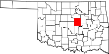 | |
| Towns | ||
| Unincorporated communities |
| |
| Ghost towns | ||
| Footnotes | ‡This populated place also has portions in an adjacent county or counties | |