Orlando, Oklahoma
| Orlando, Oklahoma | |
|---|---|
| Town | |
 Location of Orlando, Oklahoma | |
| Coordinates: 36°8′54″N 97°22′39″W / 36.14833°N 97.37750°WCoordinates: 36°8′54″N 97°22′39″W / 36.14833°N 97.37750°W | |
| Country | United States |
| State | Oklahoma |
| Counties | Logan, Payne |
| Area | |
| • Total | 0.2 sq mi (0.6 km2) |
| • Land | 0.2 sq mi (0.6 km2) |
| • Water | 0.0 sq mi (0.0 km2) |
| Elevation | 1,099 ft (335 m) |
| Population (2000) | |
| • Total | 201 |
| • Density | 1,000/sq mi (340/km2) |
| Time zone | Central (CST) (UTC-6) |
| • Summer (DST) | CDT (UTC-5) |
| ZIP code | 73073 |
| Area code(s) | 580 |
| FIPS code | 40-56050 [1] |
| GNIS feature ID | 1096304 [2] |
Orlando is a town in Logan and Payne counties in the U.S. state of Oklahoma. The population was 148 at the 2010 census, compared to 201 at the 2000 census.[3] It is part of the Oklahoma City Metropolitan Statistical Area.
History
Before the opening of the Cherokee Outlet for settlement, this community was called Cherokee, but the name was changed to Orlando, when a post office was opened on July 18, 1889.[3]
Early Orlando had a colorful history. In 1892, Oliver Yantis, a member of the Doolin Gang, was wounded and captured outside of the town. He was brought into Orlando, where he died. In 1896, a group of con artists bought some homesteads near the town, salted them with gold nuggets and started a gold rush. Several townspeople lost a great deal of money before the plot was exposed. In 1902, a woman who had bought adulterated kerosene for the lamps in her house. The impure material exploded when she lit the lamps, starting a fire that killed her, two children and spread to several nearby houses.[3]
A 1927 tornado killed two people and destroyed several houses. Construction of Lake Carl Blackwell in the 1930s forced about 100 families that had regularly traded in Orlando to move away.[3]
Passenger train service through Orlando ceased after World War II ended, and construction of I-35 caused the town to lose most of its commercial highway traffic after 1964.[3]
Geography
Orlando is located at 36°8′54″N 97°22′39″W / 36.14833°N 97.37750°W (36.148267, -97.377512).[4] It is 21 miles (34 km) north of Guthrie, the county seat, 1 mile (1.6 km) west of the Payne County line, and 1 mile (1.6 km) south of the Noble County line.[3] According to the United States Census Bureau, the town has a total area of 0.2 square miles (0.52 km2), all of it land.
Demographics
| Historical population | |||
|---|---|---|---|
| Census | Pop. | %± | |
| 1900 | 300 | — | |
| 1910 | 340 | 13.3% | |
| 1920 | 161 | −52.6% | |
| 1930 | 226 | 40.4% | |
| 1940 | 332 | 46.9% | |
| 1950 | 262 | −21.1% | |
| 1960 | 194 | −26.0% | |
| 1970 | 202 | 4.1% | |
| 1980 | 218 | 7.9% | |
| 1990 | 198 | −9.2% | |
| 2000 | 201 | 1.5% | |
| 2010 | 148 | −26.4% | |
| Est. 2015 | 163 | [5] | 10.1% |
As of the census[1] of 2000, there were 201 people, 74 households, and 52 families residing in the town. The population density was 942.5 people per square mile (369.6/km²). There were 88 housing units at an average density of 412.6 per square mile (161.8/km²). The racial makeup of the town was 86.07% White, 9.95% Native American, 1.00% Asian, and 2.99% from two or more races.
There were 74 households out of which 33.8% had children under the age of 18 living with them, 51.4% were married couples living together, 10.8% had a female householder with no husband present, and 29.7% were non-families. 25.7% of all households were made up of individuals and 12.2% had someone living alone who was 65 years of age or older. The average household size was 2.72 and the average family size was 3.29.
In the town the population was spread out with 29.9% under the age of 18, 11.9% from 18 to 24, 24.4% from 25 to 44, 22.4% from 45 to 64, and 11.4% who were 65 years of age or older. The median age was 32 years. For every 100 females there were 105.1 males. For every 100 females age 18 and over, there were 98.6 males.
The median income for a household in the town was $28,929, and the median income for a family was $35,625. Males had a median income of $30,000 versus $27,500 for females. The per capita income for the town was $12,826. About 18.0% of families and 17.8% of the population were below the poverty line, including 15.4% of those under the age of eighteen and 14.3% of those sixty five or over.
References
- 1 2 "American FactFinder". United States Census Bureau. Retrieved 2008-01-31.
- ↑ "US Board on Geographic Names". United States Geological Survey. 2007-10-25. Retrieved 2008-01-31.
- 1 2 3 4 5 6 Thomas L. Hedglen, "Orlando," Encyclopedia of Oklahoma History and Culture. Accessed May 28, 2015.
- ↑ "US Gazetteer files: 2010, 2000, and 1990". United States Census Bureau. 2011-02-12. Retrieved 2011-04-23.
- ↑ "Annual Estimates of the Resident Population for Incorporated Places: April 1, 2010 to July 1, 2015". Retrieved July 2, 2016.
- ↑ "Census of Population and Housing". Census.gov. Archived from the original on May 11, 2015. Retrieved June 4, 2015.
Municipalities and communities of Logan County, Oklahoma, United States | ||
|---|---|---|
| Cities | 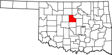 | |
| Towns | ||
| Unincorporated communities |
| |
| Footnotes | ‡This populated place also has portions in an adjacent county or counties | |
Municipalities and communities of Payne County, Oklahoma, United States | ||
|---|---|---|
| Cities | 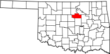 | |
| Towns | ||
| Unincorporated communities | ||
| Ghost town | ||
| Footnotes | ‡This populated place also has portions in an adjacent county or counties | |