Calumet, Oklahoma
| Calumet, Oklahoma | |
|---|---|
| Town | |
 Location of Calumet, Oklahoma | |
| Coordinates: 35°36′2″N 98°7′13″W / 35.60056°N 98.12028°WCoordinates: 35°36′2″N 98°7′13″W / 35.60056°N 98.12028°W | |
| Country | United States |
| State | Oklahoma |
| County | Canadian |
| Area | |
| • Total | 1.3 sq mi (3.3 km2) |
| • Land | 1.3 sq mi (3.3 km2) |
| • Water | 0.0 sq mi (0.0 km2) |
| Elevation | 1,381 ft (421 m) |
| Population (2010) | |
| • Total | 507 |
| • Density | 390/sq mi (153.6/km2) |
| Time zone | Central (CST) (UTC-6) |
| • Summer (DST) | CDT (UTC-5) |
| ZIP code | 73014 |
| Area code(s) | 405 |
| FIPS code | 40-11050[1] |
| GNIS feature ID | 1090810[2] |
Calumet is a town in Canadian County, Oklahoma, United States and is part of the Oklahoma City Metropolitan Area. The population was 507 at the 2010 census, a 5.23 percent decrease since 2000.[3]
Calumet is a variant term for Ceremonial pipe.[4] Incorporated in 1942, the town's land was settled in the Land Run of 1892.
History
Calumet incorporated in 1942 in order to construct a town water system.[5] Prior to its incorporation, the town existed as an unincorporated community with a post office, three combination mills and elevators, two general stores, a furniture store, and a hardware store.[5]
The town lies in an area that in 1803 was part of the Louisiana Purchase.[6] After the Organic Act of 1890 recreated the area as Oklahoma Territory, present-day Canadian County was designated as County Four and settled by non-Indian settlers through the Land Run of 1889, the Land Run of 1892, and a 1901 land lottery.[6] The Land Run of 1892 opened up the surplus Cheyenne-Arapaho lands to non-Indian settlement, which opened up Calumet.
Geography
Calumet is located in northwestern Canadian County, Oklahoma, 15 miles northwest of El Reno, at 35°36′2″N 98°7′13″W / 35.60056°N 98.12028°W (35.600454, -98.120409).[7]
According to the United States Census Bureau, the town has a total land area of 1.3 square miles (3.4 km2), and no water.
The town lies just south of the North Canadian River,[8] on the border of the Red Bed Plains and Gypsum Hills ecoregions of Oklahoma.[9]
Climate
| Climate data for Calumet, Oklahoma | |||||||||||||
|---|---|---|---|---|---|---|---|---|---|---|---|---|---|
| Month | Jan | Feb | Mar | Apr | May | Jun | Jul | Aug | Sep | Oct | Nov | Dec | Year |
| Average high °F (°C) | 46.9 (8.3) |
52.1 (11.2) |
62.4 (16.9) |
72.7 (22.6) |
80.3 (26.8) |
88.4 (31.3) |
94.4 (34.7) |
93.4 (34.1) |
84.6 (29.2) |
73.7 (23.2) |
59.8 (15.4) |
49.2 (9.6) |
71.5 (21.9) |
| Average low °F (°C) | 24.2 (−4.3) |
28.6 (−1.9) |
37.3 (2.9) |
47.6 (8.7) |
56.3 (13.5) |
65.1 (18.4) |
69.9 (21.1) |
68.3 (20.2) |
60.9 (16.1) |
49.6 (9.8) |
37.2 (2.9) |
27.5 (−2.5) |
47.7 (8.7) |
| Average precipitation inches (mm) | 0.8 (20) |
1.2 (30) |
2.1 (53) |
2.4 (61) |
4.5 (114) |
4.3 (109) |
2.1 (53) |
2.2 (56) |
3.8 (97) |
2.2 (56) |
1.7 (43) |
0.9 (23) |
28.1 (714) |
| Source: Weatherbase.com [10] | |||||||||||||
Demographics
| Historical population | |||
|---|---|---|---|
| Census | Pop. | %± | |
| 1950 | 339 | — | |
| 1960 | 354 | 4.4% | |
| 1970 | 386 | 9.0% | |
| 1980 | 469 | 21.5% | |
| 1990 | 560 | 19.4% | |
| 2000 | 535 | −4.5% | |
| 2010 | 507 | −5.2% | |
| Est. 2015 | 564 | [11] | 11.2% |
As of the 2010 United States Census, there were 507 people, 187 households, and 130 families residing in the town.[13] The population density was 390 people per square mile (153.6/km²). There were 214 housing units at an average density of 164.6 per square mile (64.8/km²). The racial makeup of the town was 78.9% white, 13.6% Native American, 0.4% Asian, 2.4% from other races, and 4.7% from two or more races. Hispanics or Latinos were 4% of the population.
There were 187 households out of which 40.6% had children under the age of 18 living with them, 69.5% were married couples living together, 9.6% had a female householder with no husband present, and 30.5% were non-families.[13] Less than a third of households (28.9%) were made up of individuals and 13.4% had someone living alone who was 65 years of age or older.[13] The average household size was 2.71 and the average family size was 3.28.[13]
In the town the population was spread out with 29.6% under the age of 18, 8.4% from 18 to 24, 25.4% from 25 to 44, 24% from 45 to 64, and 12.6% who were 65 years of age or older.[13] The median age was 36.2 years.[13] For every 100 females there were 91.3 males. For every 100 females age 18 and over, there were X males.
The median income for a household in the town was $50,625, (compared to a national median income of $52,762) and the median income for a family was $56,607.[14] Males had a median income of $46,786 versus $26,875 for females.[14] The per capita income for the town was $27,113. An estimated 8% of families and 9.5% of the population were below the poverty line, including 12.6% of those under age 18.[14]
Education
Calumet contains three schools housed in one building: an elementary school, a junior high, and a high school.[15] A fourth school, Maple Public School, is separate from the Calumet school district.[15]
References
- ↑ "American FactFinder". United States Census Bureau. Archived from the original on 2013-09-11. Retrieved 2008-01-31.
- ↑ "US Board on Geographic Names". United States Geological Survey. 2007-10-25. Retrieved 2008-01-31.
- ↑ Census Viewer: Calumet, Oklahoma (accessed November 4, 2013)
- ↑ "Oklahoma's Strangely Named Towns". KWTV. Archived from the original on December 2, 2001. Retrieved 14 November 2015.
- 1 2 Savage, Cynthia. "Calumet," Encyclopedia of Oklahoma History and Culture, Oklahoma Historical Society. Accessed April 18, 2015.
- 1 2 Hedglen, Thomas L. "Canadian County," Encyclopedia of Oklahoma History and Culture, Oklahoma Historical Society. Accessed April 18, 2015.
- ↑ "US Gazetteer files: 2010, 2000, and 1990". United States Census Bureau. 2011-02-12. Retrieved 2011-04-23.
- ↑ North Canadian River map, Oklahoma Conservation Commission. (accessed October 16, 2013)
- ↑ Oklahoma Geography, Glencoe.com. (accessed October 16, 2013)
- ↑ "Historical Weather for Calumet, Oklahoma, United States".
- ↑ "Annual Estimates of the Resident Population for Incorporated Places: April 1, 2010 to July 1, 2015". Retrieved July 2, 2016.
- ↑ "Census of Population and Housing". Census.gov. Archived from the original on May 11, 2015. Retrieved June 4, 2015.
- 1 2 3 4 5 6 2010 Demographic Profile Data, American FactFinder Archived September 11, 2013, at the Wayback Machine. (accessed November 4, 2013)
- 1 2 3 2007-2011 American Community Survey 5-Year Estimates, American FactFinder Archived September 11, 2013, at the Wayback Machine.. (accessed November 4, 2013)
- 1 2 GreatSchools.org Search: Calumet, OK (accessed October 16, 2013)
External links
Municipalities and communities of Canadian County, Oklahoma, United States | ||
|---|---|---|
| Cities | 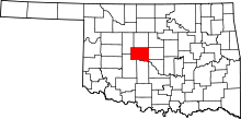 | |
| Towns | ||
| Unincorporated communities | ||
| Footnotes | ‡This populated place also has portions in an adjacent county or counties | |