Soudan, Loire-Atlantique
| Soudan | ||
|---|---|---|
|
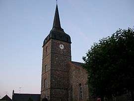
The church in Soudan | ||
| ||
 Soudan | ||
|
Location within Pays de la Loire region  Soudan | ||
| Coordinates: 47°44′18″N 1°18′13″W / 47.7383°N 1.3036°WCoordinates: 47°44′18″N 1°18′13″W / 47.7383°N 1.3036°W | ||
| Country | France | |
| Region | Pays de la Loire | |
| Department | Loire-Atlantique | |
| Arrondissement | Châteaubriant | |
| Canton | Châteaubriant | |
| Intercommunality | Castelbriantais | |
| Government | ||
| • Mayor (2008–2014) | Bernard Douaud | |
| Area1 | 53.82 km2 (20.78 sq mi) | |
| Population (2006)2 | 2,015 | |
| • Density | 37/km2 (97/sq mi) | |
| Time zone | CET (UTC+1) | |
| • Summer (DST) | CEST (UTC+2) | |
| INSEE/Postal code | 44199 / 44110 | |
| Elevation | 57–111 m (187–364 ft) | |
| Website | http://www.cc-castelbriantais.fr/ | |
|
1 French Land Register data, which excludes lakes, ponds, glaciers > 1 km² (0.386 sq mi or 247 acres) and river estuaries. 2 Population without double counting: residents of multiple communes (e.g., students and military personnel) only counted once. | ||
.svg.png)
Soudan is a commune in the Loire-Atlantique department in western France.
Geography
The river Verzée rises in the north-western part of the commune, then flows eastward through its northern part; the river Chère rises in the southern part of the commune, then flows northwestward through its western part.
See also
| Wikimedia Commons has media related to Soudan (Loire-Atlantique). |
This article is issued from Wikipedia - version of the 2/22/2015. The text is available under the Creative Commons Attribution/Share Alike but additional terms may apply for the media files.