Le Bignon
| Le Bignon | ||
|---|---|---|
|
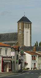
The church in Le Bignon | ||
| ||
 Le Bignon | ||
|
Location within Pays de la Loire region  Le Bignon | ||
| Coordinates: 47°05′57″N 1°29′22″W / 47.0992°N 1.4894°WCoordinates: 47°05′57″N 1°29′22″W / 47.0992°N 1.4894°W | ||
| Country | France | |
| Region | Pays de la Loire | |
| Department | Loire-Atlantique | |
| Arrondissement | Nantes | |
| Canton | Aigrefeuille-sur-Maine | |
| Intercommunality | Grand Lieu | |
| Government | ||
| • Mayor (2008–2014) | Martin Legeay | |
| Area1 | 27.54 km2 (10.63 sq mi) | |
| Population (2009)2 | 3,227 | |
| • Density | 120/km2 (300/sq mi) | |
| Time zone | CET (UTC+1) | |
| • Summer (DST) | CEST (UTC+2) | |
| INSEE/Postal code | 44014 / 44140 | |
| Elevation | 3–58 m (9.8–190.3 ft) | |
|
1 French Land Register data, which excludes lakes, ponds, glaciers > 1 km² (0.386 sq mi or 247 acres) and river estuaries. 2 Population without double counting: residents of multiple communes (e.g., students and military personnel) only counted once. | ||
.svg.png)
This article is about the commune in western France. For the commune in north-central France, see Le Bignon-Mirabeau.
Le Bignon is a commune in the Loire-Atlantique department in western France.
Population
| Historical population | ||
|---|---|---|
| Year | Pop. | ±% |
| 1806 | 1,643 | — |
| 1821 | 1,833 | +11.6% |
| 1836 | 1,962 | +7.0% |
| 1841 | 2,032 | +3.6% |
| 1846 | 2,100 | +3.3% |
| 1851 | 2,205 | +5.0% |
| 1856 | 2,155 | −2.3% |
| 1861 | 2,119 | −1.7% |
| 1866 | 1,833 | −13.5% |
| 1872 | 1,805 | −1.5% |
| 1876 | 1,805 | +0.0% |
| 1881 | 1,842 | +2.0% |
| 1886 | 1,825 | −0.9% |
| 1891 | 1,823 | −0.1% |
| 1896 | 1,747 | −4.2% |
| 1901 | 1,763 | +0.9% |
| 1906 | 1,743 | −1.1% |
| 1911 | 1,705 | −2.2% |
| 1921 | 1,506 | −11.7% |
| 1926 | 1,501 | −0.3% |
| 1931 | 1,409 | −6.1% |
| 1936 | 1,302 | −7.6% |
| 1946 | 1,269 | −2.5% |
| 1954 | 1,414 | +11.4% |
| 1962 | 1,438 | +1.7% |
| 1968 | 1,471 | +2.3% |
| 1975 | 1,880 | +27.8% |
| 1982 | 2,279 | +21.2% |
| 1990 | 2,378 | +4.3% |
| 1999 | 2,583 | +8.6% |
| 2006 | 3,111 | +20.4% |
| 2009 | 3,227 | +3.7% |
See also
References
| Wikimedia Commons has media related to Le Bignon. |
This article is issued from Wikipedia - version of the 8/16/2016. The text is available under the Creative Commons Attribution/Share Alike but additional terms may apply for the media files.