La Chapelle-des-Marais
| La Chapelle-des-Marais | ||
|---|---|---|
|
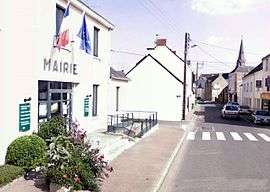
The town hall in La Chapelle-des-Marais | ||
| ||
 La Chapelle-des-Marais | ||
|
Location within Pays de la Loire region  La Chapelle-des-Marais | ||
| Coordinates: 47°26′53″N 2°14′25″W / 47.4481°N 2.2403°WCoordinates: 47°26′53″N 2°14′25″W / 47.4481°N 2.2403°W | ||
| Country | France | |
| Region | Pays de la Loire | |
| Department | Loire-Atlantique | |
| Arrondissement | Saint-Nazaire | |
| Canton | Herbignac | |
| Intercommunality | région nazairienne et l'estuaire | |
| Government | ||
| • Mayor (2008–2014) | Franck Hervy (PS) | |
| Area1 | 18.05 km2 (6.97 sq mi) | |
| Population (2006)2 | 3,199 | |
| • Density | 180/km2 (460/sq mi) | |
| Time zone | CET (UTC+1) | |
| • Summer (DST) | CEST (UTC+2) | |
| INSEE/Postal code | 44030 / 44410 | |
| Elevation | 0–11 m (0–36 ft) | |
| Website | www.chapelledesmarais.com | |
|
1 French Land Register data, which excludes lakes, ponds, glaciers > 1 km² (0.386 sq mi or 247 acres) and river estuaries. 2 Population without double counting: residents of multiple communes (e.g., students and military personnel) only counted once. | ||
.svg.png)
La Chapelle-des-Marais is a commune in the Loire-Atlantique department in western France.
See also
- Communes of the Loire-Atlantique department
- FC La Chapelle-des-Marais
- Parc naturel régional de Brière
| Wikimedia Commons has media related to La Chapelle-des-Marais. |
This article is issued from Wikipedia - version of the 3/15/2016. The text is available under the Creative Commons Attribution/Share Alike but additional terms may apply for the media files.