Mauves-sur-Loire
| Mauves-sur-Loire | ||
|---|---|---|
|
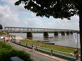
The Mauves Bridge seen from the north bank of the Loire | ||
| ||
 Mauves-sur-Loire | ||
|
Location within Pays de la Loire region  Mauves-sur-Loire | ||
| Coordinates: 47°17′49″N 1°23′32″W / 47.2969°N 1.3922°WCoordinates: 47°17′49″N 1°23′32″W / 47.2969°N 1.3922°W | ||
| Country | France | |
| Region | Pays de la Loire | |
| Department | Loire-Atlantique | |
| Arrondissement | Nantes | |
| Canton | Carquefou | |
| Intercommunality | Nantes Métropole | |
| Government | ||
| • Mayor (2008–2014) | Jean-François Retière | |
| Area1 | 14.75 km2 (5.70 sq mi) | |
| Population (2006)2 | 2,860 | |
| • Density | 190/km2 (500/sq mi) | |
| Time zone | CET (UTC+1) | |
| • Summer (DST) | CEST (UTC+2) | |
| INSEE/Postal code | 44094 / 44470 | |
| Elevation | 1–84 m (3.3–275.6 ft) | |
| Website | www.mauvessurloire.fr | |
|
1 French Land Register data, which excludes lakes, ponds, glaciers > 1 km² (0.386 sq mi or 247 acres) and river estuaries. 2 Population without double counting: residents of multiple communes (e.g., students and military personnel) only counted once. | ||
.svg.png)
Mauves-sur-Loire is a commune in the Loire-Atlantique department in western France. It is twinned with Hythe in England.
See also
| Wikimedia Commons has media related to Mauves-sur-Loire. |
This article is issued from Wikipedia - version of the 2/5/2015. The text is available under the Creative Commons Attribution/Share Alike but additional terms may apply for the media files.