Monnières, Loire-Atlantique
| Monnières | ||
|---|---|---|
|
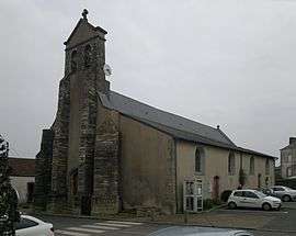
The church in Monnières | ||
| ||
 Monnières | ||
|
Location within Pays de la Loire region  Monnières | ||
| Coordinates: 47°07′57″N 1°21′17″W / 47.1325°N 1.3547°WCoordinates: 47°07′57″N 1°21′17″W / 47.1325°N 1.3547°W | ||
| Country | France | |
| Region | Pays de la Loire | |
| Department | Loire-Atlantique | |
| Arrondissement | Nantes | |
| Canton | Clisson | |
| Intercommunality | vallée de Clisson | |
| Government | ||
| • Mayor (2008–2014) | Claude Carteron | |
| Area1 | 9.78 km2 (3.78 sq mi) | |
| Population (2006)2 | 1,714 | |
| • Density | 180/km2 (450/sq mi) | |
| Time zone | CET (UTC+1) | |
| • Summer (DST) | CEST (UTC+2) | |
| INSEE/Postal code | 44100 / 44690 | |
| Elevation | 2–61 m (6.6–200.1 ft) | |
| Website | http://www.mairie-monnieres.fr/ | |
|
1 French Land Register data, which excludes lakes, ponds, glaciers > 1 km² (0.386 sq mi or 247 acres) and river estuaries. 2 Population without double counting: residents of multiple communes (e.g., students and military personnel) only counted once. | ||
.svg.png)
Monnières is a commune in the Loire-Atlantique department in western France.
See also
| Wikimedia Commons has media related to Monnières (Loire-Atlantique). |
This article is issued from Wikipedia - version of the 2/5/2015. The text is available under the Creative Commons Attribution/Share Alike but additional terms may apply for the media files.