Solebury Township, Bucks County, Pennsylvania
| Solebury Township | |
| Township | |
 | |
| Country | United States |
|---|---|
| State | Pennsylvania |
| County | Bucks |
| Elevation | 279 ft (85.0 m) |
| Coordinates | 40°23′00″N 74°59′49″W / 40.38333°N 74.99694°WCoordinates: 40°23′00″N 74°59′49″W / 40.38333°N 74.99694°W |
| Area | 27.2 sq mi (70.4 km2) |
| - land | 26.6 sq mi (69 km2) |
| - water | 0.6 sq mi (2 km2), 2.21% |
| Population | 8,692 (2010) |
| Density | 290.6/sq mi (112.2/km2) |
| Timezone | EST (UTC-5) |
| - summer (DST) | EDT (UTC-4) |
| Area code | 215 |
 Location of Solebury Township in Bucks County | |
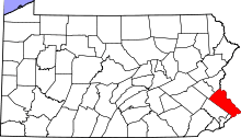
 Location of Solebury Township in Pennsylvania | |
| Website: http://www.soleburytwp.org | |
Solebury Township is a township in Bucks County, Pennsylvania, United States. The population was 8,692 at the 2010 census.
History
Solebury has had history lining its borders since the 17th century, ever since the Europeans have settled here in America. It contains historical sites that are visited every day by many. From the pre-revolutionary America, to colonial times, and finally, the industrial revolution. Prior to the "Americans" taking over this town it was owned by a Native American Tribe, the "Lenni-Lenape". This in English means, "original people". After the "Turtle Tribe" occupied this land it later became known as Solebury. In 1686 Solebury was finally signed over to the American settlers by 13 Native American tribe leaders.[1]
Abbie Hoffman committed suicide in 1989 in Solebury Township.
The Atkinson Road Bridge, Center Bridge Historic District, Cuttalossa Valley Historic District, George Nakashima House, Studio and Workshop, Isaiah Paxson Farm, Phillips Mill Historic District, [[ J Henry Warren, Author, Red Fox Farm)) Long Valley Historic District, and Van Sant Covered Bridge are listed on the National Register of Historic Places.[2]
Geography
According to the United States Census Bureau, the township has a total area of 27.2 square miles (70.6 km²), of which 26.6 square miles (69.0 km²) is land and 0.6 square miles (1.6 km²) (2.20%) is water. It is drained by the Delaware River, which separates it from New Jersey. Its villages include Bowman Hill (also in Upper Makefield Township,) Carversville (also in Plumstead Township,) Center Bridge, Highton (also in Buckingham Township,) Peters Corners, and Solebury.
Neighboring municipalities
- Upper Makefield Township (southeast)
- Buckingham Township (southwest)
- Plumstead Township (northwest)
- Kingwood Township, New Jersey (north)
- Delaware Township, Hunterdon County, New Jersey (northeast)
- Stockton, New Jersey (northeast)
- Lambertville, New Jersey (east)
- New Hope (east)
- West Amwell Township, New Jersey (east)
- Hopewell Township, Mercer County, New Jersey (east)
Attractions
There are many outdoor types of activities to do while in Solebury; for instance, the New Hope-Lambertville Winter Festival. Solebury includes a landscape of a tremendous amount of historical sites that are easily located by simply walking, such as, Magill's Hill. Magill's Hill is a 5-acre site that consists of steeply sloped hills which can be used for sledding or other winter activities. The Solebury Township includes something that is called the Trail which has a connection to the electric company power line. This also allows baseball games and athletic teams to play during the night. Solebury also contains the Washington Crossing State Park.
Education
The Solebury School, a private co-educational day and boarding school, is located in the township.
Demographics
| Historical population | |||
|---|---|---|---|
| Census | Pop. | %± | |
| 1930 | 1,564 | — | |
| 1940 | 1,689 | 8.0% | |
| 1950 | 2,208 | 30.7% | |
| 1960 | 2,972 | 34.6% | |
| 1970 | 3,547 | 19.3% | |
| 1980 | 4,827 | 36.1% | |
| 1990 | 5,998 | 24.3% | |
| 2000 | 7,743 | 29.1% | |
| 2010 | 8,692 | 12.3% | |
| http://www.dvrpc.org/data/databull/rdb/db82/appedixa.xls. | |||
As of the census[3] of 2000, there were 7,743 people, 3,053 households, and 2,170 families residing in the township. The population density was 290.6 people per square mile (112.2/km²). There were 3,207 housing units at an average density of 120.4/sq mi (46.5/km²).
The racial makeup of the township as of the 2010 census was :
- 94.3% White
- 0.9% African American
- 0.0% Native American
- 2.9% Asian
- 0.1% Pacific Islander
- 1.1% from two or more races
- 2.7% Hispanic or Latino
There are 3,053 households:
- 30.4% contain children under the age of 18
- 63.9% are married couples living together
- 5.1% have a female householder with no husband present
- 28.9% were non-families.
- 19.0% of all households were made up of individuals
- 5.5% had someone living alone who was 65 years of age or older.
The average household size was 2.52 and the average family size was 2.94.
Solebury contains citizens of different ages
- 22.0% under the age of 18
- 4.1% from 18 to 24
- 25.8% from 25 to 44
- 36.5% from 45 to 64
- 11.6% who were 65 years of age or older.
The median age was 44 years. For every 100 females there were 99.3 males. For every 100 females age 18 and over, there were 100.4 males.
The median income for a household in the township was $89,005, and the median income for a family was $103,566. Males had a median income of $71,176 versus $42,361 for females. The per capita income for the township was $52,985. About 1.7% of families and 3.1% of the population were below the poverty line, including 4.4% of those under age 18 and 3.5% of those age 65 or over.
References
- ↑ "Solebury Township: Parks & Recreation". Solebury Township, Pennsylvania. Retrieved 2011-01-24.
- ↑ National Park Service (2010-07-09). "National Register Information System". National Register of Historic Places. National Park Service.
- ↑ "American FactFinder". United States Census Bureau. Retrieved 2008-01-31.
External links
| Wikimedia Commons has media related to Solebury Township, Bucks County, Pennsylvania. |