Richland Township, Bucks County, Pennsylvania
| Richland Township | |
|---|---|
| Township | |
|
| |
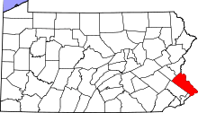
 Location of Richland Township in Bucks County | |
 Richland Township Pennsylvania | |
| Coordinates: 40°26′52″N 75°19′40″W / 40.44778°N 75.32778°WCoordinates: 40°26′52″N 75°19′40″W / 40.44778°N 75.32778°W | |
| Country | United States |
| State | Pennsylvania |
| County | Bucks |
| Established | 1734 |
| Area | |
| • Total | 20.5 sq mi (53 km2) |
| • Land | 20.5 sq mi (53 km2) |
| • Water | 0.0 sq mi (0 km2) |
| Elevation | 499 ft (152 m) |
| Population (2000) | |
| • Total | 11,100 |
| • Density | 540/sq mi (210/km2) |
| Time zone | EST (UTC-5) |
| • Summer (DST) | EDT (UTC-4) |
| Area code(s) | 215 |
| Website | http://www.richlandtownship.org |

Richland Township is a township in Bucks County, Pennsylvania, United States. The population was 11,100 at the 2010 census.
History
The Shelly School was listed on the National Register of Historic Places in 2011.[1]
Geography
According to the United States Census Bureau, the township has a total area of 20.5 square miles (53.1 km²), of which, 20.5 square miles (53.0 km²) of it is land and 0.1 square miles (0.1 km²) of it (0.24%) is water. It is drained by the Tohickon Creek eastward into the Delaware River. Its villages include California, Paletown, Quaker, Rich Hill, and Shelly.
Adjacent municipalities
- Springfield Township (north)
- Haycock Township (east)
- East Rockhill Township (southeast)
- West Rockhill Township (south)
- Milford Township (west)
Richland Township surrounds the boroughs of Quakertown and Richlandtown.
Demographics
| Historical population | |||
|---|---|---|---|
| Census | Pop. | %± | |
| 1930 | 2,173 | — | |
| 1940 | 2,105 | −3.1% | |
| 1950 | 3,050 | 44.9% | |
| 1960 | 3,783 | 24.0% | |
| 1970 | 4,089 | 8.1% | |
| 1980 | 6,286 | 53.7% | |
| 1990 | 8,560 | 36.2% | |
| 2000 | 9,920 | 15.9% | |
| 2010 | 11,100 | 11.9% | |
| http://www.dvrpc.org/data/databull/rdb/db82/appedixa.xls. | |||
As of the census[2] of 2000, there were 9,920 people, 3,763 households, and 2,667 families residing in the township. The population density was 484.7 people per square mile (187.1/km²). There were 3,877 housing units at an average density of 189.4/sq mi (73.1/km²). The racial makeup of the township was 96.35% White, 0.93% African American, 0.11% Native American, 1.16% Asian, 0.38% from other races, and 1.07% from two or more races. Hispanic or Latino of any race were 1.32% of the population.
There were 3,763 households, out of which 34.9% had children under the age of 18 living with them, 59.3% were married couples living together, 7.7% had a female householder with no husband present, and 29.1% were non-families. 23.5% of all households were made up of individuals, and 11.1% had someone living alone who was 65 years of age or older. The average household size was 2.62 and the average family size was 3.13.
In the township the population was spread out, with 26.2% under the age of 18, 6.5% from 18 to 24, 32.9% from 25 to 44, 20.7% from 45 to 64, and 13.8% who were 65 years of age or older. The median age was 37 years. For every 100 females there were 97.8 males. For every 100 females age 18 and over, there were 94.8 males.
The median income for a household in the township was $47,057, and the median income for a family was $55,359. Males had a median income of $37,677 versus $27,826 for females. The per capita income for the township was $19,582. About 2.5% of families and 5.4% of the population were below the poverty line, including 8.0% of those under age 18 and 6.4% of those age 65 or over.
Government and politics
Legislators
- State Representative Craig Staats, Republican, 145th district
- State Senator Bob Mensch, Republican, 24th district
- US Representative Mike Fitzpatrick, Republican, 8th district
Board of Supervisors
- Rick Orloff
- Tim Ritter
- Tim Arnold
References
- ↑ National Park Service (2010-07-09). "National Register Information System". National Register of Historic Places. National Park Service.
- ↑ "American FactFinder". United States Census Bureau. Archived from the original on September 11, 2013. Retrieved 2008-01-31.