Cornwells Heights, Pennsylvania
| Cornwells Heights, Pennsylvania | |
|---|---|
| Census-designated place | |
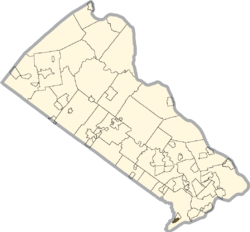 Location of Cornwells Heights within Bucks County | |
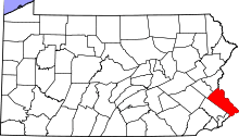
 Cornwells Heights Location of Cornwells Heights within Pennsylvania | |
| Coordinates: 40°04′36″N 74°56′56″W / 40.07667°N 74.94889°WCoordinates: 40°04′36″N 74°56′56″W / 40.07667°N 74.94889°W | |
| Country | United States |
| State | Pennsylvania |
| County | Bucks |
| Township | Bensalem |
| Elevation | 69 ft (21 m) |
| Population (2010) | |
| • Total | 1,391 |
| Time zone | Eastern (EST) (UTC-5) |
| • Summer (DST) | EDT (UTC-4) |
| ZIP code | 19020 |
| Area code(s) | 215 and 267 |
| GNIS feature ID | 1200071[1] |
Cornwells Heights is a census-designated place located in Bensalem Township in Bucks County, Pennsylvania. The community was formerly part of Cornwells Heights-Eddington, but was split into two separate CDP's. As of the 2010 census, the population was 1,391. The Cornwells Heights station is located in the community and serves SEPTA Regional Rail's Trenton Line and Amtrak's Keystone Service and Northeast Regional services along the Northeast Corridor.[2][3] The train station also has a park-and-ride with access from Interstate 95.[4]
References
- ↑ "Cornwells Heights". Geographic Names Information System. United States Geological Survey.
- ↑ SEPTA Official Transit & Street Map Suburban (PDF) (Map). SEPTA. Retrieved May 2, 2016.
- ↑ "Cornwells Heights, PA (CWH)". Amtrak. Retrieved May 2, 2016.
- ↑ "Selected Regional Park & Ride Lots" (PDF). Delaware Valley Regional Planning Commission. Retrieved May 2, 2016.
This article is issued from Wikipedia - version of the 6/22/2016. The text is available under the Creative Commons Attribution/Share Alike but additional terms may apply for the media files.