Warrington Township, Bucks County, Pennsylvania
| Warrington Township | |
|---|---|
| Township | |
|
Nathaniel Irwin House | |
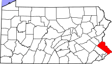
 Location of Warrington Township in Bucks County | |
 Warrington Township Pennsylvania | |
| Coordinates: 40°14′23″N 75°08′30″W / 40.23972°N 75.14167°WCoordinates: 40°14′23″N 75°08′30″W / 40.23972°N 75.14167°W | |
| Country | United States of America |
| State | Pennsylvania |
| Area | |
| • Total | 13.8 sq mi (36 km2) |
| • Land | 13.8 sq mi (36 km2) |
| • Water | 0.0 sq mi (0 km2) |
| Elevation | 338 ft (103 m) |
| Population (2010) | |
| • Total | 23,418 |
| • Density | 1,700/sq mi (660/km2) |
| Time zone | EST (UTC-5) |
| • Summer (DST) | EDT (UTC-4) |
| Postal code | 18976 and 18914 |
| Area code(s) | 215 |
| Website |
warringtontownship |

Warrington Township is a township in Bucks County, Pennsylvania, United States. Warrington Township is a suburb of Philadelphia. The population was 23,418 at the 2010 census.
History
Warrington Township was founded in October 1734, and is named after the town of Warrington in Cheshire, England, England. The early township consisted of four villages: Warrington, Neshaminy, Tradesville, and Pleasantville. Warrington was located at the intersection of Bristol Road and the Doylestown-Willow Grove Turnpike, now known as Easton Road (PA Route 611).
Neshaminy, originally known as Warrington Square, was centered at Street Road and the Turnpike (611), but became known as Neshaminy because of its proximity to the Little Neshaminy Creek. The Village of Tradesville was near Lower State Road and was originally known as Stuckert's Corner because of a store operated by a man named Stuckert.
The Village of Pleasantville (or Eureka) was located near Lower State Road and County Line Road. It was the location of the first church in the township, The Reformed Church of Pleasantville, founded in 1840.[1]
In 2010, Teva Pharmaceutical Industries proposed to build the largest warehouse facility in Pennsylvania near residential neighborhoods in Warrington, leading to vocal community opposition.[2][3] Teva eventually chose a less controversial site in Northeast Philadelphia.[4]
Demographics
| Historical population | |||
|---|---|---|---|
| Census | Pop. | %± | |
| 1930 | 1,139 | — | |
| 1940 | 1,307 | 14.7% | |
| 1950 | 2,336 | 78.7% | |
| 1960 | 4,148 | 77.6% | |
| 1970 | 7,550 | 82.0% | |
| 1980 | 10,704 | 41.8% | |
| 1990 | 12,169 | 13.7% | |
| 2000 | 17,580 | 44.5% | |
| 2010 | 23,418 | 33.2% | |
| http://www.dvrpc.org/data/databull/rdb/db82/appedixa.xls. | |||
As of the 2010 census, the township was 86.3% Non-Hispanic White, 2.1% Black or African American, 0.2% Native American, 6.1% Asian, and 1.4% were two or more races. 4.2% of the population were of Hispanic or Latino ancestry.[5] Much alike the rest of Bucks County, Warrington has seen a surge in its Indian and Mexican populations.
As of the census[6] of 2000, there were 17,580 people, 6,124 households, and 4,807 families residing in the township. The population density was 1,276.8 people per square mile (492.9/km²). There were 6,314 housing units at an average density of 458.6/sq mi (177.0/km²). The racial makeup of the township was 94.16% White, 1.93% African American, 0.07% Native American, 2.50% Asian, 0.07% Pacific Islander, 0.53% from other races, and 0.75% from two or more races. Hispanic or Latino of any race were 1.56% of the population.
There were 6,124 households, out of which 42.7% had children under the age of 18 living with them, 67.9% were married couples living together, 7.5% had a female householder with no husband present, and 21.5% were non-families. 16.6% of all households were made up of individuals, and 4.7% had someone living alone who was 65 years of age or older. The average household size was 2.86 and the average family size was 3.26.
In the township the population was spread out, with 29.1% under the age of 18, 6.2% from 18 to 24, 34.5% from 25 to 44, 21.6% from 45 to 64, and 8.5% who were 65 years of age or older. The median age was 35 years. For every 100 females there were 100.2 males. For every 100 females age 18 and over, there were 96.4 males.
The median income for a household in the township was $66,364, and the median income for a family was $76,065 (these figures had risen to $86,754 and $100,678 respectively as of a 2007 estimate[7]). Males had a median income of $49,643 versus $34,175 for females. The per capita income for the township was $25,810. About 1.8% of families and 2.6% of the population were below the poverty line, including 2.1% of those under age 18 and 4.5% of those age 65 or over.
Educational institutions
Warrington Township is located in the Central Bucks School District. Educational institutions include:
- Barclay Elementary School
- Mill Creek Elementary School
- Titus Elementary School
- Tamanend Middle School
- Central Bucks High School South
- St Joseph St Robert School
Geography
Warrington is located at 40°14′23″N 75°08′30″W / 40.23972°N 75.14167°W (40.239722, −75.141667).[8] According to the United States Census Bureau, the township has a total area of 13.8 square miles (35.7 km²), all of it land. The town takes nameship after Warrington, England. It is in the Delaware watershed and is drained by the Neshaminy Creek. Its villages include Eureka (also in Montgomery County,) Neshaminy, Palomino Farms, Tradesville (also in Doylestown Township,) and Warrington.
Neighboring municipalities
- New Britain Township (northwest)
- Doylestown Township (north)
- Warwick Township (east)
- Warminster Township (southeast)
- Horsham Township, Montgomery County (south)
- Montgomery Township, Montgomery County (southwest)
Climate
| Climate data for Warrington | |||||||||||||
|---|---|---|---|---|---|---|---|---|---|---|---|---|---|
| Month | Jan | Feb | Mar | Apr | May | Jun | Jul | Aug | Sep | Oct | Nov | Dec | Year |
| Average high °F (°C) | 39 (4) |
43 (6) |
52 (11) |
63 (17) |
74 (23) |
82 (28) |
87 (31) |
85 (29) |
77 (25) |
66 (19) |
55 (13) |
44 (7) |
64 (18) |
| Average low °F (°C) | 24 (−4) |
25 (−4) |
33 (1) |
42 (6) |
52 (11) |
61 (16) |
66 (19) |
65 (18) |
57 (14) |
45 (7) |
37 (3) |
29 (−2) |
45 (7) |
| Average precipitation inches (mm) | 3.94 (100.1) |
2.87 (72.9) |
4.24 (107.7) |
3.85 (97.8) |
4.81 (122.2) |
3.61 (91.7) |
4.72 (119.9) |
4.34 (110.2) |
4.66 (118.4) |
3.35 (85.1) |
3.74 (95) |
3.80 (96.5) |
47.93 (1,217.4) |
| Source: Weather Channel[9] | |||||||||||||
Transportation
Major roads in Warrington Township include U.S. Route 202, which runs southwest-northeast through the western part of the township along a two-lane parkway; Pennsylvania Route 611, which passes north-south through the eastern section of the Warrington Township on Easton Road; Pennsylvania Route 152, which heads north-south through the western portion of the township on Limeklin Pike; Street Road, which runs northwest-southeast through the middle of the township and is designated Pennsylvania Route 132 east of Pennsylvania Route 611; County Line Road, which runs northwest-southeast along the southwestern border with Montgomery County; Bristol Road, which runs northwest-southeast along the northeastern boundary of the township; Lower State Road, which runs southwest-northeast in the western part of Warrington Township; and Upper State Road, which runs southwest-northeast along the northwestern border of the township.[10] SEPTA provides bus service to Warrington Township along the Route 55 line, which follows Pennsylvania Route 611 and heads north to Doylestown and south to Willow Grove and Olney Transportation Center in North Philadelphia.[11]
Notable people
- Josh Adams, football player at the University of Notre Dame[12]
- Robert McCormick Holbert, 1923–2007 Porsche racer, 4-time SCCA National Champion[13]
- Bryan Scott, National Football League player
References
- ↑ "From Wilderness to Bustling Community, A History of Warrington Township" by Delores Deabler Capone, 1976
- ↑ Teva plan fails to sway residents, Bucks County Courier Times, February 17, 2010
- ↑ TevaProject, Warrington Township Coalition
- ↑ Teva picks N.E. Phila. for distribution center, Philadelphia Business Journal, October 27, 2010
- ↑
- ↑ "American FactFinder". United States Census Bureau. Archived from the original on September 11, 2013. Retrieved 2008-01-31.
- ↑ 2005–2007 American Community Survey 3-Year Estimates
- ↑ "US Gazetteer files: 2010, 2000, and 1990". United States Census Bureau. February 12, 2011. Retrieved 2011-04-23.
- ↑ Average weather for Warringon Weather Channel Retrieved 2008-05-12
- ↑ Bucks County, Pennsylvania Highway Map (PDF) (Map). PennDOT. 2015. Retrieved January 10, 2016.
- ↑ "Route 55 bus schedule" (PDF). SEPTA. Retrieved May 4, 2016.
- ↑ "Josh Adams". UND.com. Retrieved July 29, 2016.
- ↑ http://autoweek.com/article/car-news/us-porsche-pioneer-bob-holbert-dies