Tullytown, Pennsylvania
| Borough of Tullytown | |
| Borough | |
 | |
| Country | United States |
|---|---|
| State | Pennsylvania |
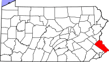
| County | Bucks |
| Elevation | 20 ft (6.1 m) |
| Coordinates | 40°08′42″N 74°49′04″W / 40.14500°N 74.81778°WCoordinates: 40°08′42″N 74°49′04″W / 40.14500°N 74.81778°W |
| Area | 2.1 sq mi (5.4 km2) |
| - land | 1.6 sq mi (4 km2) |
| - water | 0.5 sq mi (1 km2), 23.81% |
| Population | 1,872 (2010) |
| Density | 1,289.2/sq mi (497.8/km2) |
| Timezone | EST (UTC-5) |
| - summer (DST) | EDT (UTC-4) |
| ZIP Code | 19007 |
| Area code | 215 and 267 |
 Location of Tullytown in Bucks County | |
 Location of Tullytown in Pennsylvania | |
 Location of Pennsylvania in the United States | |
Tullytown is a borough in Bucks County, Pennsylvania, United States. The population was 1,872 at the 2010 census. Part of Levittown is located in Tullytown.
History
The Walt Disney Elementary School was listed on the National Register of Historic Places in 2007.[1]
Geography
Tullytown is located at 40°8′42″N 74°49′4″W / 40.14500°N 74.81778°W (40.145077, -74.817841).[2]
According to the United States Census Bureau, the borough has a total area of 2.1 square miles (5.4 km²), of which, 1.6 square miles (4.1 km²) of it is land and 0.5 square miles (1.3 km²) of it (24.88%) is water.
Demographics
| Historical population | |||
|---|---|---|---|
| Census | Pop. | %± | |
| 1880 | 262 | — | |
| 1900 | 528 | — | |
| 1910 | 622 | 17.8% | |
| 1920 | 572 | −8.0% | |
| 1930 | 658 | 15.0% | |
| 1940 | 562 | −14.6% | |
| 1950 | 648 | 15.3% | |
| 1960 | 2,452 | 278.4% | |
| 1970 | 2,194 | −10.5% | |
| 1980 | 2,277 | 3.8% | |
| 1990 | 2,339 | 2.7% | |
| 2000 | 2,031 | −13.2% | |
| 2010 | 1,872 | −7.8% | |
| Est. 2015 | 1,859 | [3] | −0.7% |
| Sources:[4][5][6] | |||
As of the 2010 census, the borough was 92.5% Non-Hispanic White, 3.2% Black or African American, 0.2% Native American, 0.4% Asian, and 1.1% were two or more races. 3.0% of the population were of Hispanic or Latino ancestry .
As of the census[5] of 2000, there were 2,031 people, 803 households, and 501 families residing in the borough. The population density was 1,289.2 people per square mile (496.3/km²). There were 819 housing units at an average density of 519.9 per square mile (200.1/km²). The racial makeup of the borough was 97.74% White, 1.48% African American, 0.05% Native American, 0.49% Asian, 0.10% from other races, and 0.15% from two or more races. Hispanic or Latino of any race were 1.38% of the population.
There were 803 households, out of which 29.0% had children under the age of 18 living with them, 46.7% were married couples living together, 10.3% had a female householder with no husband present, and 37.5% were non-families. 33.3% of all households were made up of individuals, and 19.3% had someone living alone who was 65 years of age or older. The average household size was 2.52 and the average family size was 3.24.
In the borough the population was spread out, with 24.5% under the age of 18, 7.9% from 18 to 24, 30.3% from 25 to 44, 20.4% from 45 to 64, and 16.9% who were 65 years of age or older. The median age was 39 years. For every 100 females there were 92.9 males. For every 100 females age 18 and over, there were 90.6 males.
The median income for a household in the borough was $45,625, and the median income for a family was $57,917. Males had a median income of $35,774 versus $28,352 for females. The per capita income for the borough was $22,206. About 1.6% of families and 4.2% of the population were below the poverty line, including none of those under age 18 and 8.3% of those age 65 or over.
References
- ↑ National Park Service (2010-07-09). "National Register Information System". National Register of Historic Places. National Park Service.
- ↑ "US Gazetteer files: 2010, 2000, and 1990". United States Census Bureau. 2011-02-12. Retrieved 2011-04-23.
- ↑ "Annual Estimates of the Resident Population for Incorporated Places: April 1, 2010 to July 1, 2015". Retrieved July 2, 2016.
- ↑ "Census of Population and Housing". U.S. Census Bureau. Retrieved 11 December 2013.
- 1 2 "American FactFinder". United States Census Bureau. Retrieved 2008-01-31.
- ↑ "Incorporated Places and Minor Civil Divisions Datasets: Subcounty Resident Population Estimates: April 1, 2010 to July 1, 2012". Population Estimates. U.S. Census Bureau. Retrieved 11 December 2013.
External links
| Wikivoyage has a travel guide for Tullytown. |