Snowcrest Range
| Snowcrest Range | |
|---|---|
 Hogback Mountain, a prominent peak in the range | |
| Highest point | |
| Peak | Sunset Peak (Snowcrest Range) |
| Elevation | 10,581 ft (3,225 m) |
| Coordinates | 44°50′34″N 112°05′41″W / 44.84278°N 112.09472°WCoordinates: 44°50′34″N 112°05′41″W / 44.84278°N 112.09472°W |
| Geography | |
| Country | United States |
| State | Montana |
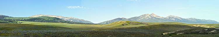
The Snowcrest Range, el. 10,581 feet (3,225 m),[1] is a small mountain range southeast of Dillon, Montana in Madison County, Montana. The Snowcrest and adjacent Gravelly Range is one of Montana's most popular hunting grounds.[2] The two mountain ranges are home to nearly 10,000 elk and a growing population of grizzly bears.[2]
The Snowcrest Range is extremely wild, with about 166,000 acres of roadless country, including 97,000 acres of roadless National Forest, as well as adjacent private and state lands.[3]
Wolke characterizes the Snowcrest thus: "Spectacular grassland foothills and slopes rise through a thin band of Limber Pine, Douglas-Fir, Aspen, spruce, and fir to alpine summits . . . [t]his is high, dry, east-slope country, and the rich habitat mosaic is superb for Elk, Bighorn, Moose, Mule Deer, Red Tailed Hawk, Swainson's Hawk and Golden Eagle."[3] The Snowcrest Range receives very little use outside of hunting season.[3]
Sunset Peak, el. 10,581, is the highest point in the Snowcrest Range.[3] (Although Wolke lists Sunset's elevation at 10,573, Peakbagger.com lists its elevation as 10,581).[4]

See also
Notes
- ↑ "Snowcrest Range". Geographic Names Information System. United States Geological Survey.
- 1 2 Backus, Perry (November 6, 2011). "Up Your Game". Missoulian.
- 1 2 3 4 Wolke, Howie (1992). The Big Outside. New York, NY: Harmony Books. p. 131. ISBN 0-517-58737-8.
- ↑ Peakbagger.com. "Sunset Peak, Montana". Retrieved 8 November 2011.