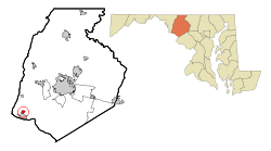
Rosemont, Maryland
| Rosemont, Maryland | |
|---|---|
| Village | |
| Village of Rosemont | |
|
Rosemont | |
 | |
| Coordinates: 39°19′47″N 77°37′7″W / 39.32972°N 77.61861°WCoordinates: 39°19′47″N 77°37′7″W / 39.32972°N 77.61861°W | |
| Country |
|
| State |
|
| County |
|
| Government | |
| • Type | Municipality |
| • Burgess | Tom Watson |
| • Commissioners | David Blackmon, Joe Wiles, Stephen Harshman ,John Leach |
| Area[1] | |
| • Total | 0.56 sq mi (1.45 km2) |
| • Land | 0.56 sq mi (1.45 km2) |
| • Water | 0 sq mi (0 km2) |
| Elevation | 502 ft (153 m) |
| Population (2010)[2] | |
| • Total | 294 |
| • Estimate (2012[3]) | 302 |
| • Density | 525.0/sq mi (202.7/km2) |
| Time zone | Eastern (EST) (UTC-5) |
| • Summer (DST) | EDT (UTC-4) |
| FIPS code | 24-68600 |
| GNIS feature ID | 0591187 |
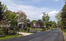
Rosemont is a village in Frederick County, Maryland, United States. The population was 294 at the 2010 census.
Geography
Rosemont is located at 39°19′47″N 77°37′7″W / 39.32972°N 77.61861°W (39.329608, -77.618522).[4]
According to the United States Census Bureau, the village has a total area of 0.56 square miles (1.45 km2), all of it land.[1]
Demographics
| Historical population | |||
|---|---|---|---|
| Census | Pop. | %± | |
| 1960 | 212 | — | |
| 1970 | 250 | 17.9% | |
| 1980 | 223 | −10.8% | |
| 1990 | 256 | 14.8% | |
| 2000 | 273 | 6.6% | |
| 2010 | 294 | 7.7% | |
| Est. 2015 | 307 | [5] | 4.4% |
2010 census
As of the census[2] of 2010, there were 294 people, 114 households, and 84 families residing in the village. The population density was 525.0 inhabitants per square mile (202.7/km2). There were 118 housing units at an average density of 210.7 per square mile (81.4/km2). The racial makeup of the village was 92.9% White, 1.4% African American, 0.3% Asian, 0.3% Pacific Islander, 0.7% from other races, and 4.4% from two or more races. Hispanic or Latino of any race were 1.4% of the population.
There were 114 households of which 22.8% had children under the age of 18 living with them, 58.8% were married couples living together, 9.6% had a female householder with no husband present, 5.3% had a male householder with no wife present, and 26.3% were non-families. 18.4% of all households were made up of individuals and 10.6% had someone living alone who was 65 years of age or older. The average household size was 2.58 and the average family size was 2.93.
The median age in the village was 49.6 years. 14.6% of residents were under the age of 18; 8.2% were between the ages of 18 and 24; 19% were from 25 to 44; 38.4% were from 45 to 64; and 19.7% were 65 years of age or older. The gender makeup of the village was 49.3% male and 50.7% female.
2000 census
As of the census[7] of 2000, there were 273 people, 104 households, and 76 families residing in the village. The population density was 488.3 people per square mile (188.2/km²). There were 106 housing units at an average density of 189.6 per square mile (73.1/km²). The racial makeup of the village was 99.27% White, 0.37% African American and 0.37% Native American. Hispanic or Latino of any race were 0.37% of the population.
There were 104 households out of which 26.0% had children under the age of 18 living with them, 63.5% were married couples living together, 8.7% had a female householder with no husband present, and 26.9% were non-families. 16.3% of all households were made up of individuals and 10.6% had someone living alone who was 65 years of age or older. The average household size was 2.63 and the average family size was 3.04.
In the village the population was spread out with 19.8% under the age of 18, 5.9% from 18 to 24, 23.1% from 25 to 44, 31.9% from 45 to 64, and 19.4% who were 65 years of age or older. The median age was 46 years. For every 100 females there were 88.3 males. For every 100 females age 18 and over, there were 87.2 males.
The median income for a household in the village was $59,750, and the median income for a family was $66,875. Males had a median income of $52,000 versus $31,806 for females. The per capita income for the village was $24,382. None of the families and 1.0% of the population were living below the poverty line, including none under eighteen and 4.2% of those over 64.
References
- 1 2 "US Gazetteer files 2010". United States Census Bureau. Retrieved 2013-01-25.
- 1 2 "American FactFinder". United States Census Bureau. Retrieved 2013-01-25.
- ↑ "Population Estimates". United States Census Bureau. Retrieved 2013-06-26.
- ↑ "US Gazetteer files: 2010, 2000, and 1990". United States Census Bureau. 2011-02-12. Retrieved 2011-04-23.
- ↑ "Annual Estimates of the Resident Population for Incorporated Places: April 1, 2010 to July 1, 2015". Retrieved July 2, 2016.
- ↑ "Census of Population and Housing". Census.gov. Retrieved June 4, 2015.
- ↑ "American FactFinder". United States Census Bureau. Retrieved 2008-01-31.
External links
Municipalities and communities of Frederick County, Maryland, United States | ||
|---|---|---|
| Cities | 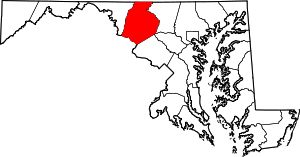 | |
| Towns | ||
| Village | ||
| CDPs | ||
| Other communities |
| |
| Footnotes | ‡This populated place also has portions in an adjacent county or counties | |