Emmitsburg, Maryland
| Emmitsburg, Maryland | |
|---|---|
| Town | |
| Town of Emmitsburg | |
|
Panoramic view of Emmitsburg from US-15 Rest Area | |
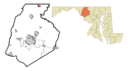 Location of Emmitsburg, Maryland | |
| Coordinates: 39°42′17″N 77°19′31″W / 39.70472°N 77.32528°WCoordinates: 39°42′17″N 77°19′31″W / 39.70472°N 77.32528°W | |
| Country | United States |
| State |
|
| County |
|
| Area[1] | |
| • Total | 1.52 sq mi (3.94 km2) |
| • Land | 1.52 sq mi (3.94 km2) |
| • Water | 0 sq mi (0 km2) |
| Elevation | 436 ft (133 m) |
| Population (2010)[2] | |
| • Total | 2,814 |
| • Estimate (2012[3]) | 3,086 |
| • Density | 1,851.3/sq mi (714.8/km2) |
| Time zone | Eastern (EST) (UTC-5) |
| • Summer (DST) | EDT (UTC-4) |
| ZIP code | 21727 |
| Area code(s) | 301 |
| FIPS code | 24-26200 |
| GNIS feature ID | 0584300 |

Emmitsburg is a town in Frederick County, Maryland, United States, just south of the Mason-Dixon line separating Maryland from Pennsylvania. Founded in 1785, Emmitsburg is the home of Mount St. Mary's University. The town has two Catholic pilgrimage sites: the National Shrine Grotto of Our Lady of Lourdes, which is on the campus of Mount St. Mary's, and the Basilica and National Shrine of St. Elizabeth Ann Seton, who was the first native born United States citizen to be canonized as a saint.[4] The Seton Shrine is one of the top eight Catholic pilgrimage destinations in the United States. [5]
The National Emergency Training Center (NETC) campus is in Emmitsburg on the former campus of Saint Joseph College. The campus includes the Emergency Management Institute, the National Fire Academy and the National Fallen Firefighters Memorial.
The population as of the 2010 U.S Census was 2,814.
The current mayor of Emmitsburg is Don Briggs. The current commissioners are Glenn Blanchard, Jennifer Mellor, Tim O'Donnell, Joseph Ritz III and Cliff Sweeney.
History
Emmitsburg was named for its founder, William Emmit in 1785.[6] However, settlement preceded the town, particularly since British authorities restricted colonists' expansion during and after the French and Indian War.
The Tom's Creek Methodist Church was founded in 1757 for the benefit of settlers in the area (including William Emmit's father Samuel Emmit) as well as travelers. In the same year, Lutherans led by pastor George Bager built a church, which they shared with a German Reformed congregation until 1798 (and for a briefer time with a Presbyterian congregation).[7] After the American Revolutionary War, Catholic missionary Rev. Jean Dubois established a mission church, and then seminary at Emmitsburg. Later Elizabeth Ann Seton established a convent, with a school and hospital. Soon, the number of Methodists in Emmitsburg led to the formation of a circuit around town, rather than share a minister with Gettysburg, Pennsylvania,
The Union fortified Emmitsburg to stop the Confederate invasion of the Union territory in June 1863 during the American Civil War. Half the town was burned to the ground in a mysterious fire on the night of June 23. Folklore has it that 'The Great Fire,' as it was known, was started by a Union sympathizer to prevent advancing Confederates from taking supplies from the town. However fate spared the town a battle between the opposing forces, which instead took place 12 miles north of it in Pennsylvania near the town of Gettysburg. The town was briefly held by the retreating Confederates on July 4.
Geography
Emmitsburg is located at 39°42′17″N 77°19′31″W / 39.70472°N 77.32528°W (39.704697, -77.325294).[8]
According to the United States Census Bureau, the town has a total area of 1.52 square miles (3.94 km2), all of it land.[1]
Climate
Emmitsburg is situated in the transition between the humid subtropical climate zone and the humid continental climate zone (Köppen Dfa), with hot, humid summers and moderately cold winters. It is known for being located near the base of Catoctin Mountain.
| Emmitsburg, MD | ||||||||||||||||||||||||||||||||||||||||||||||||||||||||||||
|---|---|---|---|---|---|---|---|---|---|---|---|---|---|---|---|---|---|---|---|---|---|---|---|---|---|---|---|---|---|---|---|---|---|---|---|---|---|---|---|---|---|---|---|---|---|---|---|---|---|---|---|---|---|---|---|---|---|---|---|---|
| Climate chart (explanation) | ||||||||||||||||||||||||||||||||||||||||||||||||||||||||||||
| ||||||||||||||||||||||||||||||||||||||||||||||||||||||||||||
| ||||||||||||||||||||||||||||||||||||||||||||||||||||||||||||
| Climate data for Emmitsburg, Maryland | |||||||||||||
|---|---|---|---|---|---|---|---|---|---|---|---|---|---|
| Month | Jan | Feb | Mar | Apr | May | Jun | Jul | Aug | Sep | Oct | Nov | Dec | Year |
| Record high °F (°C) | 74 (23) |
78 (26) |
85 (29) |
92 (33) |
94 (34) |
101 (38) |
103 (39) |
103 (39) |
98 (37) |
90 (32) |
82 (28) |
77 (25) |
103 (39) |
| Average high °F (°C) | 39.3 (4.1) |
43.6 (6.4) |
53.5 (11.9) |
64.8 (18.2) |
73.8 (23.2) |
81.7 (27.6) |
85.8 (29.9) |
84.2 (29) |
77.3 (25.2) |
66.4 (19.1) |
54.5 (12.5) |
43.9 (6.6) |
64.07 (17.81) |
| Average low °F (°C) | 22.7 (−5.2) |
24.5 (−4.2) |
32.4 (0.2) |
40.7 (4.8) |
50.6 (10.3) |
59.3 (15.2) |
64.1 (17.8) |
62.3 (16.8) |
55.4 (13) |
43.4 (6.3) |
35.0 (1.7) |
27.8 (−2.3) |
43.18 (6.2) |
| Record low °F (°C) | −27 (−33) |
−13 (−25) |
−5 (−21) |
15 (−9) |
26 (−3) |
35 (2) |
42 (6) |
36 (2) |
24 (−4) |
16 (−9) |
9 (−13) |
−19 (−28) |
−27 (−33) |
| Average precipitation inches (mm) | 3.66 (93) |
2.97 (75.4) |
3.95 (100.3) |
3.80 (96.5) |
4.52 (114.8) |
4.35 (110.5) |
3.64 (92.5) |
3.60 (91.4) |
4.26 (108.2) |
3.48 (88.4) |
3.80 (96.5) |
3.31 (84.1) |
45.34 (1,151.6) |
| Average snowfall inches (cm) | 11.8 (30) |
8.7 (22.1) |
4.5 (11.4) |
0.7 (1.8) |
0 (0) |
0 (0) |
0 (0) |
0 (0) |
0 (0) |
0.1 (0.3) |
1.4 (3.6) |
3.6 (9.1) |
30.8 (78.2) |
| Average precipitation days | 8.9 | 7.9 | 9.1 | 9.5 | 11.7 | 10.3 | 9.4 | 9.0 | 8.2 | 7.5 | 8.7 | 8.3 | 108.5 |
| Average snowy days | 4.1 | 3.0 | 1.7 | 0.4 | 0 | 0 | 0 | 0 | 0 | 0.1 | 0.6 | 2.2 | 12.1 |
| Source: NOAA [9] | |||||||||||||
Demographics
| Historical population | |||
|---|---|---|---|
| Census | Pop. | %± | |
| 1850 | 812 | — | |
| 1870 | 706 | — | |
| 1880 | 847 | 20.0% | |
| 1890 | 844 | −0.4% | |
| 1900 | 849 | 0.6% | |
| 1910 | 1,054 | 24.1% | |
| 1920 | 940 | −10.8% | |
| 1930 | 1,235 | 31.4% | |
| 1940 | 1,412 | 14.3% | |
| 1950 | 1,261 | −10.7% | |
| 1960 | 1,369 | 8.6% | |
| 1970 | 1,532 | 11.9% | |
| 1980 | 1,552 | 1.3% | |
| 1990 | 1,688 | 8.8% | |
| 2000 | 2,290 | 35.7% | |
| 2010 | 2,814 | 22.9% | |
| Est. 2015 | 3,021 | [10] | 7.4% |
2010 census
As of the census[2] of 2010, there were 2,814 people, 997 households, and 670 families residing in the town. The population density was 1,851.3 inhabitants per square mile (714.8/km2). There were 1,070 housing units at an average density of 703.9 per square mile (271.8/km2). The racial makeup of the town was 95.0% White, 2.0% African American, 0.2% Native American, 0.9% Asian, 0.7% from other races, and 1.3% from two or more races. Hispanic or Latino of any race were 2.5% of the population.
There were 997 households of which 38.8% had children under the age of 18 living with them, 50.8% were married couples living together, 11.6% had a female householder with no husband present, 4.8% had a male householder with no wife present, and 32.8% were non-families. 26.6% of all households were made up of individuals and 9.3% had someone living alone who was 65 years of age or older. The average household size was 2.64 and the average family size was 3.22.
The median age in the town was 39.5 years. 26% of residents were under the age of 18; 7.2% were between the ages of 18 and 24; 25.4% were from 25 to 44; 25.1% were from 45 to 64; and 16.3% were 65 years of age or older. The gender makeup of the town was 47.3% male and 52.7% female.
2000 census
As of the census[12] of 2000, there were 2,290 people, 811 households, and 553 families residing in the town. The population density was 1,992.9 people per square mile (768.8/km²). There were 862 housing units at an average density of 750.2 per square mile (289.4/km²). The racial makeup of the town was 97.16% White, 0.87% African American, 0.04% Native American, 0.31% Asian, 0.04% from other races, and 1.57% from two or more races. Hispanic or Latino of any race were 0.44% of the population.
There were 811 households out of which 38.3% had children under the age of 18 living with them, 50.2% were married couples living together, 13.2% had a female householder with no husband present, and 31.7% were non-families. 26.8% of all households were made up of individuals and 11.1% had someone living alone who was 65 years of age or older. The average household size was 2.56 and the average family size was 3.03.
In the town the population was spread out with 24.4% under the age of 18, 6.7% from 18 to 24, 31.4% from 25 to 44, 16.6% from 45 to 64, and 20.8% who were 65 years of age or older. The median age was 37 years. For every 100 females there were 76.7 males. For every 100 females age 18 and over, there were 70.0 males.
The median income for a household in the town was $38,710, and the median income for a family was $46,328. Males had a median income of $32,578 versus $23,235 for females. The per capita income for the town was $16,216. About 4.2% of families and 12.9% of the population were below the poverty line, including 4.1% of those under age 18 and 44.4% of those age 65 or over.
Media
Emmitsburg was featured on the Food Network television Series Throwdown! with Bobby Flay in September 2009. Flay challenged Father Leo Patalinghug, a priest and seminary professor at nearby Mount St. Mary's University. Patalinghug is also known as "The Cooking Priest".[13] He is the founder of Grace Before Meals, a movement which seeks to strengthen families and communities around the dinner table.[14]
The town has 2 newspapers: the Emmitsburg News-Journal[15] which is published monthly, and The Catoctin Banner.[16]
References
- 1 2 "US Gazetteer files 2010". United States Census Bureau. Retrieved 2013-01-25.
- 1 2 "American FactFinder". United States Census Bureau. Retrieved 2013-01-25.
- ↑ "Population Estimates". United States Census Bureau. Retrieved 2013-06-26.
- ↑ "The National Shrine of Saint Elizabeth Ann Seton". Biography of St. Elizabeth Ann Seton. 2013-07-23.
- ↑ The Official Catholic Directory 2009–2010 Pilgrimage Guide. (New Providence, N.J.: Kenedy and Sons, 2009), 55–63.
- ↑ Gannett, Henry (1905). The Origin of Certain Place Names in the United States. Govt. Print. Off. p. 119.
- ↑ http://www.emmitsburg.net/archive_list/articles/places/churches/toms_creek_umc.htm
- ↑ "US Gazetteer files: 2010, 2000, and 1990". United States Census Bureau. 2011-02-12. Retrieved 2011-04-23.
- ↑ "NCDC: U.S. Climate Normals" (PDF). National Oceanic and Atmospheric Administration. July 2011. Retrieved 2011-07-24.
- ↑ "Annual Estimates of the Resident Population for Incorporated Places: April 1, 2010 to July 1, 2015". Retrieved July 2, 2016.
- ↑ "Census of Population and Housing". Census.gov. Retrieved June 4, 2015.
- ↑ "American FactFinder". United States Census Bureau. Retrieved 2008-01-31.
- ↑ Siouxlandnews.com Cooking Priest Comes To Sioux City By Jaclyn Driscoll, Reporter
- ↑ Pilot Tribune "Two from St. Mary's School to receive awards"
- ↑ Emmitsburg News-Journal
- ↑ The Catoctin Banner
External links
| Wikimedia Commons has media related to Emmitsburg, Maryland. |
- Emmitsburg.net - Emmitsburg's Non-Profit Community web site
- Emmitsburg Historical Society's web site
- Mount St. Mary's University
- The Emmitsburg News-Journal - Emmitsburg's Community Newspaper
Municipalities and communities of Frederick County, Maryland, United States | ||
|---|---|---|
| Cities | 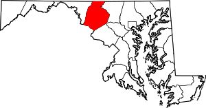 | |
| Towns | ||
| Village | ||
| CDPs | ||
| Other communities |
| |
| Footnotes | ‡This populated place also has portions in an adjacent county or counties | |