Spring Ridge, Maryland
| Spring Ridge, Maryland | |
|---|---|
| Census-designated place | |
 Spring Ridge  Spring Ridge Location in Maryland | |
| Coordinates: 39°24′31″N 77°20′27″W / 39.40861°N 77.34083°WCoordinates: 39°24′31″N 77°20′27″W / 39.40861°N 77.34083°W | |
| Country |
|
| State |
|
| County |
|
| Area | |
| • Total | 2.67 sq mi (6.91 km2) |
| • Land | 2.64 sq mi (6.83 km2) |
| • Water | 0.03 sq mi (0.08 km2) |
| Elevation | 370 ft (110 m) |
| Population (2010) | |
| • Total | 5,795 |
| • Density | 2,198/sq mi (848.6/km2) |
| Time zone | Eastern (EST) (UTC-5) |
| • Summer (DST) | EDT (UTC-4) |
| Area code(s) | 301 and 240 |
| FIPS code | 24-74560 |
| GNIS feature ID | 1711956[1] |
Spring Ridge is census-designated place (CDP) and suburban housing community in Frederick County, in the U.S. state of Maryland, just outside the city of Frederick. As of the 2010 census it had a population of 5,795.[2] Before 2010, it was part of the Linganore-Bartonsville, Maryland census-designated place, which was split into three for the 2010 census.
Geography
Spring Ridge is in east-central Frederick County, bordered to the west, across the Monocacy River, by the city of Frederick; to the north by Linganore Creek; to the east, at Meadow Road, by the Linganore CDP; and to the south, across Maryland Route 144, by the Bartonsville CDP. Interstate 70 runs through the middle of the Spring Ridge CDP, leading west 4 miles (6 km) to Frederick and east 34 miles (55 km) to the Baltimore Beltway. Primary access to the community is via the Spring Ridge Parkway from MD 144.
According to the U.S. Census Bureau, the Spring Ridge CDP has a total area of 2.67 square miles (6.91 km2), of which 2.64 square miles (6.83 km2) is land and 0.031 square miles (0.08 km2), or 1.14%, is water.[2]
References
- ↑ U.S. Geological Survey Geographic Names Information System: Spring Ridge
- 1 2 "Geographic Identifiers: 2010 Census Summary File 1 (G001), Spring Ridge CDP, Maryland". American FactFinder. U.S. Census Bureau. Retrieved June 2, 2016.
Municipalities and communities of Frederick County, Maryland, United States | ||
|---|---|---|
| Cities | 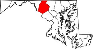 | |
| Towns | ||
| Village | ||
| CDPs | ||
| Other communities |
| |
| Footnotes | ‡This populated place also has portions in an adjacent county or counties | |