Aberdeen, Maryland
| Aberdeen, Maryland | |
|---|---|
| City | |
| City of Aberdeen | |
|
Bel Air Avenue in downtown Aberdeen. | |
| Nickname(s): "All America City" | |
| Motto: "The Future of Harford!" | |
 Location in Harford County, Maryland | |
| Coordinates: 39°30′37″N 76°10′9″W / 39.51028°N 76.16917°WCoordinates: 39°30′37″N 76°10′9″W / 39.51028°N 76.16917°W | |
| Country |
|
| State |
|
| County |
|
| Incorporated | 1892 |
| Government | |
| • Mayor | Patrick McGrady |
| Area[1] | |
| • Total | 17.64 km2 (6.81 sq mi) |
| • Land | 17.61 km2 (6.80 sq mi) |
| • Water | 0.03 km2 (0.01 sq mi) |
| Elevation | 29 m (95 ft) |
| Population (2010)[2] | |
| • Total | 14,959 |
| • Estimate (2013[3]) | 15,120 |
| • Density | 849.4/km2 (2,199.9/sq mi) |
| Time zone | Eastern (UTC-5) |
| • Summer (DST) | Eastern (UTC-4) |
| ZIP code | 21001 |
| Area code(s) | 410 |
| FIPS code | 24-00125 |
| GNIS feature ID | 0582854 |
| Website | www.aberdeen-md.org |
_at_Howard_Street_in_Aberdeen%2C_Harford_County%2C_Maryland.jpg)
Aberdeen is a city in Harford County, Maryland, 26 miles (42 km) from Baltimore.[4] The population was 14,959 at the 2010 United States Census. Aberdeen is the largest municipality in Harford County.
Aberdeen is part of the Baltimore-Towson Metropolitan Statistical Area (MSA), which is the 20th-largest United States metropolitan area. The nearest city to Aberdeen is Havre de Grace, Maryland, 4.8 miles (7.7 km) to the northeast.
History
Aberdeen was named after Aberdeen, Scotland, by immigrating Scots.
The James B. Baker House, Chestnut Ridge, Griffith House, Poplar Hill, Sophia's Dairy, and Swansbury are listed on the National Register of Historic Places.[5]
The Village of Aberdeen
The Village of Aberdeen was a development by Edmund Law Rogers around 1800.[4] The name originated from its mother city, Aberdeen, Scotland, as a result of the close relationship the Rogers family of Baltimore had with their cousin, the Earl of Aberdeen, who became Prime Minister of Great Britain in 1852.[6] The area now known as Aberdeen is a cluster of three communities[7][8]
- Hall's Cross Roads, located[9] at the intersection of Old Philadelphia Road (MD-7, in some places known as Old Post Road, then known as Philadelphia Post Road) and Bush River Neck Road[10] (then the main road from Swan Creek 39°31′28.41″N 76°8′17.75″W / 39.5245583°N 76.1382639°W)
- Mechanicsville, located[11] at 39°36′7.3836″N 76°19′10.8516″W / 39.602051000°N 76.319681000°W
- The Village of Aberdeen[7]
The Town of Aberdeen
In 1892, Aberdeen was incorporated as a Town, under Chapter 136 of the Acts of 1892.[12]
The Town Board of Commissioners
When incorporated as a Town, Aberdeen government was led by a board of commissioners.[13]
- 1892–1905, a Board President was elected annually by the commissioners
- 1906–1954, this election was changed to be biennial
- 1955–1992, the election of a Board President was changed back to be annual
In 1992, the Town of Aberdeen revised the Charter and became the City of Aberdeen with an Elected Mayor. The first Mayor of the City of Aberdeen was Ruth Elliot. The second Mayor was Doug Wilson was elected Mayor in Fred Simmons was elected Mayor in 2005. Michael Bennett elected in 2007-2015 In 2015, Patrick McGrady was elected as the Mayor of Aberdeen and is currently serving a 4-year term.
Presidents – Aberdeen Board of Commissioners
- 1892–1894 Charles W. Baker
- 1894–1896 George Walker
- 1896–1899 John Finney Wells
- 1899–1900 George H. Irvins
- 1900–1905 John Finney Wells
- 1905–1906 James A. Wiles
- 1906–1908 John Finney Wells
- 1908–1914 C. H. Johnson
- 1914–1916 None listed
- 1916–1950 Frank E. Baker
- 1950–1952 J. Wilmer Cronin
- 1952–1954 Charles J. Kelly
- 1954–1955 Clark D. Connellee
- 1955–1956 J. Wilmer Cronin
- 1956–1958 R. Lee Mitchell
- 1958–1959 Robert P. Atkins
- 1959–1964 George B. Adams, Jr.
- 1964–1965 Robert H. Krieger
- 1965–1967 William Cooper, Jr.
- 1967–1968 Warren Parrish
- 1968–1969 John A. Feroll
- 1969–1970 William Cooper, Jr.
- 1970–1971 Warren Parrish
- 1971–1972 Alphonse Demarco
- 1972–1974 George B. Adams, Jr.
- 1974–1975 William B. Hause
- 1975–1977 Kent F. Stewart
- 1977–1978 William B. Hause
- 1978–1979 Jerry A. Nolan
- 1979–1980 William Cooper, Jr.
- 1980–1981 Raymond H. Warfield
- 1981–1986 Ronald Kupferman
- 1986–1987 Raymond H. Warfield
- 1987–1992 George J. Englesson
The City of Aberdeen
In 1992, the 100th anniversary year of Aberdeen becoming a Town, Aberdeen incorporated as the City it is today.
Geography
According to the United States Census Bureau, the city has a total area of 6.81 square miles (17.64 km2), of which, 6.80 square miles (17.61 km2) is land and 0.01 square miles (0.03 km2) is water.[1]
Climate
The climate in this area is characterized by hot, humid summers and generally mild to cool winters. According to the Köppen Climate Classification system, Aberdeen has a humid subtropical climate, abbreviated "Cfa" on climate maps.[14]
Demographics
| Historical population | |||
|---|---|---|---|
| Census | Pop. | %± | |
| 1880 | 101 | — | |
| 1890 | 448 | 343.6% | |
| 1900 | 600 | 33.9% | |
| 1910 | 616 | 2.7% | |
| 1920 | 1,067 | 73.2% | |
| 1930 | 1,240 | 16.2% | |
| 1940 | 1,525 | 23.0% | |
| 1950 | 2,944 | 93.0% | |
| 1960 | 9,679 | 228.8% | |
| 1970 | 12,375 | 27.9% | |
| 1980 | 11,533 | −6.8% | |
| 1990 | 13,087 | 13.5% | |
| 2000 | 13,842 | 5.8% | |
| 2010 | 14,959 | 8.1% | |
| Est. 2015 | 15,580 | [15] | 4.2% |
2000 census
As of the census[17] of 2000, there were 13,842 people, 5,475 households, and 3,712 families residing in the city. The population density was 2,166.2 people per square mile (836.4/km²). There were 5,894 housing units at an average density of 922.4 per square mile (356.1/km²). The racial makeup of the city was 64.90% White, 27.38% African American, 0.25% Native American, 2.48% Asian, 0.09% Pacific Islander, 1.42% from other races, and 3.47% from two or more races. Hispanic or Latino of any race were 3.45% of the population.
There were 5,475 households out of which 32.4% had children under the age of 18 living with them, 44.8% were married couples living together, 17.2% had a female householder with no husband present, and 32.2% were non-families. 26.8% of all households were made up of individuals and 10.7% had someone living alone who was 65 years of age or older. The average household size was 2.51 and the average family size was 3.02.
In the city the population was spread out with 26.4% under the age of 18, 8.7% from 18 to 24, 28.6% from 25 to 44, 23.7% from 45 to 64, and 12.7% who were 65 years of age or older. The median age was 37 years. For every 100 females there were 90.6 males. For every 100 females age 18 and over, there were 85.8 males.
The median income for a household in the city was $39,190, and the median income for a family was $48,357. Males had a median income of $32,783 versus $26,025 for females. The per capita income for the city was $18,940. About 9.0% of families and 11.9% of the population were below the poverty line, including 15.9% of those under age 18 and 11.1% of those age 65 or over.
2010 census
As of the census[2] of 2010, there were 14,959 people, 5,801 households, and 3,897 families residing in the city. The population density was 2,199.9 inhabitants per square mile (849.4/km2). There were 6,191 housing units at an average density of 910.4 per square mile (351.5/km2). The racial makeup of the city was 58.9% White, 30.5% African American, 0.4% Native American, 2.9% Asian, 0.3% Pacific Islander, 1.6% from other races, and 5.3% from two or more races. Hispanic or Latino of any race were 5.4% of the population.
There were 5,801 households of which 34.3% had children under the age of 18 living with them, 43.5% were married couples living together, 18.3% had a female householder with no husband present, 5.4% had a male householder with no wife present, and 32.8% were non-families. 26.7% of all households were made up of individuals and 10.8% had someone living alone who was 65 years of age or older. The average household size was 2.57 and the average family size was 3.09.
The median age in the city was 38 years. 24.7% of residents were under the age of 18; 9.2% were between the ages of 18 and 24; 24.9% were from 25 to 44; 28.6% were from 45 to 64; and 12.6% were 65 years of age or older. The gender makeup of the city was 47.8% male and 52.2% female.
Government
Since its incorporation as a city, Aberdeen has had a council-manager form of government.[18] The Mayor and Council are elected to four-year terms in November, with terms beginning in November. The Mayor and Council define policy and appoint the City Manager who may be dismissed at any time, by vote of the Council. The City Manager, with the approval of the Council, appoints all officers and department heads who may be dismissed for cause by action of the City Manager.
Mayors of Aberdeen
- Ruth Elliott, 1992–1994
- Charles R. Boutin, 1994–1998
- Douglas S. Wilson, 1998–2005
- S. Fred Simmons, 2005–2007
- Michael E. Bennett, 2007–2015
- Patrick McGrady, 2015-present
Aberdeen City Council
The current Council[19] members were elected by Voters to 4-year terms beginning in November 2011. Their terms expire in 2015.
- Patrick L. McGrady, Mayor
- Timothy Lindecamp, Councilwoman
- Sandra Landbeck, Councilwoman
- Steve Goodin, Councilwoman
- Melvin Taylor, Councilman
Aberdeen City Manager
Randy Robertson July 1, 2016- Current Douglas R. Miller, City Manager 2007-2015
Harford County Council
Council District E
- Patrick Vincenti[20] (Republican)
Maryland General Assembly
State Senate, District 34A
- State Senator Bob Cassilly[21] (Republican)
House of Delegates, District 34A
- Mary Ann Lisanti[22] (Democrat)
- Glen Glass[23] (Republican)
Congressional Delegation
US Senate
- Senator Barbara A. Mikulski[24] (Democrat)
- Senator Benjamin L. Cardin[25] (Democrat)
US House of Representatives, 2nd Congressional District
- Congressman C.A. Dutch Ruppersberger[26] (Democrat)
Aberdeen Proving Ground
Aberdeen is home to the U.S. Army's Aberdeen Proving Ground (APG). The proving ground was established by Act of Congress and came into operation in January 1918. APG is headquarters of the United States Army Test and Evaluation Command (ATEC). The proving ground occupies more than 72,500 acres (293 km2) in Harford County. More than 7,500 civilians and 5,000 military personnel work at APG.
Notable people
- William Benjamin Baker, U.S. Congressman for Maryland's 2nd District, from 1895 to 1901.
- Linwood Clark, U.S. Congressman for Maryland's 2nd District, 1929–1931. Born in Aberdeen, MD on March 21, 1876
- Les German, Major League Baseball Pitcher, Trap-shooter
- Michael D. Griffin, head administrator of NASA
- E. J. Henderson, Minnesota Viking football player, former Maryland Terrapin.
- Erin Henderson, Minnesota Viking football player, former Maryland Terrapin.
- Jai Lewis, College basketball player (George Mason Patriots).
- Gary Neal, Current NBA Player for the Washington Wizards
- Irv Pankey, Aberdeen High School, 2 time wrestling state champion (1975–1976); Penn State offensive lineman (1976–1980); NFL: Los Angeles Rams (1980–1990) Indianapolis Colts (1991–1992)
- Billy Ripken, former Oriole and brother of Cal Ripken Jr.
- Cal Ripken, Jr., Baltimore Orioles legend, grew up in Aberdeen and was a student at Aberdeen High School.
- Richard Slutzky, "Coach Slutzky", honoree of the National Wrestling Hall of Fame, long-time Aberdeen High School coach.
- Lisa Welch, Playboy Playmate of the Month, September 1980
- Steven M. Wise, animal rights lawyer and scholar, inducted into Aberdeen High School Hall of Fame.
- Frank Zappa, musician, lived in Aberdeen for a short period, father worked at APG.
- David Grace (basketball), UCLA and Oregon State University basketball coach (USAF Retired) [27]
Aberdeen IronBirds
Cal Ripken Jr. and brother Billy are owners of the Aberdeen IronBirds minor league baseball team, which plays at Ripken Stadium.
Media
Aberdeen's local radio station is WAMD, broadcasting at 970 on the AM dial. Local newspaper coverage is provided by Harford County publications The Aegis and The Record. Electronic media covering Aberdeen issues is Aberdeen Patch and The Dagger Press (electronic)
Aberdeen is served by Baltimore television stations.
Aberdeen was host to the 2014 Bimmerfest East celebration on August 2, 2014.
References
- 1 2 "US Gazetteer files 2010". United States Census Bureau. Archived from the original on 2012-01-24. Retrieved 2013-01-25.
- 1 2 "American FactFinder". United States Census Bureau. Retrieved 2013-01-25.
- ↑ "Population Estimates". United States Census Bureau. Archived from the original on 2013-06-17. Retrieved 2013-06-26.
- 1 2 Hoiberg, Dale H., ed. (2010). "Aberdeen". Encyclopedia Britannica. I: A-ak Bayes (15th ed.). Chicago, IL: Encyclopedia Britannica Inc. p. 28. ISBN 978-1-59339-837-8.
- ↑ National Park Service (2010-07-09). "National Register Information System". National Register of Historic Places. National Park Service.
- ↑ [Plat of Aberdeen, Edmund Law Rogers. 1852]
- 1 2 The Aberdeen Room – Exhibits – Aberdeen: Its Three Components
- ↑ Harford County, MDGenWeb – Aberdeen
- ↑ Historical Marker DataBase – Halls' Cross Roads
- ↑ Historic Tour of Hall's Cross Roads
- ↑ Mechanicsville (historical) in Harford County, MD
- ↑ Aberdeen Municipality, Harford County, Maryland
- ↑ Aberdeen Board Presidents and Mayors
- ↑ Climate Summary for Aberdeen, Maryland
- ↑ "Annual Estimates of the Resident Population for Incorporated Places: April 1, 2010 to July 1, 2015". Retrieved July 2, 2016.
- ↑ "Census of Population and Housing". Census.gov. Archived from the original on May 11, 2015. Retrieved June 4, 2015.
- ↑ "American FactFinder". United States Census Bureau. Archived from the original on 2013-09-11. Retrieved 2008-01-31.
- ↑ Aberdeen City Government Archived April 23, 2008, at the Wayback Machine.
- ↑ Aberdeen City Council Archived May 8, 2010, at the Wayback Machine.
- ↑ Harford County Council District E Archived October 29, 2007, at the Wayback Machine.
- ↑ Maryland State Senator Bob Cassilly
- ↑ Mary Ann Lisanti, Maryland House of Delegates District 34A
- ↑ Glen Glass, Maryland State Delegate
- ↑ U.S. Senator Barbara Mikulsi, Maryland
- ↑ Benjamin L. Cardin, United States Senator for Maryland
- ↑ Congressman C.A. Dutch Ruppersberger Representing Maryland's 2nd District
- ↑ http://www.uclabruins.com/ViewArticle.dbml?ATCLID=207913802
External links
| Wikivoyage has a travel guide for Aberdeen. |
| Wikimedia Commons has media related to Aberdeen, Maryland. |
- City of Aberdeen
- Aberdeen Chamber of Commerce
- Aberdeen Fire Department
- Aberdeen Ironbirds
- Aberdeen Room Archives & Museum
- Ripken Baseball
- Cal Ripken Sr. Foundation
- Aberdeen Proving Ground
- APG News
 |
Carsins | Webster | Swan Creek | |
| Creswell | |
Oakington | ||
| ||||
| | ||||
| Perryman | APG | APG |
Municipalities and communities of Harford County, Maryland, United States | ||
|---|---|---|
| Cities | 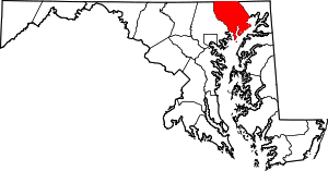 | |
| Town | ||
| CDPs | ||
| Other communities | ||