Olney, Maryland
| Olney, Maryland | |
|---|---|
| Census-designated place | |
|
The St. John's Episcopal Church in May 2013. | |
 Location of Olney, Maryland | |
| Coordinates: 39°9′11″N 77°4′29″W / 39.15306°N 77.07472°W | |
| Country |
|
| State |
|
| County |
|
| Area | |
| • Total | 13.0 sq mi (33.7 km2) |
| • Land | 13.0 sq mi (33.6 km2) |
| • Water | 0.0 sq mi (0.0 km2) |
| Elevation | 541 ft (165 m) |
| Population (2010) | |
| • Total | 33,844 |
| • Density | 2,603.4/sq mi (1,004.3/km2) |
| Time zone | Eastern (EST) (UTC-5) |
| • Summer (DST) | EDT (UTC-4) |
| ZIP codes | 20830, 20832, 20833 |
| Area code(s) | 301 |
| FIPS code | 24-58900 |
| GNIS feature ID | 0590948 |
| Website |
http: |

Olney is a census-designated place and an unincorporated area in Montgomery County, Maryland. It is located in the north central part of the county, twenty miles (32 km) north of Washington, D.C. It was largely agricultural until the 1960s, when growth of the Washington suburbs led to its conversion into a mostly residential area. As generally defined, Olney had a total population of 33,844 in the 2010 U.S. Census. In 2013 it was ranked #22 Money magazine's "top-earning towns" edition of "America's Best Places to Live."[1]
History
Originally known as Mechanicsville, the village which became Olney was established in 1800. The area was mostly farmland, but it soon began attracting artisans. Early residents Sarah Brooke and Dr. Charles Farquhar were devotees of the English poet William Cowper, and named their home after the poet's hometown. The area was in turn named for their home, which still stands and is known as the Olney House.
The Brooke family held the largest tracts of land in Olney, whose central village was at the intersection of the Rockville to Baltimore road, and the one which connected Washington with Westminster, Maryland, to the north. The Quaker community in Sandy Spring thrived just to Olney's east. The Sandy Spring Museum is a historical museum featuring educational programs and displays. St. John's Episcopal Church was established in 1842 and survives to this day.
After the siege of Washington by the British in 1814 during the War of 1812, President Madison and his family passed through Olney en route to taking refuge in the neighboring town of Brookeville.[2] Although not as involved in the Civil War as areas of Maryland to the west, Olney residents still experienced the tug-of-war between loyalty to the plantation economy of the South and to the Federal government in Maryland's midst. Both Union and Confederate forces made stops in Olney during the war. Union Generals George B. McClellan and Ambrose Burnside led soldiers through in the midst of the Maryland Campaign in 1862. During the Gettysburg Campaign in 1863, Confederate General J. E. B. Stuart marched a 10,000 and 20,000 troops north through the village and raided it of supplies, including horses and crops from surrounding farms in which they bivouacked.[3]
Geography
As an unincorporated area, Olney's boundaries are not officially defined. The United States Census Bureau defines a census-designated place of Olney centered at 39°9' North and 77°5' West. It has a total area of 13.0 square miles (34 km2), all land.
Olney's town center sits at the intersection of state route 97 (Georgia Avenue) and route 108 (Olney-Laytonsville Road). The town, larger than any other in the neighboring areas, lies south of Brookeville, west of Sandy Spring, east-northeast of Gaithersburg, north-northeast of Rockville, and north of Aspen Hill.
Demographics
At the 2010 U.S. Census,[4] there were 33,844 people, 11,606 households, and 9,447 families residing in the area. The population density is 2,603.4 people per square mile (1,004.3/km²). There are 11,879 housing units at an average density of 913.8 per square mile (352.5/km²). The ethnic makeup of the area is 75.1% White, 11.9% African American, 12.0% Asian, 8.5% Hispanic or Latino, and 0.53% Native American. 3.1% of the population identifies with "Some Other Race."
There are 11,606 households, of which 81.4% are family households. Among all households:
- 41.7% have children under the age of 18 living with them.
- 67.2% are married couples living together.
- 11.0% have a female householder with no husband present.
- 3.1% have a male householder with no wife present.
- 22.8% have individuals 65 years and over.
- 18.6% are non-families.
The average household size is 2.91 and the average family size is 3.25.
28.9% of residents are under the age of 20, 25.8% from 20 to 44, 34.4% from 45 to 64, and 10.8% 65 years of age or older. The median age is 41.9 years. For every 100 females there are 91.8 males.
According to a 2007 estimate,[5] the median household income is $116,319, and the median family income is $126,849. Males have a median income of $69,911 versus $45,818 for females. The per capita income for the area is $35,267. 2.6% of the population and 1.9% of families are below the poverty line.
Education
Brooke Grove Elementary School, a public elementary school in Olney, was awarded the prestigious Blue Ribbon School for Excellence. There are three Montgomery County Public School clusters that bisect Olney, with some children attending elementary and middle schools that send students on to Magruder High School and others attending schools that send students to Sherwood High School or James Hubert Blake High School. The Our Lady Of Good Counsel High School building opened in January 2007, enabling the Roman Catholic high school to relocate to Olney from Wheaton, Maryland. The new building of Washington Christian Academy opened in 2008 in Olney.
Culture

The historic Olney Ale House continues to operate on the east edge of town. Farther east lies the Sandy Spring Museum and Woodlawn Manor Living History Museum.[6] Olney is also home to MedStar Montgomery Medical Center, a branch of the Montgomery County Library, the Olney Swim Center, and the Norbeck golf course.
The Olney Theatre presents professional level dramatic and musical live theatrical productions in its large and modern playhouse on the East edge of town, drawing audiences from across the Maryland and D.C. metropolitan area.
Olney is also home to the Olney Big Band and Olney Concert Band.[7]
Olney is the home to Rock N' Roll Revival which is an annual show and community tradition at Sherwood High School.
Recreation
Playgrounds, playing fields and courts are available throughout Olney and the surrounding area. Many of the parks are public and some belong to homeowners or other private associations. Public parks include Olney Manor Park (featuring the Olney Swim Center, a year-round indoor public pool), Southeast Olney Park, Longwood Park, Cherrywood Park, Bowie Mill Park, and the OBGC Park at Freeman Fields.
Olney is also home to a private country club and a golf driving range.
As an all-volunteer (but for a handful of admin staff) non-profit organization, OBGC has provided sports recreation and training for over 45,000 Olney youth since 1969.[8] (April 2005) In 1999 Joshua Freeman and The Carl M. Freeman Foundation joined with the Olney Boys and Girls Community Sports Club in their collective vision to bring additional youth recreational facilities to the Olney Community. Freeman Fields is named in memory of Carl M. Freeman and his commitment to investing in the future of our children and the quality of life for our community.[9] As the site of OBGC Park, Falling Green had been an active farm since 1764.[10] A house and barn survive from the original farm. Falling Green house, built c. 1770 by Quaker planter Basil Brooke, is one of Montgomery County, MD's finest expressions of Georgian architecture.[11]
Notable people
- Secretary of the Interior Harold L. Ickes bought the 250-acre (1.0 km2) Headwaters Farm in 1937. His wife maintained the farm after his death until she sold it in 1971. The Ickes' large white house still stands in the middle of the original core of the Olney Oaks development/subdivision.[12]
- Frank Miller, an artist and film director best known for his film noir-style comic book stories, was born in Olney.
- Justin Maxwell, outfielder for the Lotte Giants.
- Stefon Diggs, wide receiver for the Minnesota Vikings, attended Our Lady of Good Counsel in Olney, Maryland.
References
- ↑ Lampert, Jacqueline (13 August 2013). "Four Washington-area towns make Money Magazine's top-earning list". Washington Business Journal. Retrieved 18 July 2016.
- ↑ Hughes, Will (14 November 2012). "Capital for a Day". Boundary Stones. WETA. Retrieved 18 July 2016.
- ↑ Farquhar, Robert Brooke (1954). Historic Montgomery County, Maryland: Old Homes and History. University of Michigan. pp. 148, 243.
- ↑ "Community Facts (for Olney CDP, Maryland)". American FactFinder. United States Census Bureau. Retrieved 27 September 2016.
- ↑
- ↑ "(in process of moving) to Historic Brookeville Academy". Woodlawn Manor Museum. Retrieved 2016-09-27.
- ↑ "Olney Concert Band". Olney Concert Band. Retrieved 2016-09-27.
- ↑ "OBGC History & Info". Olney Boys & Girls Club (OBGC). Olney Boys and Girls Community Sports Association. Retrieved 27 September 2016.
- ↑ "Legacy Grants". Carl M. Freedman Foundation. Retrieved 27 September 2016.
- ↑ "OBGC Park History". Olney Boys and Girls Community Sports Association. (c) 2016 Olney Boys & Girls Community, (c) 2016 Demosphere International, Inc. Retrieved 27 September 2016.
- ↑ "Falling Green House". Falling Green House. Olney Boys and Girls Community Sports Association. Retrieved 27 September 2016.
- ↑ "Homeland Village History". Homeland Village Community Association. Retrieved 18 July 2016.
External links
| Wikimedia Commons has media related to Olney, Maryland. |
-
 Olney travel guide from Wikivoyage
 -
 Geographic data related to Olney, Maryland at OpenStreetMap
 - Olney, Maryland Community web page
- Olney, Maryland Chamber of Commerce web page
Coordinates: 39°09′11″N 77°04′29″W / 39.153022°N 77.0747°W
Municipalities and communities of Montgomery County, Maryland, United States | ||
|---|---|---|
| Cities | 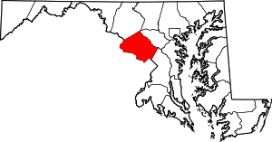 | |
| Towns | ||
| Villages & Special Tax Districts | ||
| CDPs |
| |
| Unincorporated communities | ||
| Footnotes | ‡This populated place also has portions in an adjacent county or counties | |