Rawlins, Wyoming
| Rawlins, Wyoming | |
|---|---|
| City | |
|
Downtown Rawlins | |
 Location in Carbon County and the state of Wyoming. | |
 Rawlins, Wyoming Location in the United States | |
| Coordinates: 41°47′25″N 107°14′3″W / 41.79028°N 107.23417°WCoordinates: 41°47′25″N 107°14′3″W / 41.79028°N 107.23417°W | |
| Country | United States |
| State | Wyoming |
| County | Carbon |
| Government | |
| • Mayor | Kenneth C. Klouda |
| Area[1] | |
| • Total | 8.28 sq mi (21.45 km2) |
| • Land | 8.24 sq mi (21.34 km2) |
| • Water | 0.04 sq mi (0.10 km2) |
| Elevation | 6,834 ft (2,083 m) |
| Population (2010)[2] | |
| • Total | 9,259 |
| • Estimate (2012[3]) | 9,113 |
| • Density | 1,123.7/sq mi (433.9/km2) |
| Time zone | Mountain (MST) (UTC-7) |
| • Summer (DST) | MDT (UTC-6) |
| ZIP code | 82301 |
| Area code(s) | 307 |
| FIPS code | 56-63900[4] |
| GNIS feature ID | 1593213[5] |
| Website | www.rawlins-wyoming.com |

Rawlins is a city in Carbon County, Wyoming, United States. The population was 9,259 at the 2010 census. It is the county seat of Carbon County.[6] It was named for Union General John Aaron Rawlins, who camped in the locality in 1867.[7]
Demographics
| Historical population | |||
|---|---|---|---|
| Census | Pop. | %± | |
| 1870 | 612 | — | |
| 1880 | 1,451 | 137.1% | |
| 1890 | 2,235 | 54.0% | |
| 1900 | 2,317 | 3.7% | |
| 1910 | 4,256 | 83.7% | |
| 1920 | 3,969 | −6.7% | |
| 1930 | 4,868 | 22.7% | |
| 1940 | 5,531 | 13.6% | |
| 1950 | 7,415 | 34.1% | |
| 1960 | 8,968 | 20.9% | |
| 1970 | 7,855 | −12.4% | |
| 1980 | 11,547 | 47.0% | |
| 1990 | 9,380 | −18.8% | |
| 2000 | 8,538 | −9.0% | |
| 2010 | 9,259 | 8.4% | |
| Est. 2015 | 9,040 | [8] | −2.4% |
| [9] | |||
2010 census
As of the census of 2010, there were 9,259 people, 3,443 households, and 2,206 families residing in the city.[2] The population density was 1,123.7 inhabitants per square mile (433.9/km2). There were 3,960 housing units at an average density of 480.6 per square mile (185.6/km2). The racial makeup of the city was 84.7% White, 1.1% African American, 1.3% Native American, 1.0% Asian, 0.1% Pacific Islander, 9.2% from other races, and 2.7% from two or more races. Hispanic or Latino of any race were 24.3% of the population.
There were 3,443 households of which 35.5% had children under the age of 18 living with them, 48.2% were married couples living together, 10.2% had a female householder with no husband present, 5.6% had a male householder with no wife present, and 35.9% were non-families. 29.0% of all households were made up of individuals and 7.3% had someone living alone who was 65 years of age or older. The average household size was 2.47 and the average family size was 3.04.
The median age in the city was 34.3 years. 25.5% of residents were under the age of 18; 9.5% were between the ages of 18 and 24; 29% were from 25 to 44; 26.8% were from 45 to 64; and 9.3% were 65 years of age or older. The gender makeup of the city was 54.7% male and 45.3% female.
2000 census
As of the census[4] of 2000, there were 8,538 people, 3,320 households, and 2,237 families residing in the city. The population density was 1,153.4 people per square mile (445.5/km²). There were 3,860 housing units at an average density of 521.4 per square mile (201.4/km²). The racial makeup of the city was 85.86% White, 0.81% African American, 1.46% Native American, 0.84% Asian, 0.09% Pacific Islander, 8.28% from other races, and 2.65% from two or more races. Hispanic or Latino of any race were 21.05% of the population.
There were 3,320 households out of which 33.9% had children under the age of 18 living with them, 52.6% were married couples living together, 10.5% had a female householder with no husband present, and 32.6% were non-families. 26.9% of all households were made up of individuals and 8.6% had someone living alone who was 65 years of age or older. The average household size was 2.45 and the average family size was 2.97.
In the city the population was spread out with 26.0% under the age of 18, 10.1% from 18 to 24, 29.4% from 25 to 44, 24.2% from 45 to 64, and 10.3% who were 65 years of age or older. The median age was 36 years. For every 100 females there were 111.5 males. For every 100 females age 18 and over, there were 112.8 males.
The median income for a household in the city was $36,600, and the median income for a family was $42,137. Males had a median income of $33,179 versus $22,580 for females. The per capita income for the city was $17,887. About 10.4% of families and 13.7% of the population were below the poverty line, including 18.2% of those under age 18 and 17.7% of those age 65 or over.
Geography
Rawlins is located in Carbon County, Wyoming. 41°47′25″N 107°14′3″W / 41.79028°N 107.23417°W (41.790397, -107.234297).[10]
According to the United States Census Bureau, the city has a total area of 8.28 square miles (21.45 km2), of which, 8.24 square miles (21.34 km2) is land and 0.04 square miles (0.10 km2) is water.[1] The city is approximately 6800 feet (2073 m) above sea level.
Climate
Rawlins' climate is semi-arid (Köppen climate classification BSk).
| Climate data for Rawlins Airport | |||||||||||||
|---|---|---|---|---|---|---|---|---|---|---|---|---|---|
| Month | Jan | Feb | Mar | Apr | May | Jun | Jul | Aug | Sep | Oct | Nov | Dec | Year |
| Record high °F (°C) | 56 (13) |
58 (14) |
68 (20) |
77 (25) |
88 (31) |
97 (36) |
98 (37) |
98 (37) |
95 (35) |
81 (27) |
70 (21) |
57 (14) |
98 (37) |
| Average high °F (°C) | 33.4 (0.8) |
37.1 (2.8) |
45.5 (7.5) |
55.1 (12.8) |
65.7 (18.7) |
77.9 (25.5) |
85.3 (29.6) |
83.8 (28.8) |
73.3 (22.9) |
59.8 (15.4) |
42.9 (6.1) |
34.6 (1.4) |
57.87 (14.36) |
| Daily mean °F (°C) | 23.0 (−5) |
26.1 (−3.3) |
33.8 (1) |
41.6 (5.3) |
50.9 (10.5) |
61.3 (16.3) |
67.9 (19.9) |
66.5 (19.2) |
56.9 (13.8) |
45.5 (7.5) |
31.5 (−0.3) |
24.1 (−4.4) |
44.09 (6.71) |
| Average low °F (°C) | 12.5 (−10.8) |
15.1 (−9.4) |
22.1 (−5.5) |
28.0 (−2.2) |
36.1 (2.3) |
44.6 (7) |
50.5 (10.3) |
49.2 (9.6) |
40.5 (4.7) |
31.1 (−0.5) |
20.1 (−6.6) |
13.5 (−10.3) |
30.28 (−0.95) |
| Record low °F (°C) | −36 (−38) |
−36 (−38) |
−23 (−31) |
−11 (−24) |
11 (−12) |
21 (−6) |
32 (0) |
28 (−2) |
8 (−13) |
−7 (−22) |
−23 (−31) |
−35 (−37) |
−36 (−38) |
| Average precipitation inches (mm) | 0.56 (14.2) |
0.52 (13.2) |
0.65 (16.5) |
1.06 (26.9) |
1.49 (37.8) |
0.93 (23.6) |
0.90 (22.9) |
0.81 (20.6) |
0.82 (20.8) |
0.86 (21.8) |
0.65 (16.5) |
0.49 (12.4) |
9.74 (247.2) |
| Source #1: NOAA (normals, 1971–2000) [11] | |||||||||||||
| Source #2: The Weather Channel (Records) [12] | |||||||||||||
Government and infrastructure
The Wyoming Department of Corrections Wyoming State Penitentiary is located in Rawlins.[13] The facility was operated by the Wyoming Board of Charities and Reform until that agency was dissolved as a result of a state constitutional amendment passed in November 1990.[14]

The United States Postal Service operates the Rawlins Post Office.[15]
Education
Residents are zoned to schools in the Carbon County School District #1 .
All residents are zoned to Rawlins Elementary School (elementary students formerly went to either Pershing, Mountain VIew, Sunny Side, or Highlands Hills Elementary School), Rawlins Middle School and Rawlins High School; Rawlins also offers an alternative school, the Carbon County Co-operative High School.
Western Wyoming Community College also offers outreach programs through the Carbon County Higher Education Center. The main campus is housed in the former Sunny Side Elementary School building.
Media
Rawlins is served by one print newspaper, the Rawlins Daily Times.
The town's two radio stations, KRAL and KIQZ have both been silent for some time. The stations are owned by Mt. Rushmore Broadcasting, Inc. Sources connected to the FCC say, "...that any station owned or operated by Mt. Rushmore Broadcasting will "not likely" have their licenses renewed once they expire, due to the history of "past violations and cavalier attitude(s) towards following and maintaining" rules and regulations, and that this and other Mt. Rushmore stations could have their broadcasting rights taken away "at almost any moment." In early 2015, it was reported that staff had unexpectedly resigned, and there was difficulty finding new employees.
Transportation
Highways
- East-west interstate running from New York City, NY to San Francisco, CA. I-80 runs south of Rawlins. The I-80 business loop runs through Rawlins, following Cedar Street before turning north onto Third Street, and then west onto Spruce Street.
US routes:
- Runs concurrent with 1-80. The US-30 business loop also runs concurrent with the I-80 business loop.
- Runs through Rawlins on east Cedar Street before moving north onto North Higley Boulevard (the 287 bypass).
- Starts at CR401 near Teton Reservoir and travels through southern parts of Rawlins until ending at Wyoming 78 near I-80 exit 214.
- Wyoming Highway 78, also known as South Higley Boulevard, begins at the Wyoming State Penitentiary south of Rawlins, until ending at Wyoming 71 near 1-80 exit 214.
- Runs concurrent with the I-80 business loop via Spruce Street before turning north on Third Street. Wyoming 789 meets US 287 north of town, where it runs concurrent with this highway.
Scheduled bus service
Scheduled bus service is offered by Greyhound Bus Lines.
Airport
The city of Rawlins is served by Rawlins Municipal Airport (Harvey Field).
"Rawlins Red"
"Rawlins Red" is a red pigment containing hematite, an oxide of iron that was mined near Rawlins. Paint containing Rawlins Red has anti-rust properties and is thought to have been used as the original paint on the Brooklyn Bridge.[16]
Notable people
- William L. Carlisle, one of America's last train robbers, was imprisoned in Wyoming State Penitentiary.[17][18]
- Big Nose George - Wild West outlaw hanged by a lynch mob in Rawlins
- Jesse Garcia - Actor who starred in Quinceañera.[19]
- Lillian Heath (1865–1962), the first female doctor in Wyoming, she was given the cap of Big Nose George's skull at his autopsy.[20]
- John J. Hickey - U.S. Senator from Wyoming and a Governor of Wyoming.[21]
- Cindy Hill, the embattled Wyoming Superintendent of Public Instruction since 2011, spent her sixth grade in school in Rawlins.[22]
- Mike Lansing - Professional baseball player.[23]
- Russ Leatherman - Voice of Mr. Moviefone
- John Eugene Osborne - third Governor of Wyoming and US Representative for Wyoming[24]
- Larry Wilcox - Co-star of the popular 1970s TV show CHiPs. Born in San Diego, he grew up in Rawlins.[25]
References
- 1 2 "US Gazetteer files 2010". United States Census Bureau. Retrieved 2012-12-14.
- 1 2 "American FactFinder". United States Census Bureau. Retrieved 2012-12-14.
- ↑ "Population Estimates". United States Census Bureau. Retrieved 2013-06-01.
- 1 2 "American FactFinder". United States Census Bureau. Retrieved 2008-01-31.
- ↑ "US Board on Geographic Names". United States Geological Survey. 2007-10-25. Retrieved 2008-01-31.
- ↑ "Find a County". National Association of Counties. Retrieved 2011-06-07.
- ↑ Stewart, George R. (1970) American Place-Names, p. 401, New York, NY: Oxford University Press. The city is known as the only Wyoming county seat to originally be a part of the Republic of Texas before the area was given to the various territories in 1850.
- ↑ "Annual Estimates of the Resident Population for Incorporated Places: April 1, 2010 to July 1, 2015". Retrieved July 2, 2016.
- ↑ "Historical Decennial Census Population for Wyoming Counties, Cities, and Towns". Wyoming Department of State / U.S. Census Bureau. Retrieved 2008-06-30.
- ↑ "US Gazetteer files: 2010, 2000, and 1990". United States Census Bureau. 2011-02-12. Retrieved 2011-04-23.
- ↑ "Climatography of the United States NO.81" (PDF). National Oceanic and Atmospheric Administration. Retrieved January 13, 2011.
- ↑ "Monthly Averages for Rawlins, WY". The Weather Channel. Retrieved January 13, 2011.
- ↑ "Contact Institutions." Wyoming Department of Corrections. Retrieved on August 22, 2010.
- ↑ "About the Department of Corrections." Wyoming Department of Corrections. Retrieved on August 22, 2010.
- ↑ "Post Office Location - RAWLINS." United States Postal Service. Retrieved on December 12, 2010.
- ↑ Gary Buiso, New York Post (May 25, 2010). "A True Cover Up. Brooklyn Bridge Paint Job Glosses over History". Retrieved October 23, 2010.
- ↑ Morelos, Kathie Bill Carlisle on the 'Wyoming Frontier Prison' website
- ↑ "Train Robber's Term Reduced". The Pittsburgh Press. Dec 31, 1932. Retrieved 8 March 2013.
- ↑ "Jesse Garcia". IMDb. Retrieved October 30, 2012.
- ↑ Dr. Lillian Heath Nelson, National Institutes of Health. Accessed June 8, 2010.
- ↑ "HICKEY, John Joseph, (1911 - 1970)". Biographical Directory of the United States Congress. Retrieved October 30, 2012.
- ↑ "Superintendent of Public Instruction". wyomingfamilycoalition.org. Retrieved July 21, 2013.
- ↑ "Mike Lansing Stats". Baseball Almanac. Retrieved October 30, 2012.
- ↑ "OSBORNE, John Eugene, (1858 - 1943)". Biographical Directory of the United States Congress. Retrieved October 30, 2012.
- ↑ "Lary Wilcox". IMDb. Retrieved October 30, 2012.
External links
| Wikimedia Commons has media related to Rawlins, Wyoming. |
- City of Rawlins—official site\
Municipalities and communities of Carbon County, Wyoming, United States | ||
|---|---|---|
| Cities | 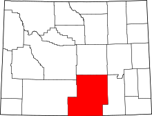 | |
| Towns | ||
| CDPs | ||
| Unincorporated communities | ||
| Ghost towns | ||
Cheyenne (capital) | |
| Topics |
|
| Society |
|
| Regions | |
| Cities | |
| Counties | |